 |
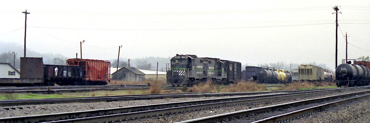
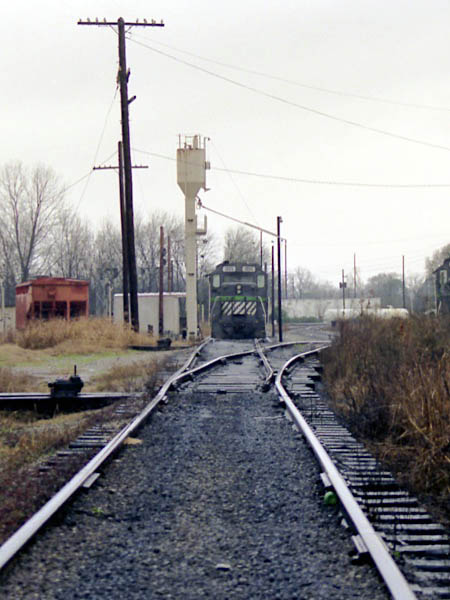
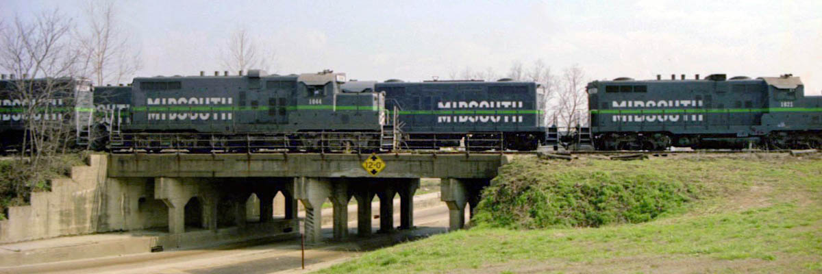
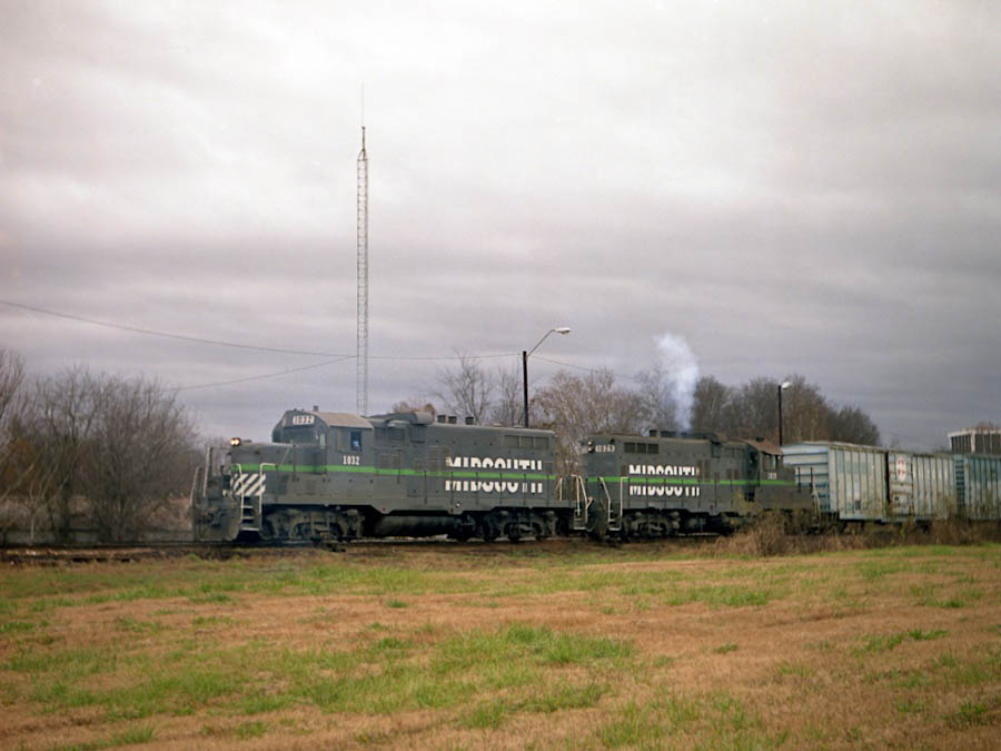
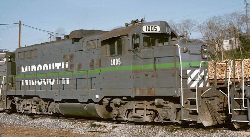
MidSouth Rail Mississippi |

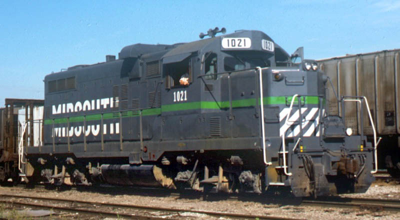
Jackson, Ms / Dec 1988 / RWH
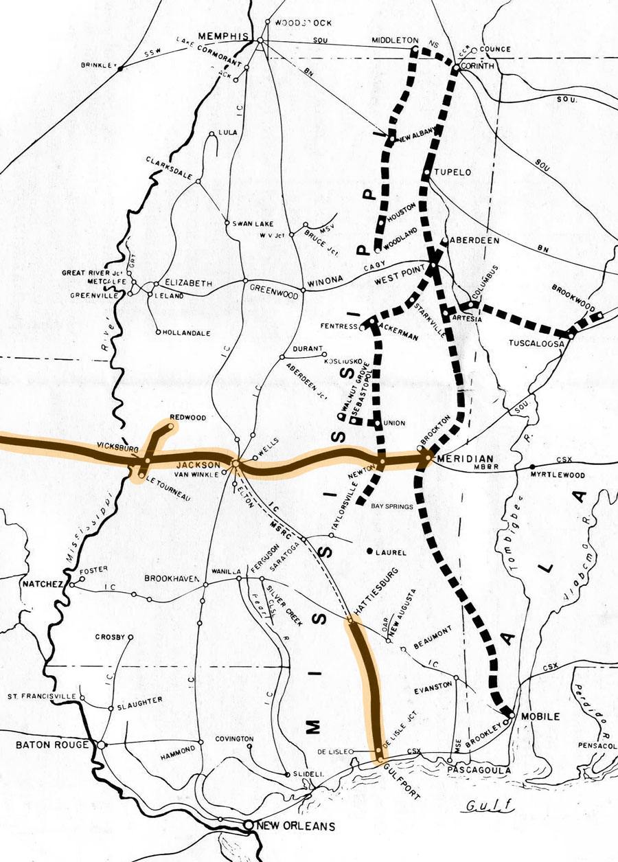
MSRC in Mississippi map / RWH


See also our complete Gulf & Mississippi Locations scrapbook for SouthRail locations in Mississippi

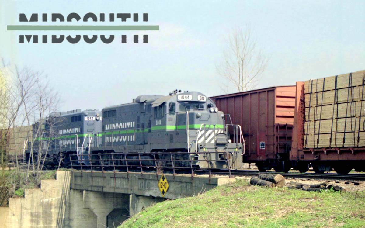
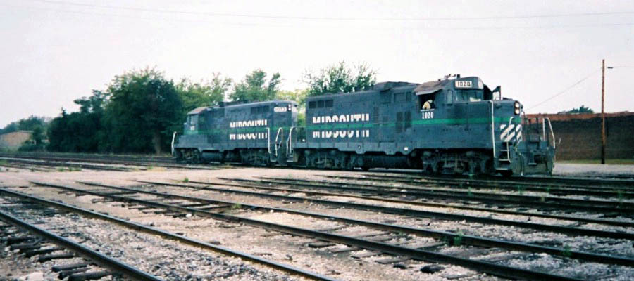
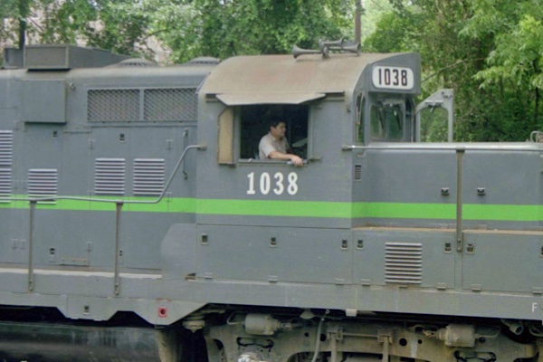
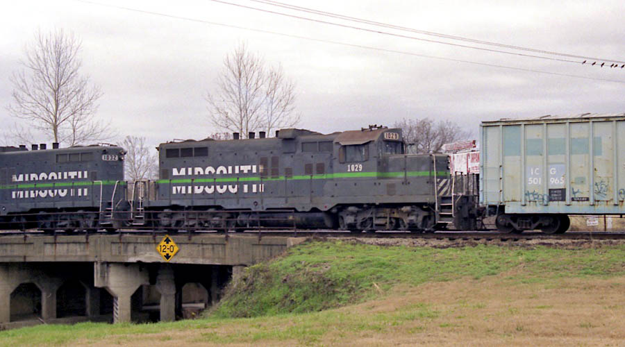
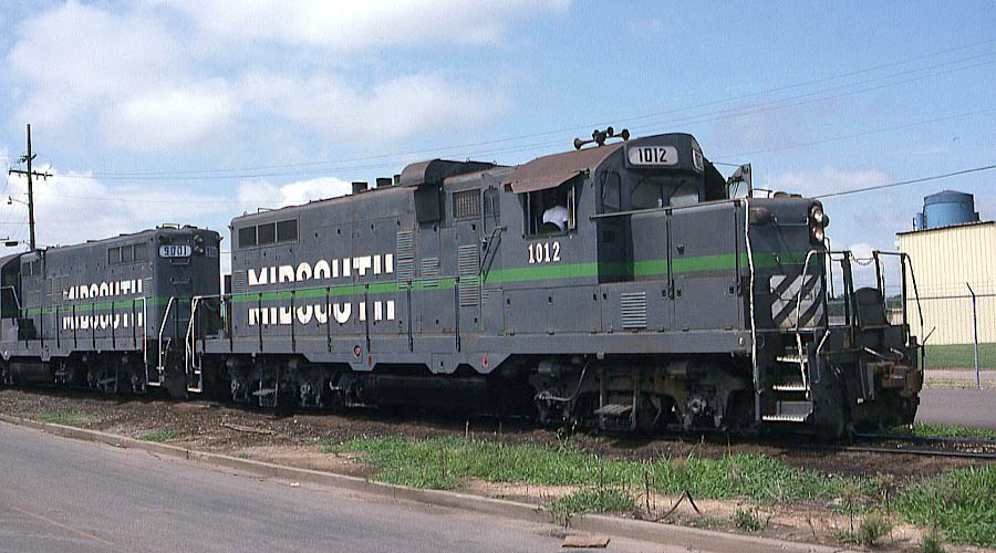
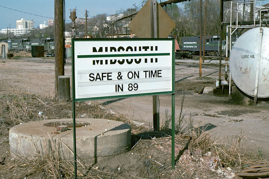
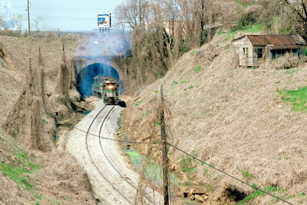
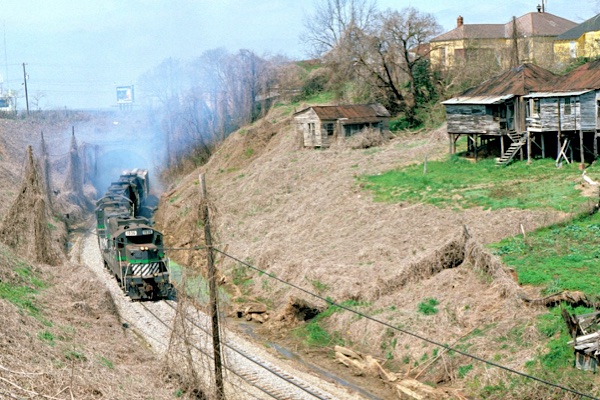
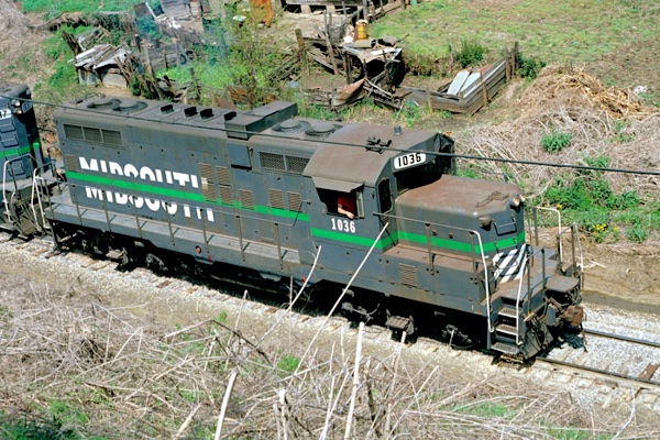
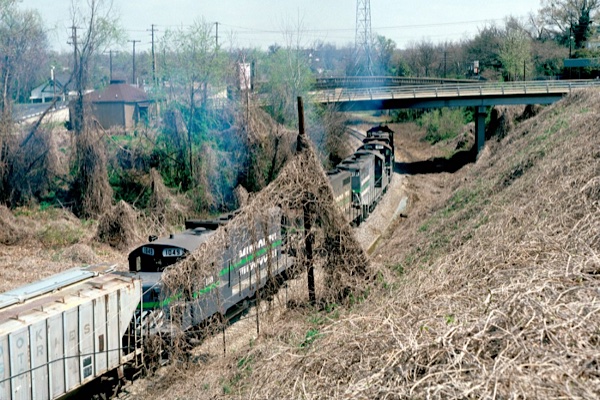
Vicksburg, Ms / Mar 1989 / Michael Palmieri
 Meridian

 he east-central Mississippi city of Meridian, which traces its origins to the northward construction of the Mobile and Ohio Railroad in the 1850's, later became a strategic railroad center during the American Civil War as well as again during World War II. Although the Illinois Central Railroad did not participate in the early developments of Meridian as a rail junction, and was never in a dominant position as it was in nearby Jackson, there was an IC presence in Meridian for over a half-century.
J. Parker Lamb
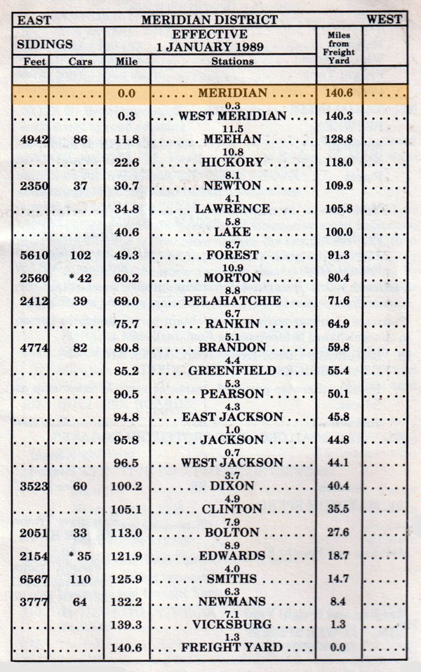
1989 timetable / collection
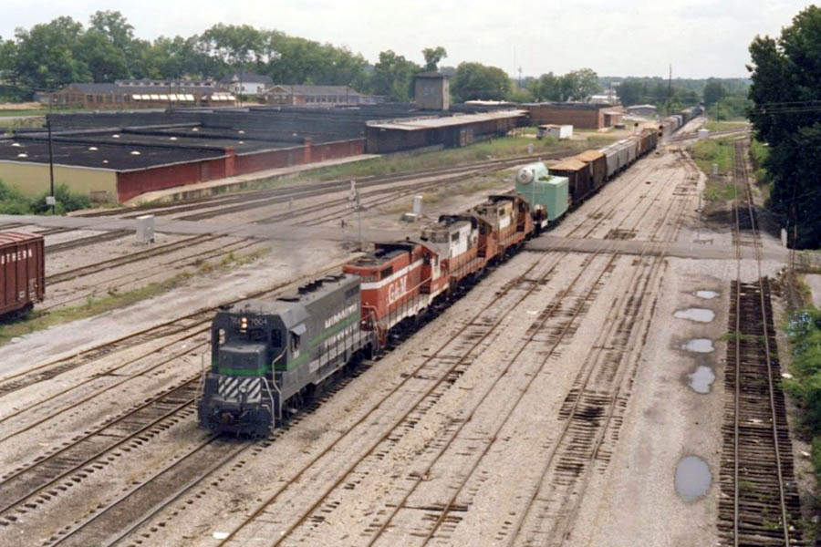
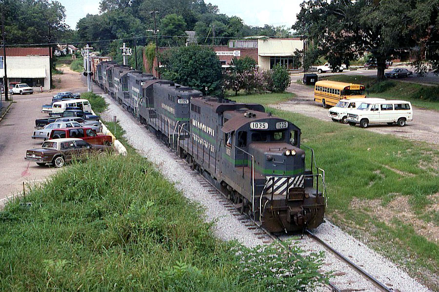
Meridian, Ms / Jul 1988 / Tony Howe
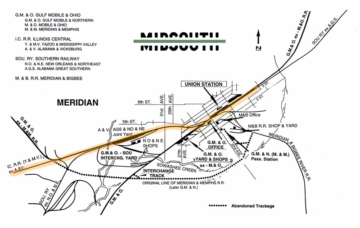
Meridian rail map / adapted RWH / collection
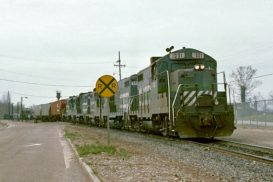
Meridian, Ms / Jan 1989 / RWH
Meridian, Ms / Jan 1989 / RWH
Meridian, Ms / Jan 1989 / RWH
Meridian, Ms / Jan 1989 / RWH
Jan 1989 / RWH
Meridian, Ms / Jan 1989 / RWH
Meridian, Ms / Jan 1989 / RWH
Meridian, Ms / Jan 1989 / RWH
Meridian, Ms / Jul 1987 / collection
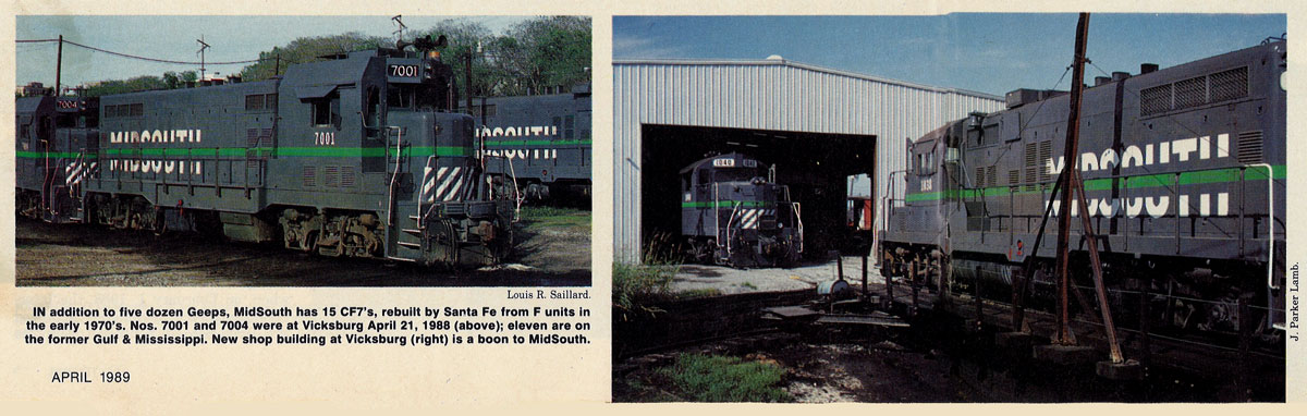
from TRAINS magazine - Apr 1989 / collection
Meridian, Ms / Nov 1994 / collection
Meridian, Ms / May 1995 / collection
Meridian, Ms / Jul 1987 / collection
Meridian, Ms / Jul 1994 / J. Williams 
See also these related scrapbooks:
- Illinois Central Mississippi scrapbook
- Southern Railway Mississippi scrapbook
- Meridian & Bigbee Railroad shortline scrapbook
- Jimmie Rodgers Museum scrapbook
- Meridian Railroad Museum scrapbook
- Amtrak Crescent Southern States scrapbook
 Newton
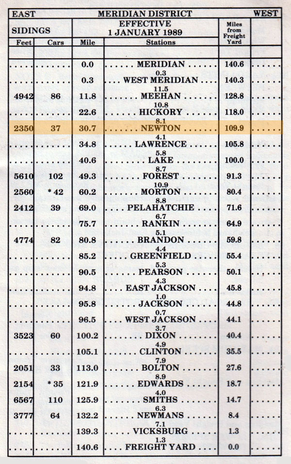
1989 timetable / collection
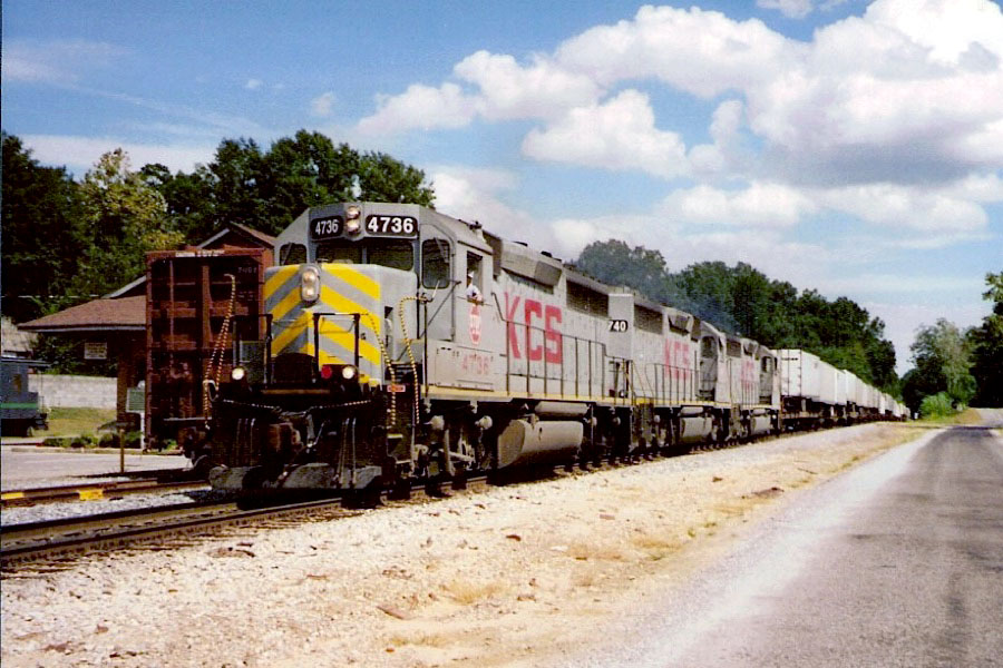
Newton, Ms / Sep 1995 / Terry Redeker

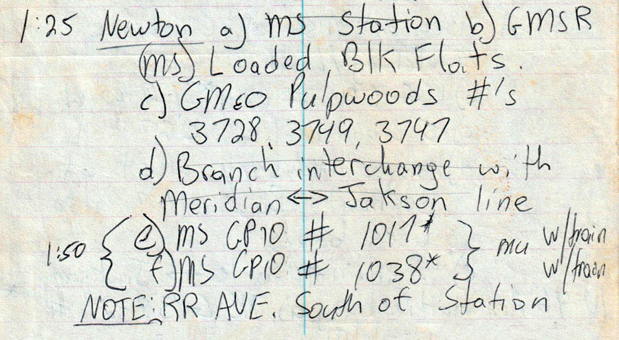
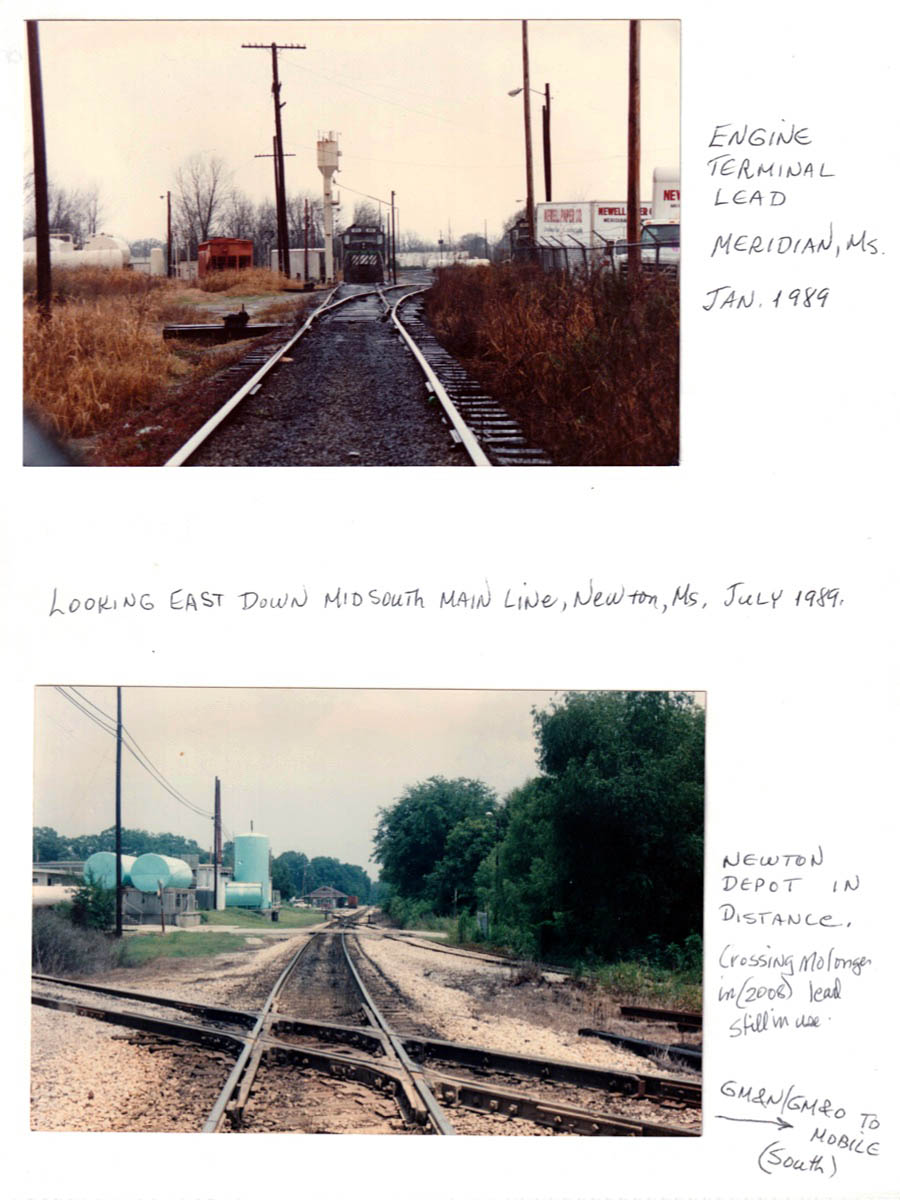
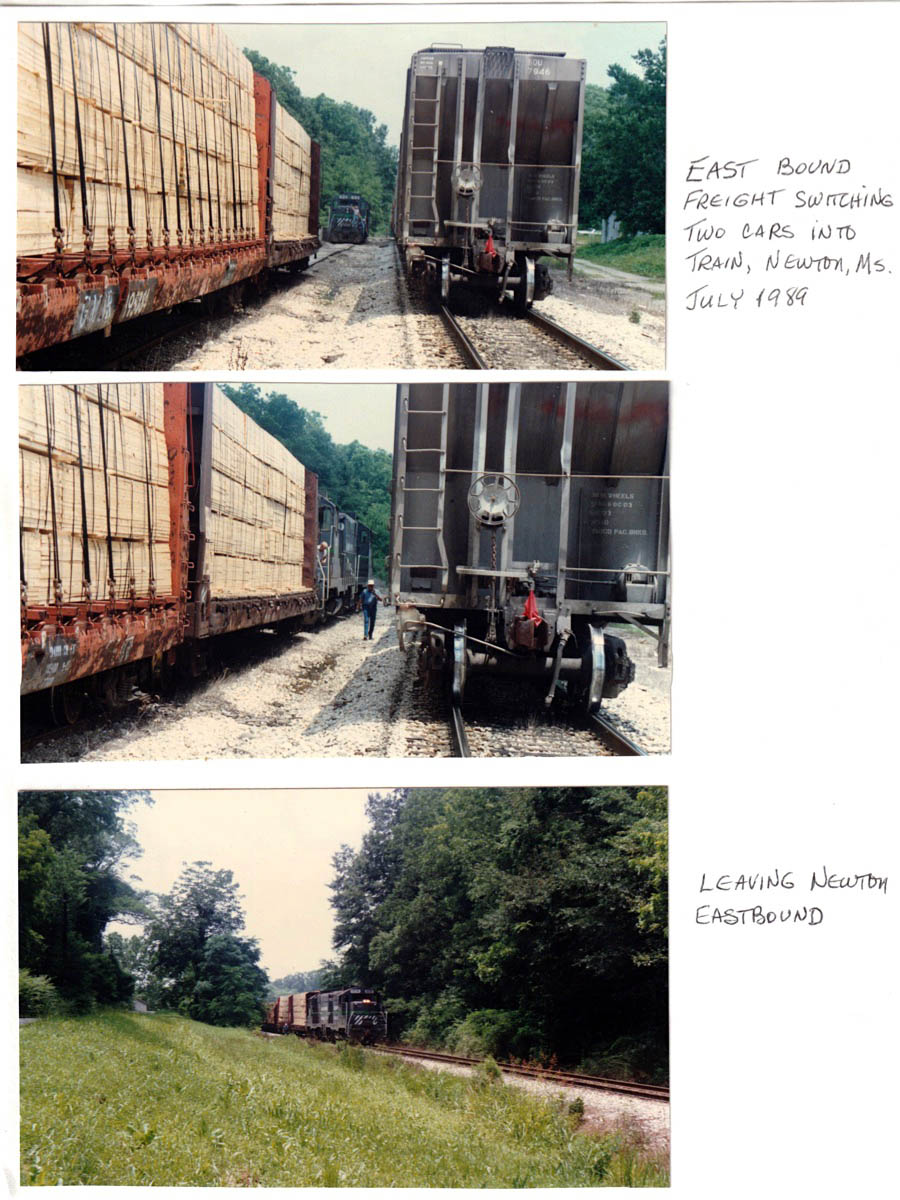
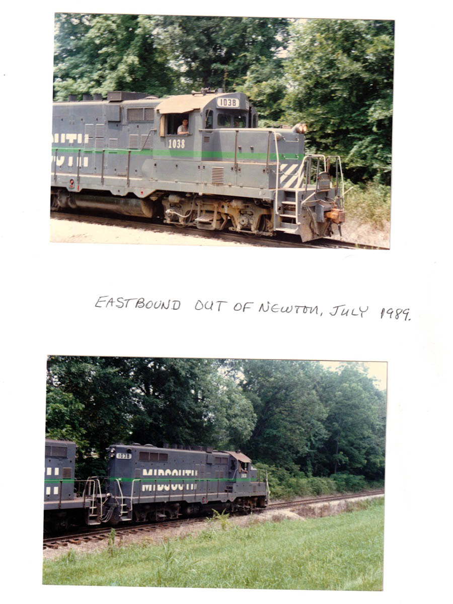
Jul 1989 field notes / RWH
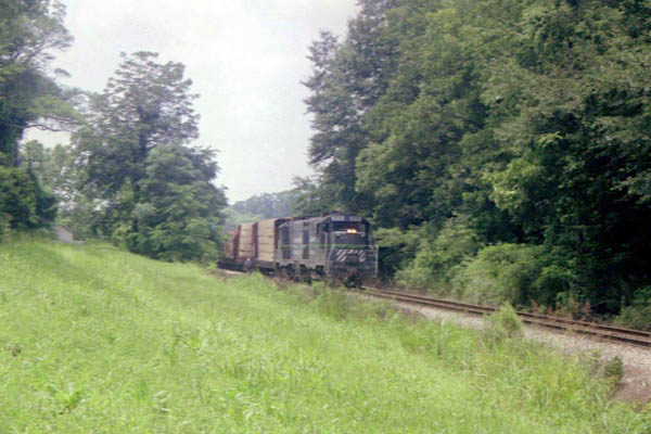
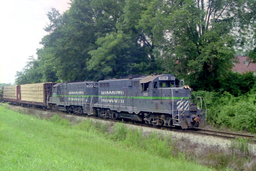
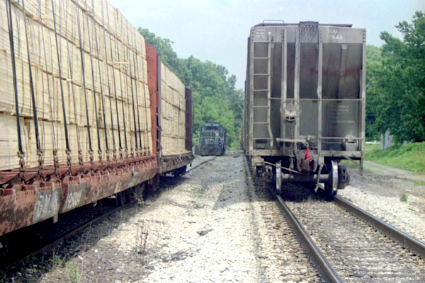
Newton, Ms / Jul 1989 / RWH
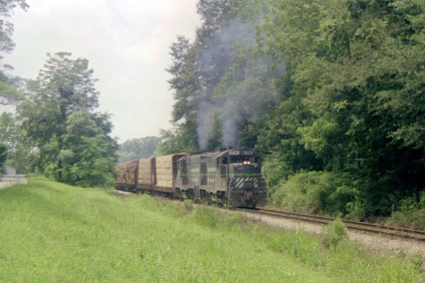
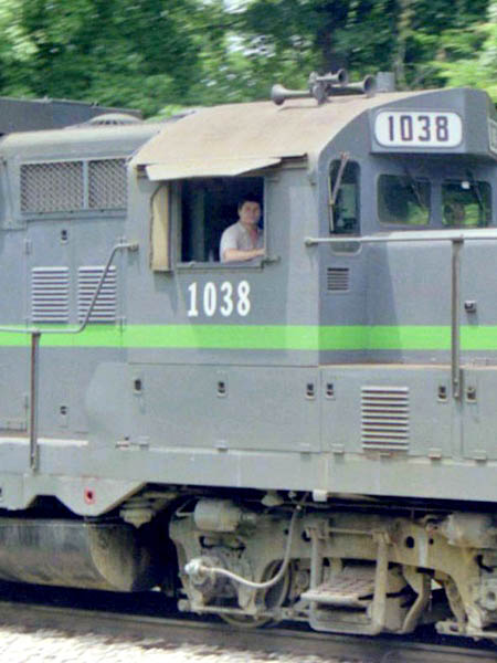
Newton, Ms / Jul 1989 / RWH
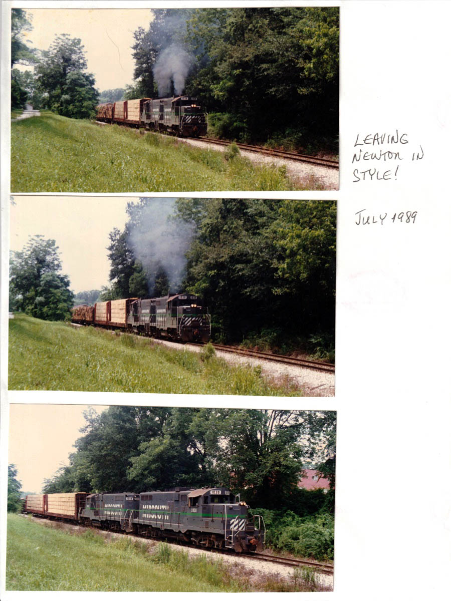
Jul 1989 / RWH
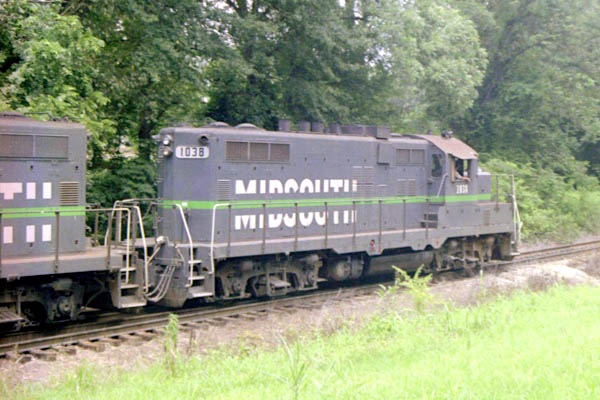
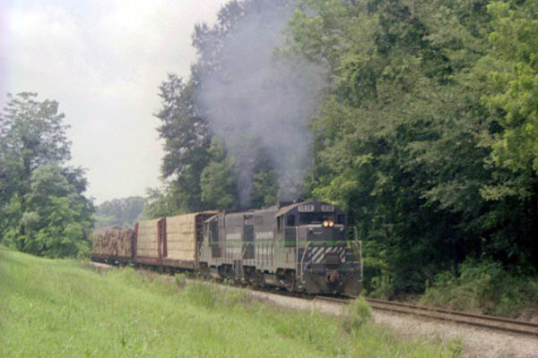
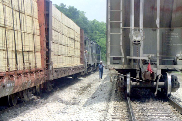
Newton, Ms / Jul 1989 / RWH
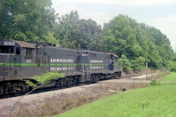
Newton, Ms / Jul 1989 / RWH
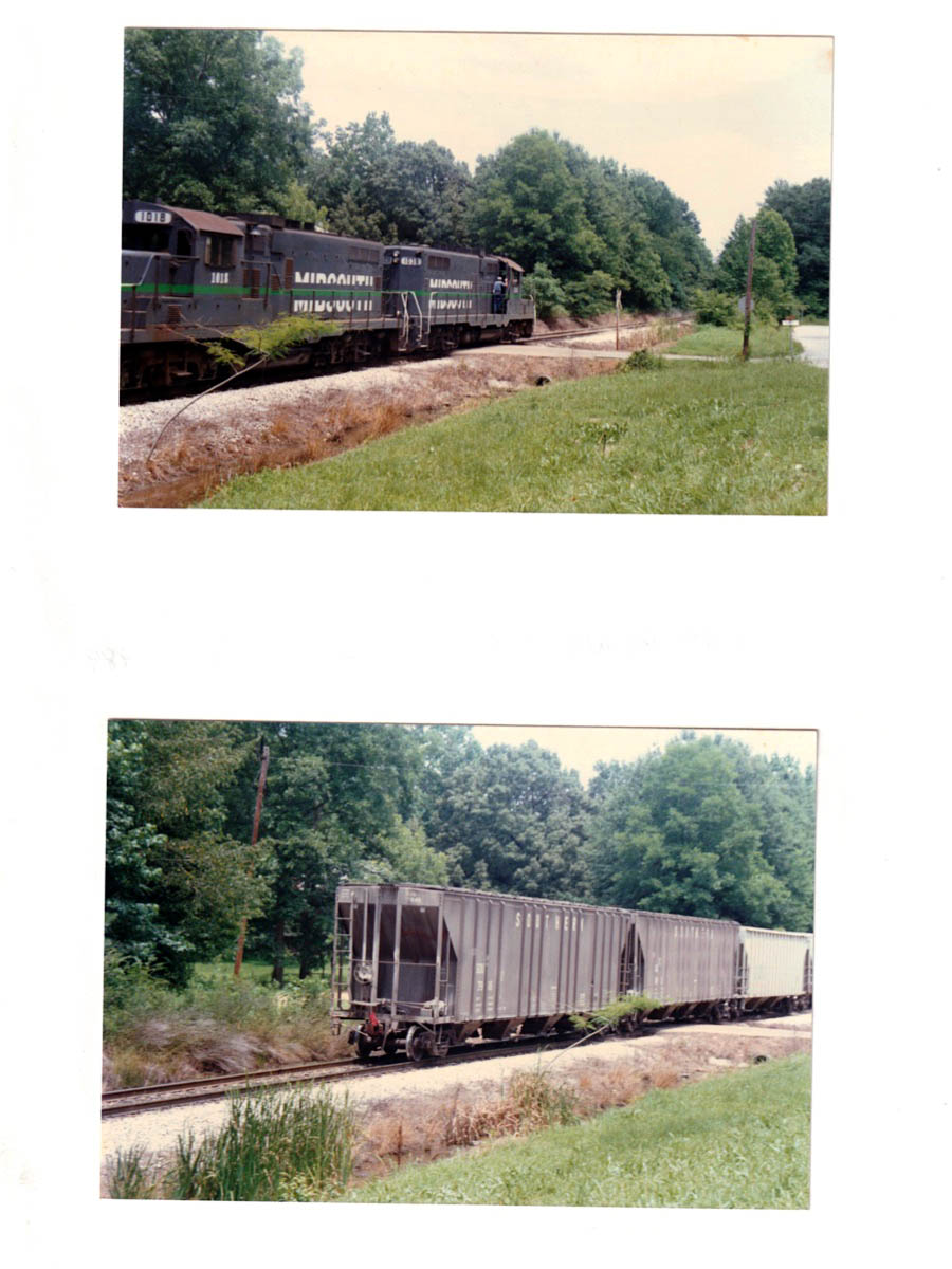
Jul 1989 / RWH
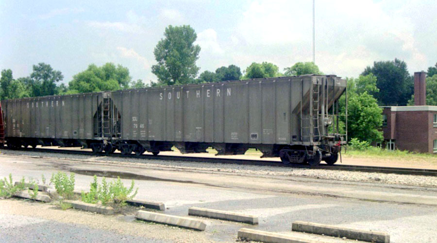
Newton, Ms / Jul 1989 / RWH
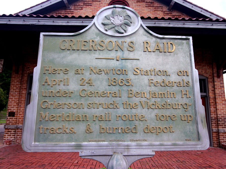
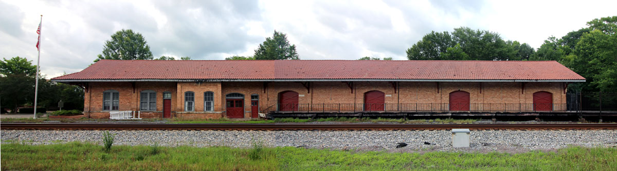
 Newton Depot
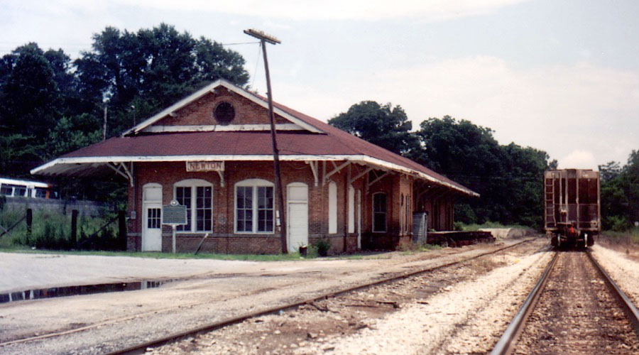
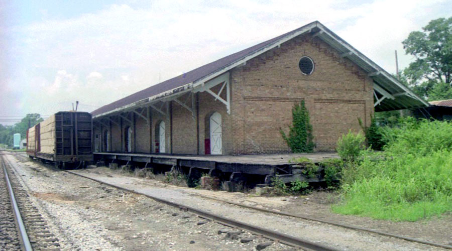
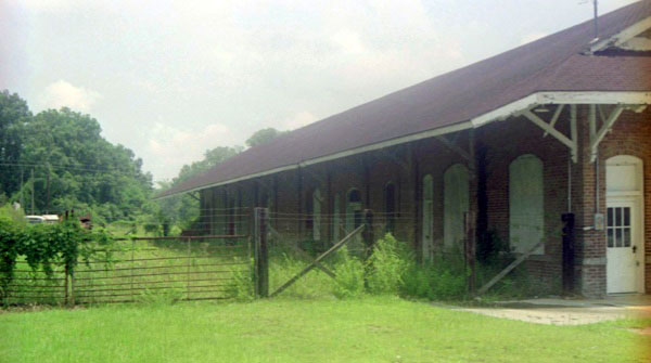
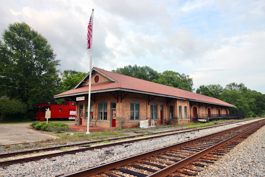
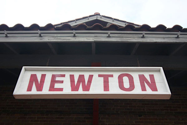
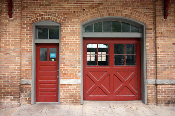
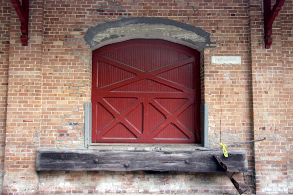
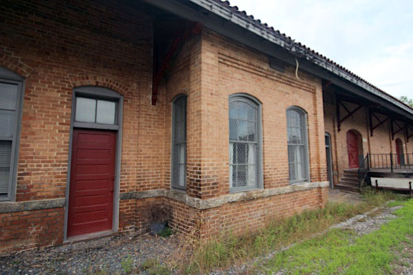
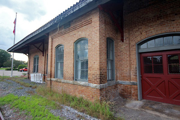
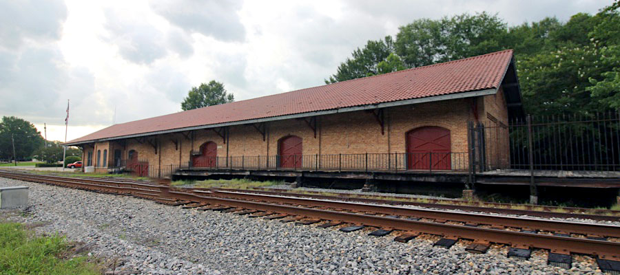
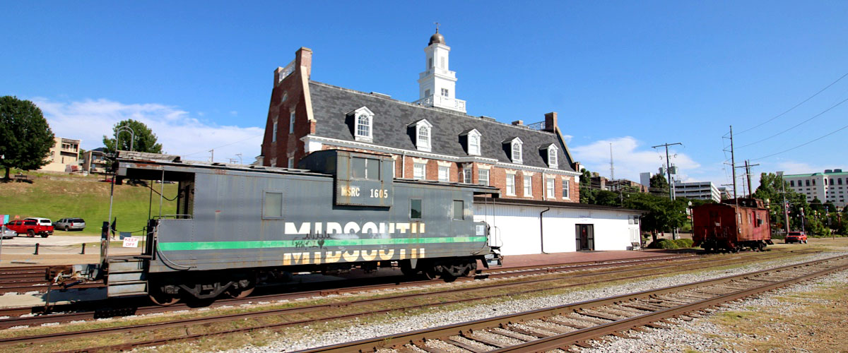
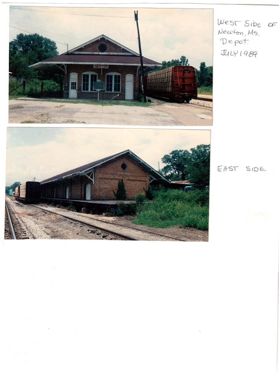
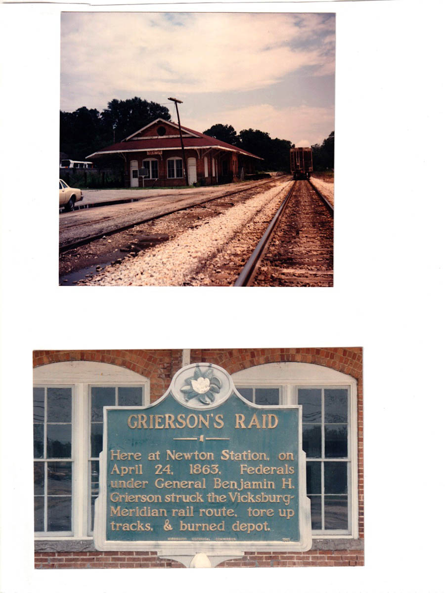
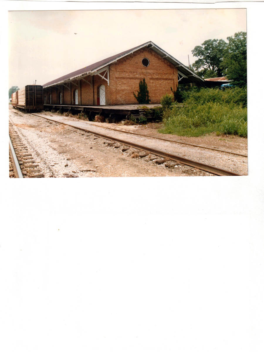
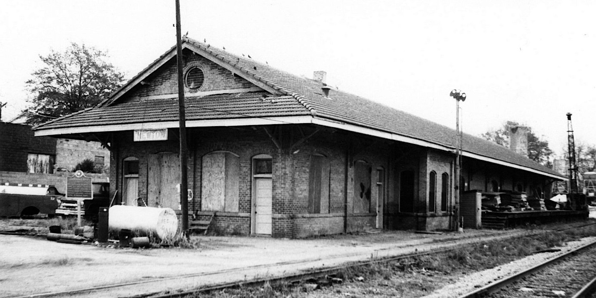 Newton station is a historic railroad depot in Newton, Mississippi.
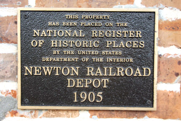
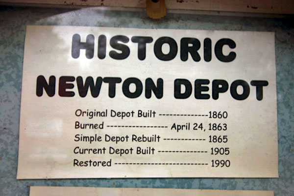
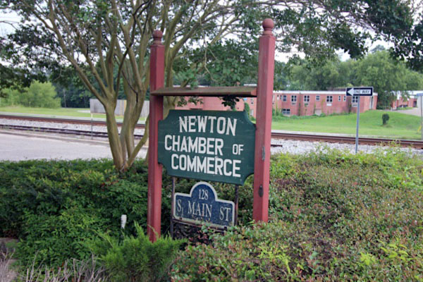
It was located on the A & V (Alabama and Vicksburg) Railroad. It was built in 1904, and later operated by the Illinois Central. It was added to the National Register of Historic Places in 1990 as the Alabama and Vicksburg Railroad Depot. It is now used by the Newton Chamber of Commerce.
During the American Civil War, on April 24, 1863, Federal troops under General Benjamin Grierson struck the Vicksburg-Meridian rail route, tore up tracks and burned the Newton depot.
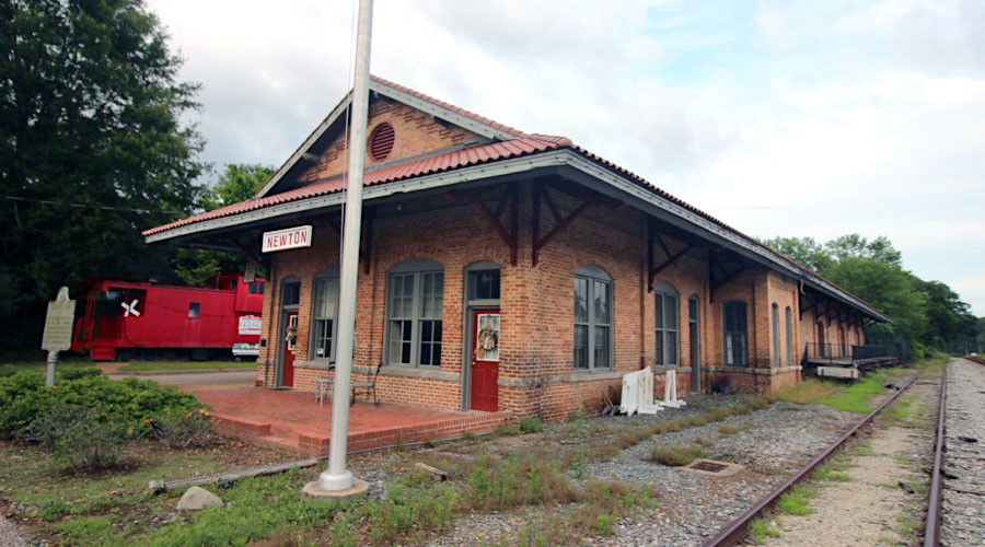
Newton station is a historic railroad depot in Newton, Mississippi.
It was located on the A & V (Alabama and Vicksburg) Railroad. It was built in 1904, and later operated by the Illinois Central. It was added to the National Register of Historic Places in 1990 as the Alabama and Vicksburg Railroad Depot. It is now used by the Newton Chamber of Commerce.
During the American Civil War, on April 24, 1863, Federal troops under General Benjamin Grierson struck the Vicksburg-Meridian rail route, tore up tracks and burned the Newton depot.
collection
Newton, Ms / Jul 1989 / JCH
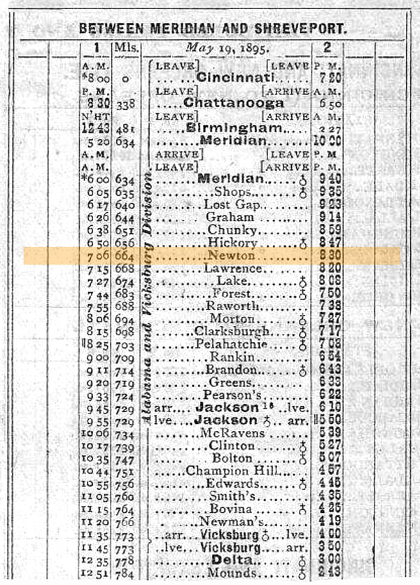
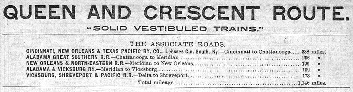
1895 Official Guide ad / collection
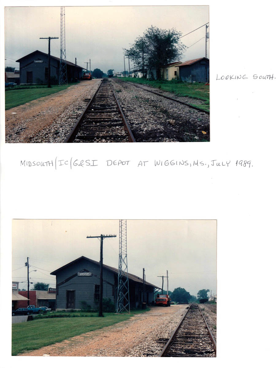
Newton, Ms / Jul 1989 / RWH
Newton, Ms / Jul 1989 / RWH
Newton, Ms / Jun 2020 / RWH

Click to see the historic Newton depot plotted on a Google Maps page
Newton, Ms / Jun 2020 / RWH
Newton, Ms / Jun 2020 / RWH
Newton, Ms / Jun 2020 / RWH

Jun 2020 / RWH
Jun 2020 / RWH
Jun 2020 / RWH
Newton, Ms / Jun 2020 / RWH
Jun 2020 / RWH
Jun 2020 / RWH
Jun 2020 / RWH
Newton, Ms / Jun 2020 / RWH
Newton, Ms / Jun 2020 / RWH
Newton, Ms / Jun 2020 / RWH
Newton, Ms / Jun 2020 / RWH
Newton, Ms / Jun 2020 / RWH
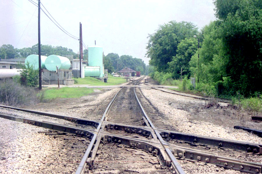
SouthRail interchange / Newton, Ms / Jun 2020 / RWH
See also our Gulf & Mississippi locations scrapbook for more Newton photographs
 Forest
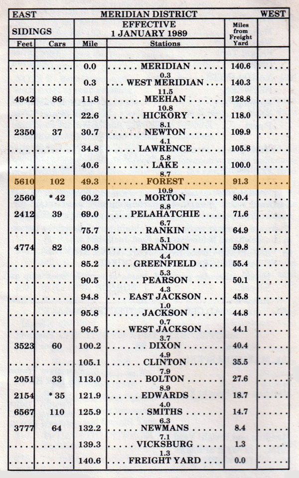
1989 timetable / collection
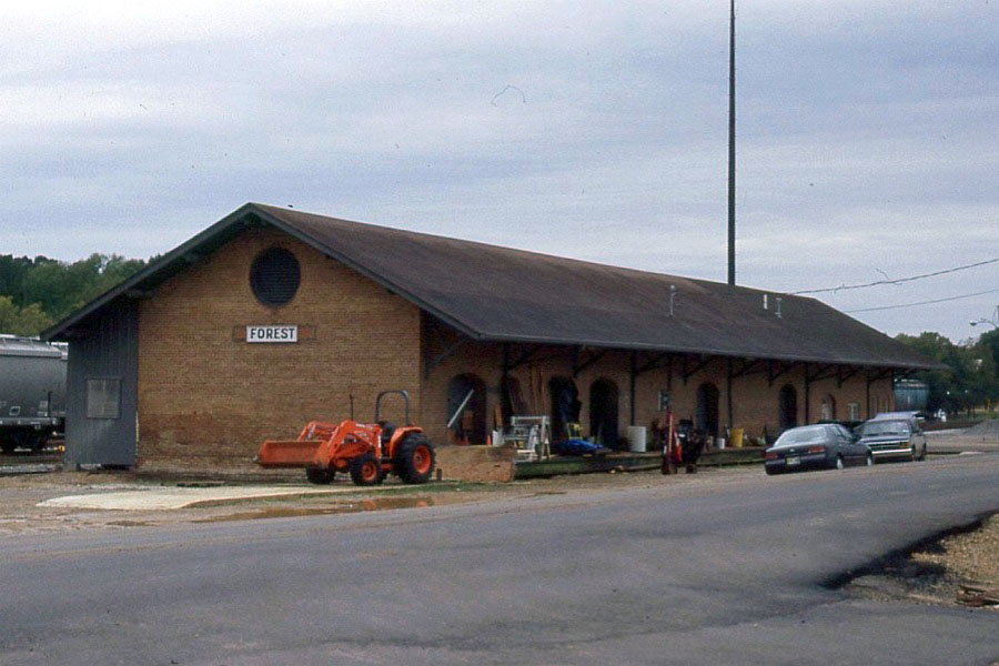
Forest, Ms / Nov 1998 / G. Gerard
 Jackson
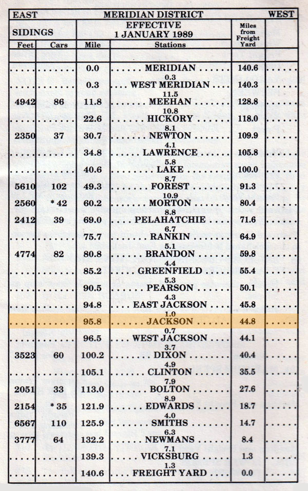
1989 timetable / collection
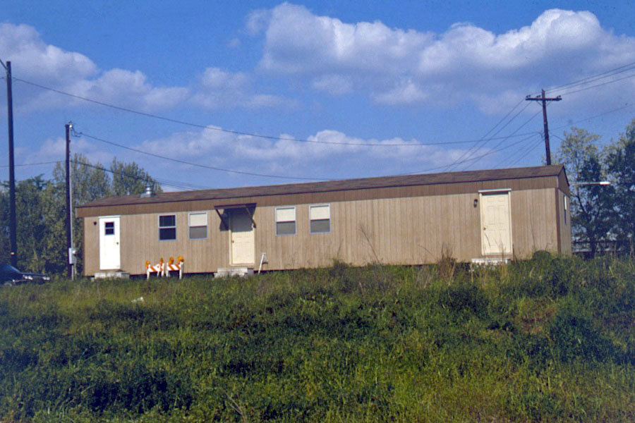
Jackson, Ms / Jul 1988 / RWH
Jackson, Ms / Dec 1988 / RWH
Click to see the former MidSouth Jackson yard area plotted on a Google Maps page
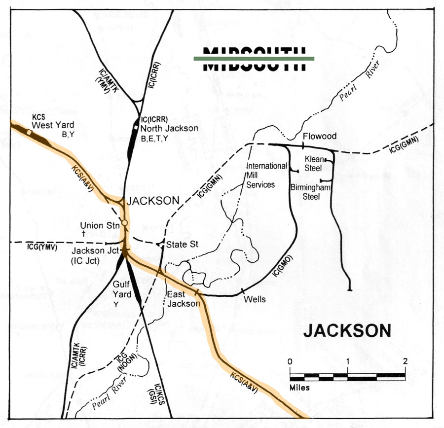
Jackson area rail map / RWH
Jackson, Ms / Dec 1988 / RWH
Jackson, Ms / Dec 1988 / RWH
Jackson, Ms / Dec 1988 / RWH
Jackson, Ms / Dec 1988 / RWH
Jackson, Ms / Dec 1988 / RWH
Jackson, Ms / Dec 1988 / RWH
Jackson, Ms / Dec 1988 / JCH
Jackson, Ms / Dec 1988 / RWH
Jackson, Ms / Dec 1988 / RWH
Dec 1988 / RWH
Jackson, Ms / Dec 1988 / RWH
Jackson, Ms / Dec 1988 / RWH
Jackson, Ms / Dec 1988 / RWH
 Edwards
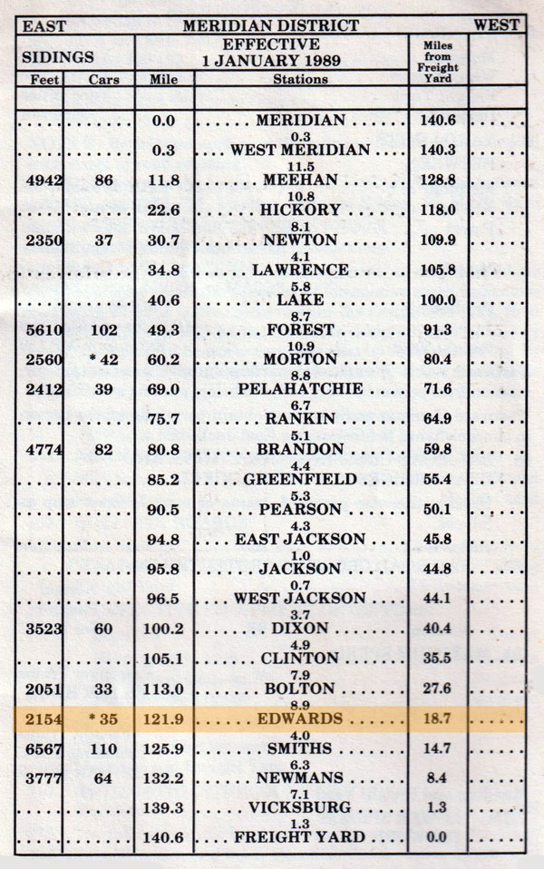
1989 timetable / collection
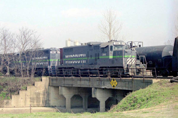
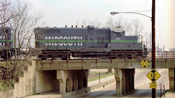
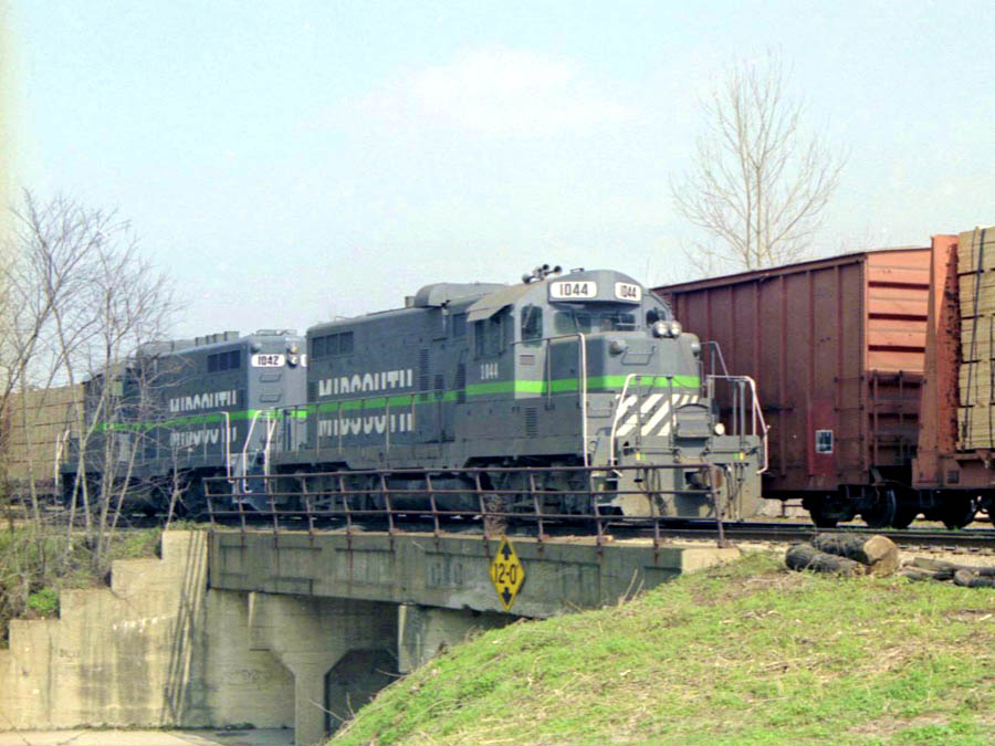
Edwards, Ms / Aug 1991 / Mark Morgan
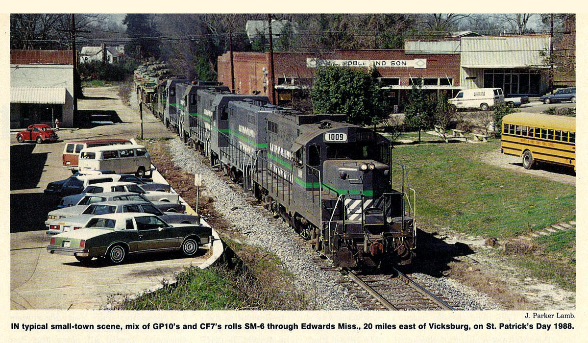
from TRAINS magazine - Apr 1989 / collection
 Vicksburg
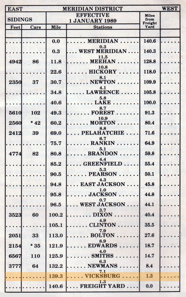
1989 timetable / collection
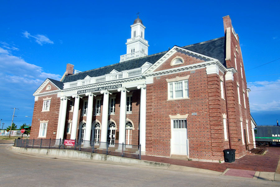
Vicksburg, Ms / Jun 2020 / RWH
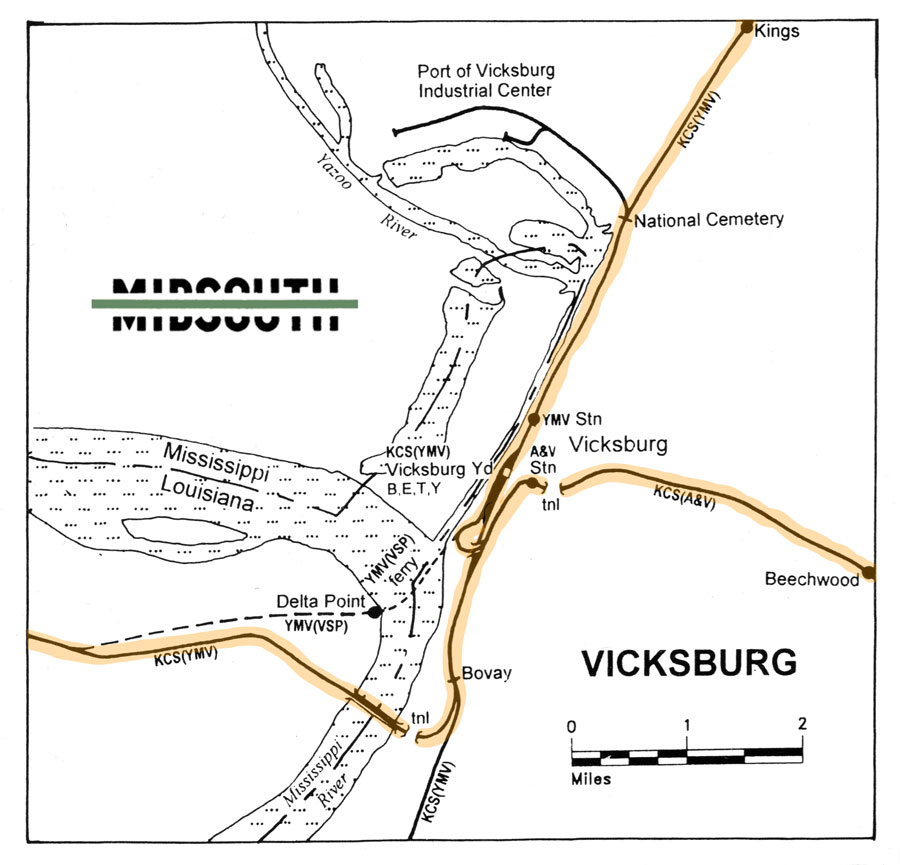
Vicksburg area rail map / RWH
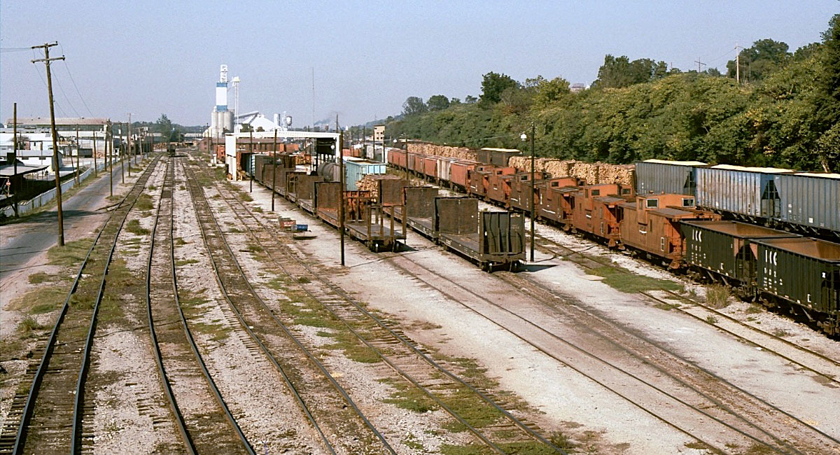
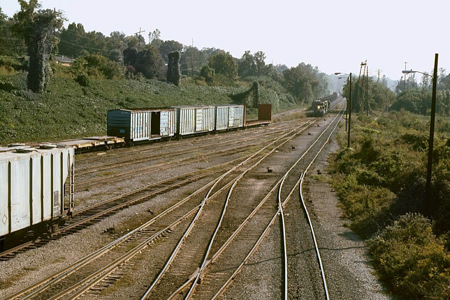
Vicksburg, Ms / Oct 1987 / Michael Palmieri
Click to see the Vicksburg rail yard area plotted on a Google Maps page
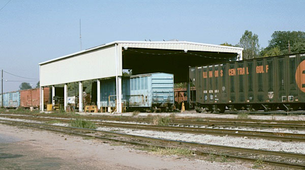
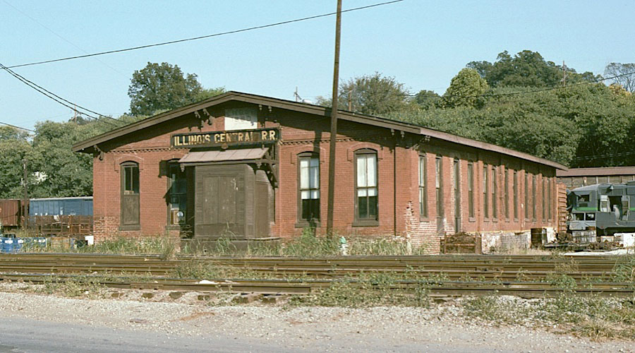
car shop / Vicksburg, Ms / Oct 1987 / Michael Palmieri
Vicksburg, Ms / Oct 1987 / Michael Palmieri
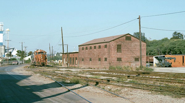
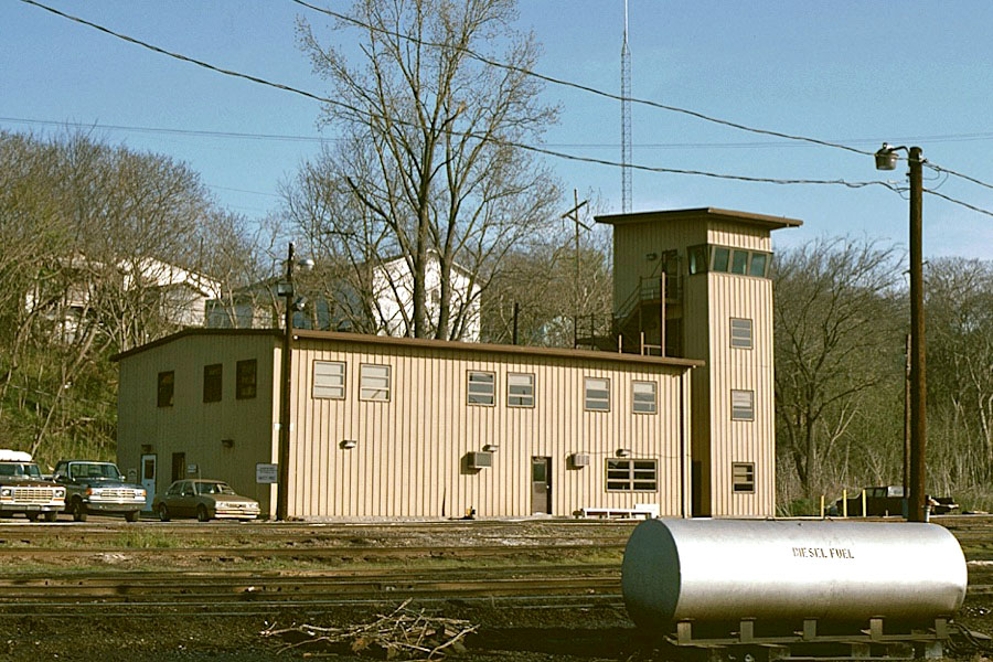
yard office / Vicksburg, Ms / Oct 1987 / Michael Palmieri

Vicksburg, Ms / Mar 1989 / Michael Palmieri
Vicksburg, Ms / Oct 1987 / Michael Palmieri
Vicksburg, Ms / Mar 1989 / Christopher Palmieri
Vicksburg, Ms / Mar 1991 / Mark Morgan
Vicksburg, Ms / Jan 1998 / Ed Hopson
Vicksburg, Ms / Aug 1993 / collection
Vicksburg, Ms / Mar 1989 / Christopher Palmieri
Vicksburg, Ms / Mar 1989 / Christopher Palmieri
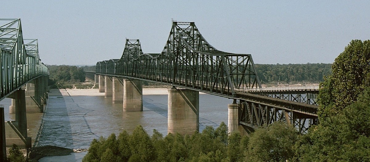
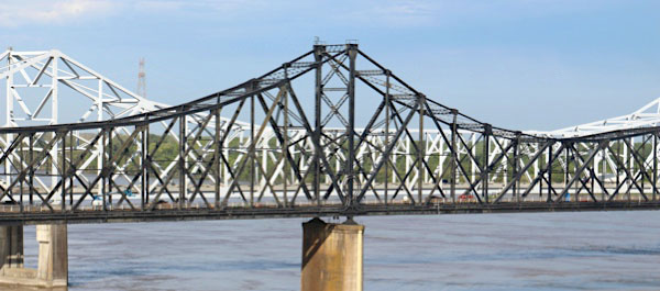
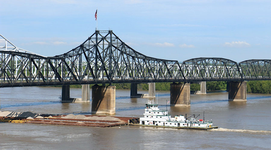
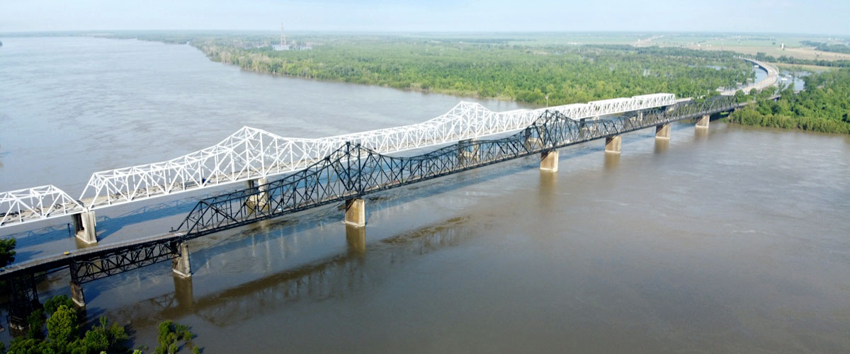
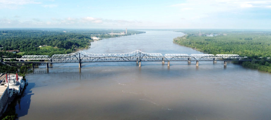
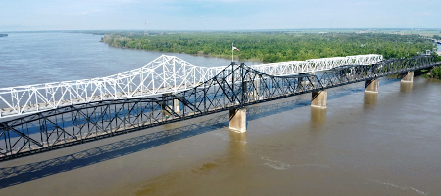
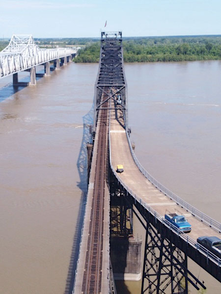
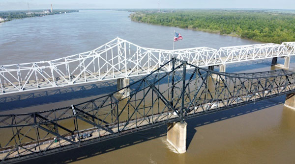
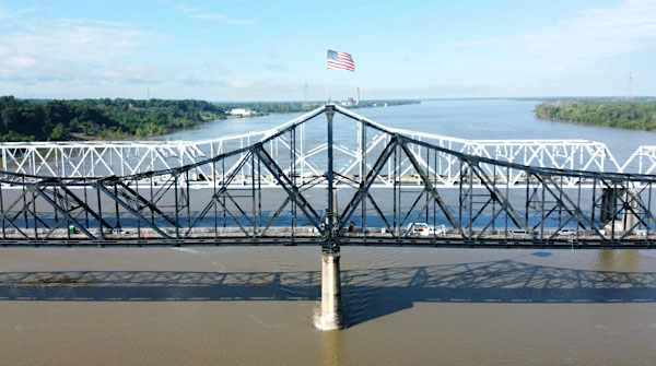
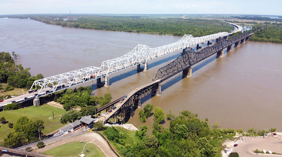
Mississippi River Bridge
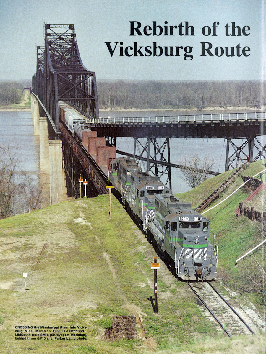
from TRAINS magazine - Apr 1989 / collection
Vicksburg, Ms / Dec 1990 / Mark Morgan
Vicksburg, Ms / Oct 1987 / Michael Palmieri
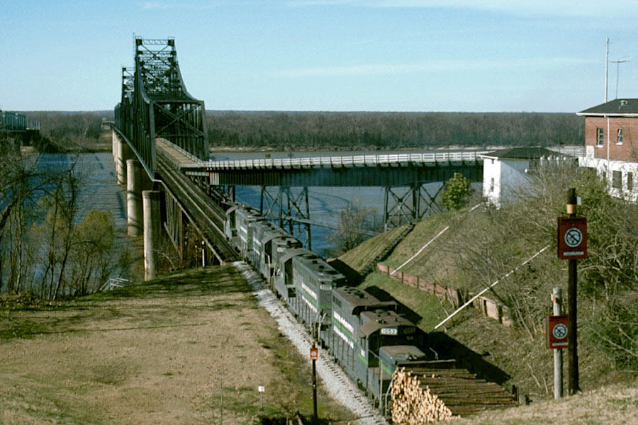
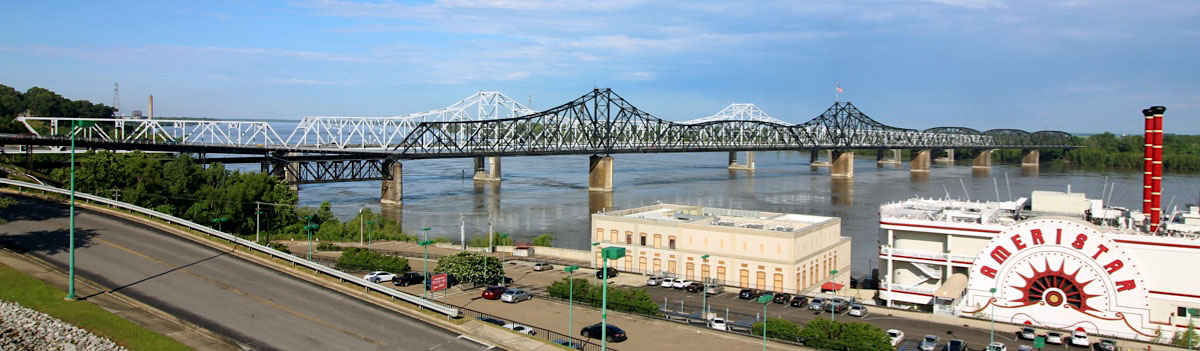
In this view (above) of the Mississippi River from the Mississippi Welcome Center, the "new" Interstate 20 bridge is on the left and the "old" rail-HIghway bridge is on the right. The old bridge was built between 1928 and 1930. It has one railroad track and two very narrow (9-foot) road lanes. Prior to the opening of the new bridge, the old bridge was the route of U.S. Highway 80. The old bridge was originally owned by the Vicksburg Bridge & Terminal Co., but was purchased by Warren County, Mississippi on 30 April 1947. It was placed on the National Register of Historic Places in 1989 and was closed to vehicular traffic in 1998. The rail line has been used by the Illinois Central, MidSouth Rail, and the Kansas City Southern.
Michael Palmieri
Vicksburg, Ms / Feb 1989 / Christopher Palmieri
Vicksburg, Ms / Dec 1993 / Christopher Palmieri
Dec 1993 / Christopher Palmieri
Vicksburg, Ms / Dec 1993 / Christopher Palmieri
Vicksburg, Ms / Jun 2020 / RWH
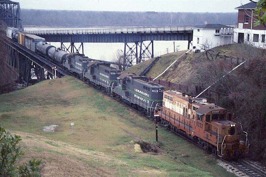
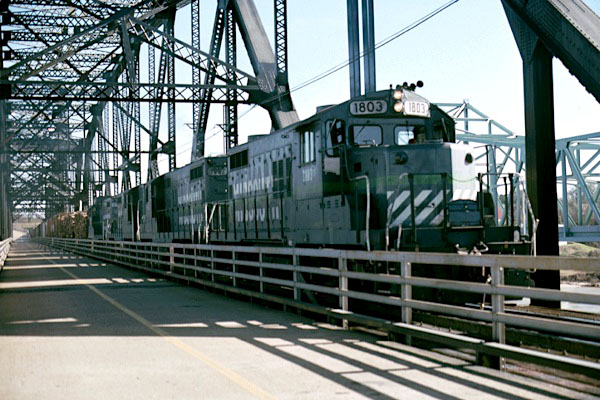
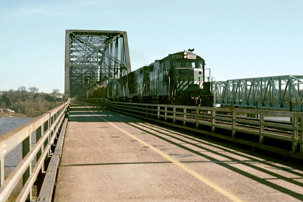
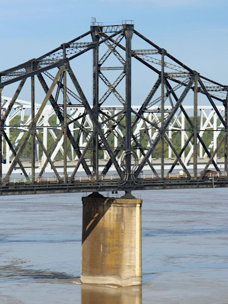
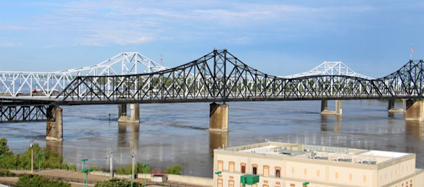
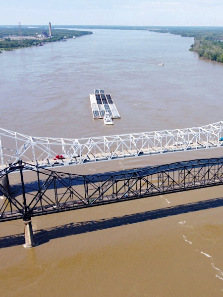
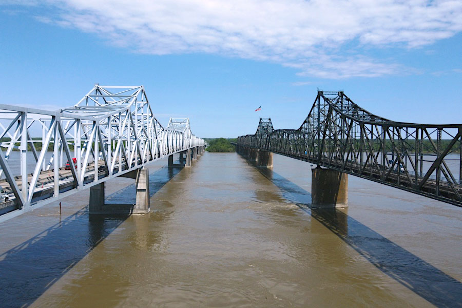
The Old Vicksburg Bridge, also known as Mississippi River Bridge, is a cantilever bridge carrying one rail line across the Mississippi River between Delta, Louisiana and Vicksburg, Mississippi. Until 1998, the bridge was open to motor vehicles and carried U.S. Route 80 (US 80) across the Mississippi River. It is now only a railroad bridge, though one road lane runs through the bridge for inspection by workers. It was replaced by the new Vicksburg Bridge, a short distance down river, for vehicle crossings. It was listed on the National Register of Historic Places in 1989. It was built by the Vicksburg Bridge & Terminal Co. during 1928-1930 and has three cantilevered truss spans and three Parker truss spans.
 The Old Vicksburg Bridge, also known as Mississippi River Bridge, is a cantilever bridge carrying one rail line across the Mississippi River between Delta, Louisiana and Vicksburg, Mississippi.
Until 1998, the bridge was open to motor vehicles and carried U.S. Route 80 (US 80) across the Mississippi River. It is now only a railroad bridge, though one road lane runs through the bridge for inspection by workers. It was replaced by the new Vicksburg Bridge, a short distance down river, for vehicle crossings.
It was listed on the National Register of Historic Places in 1989.
It was built by the Vicksburg Bridge & Terminal Co. during 1928-1930 and has three cantilevered truss spans and three Parker truss spans.
The Old Vicksburg Bridge, also known as Mississippi River Bridge, is a cantilever bridge carrying one rail line across the Mississippi River between Delta, Louisiana and Vicksburg, Mississippi.
Until 1998, the bridge was open to motor vehicles and carried U.S. Route 80 (US 80) across the Mississippi River. It is now only a railroad bridge, though one road lane runs through the bridge for inspection by workers. It was replaced by the new Vicksburg Bridge, a short distance down river, for vehicle crossings.
It was listed on the National Register of Historic Places in 1989.
It was built by the Vicksburg Bridge & Terminal Co. during 1928-1930 and has three cantilevered truss spans and three Parker truss spans.
Click to see the Vicksburg Railroad Bridge area plotted on a Google Maps page
Jun 2020 / RWH
Vicksburg, Ms / Jun 2020 / RWH
Vicksburg, Ms / Jun 2020 / RWH
Vicksburg, Ms / Jun 2020 / RWH
Vicksburg, Ms / Jun 2020 / RWH
Vicksburg, Ms / Jun 2020 / RWH
Vicksburg, Ms / Jun 2020 / RWH
Jun 2020 / RWH
Jun 2020 / RWH
Jun 2020 / RWH
Vicksburg, Ms / Jun 2020 / RWH
Vicksburg, Ms / Jun 2020 / RWH

Vicksburg, Ms / Jun 2020 / RWH

Vicksburg, Ms / Jun 2020 / RWH
Jun 2020 / RWH
Vicksburg, Ms / Jun 2020 / John Hawkins III
Vicksburg, Ms / Jun 2020 / RWH
See also our complete Vicksburg Old Depot Museum scrapbook in Preservation
 Scrapbook

all pages from MidSouth Rail Corporation scrapbook / JCH