 |
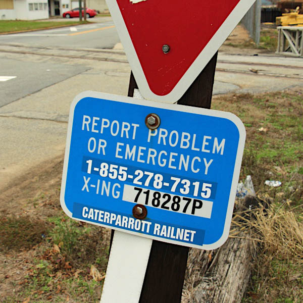
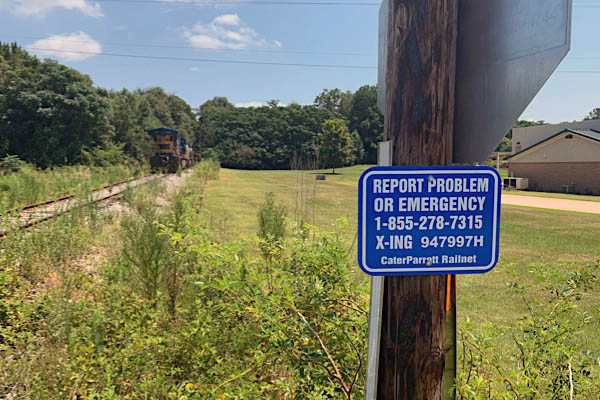
CaterParrott Railnet Thomaston Division |

The Thomaston Division was first founded and operated by the Thomaston & Barnesville Railroad Company in 1839. Through various mergers, the line became part of the Southern Railway and Norfolk Southern in 1982. CPR began operating this route in 2016 as CPR’s Thomaston Division.
Norfolk Southern system map / RWH
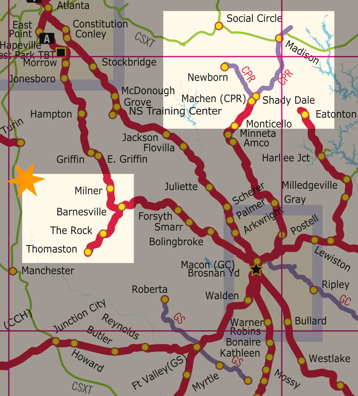
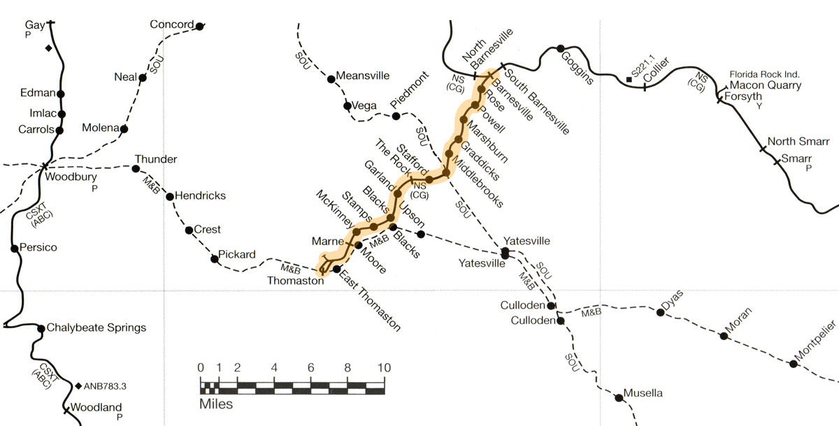
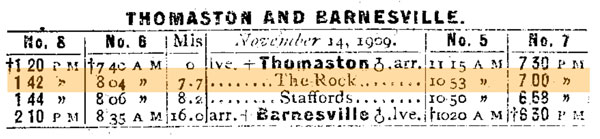
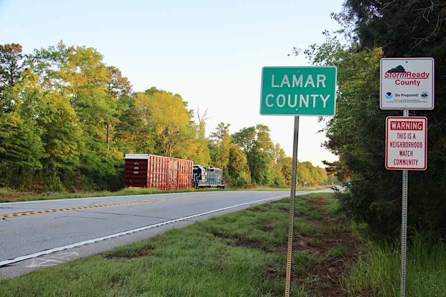
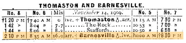
 The 16-mile branchline that today is the Thomaston Division of the CaterParrott Railnet began operations early in Georgia railroad history as the Thomaston & Barnesville Railroad, chartered in 1839. The route was laid from Barnesville in Lamar County southwest to Thomaston, in the county of Upson. Just before the Civil War, in 1860, the line was sold under foreclosure and reorganized as the Upson County Railroad. During the war the line was stripped of its rails, but was rebuilt by 1870. After the war the route was controlled by the Macon & Western Railroad, which in turn was controlled by the Central Railroad & Banking Company of Georgia, otherwise known as the Central of Georgia Railway. Although the shortline would not be officially absorbed by the Central until 1914, for all practical purposes it had been a Central branch since the Civil War.
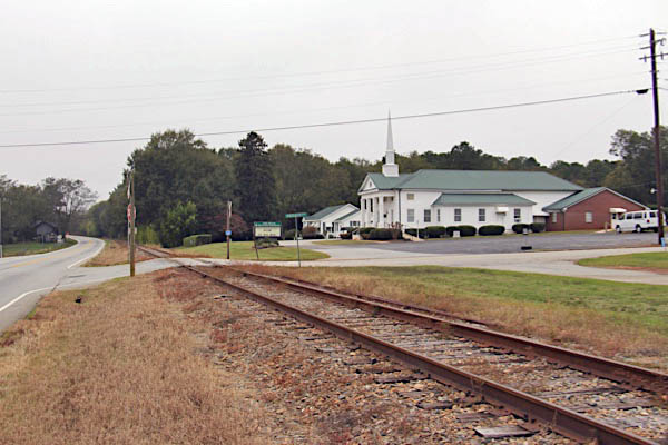
The Central of Georgia maintained the line in the post World War II years for its strong customer base in the manufacturing-rich community of Thomaston. Southern Railway crossed the route north of The Rock, Georgia, with its Atlanta to Fort Valley secondary line. And the Macon & Birmingham Railway, affiliated with the Georgia Southern & Florida Railway (later Southern), passed through Thomaston before its abandonment. Southern Railway acquired the 16-mile route from Thomaston to Barnesville in its absorption of the Central in the 1960s, and the line persisted as a remote branchline into the 1982 Norfolk Southern merger.
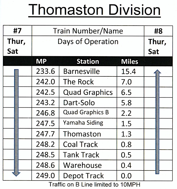
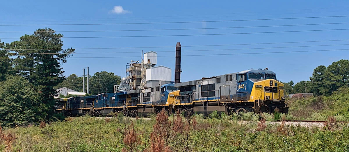
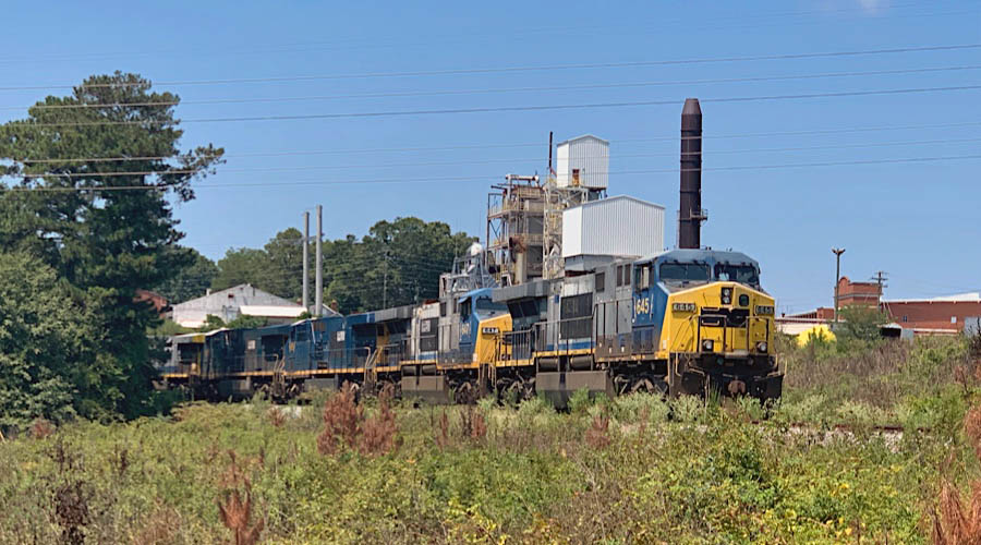
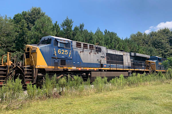
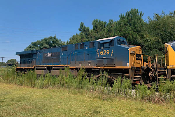
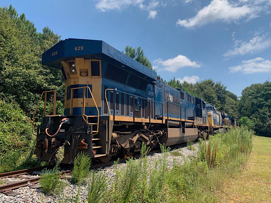
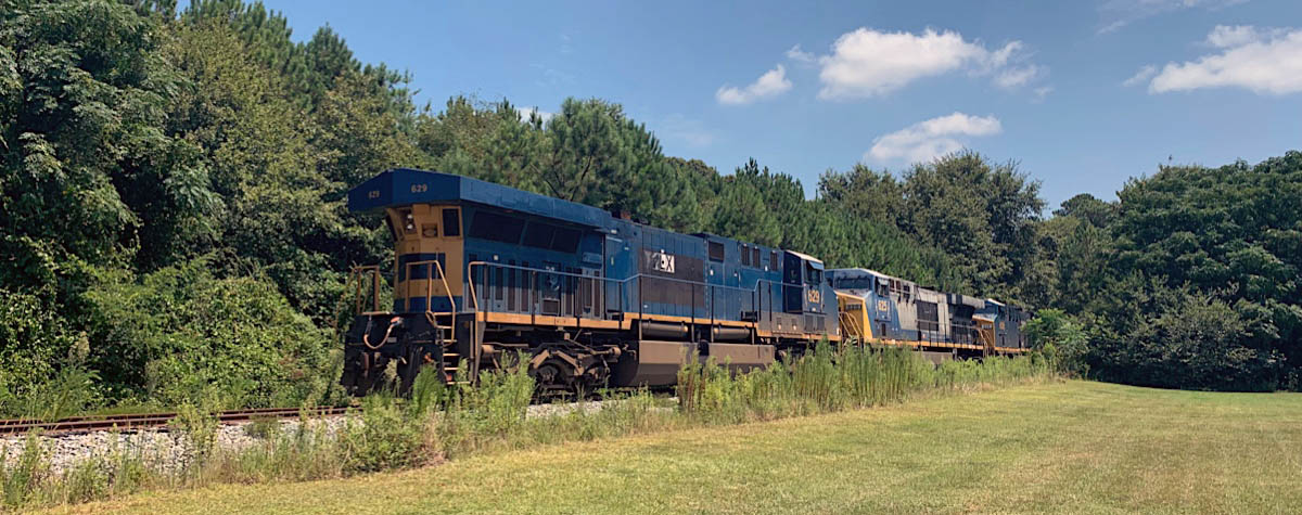
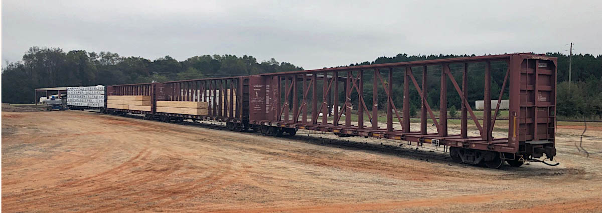
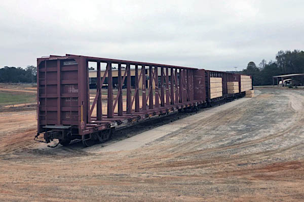
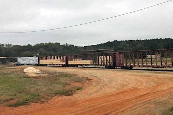
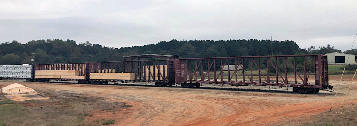
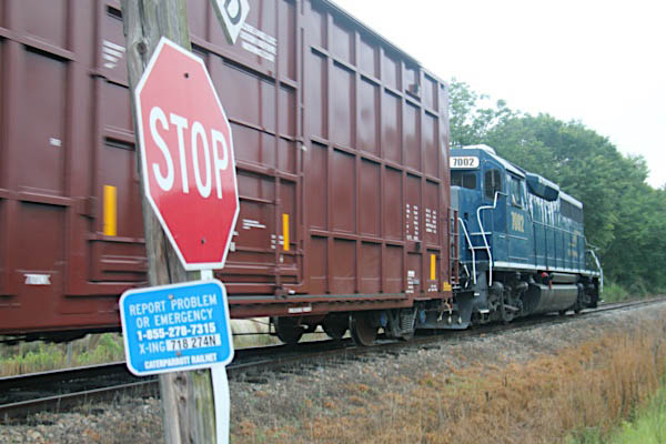
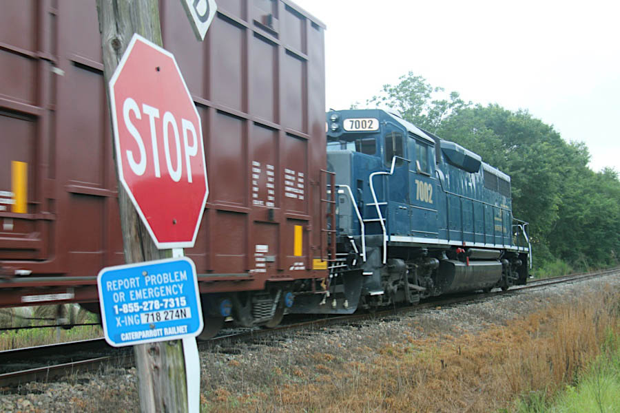
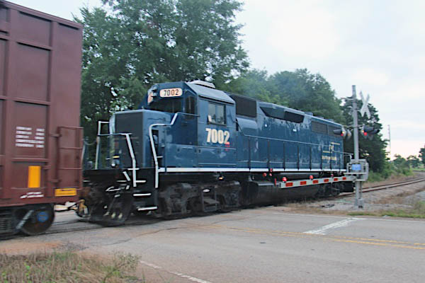
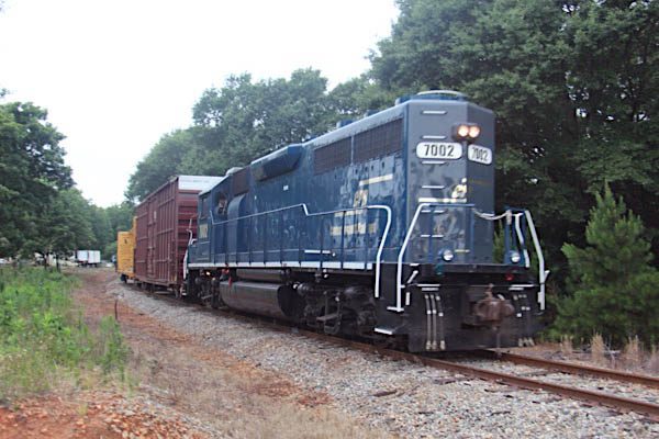
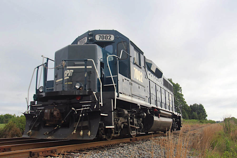
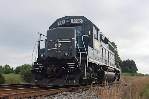
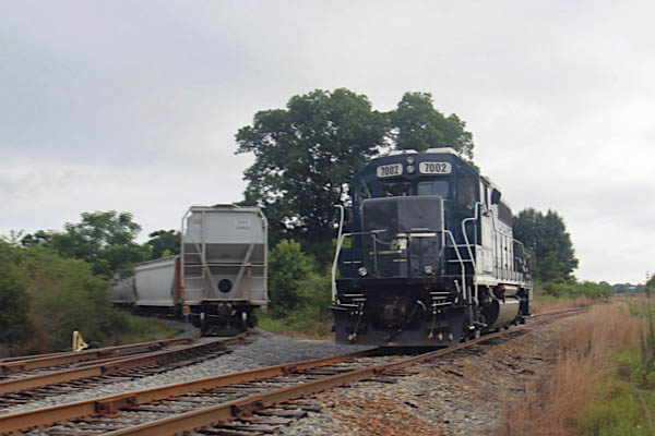
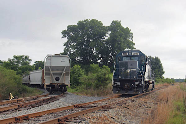
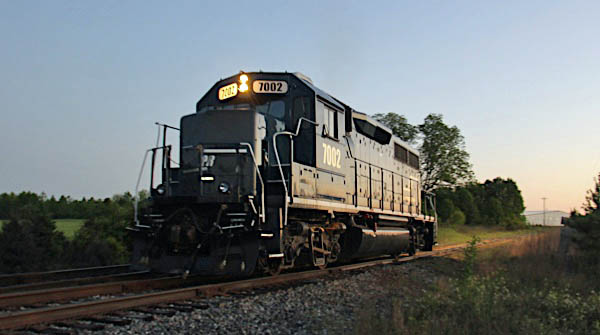
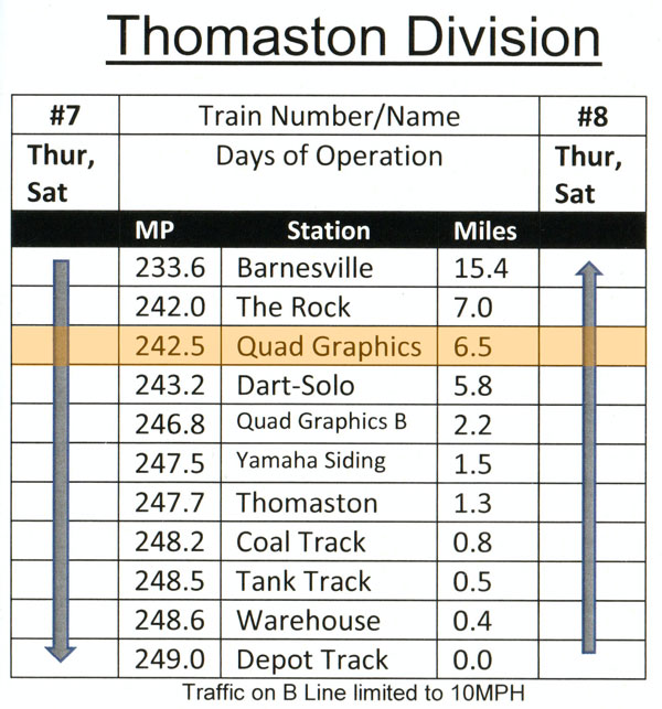
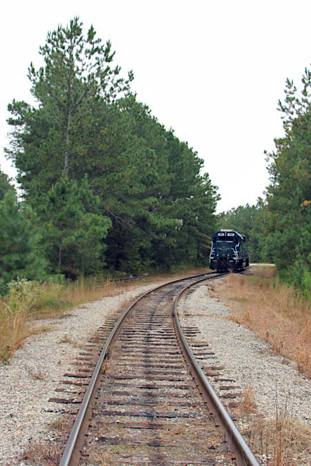
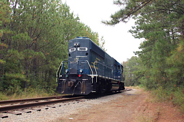
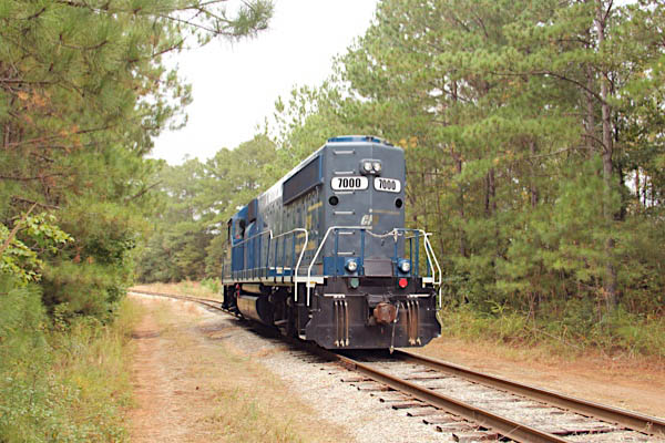
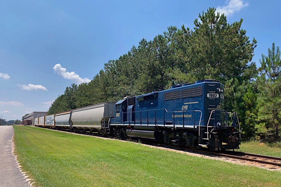
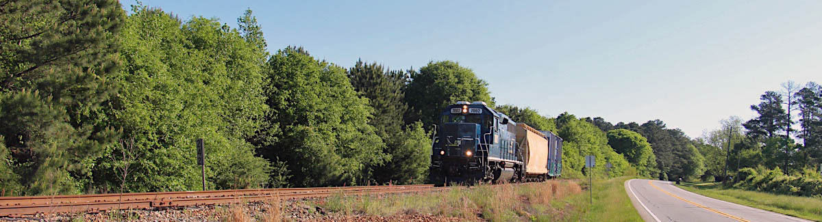
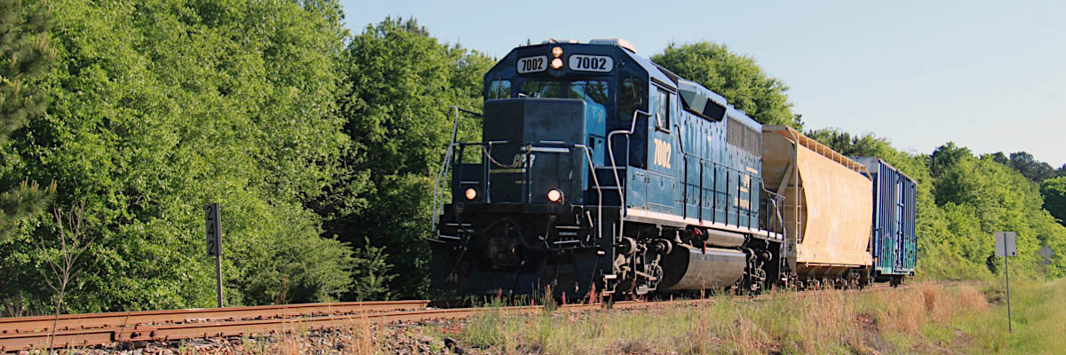
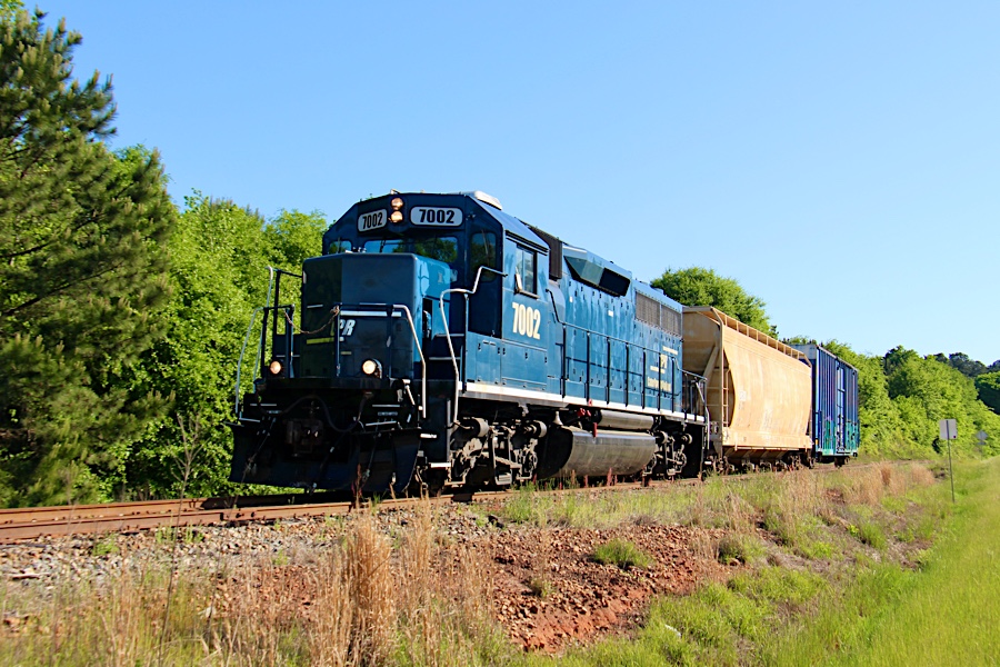
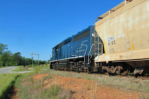
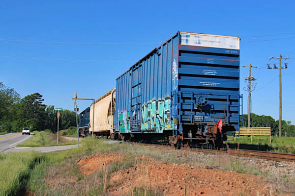
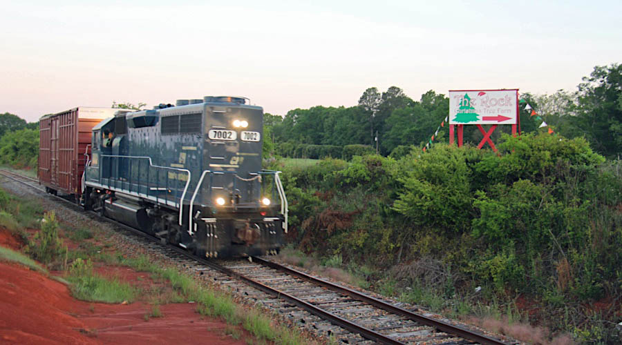
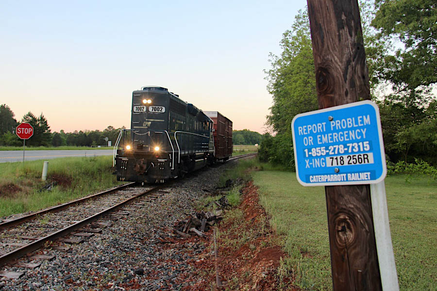
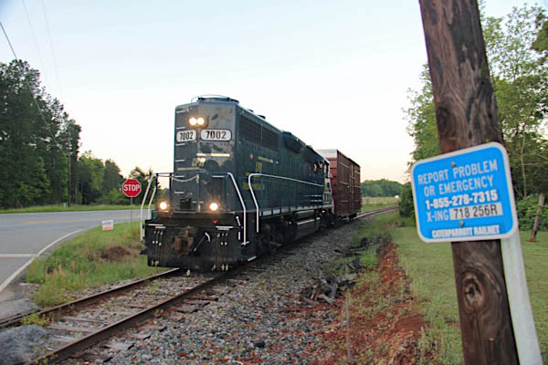
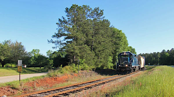
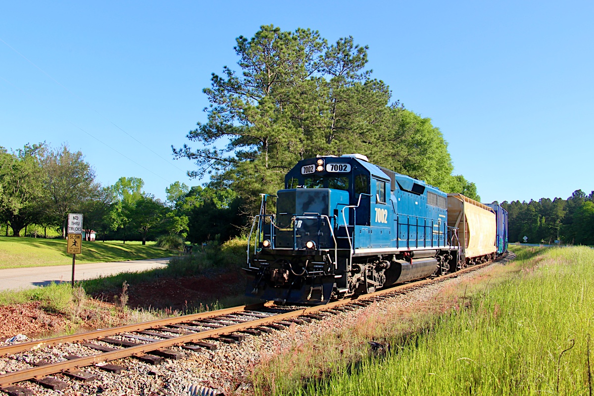
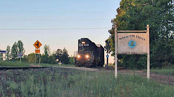
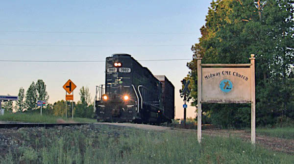
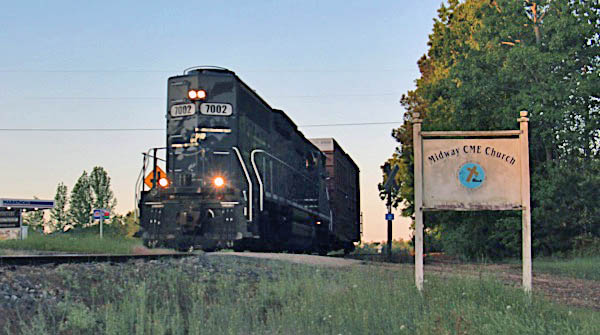
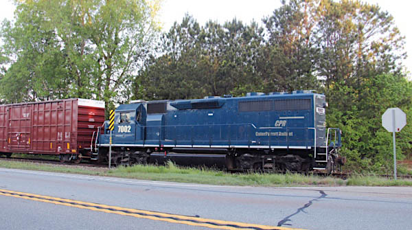
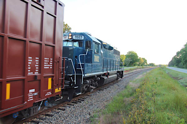
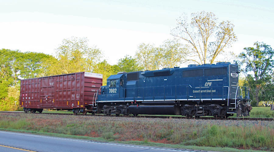
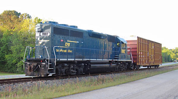
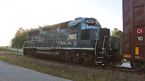
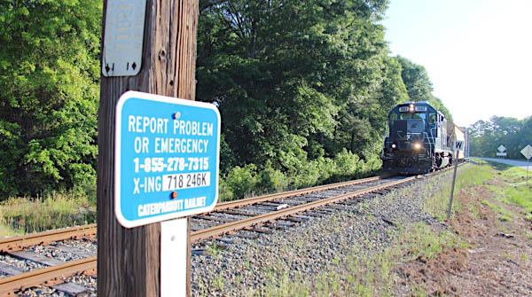
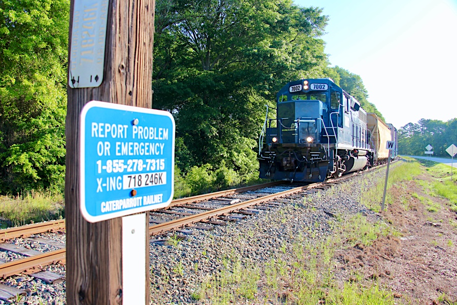
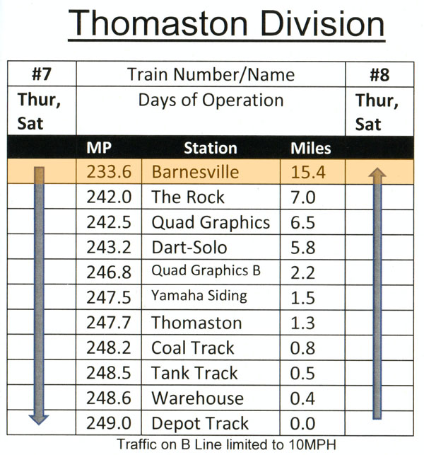
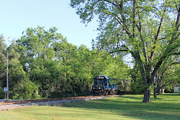
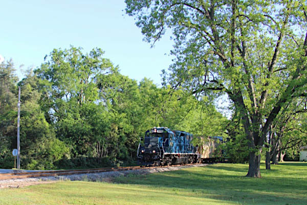
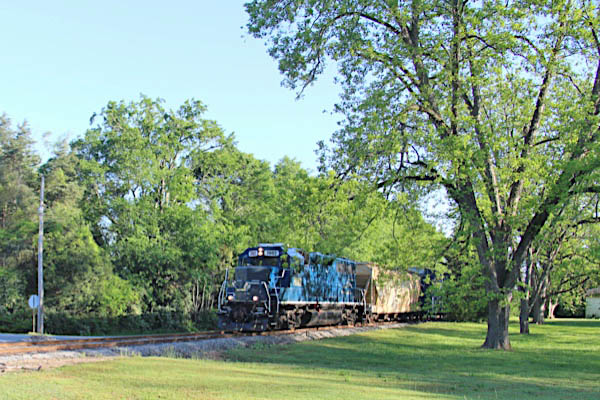
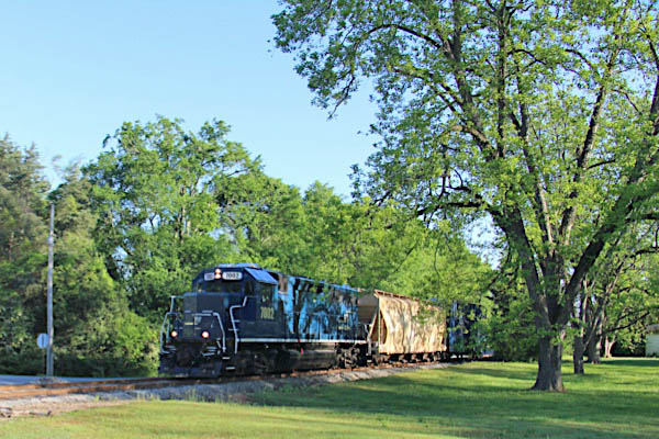
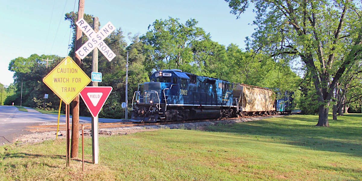
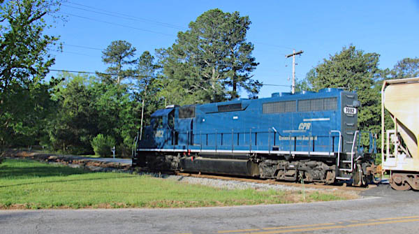
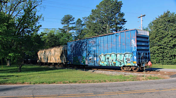
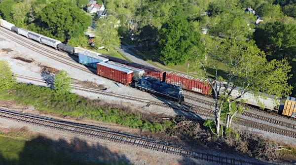
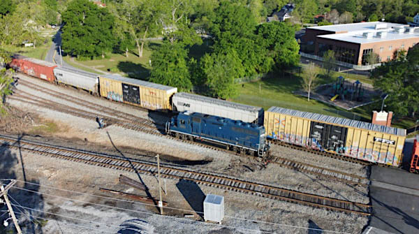
Although the industrial base of Thomaston had deteriorated by the 2000s, CaterParrott began a lease of the line from Norfolk Southern in 2016 and continues to serve several active shippers along the midsection of the route. Commodities shipped include plastic pellets, paper products, and lumber shipments. The tracks in Thomaston are often used for railcar storage. Interchange for the line is maintained in Barnesvile with the Norfolk Southern's Macon-Atlanta (former Central of Georgia) mainline. Ordinarily, CaterParrott keeps its motive power for the division on an industrial lead south of The Rock.
Georgia Department of Transportation / collection
SPV Comprehensive Railroad Atlas / collection
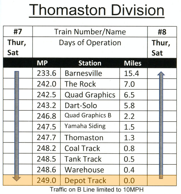
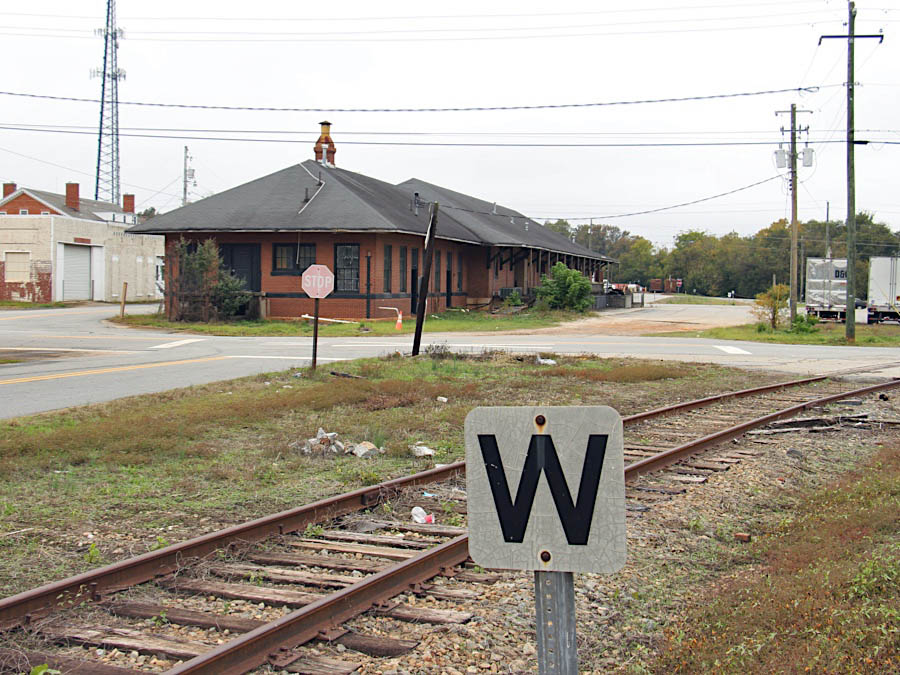
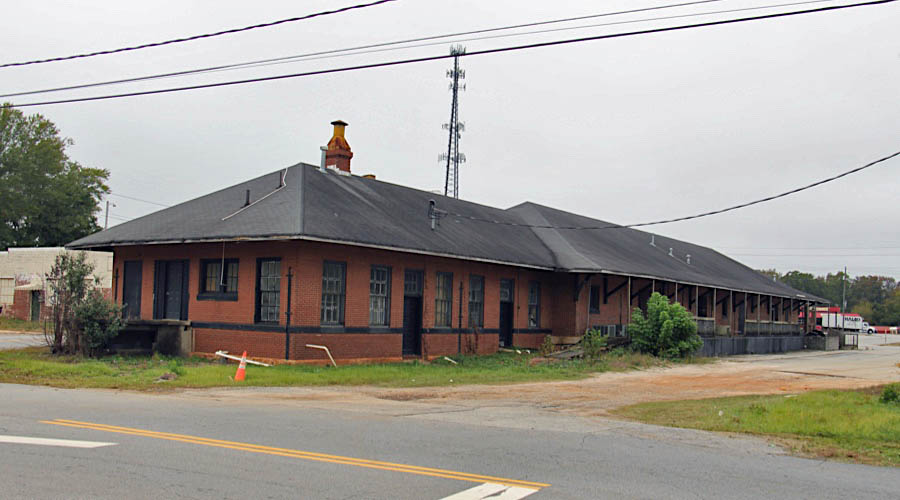
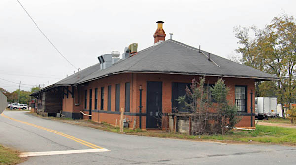
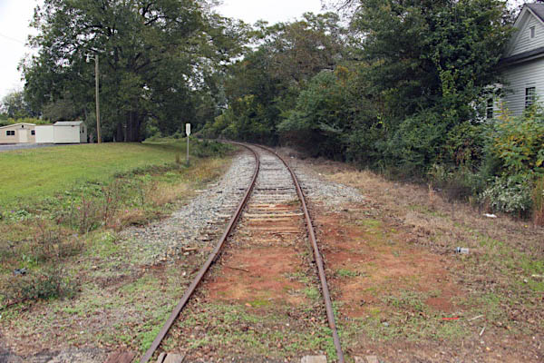
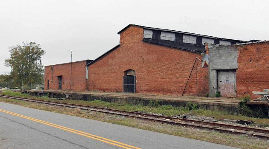
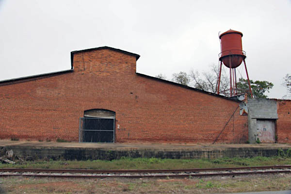
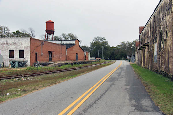
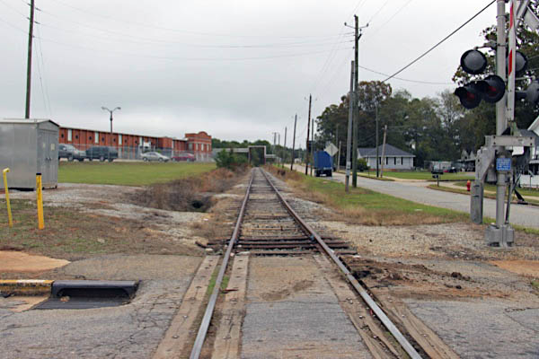
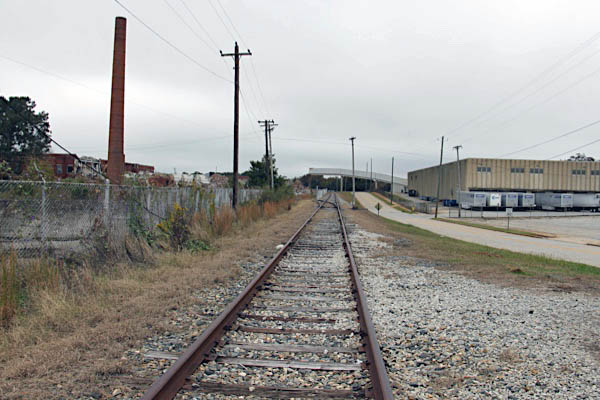
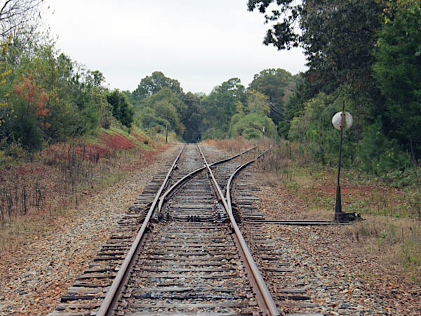
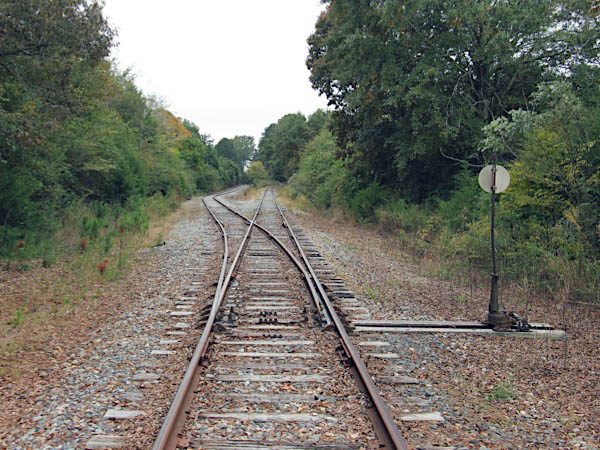
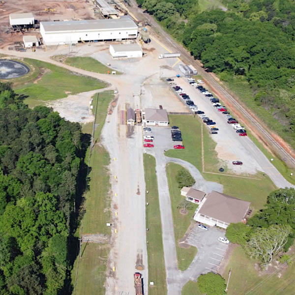
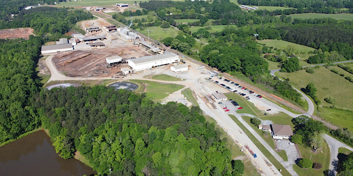
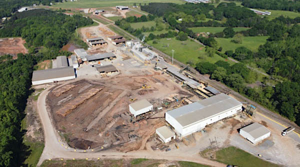
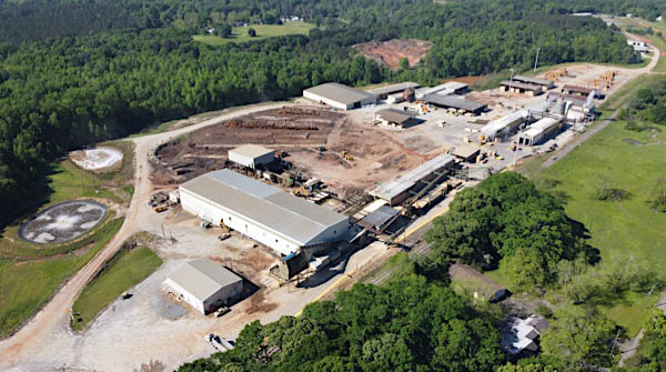
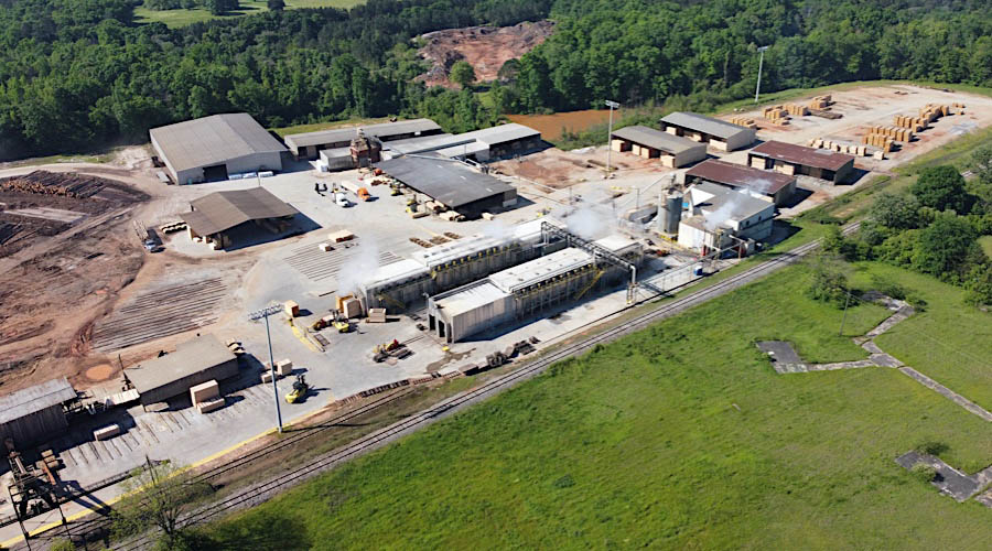
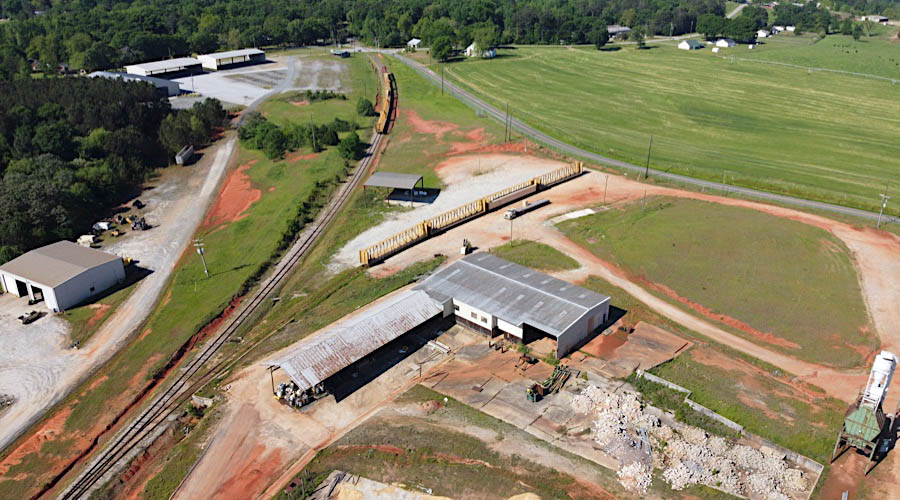
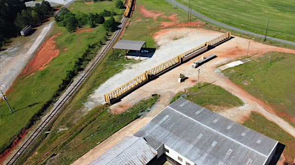
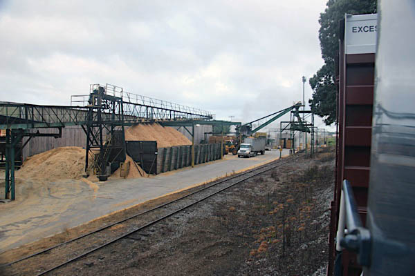
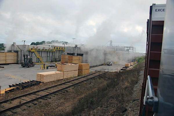
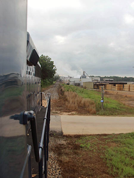
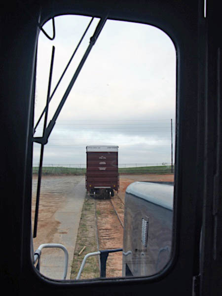
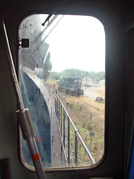
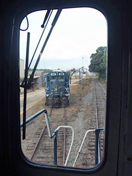
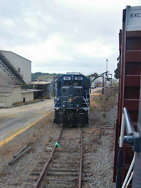
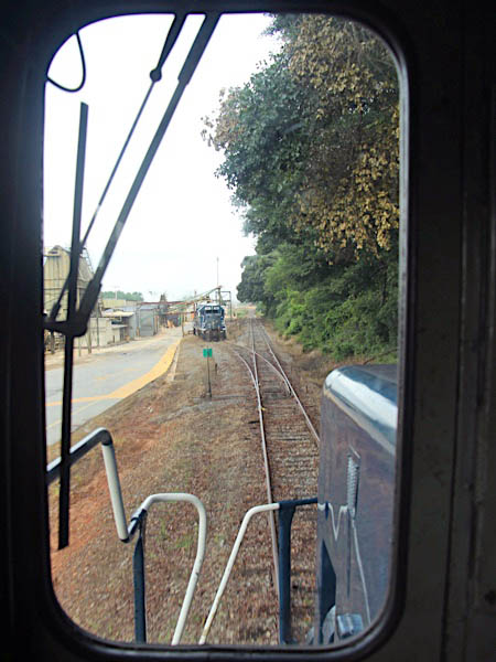
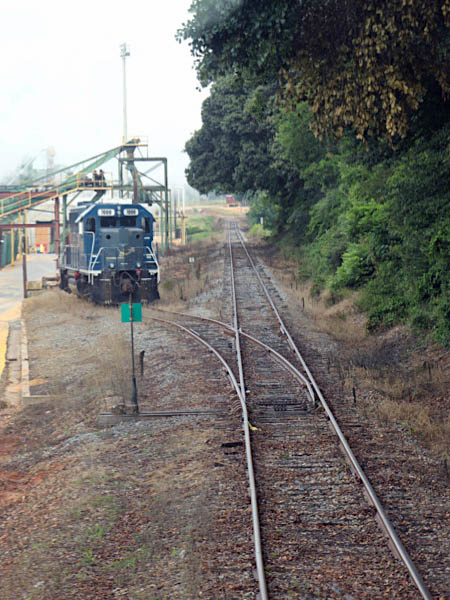
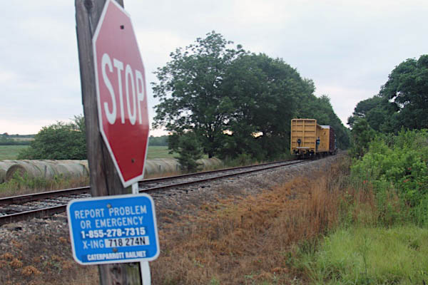
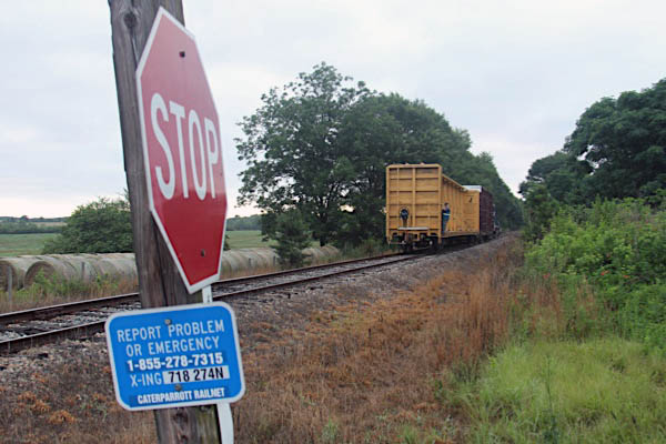
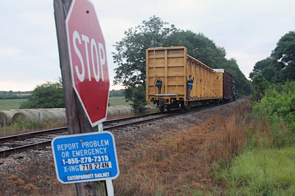
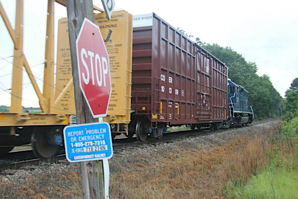
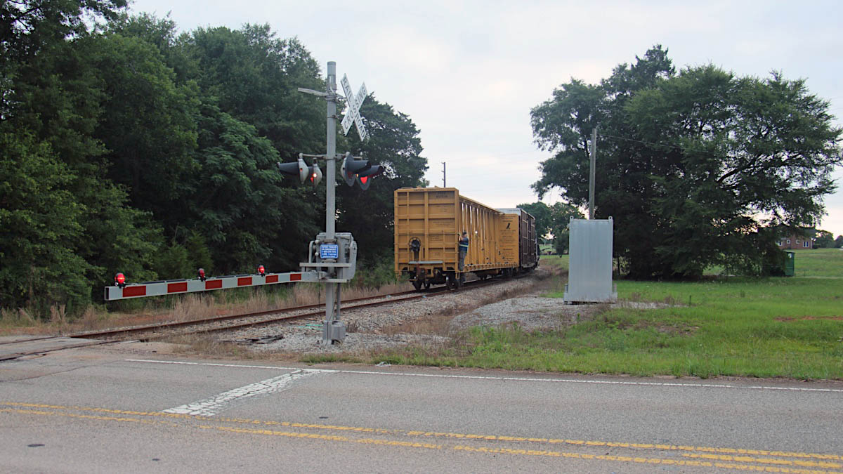
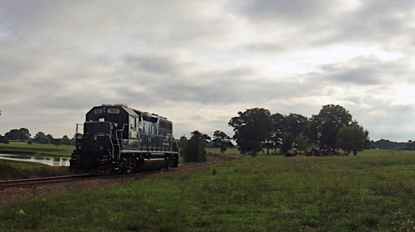
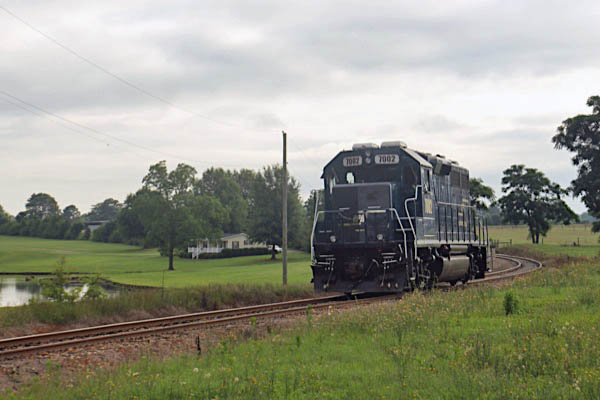
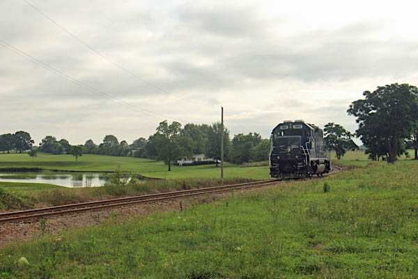
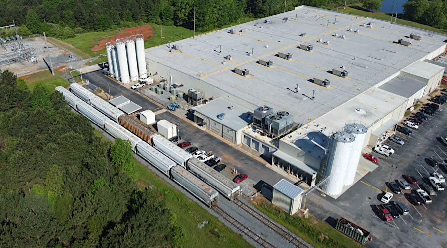
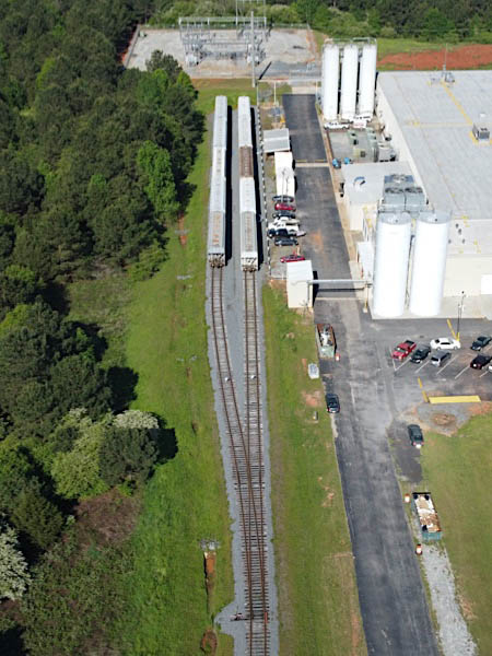
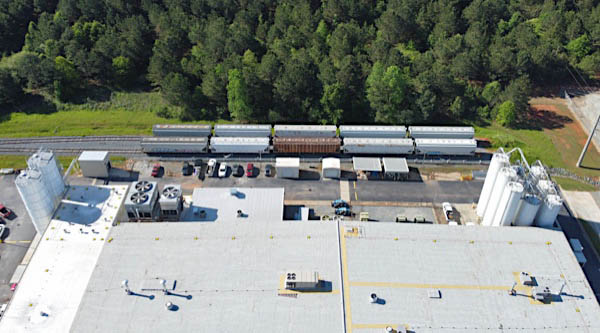
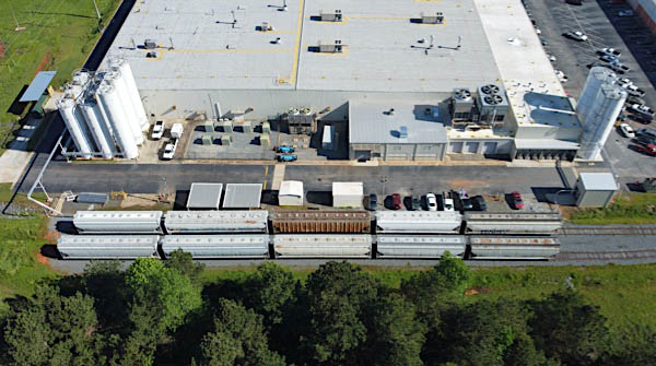
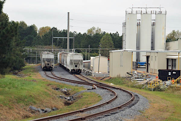
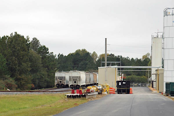
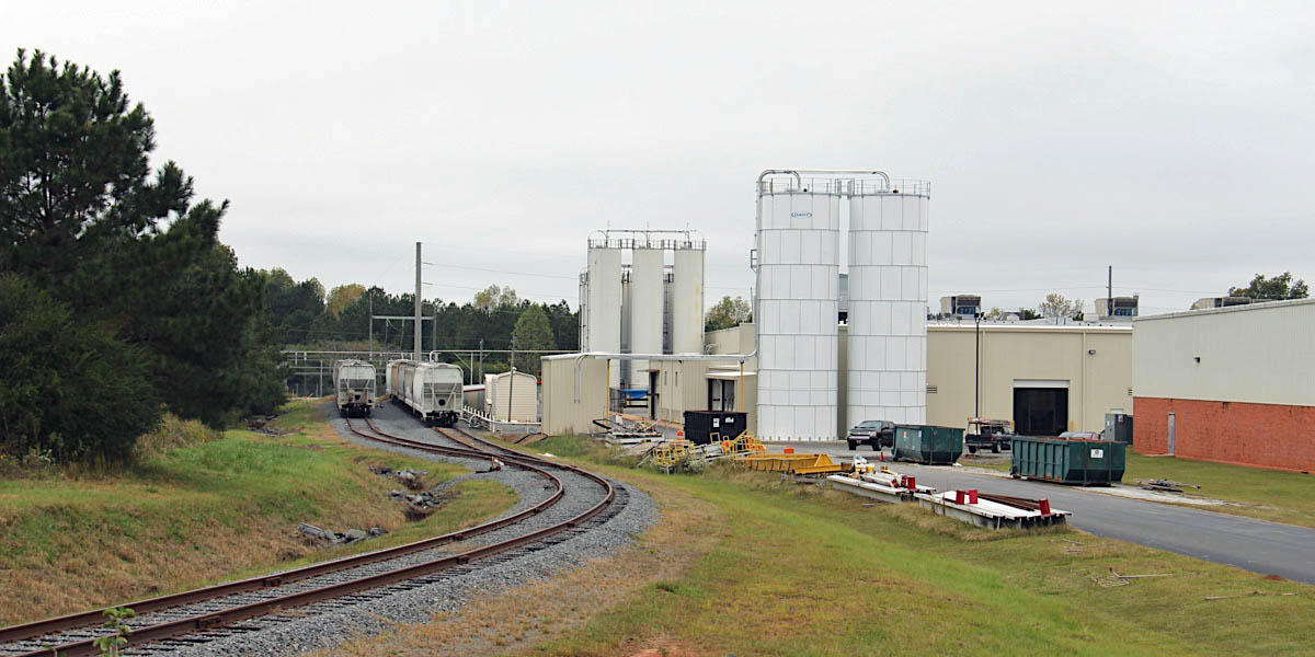
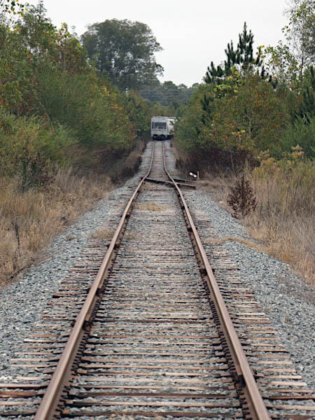
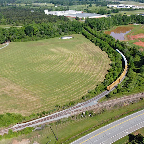
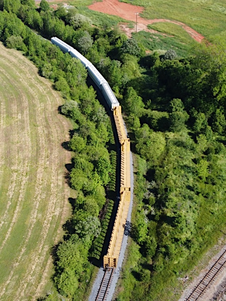
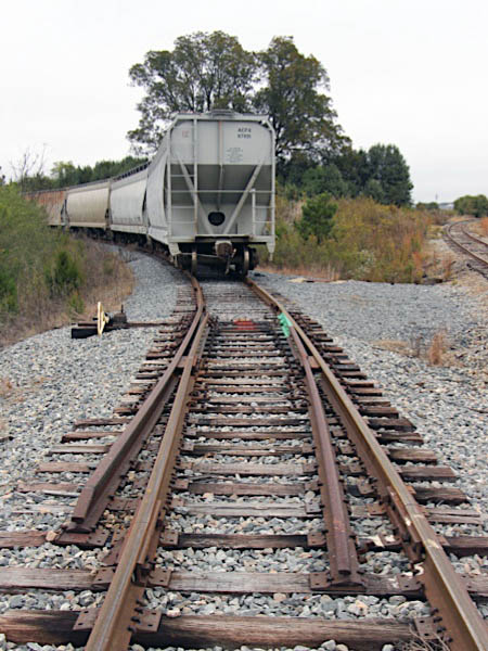
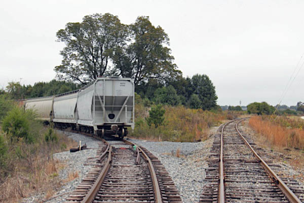
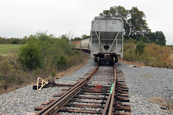
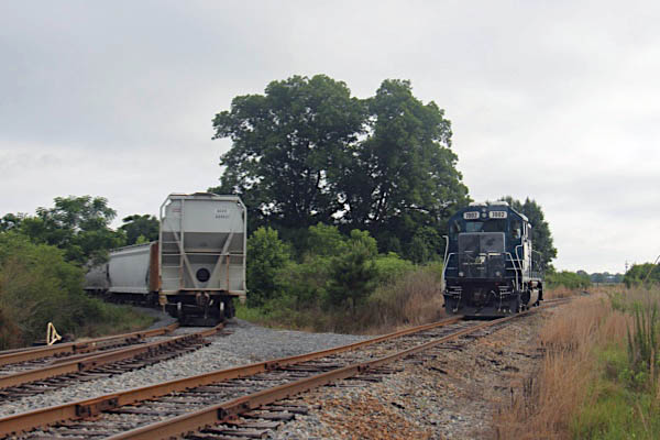
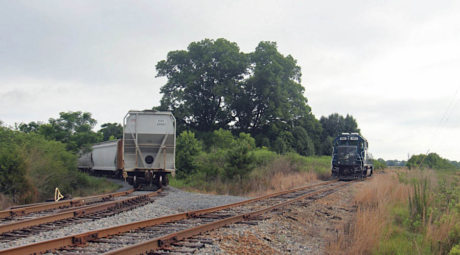
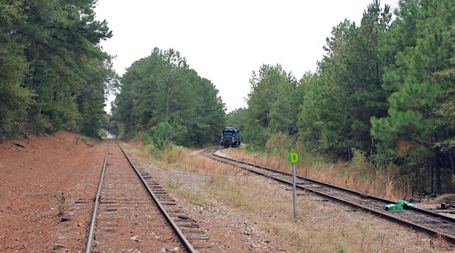
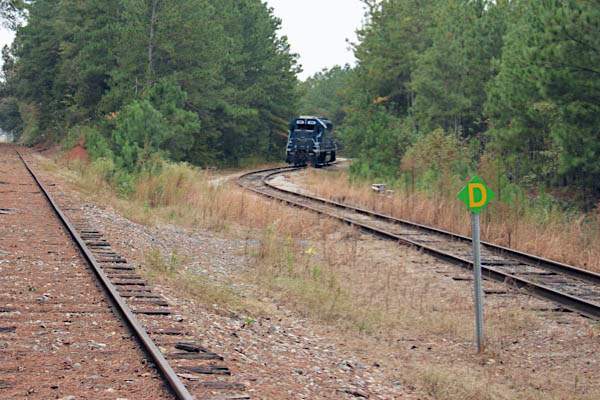
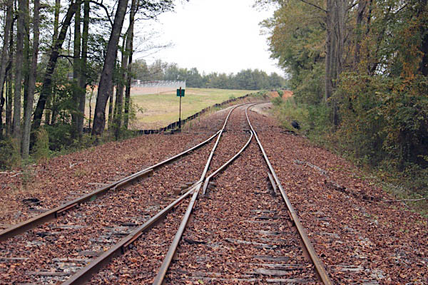
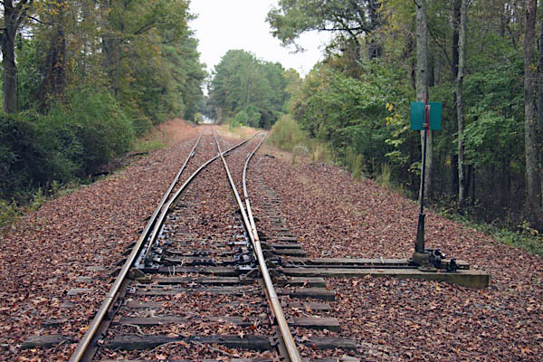
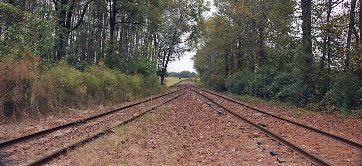
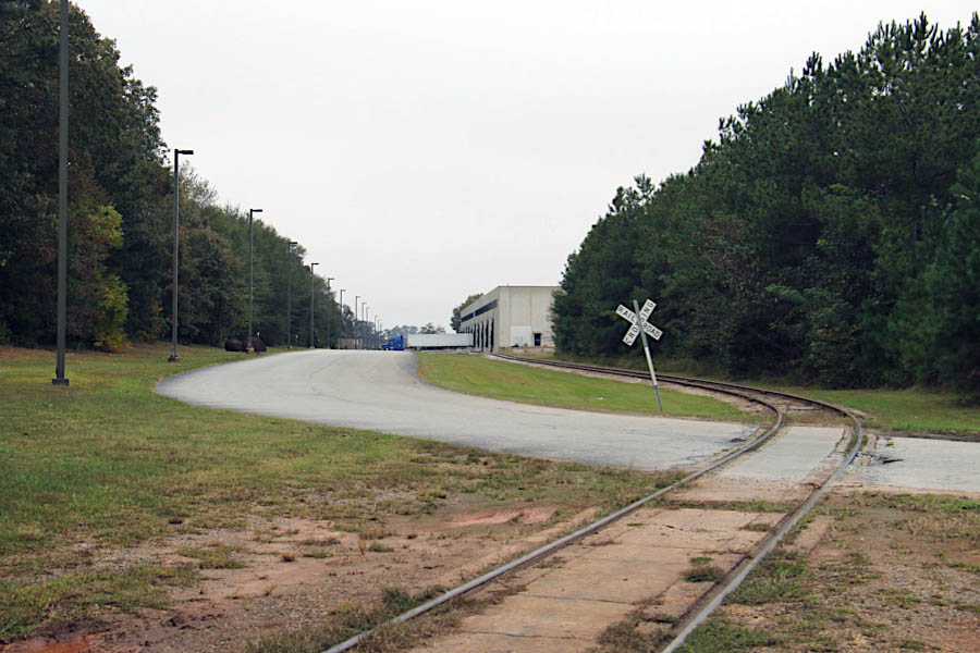
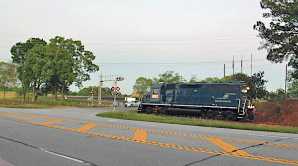
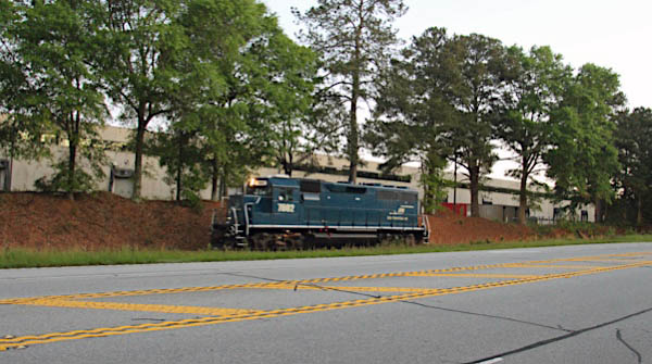
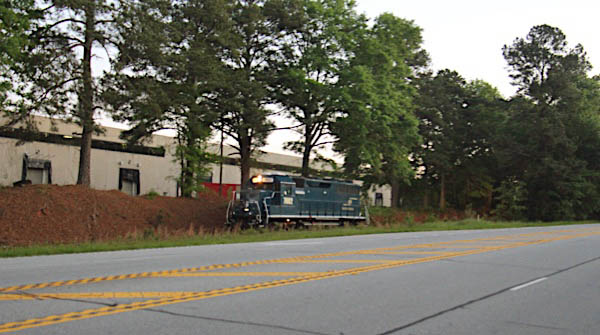
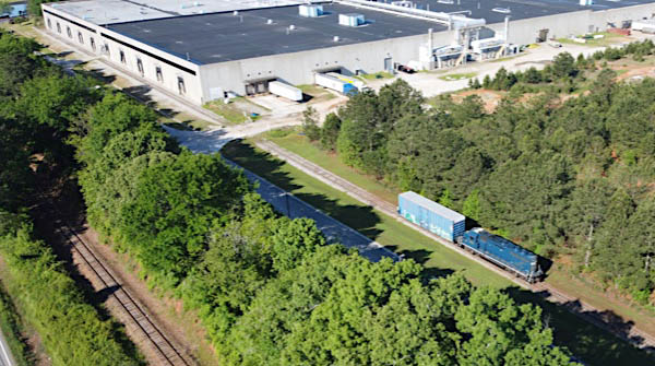
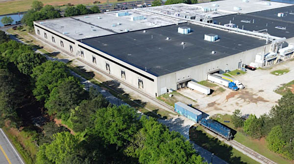
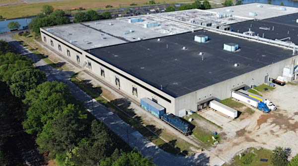
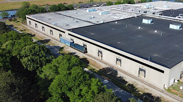
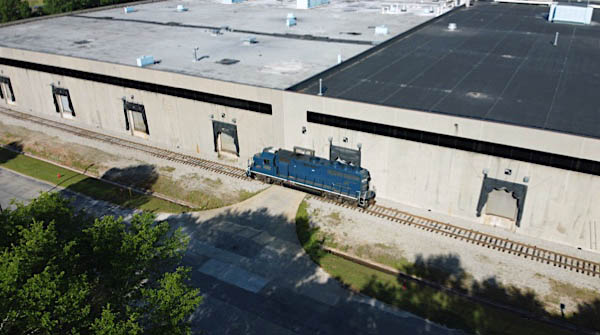
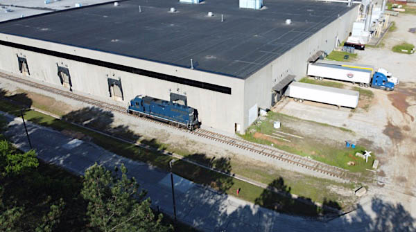
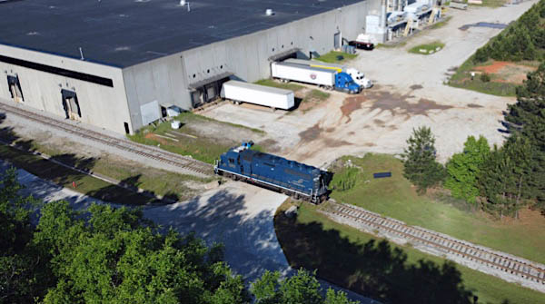
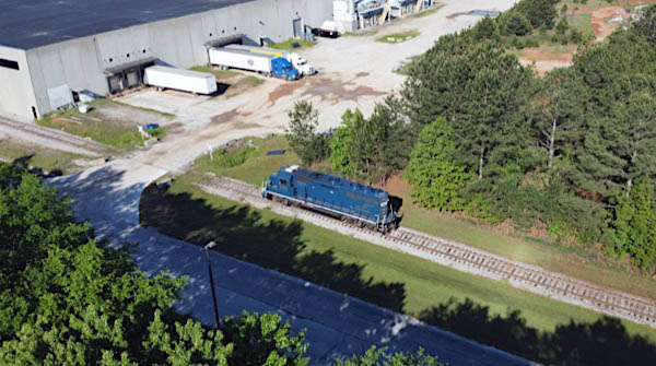
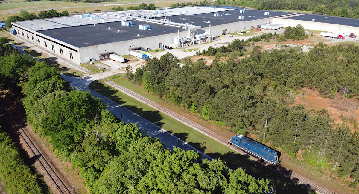
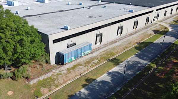
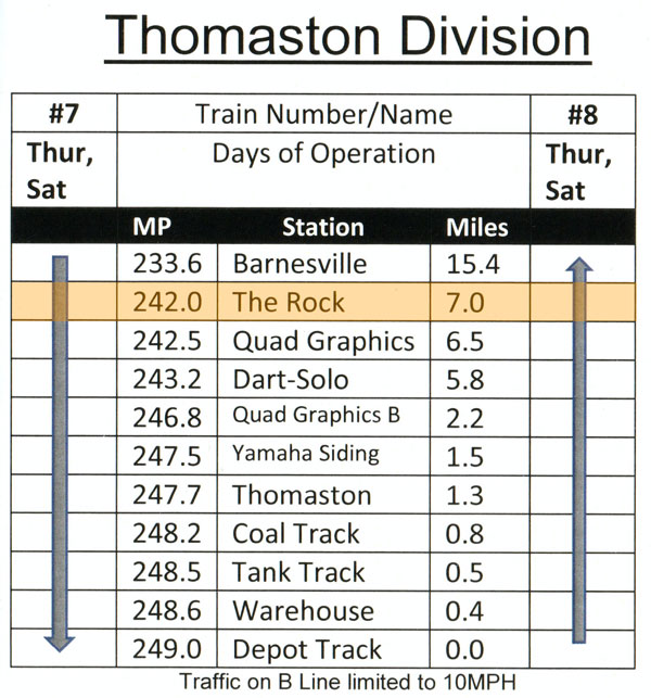
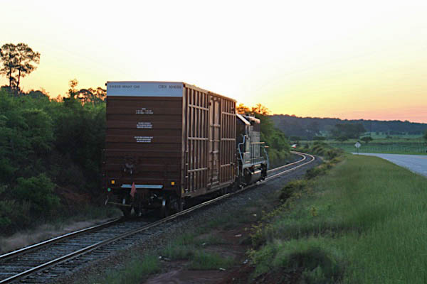
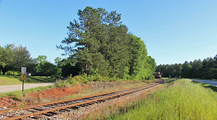
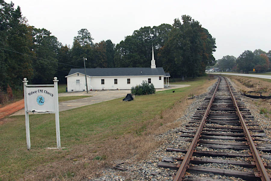
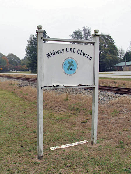
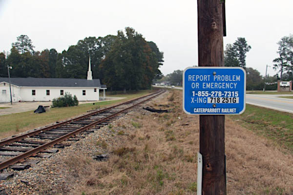
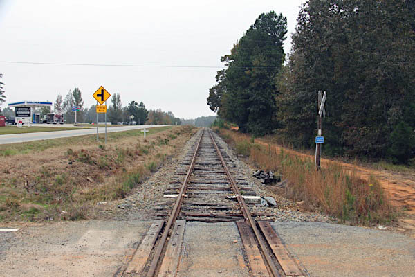
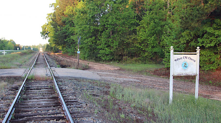
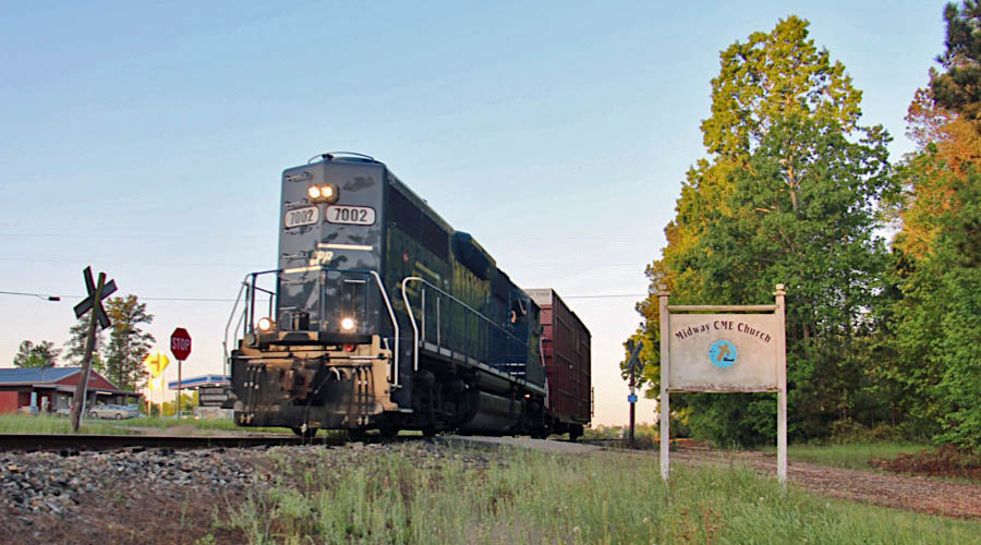
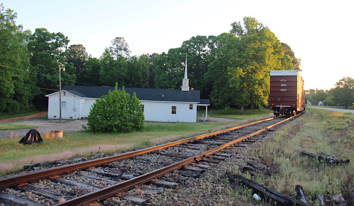
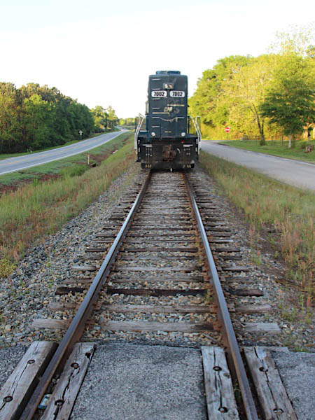
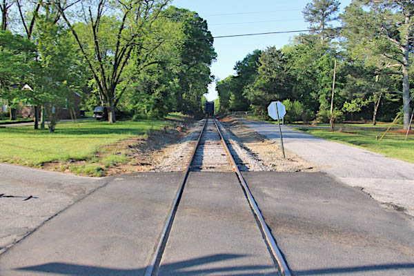
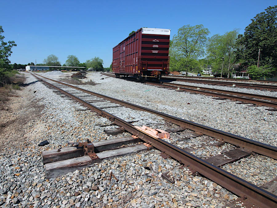
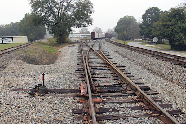
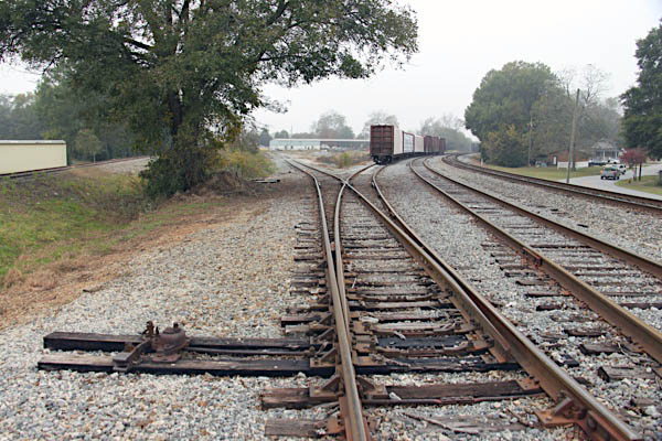
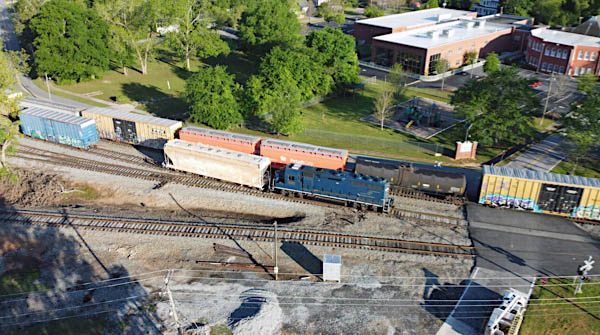
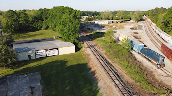
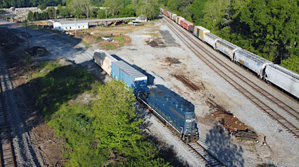
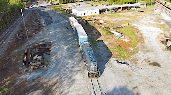
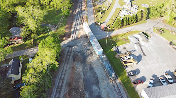
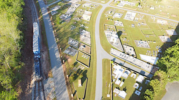
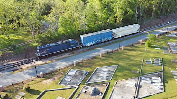
From south to north, the the Thomaston Division begins in its namesake community. Although the former Central of Georgia trackage still extends all the way into Thomaston, forming a loop that once served several manufacturing facilities, there are currently no active shippers on this portion of the line, south of the Interfor sawmill. The trackage in Thomaston is however often used for third-party railcar or locomotive storage. Furthermore, CPR crews are known to occasionally traverse the loop track for lunch at Thomaston's Dairy Queen!
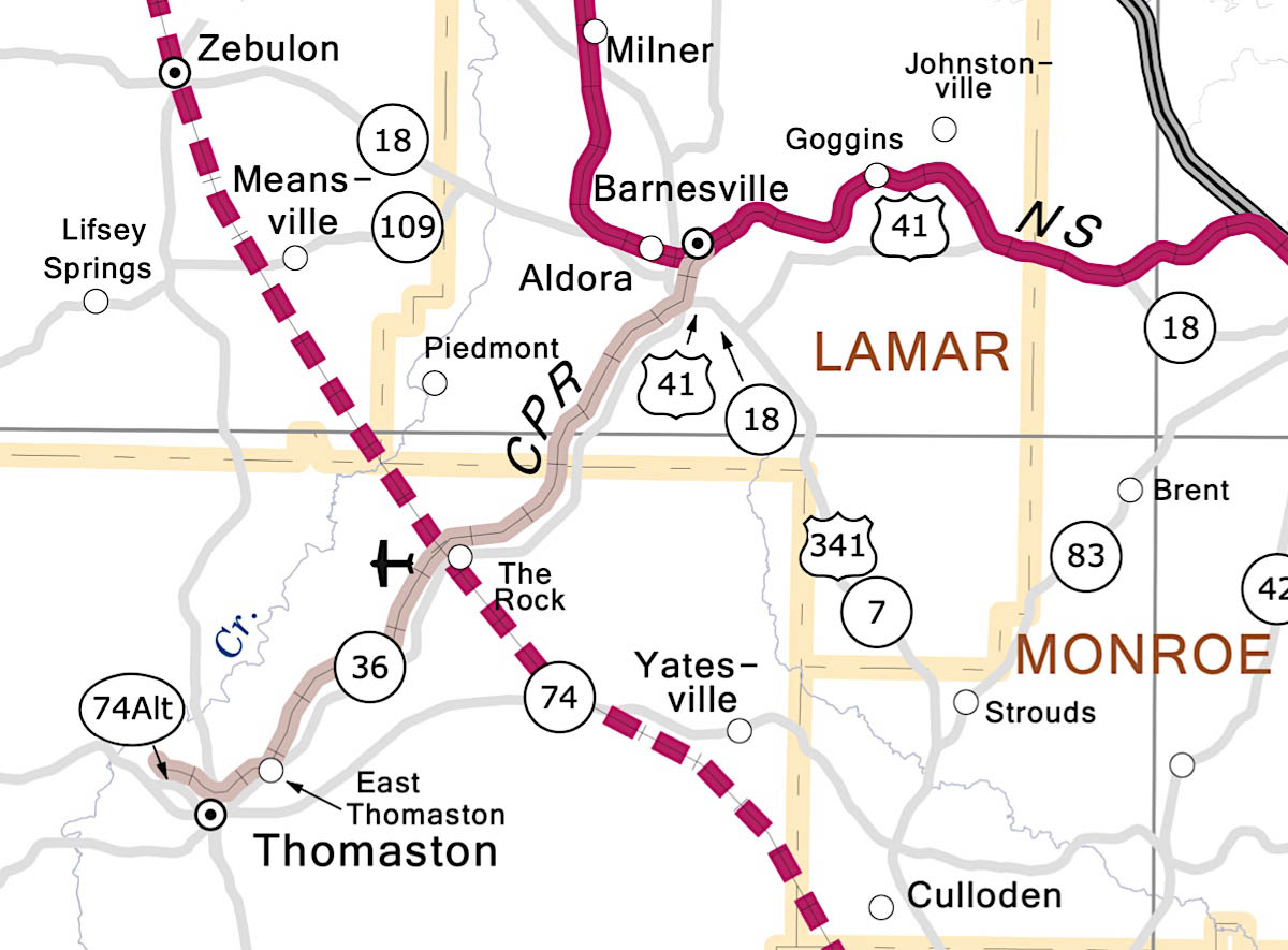
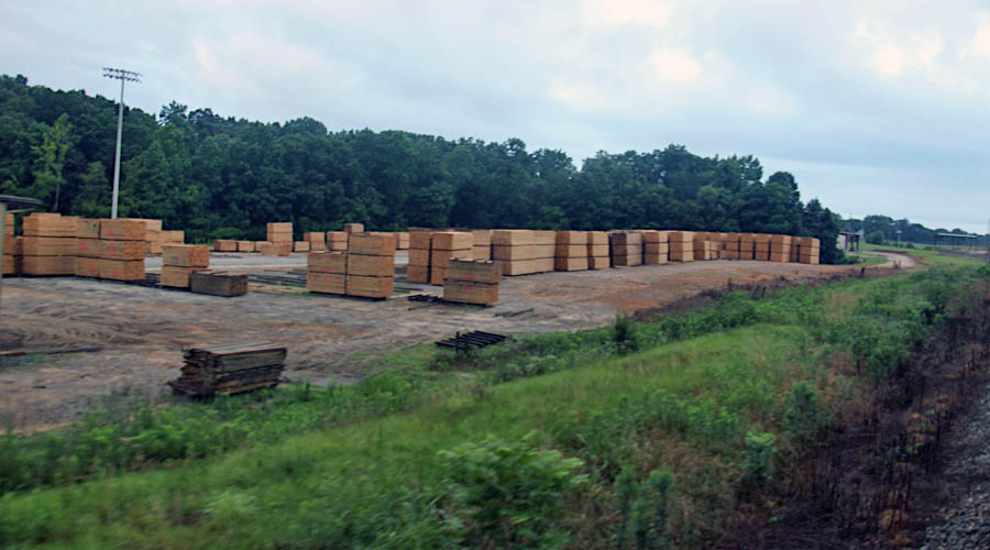
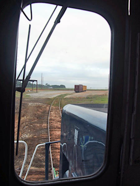
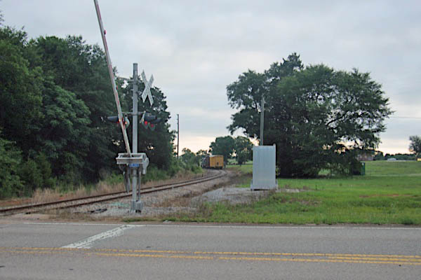
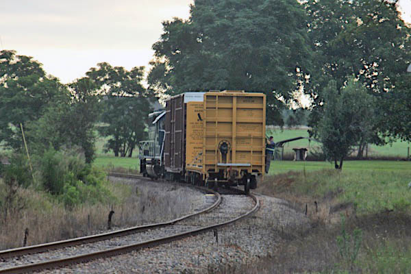
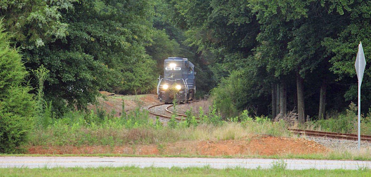
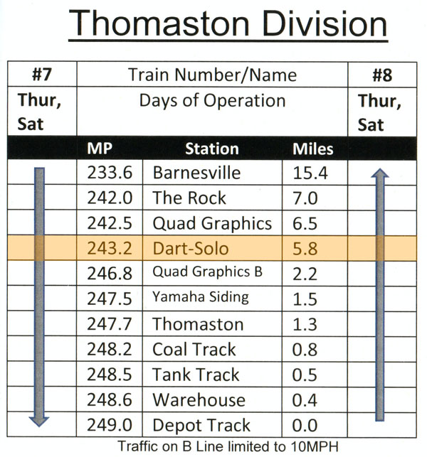
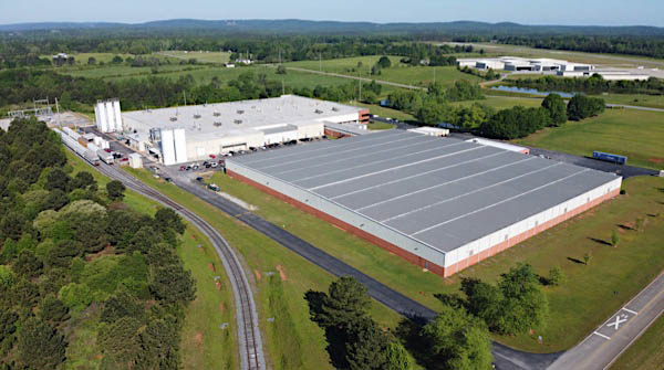
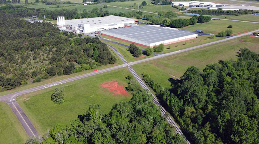
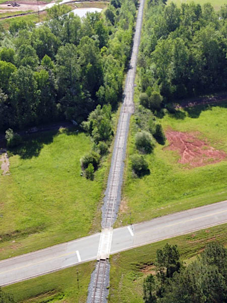
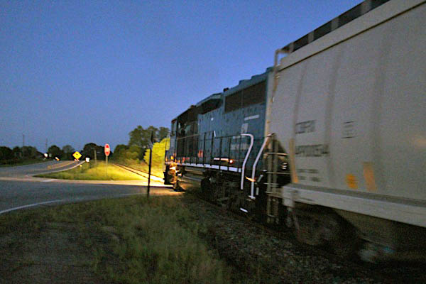
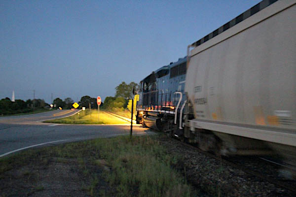
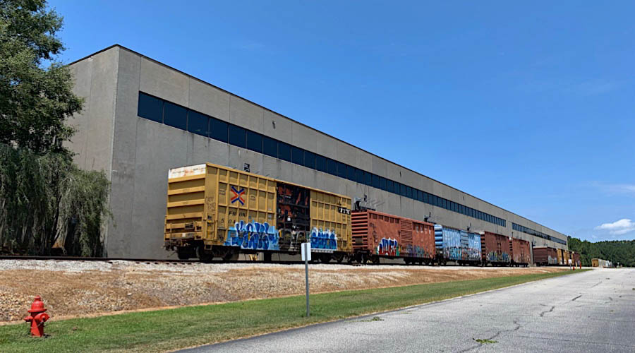
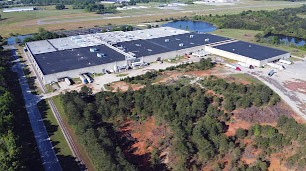
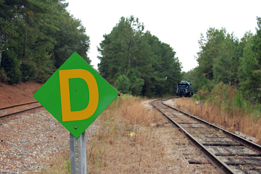
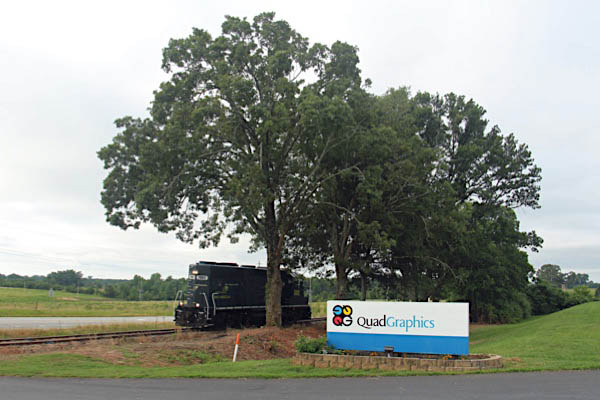
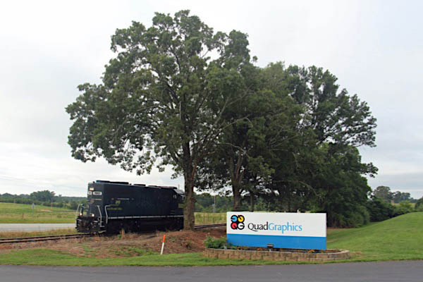
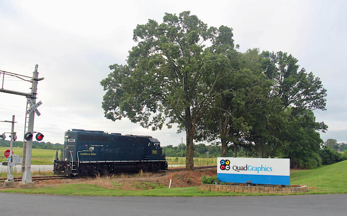
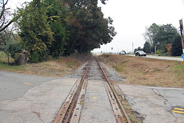
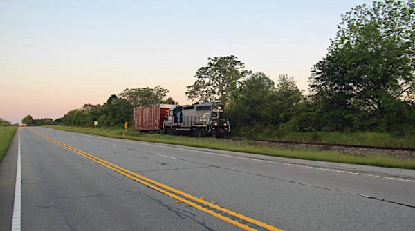
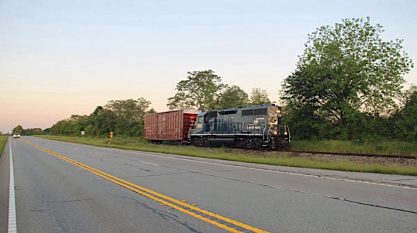
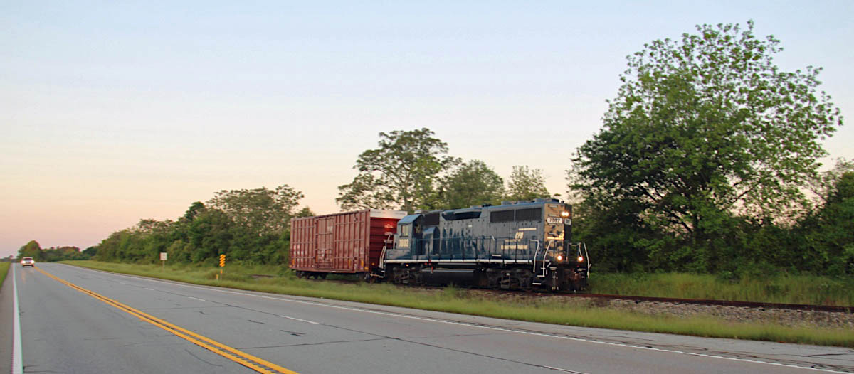
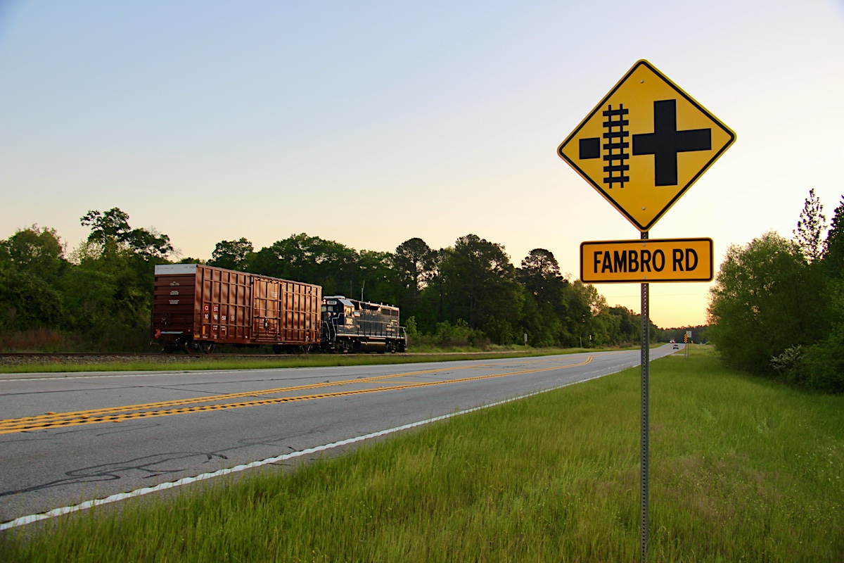
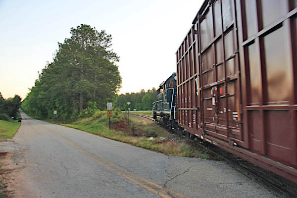
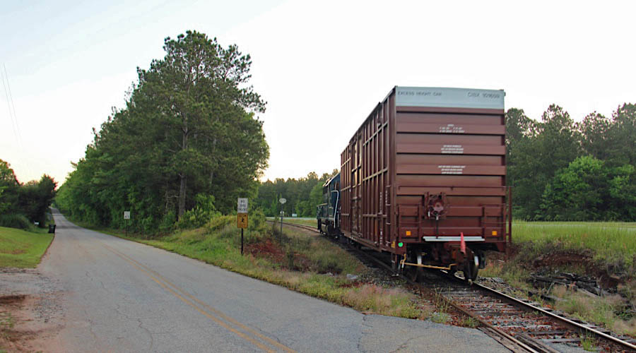
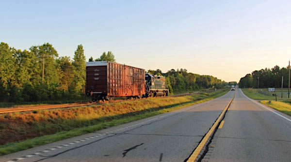
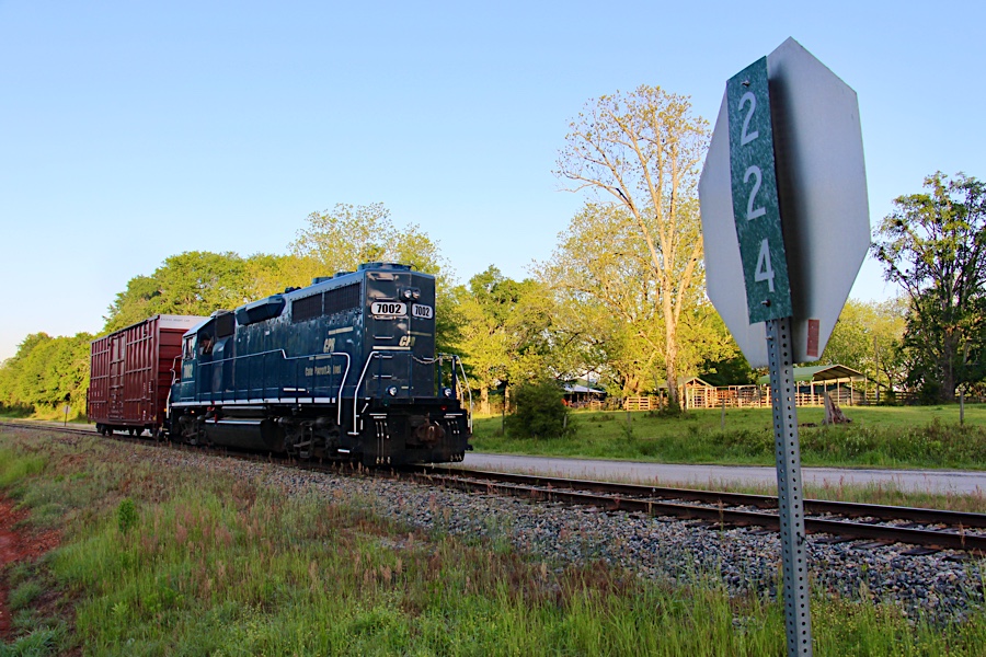
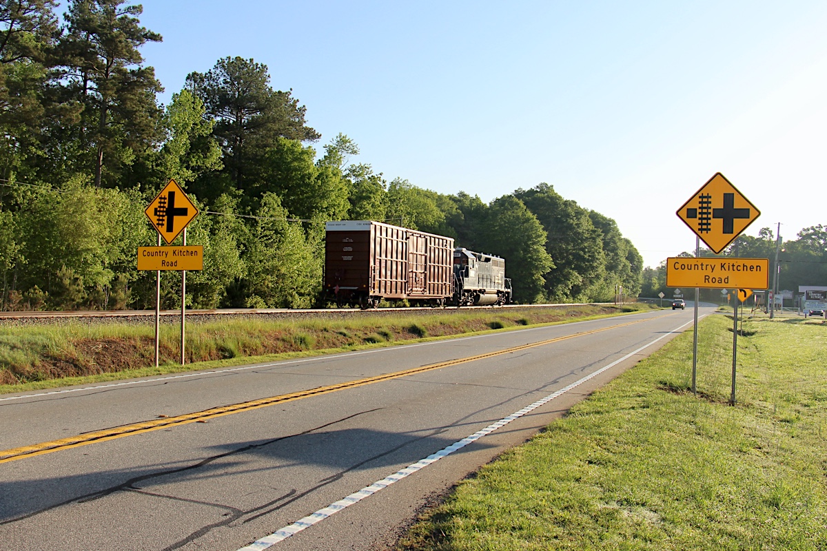
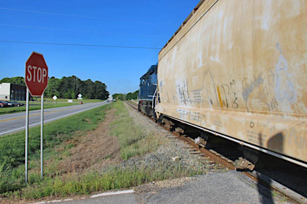
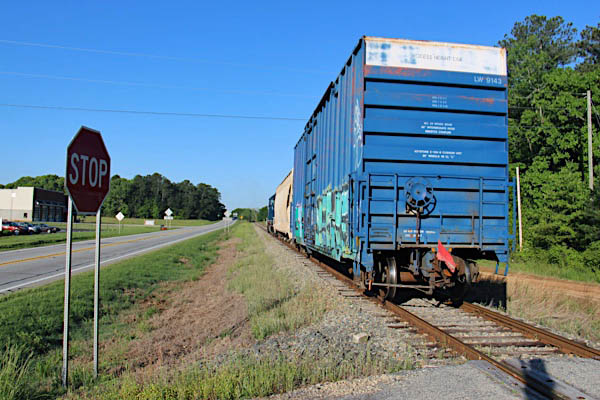
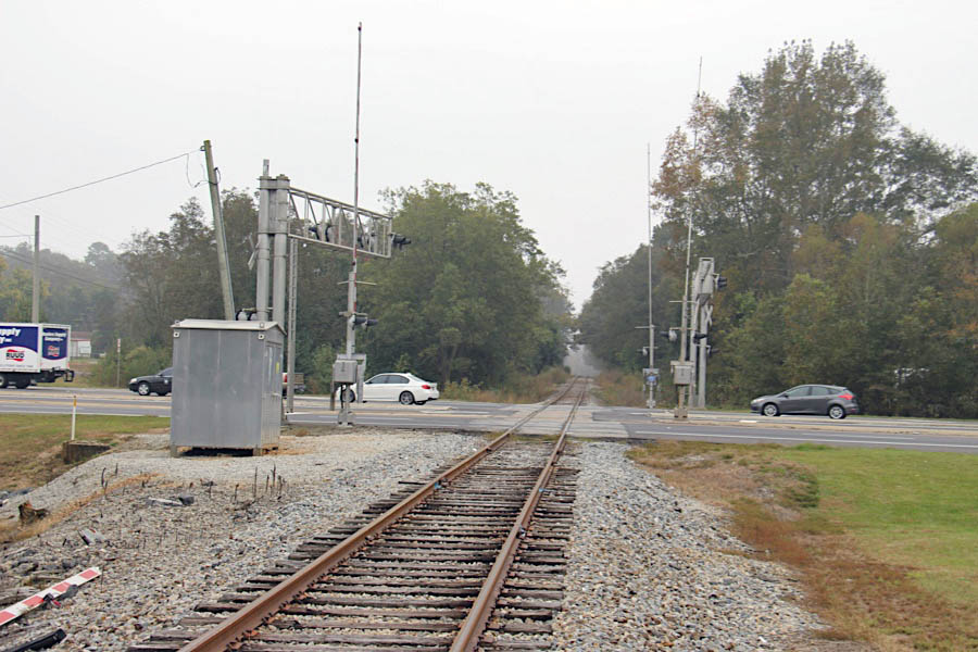
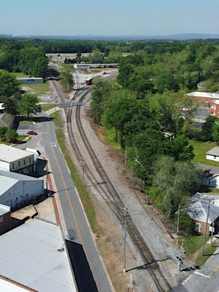
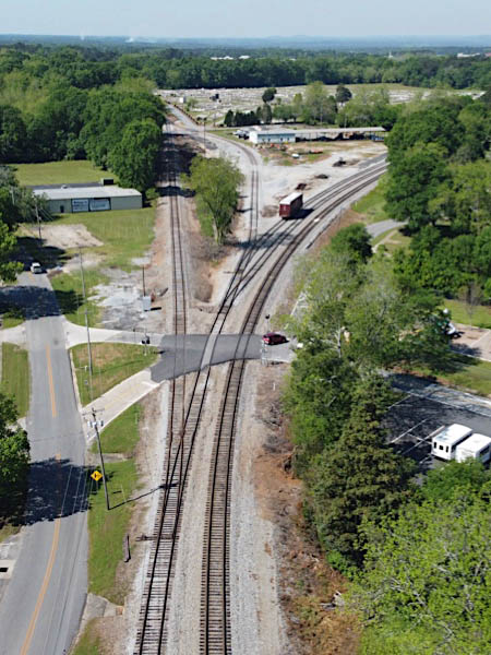
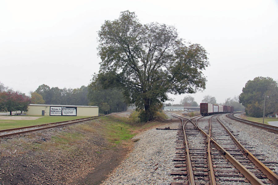
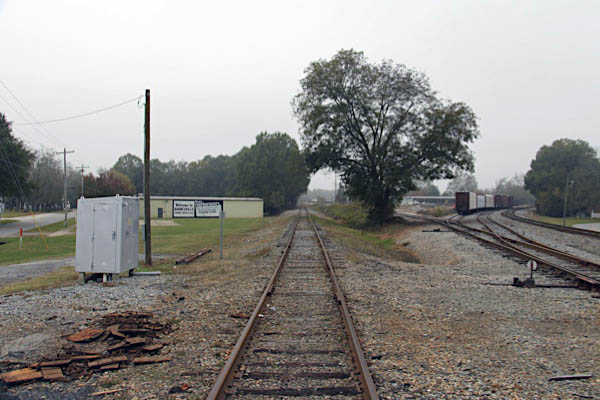
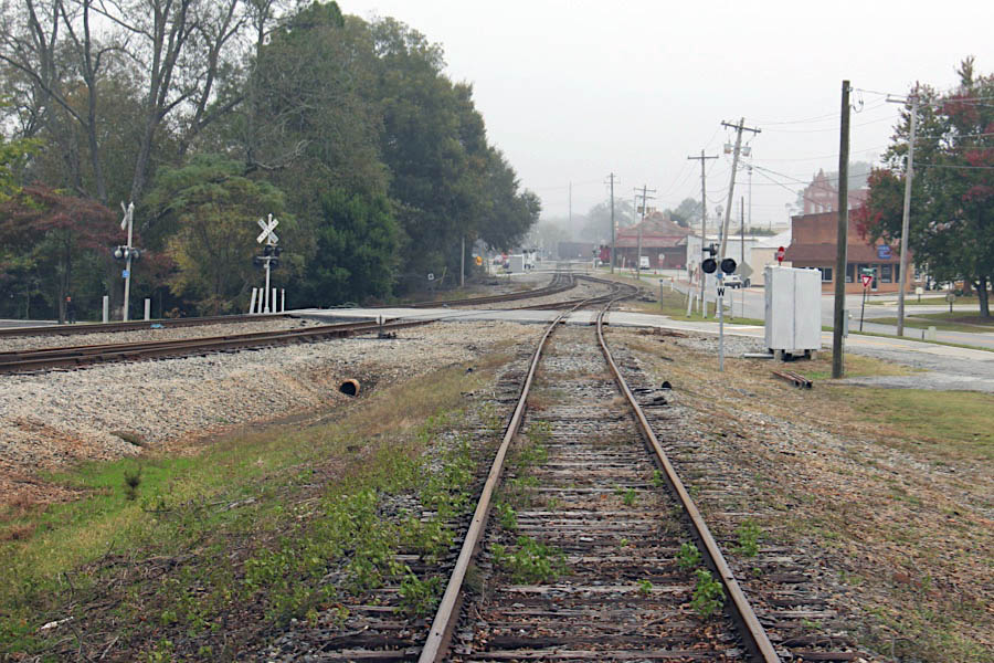
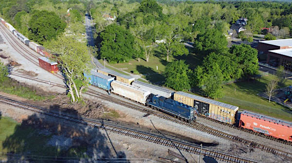
After Thomaston, the line travels northwest 16 miles to Barnesville, paralleled by State Highway 36 nearly the entire route. Along 36 north of town, a series of sidings serve the line's currently active shippers: Interfor sawmill, Dart/Solo Corporation, and Quad/Graphics. The Interfor facility is mostly inaccessible from public roads, but can be viewed at either end. The Dart/Solo siding is a new one and includes a spiked switch for future industrial expansion. CPR crews ordinarily tie down the division's power on the Quad/Graphics spur. There are no sidings or shippers between the historic village of The Rock and Barnesville, but the line features many curves, grade, and road crossings.
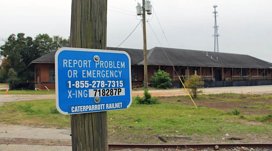
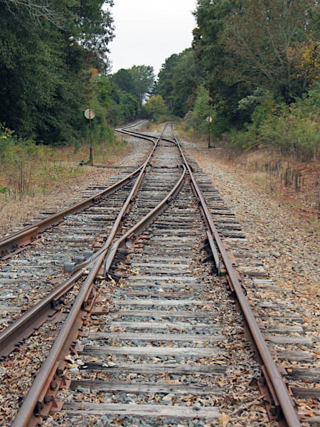
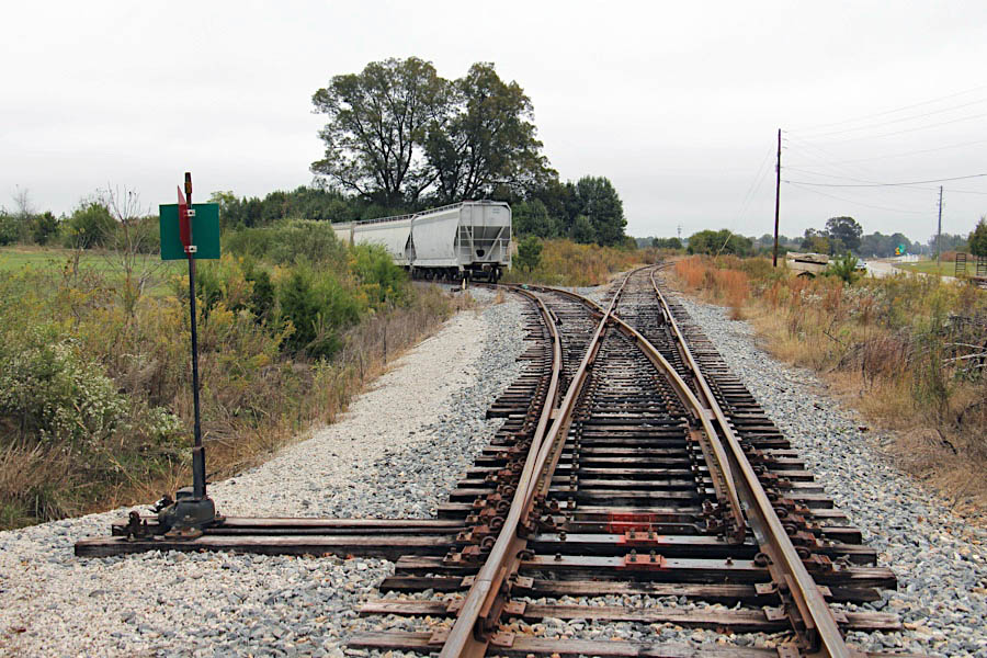
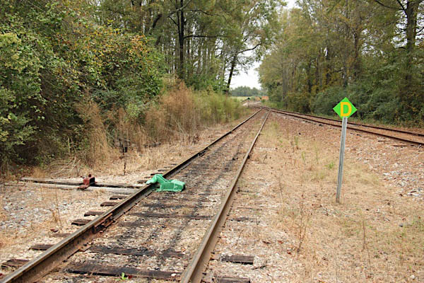
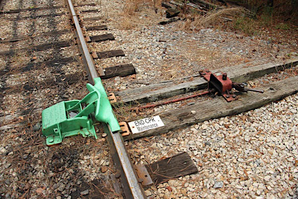
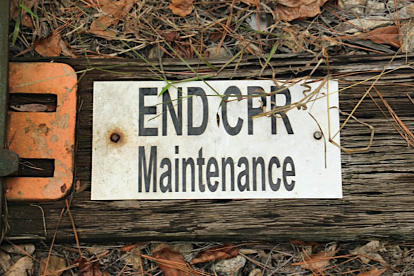
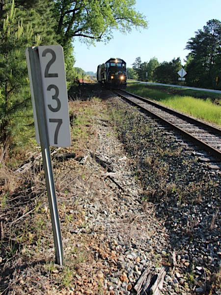
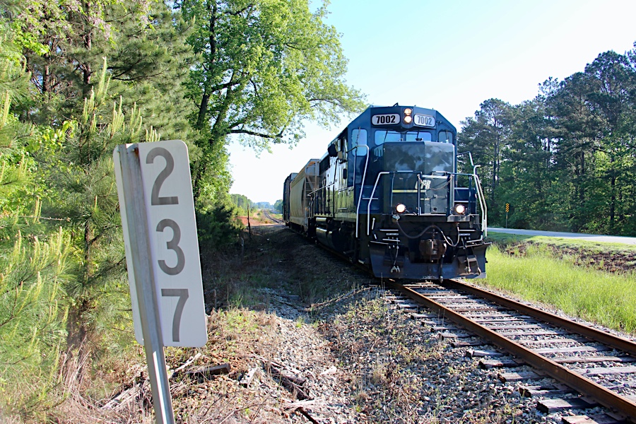
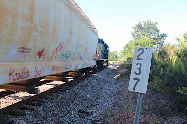
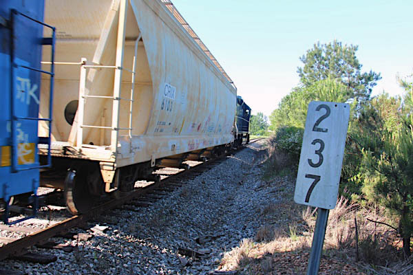
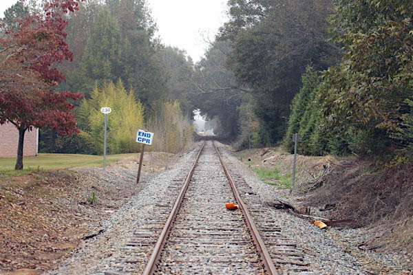
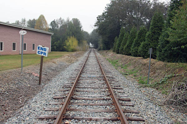
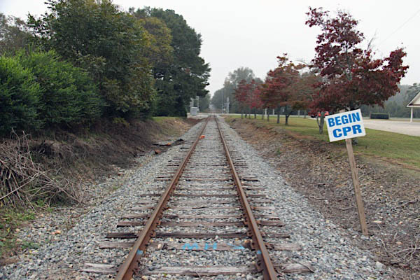
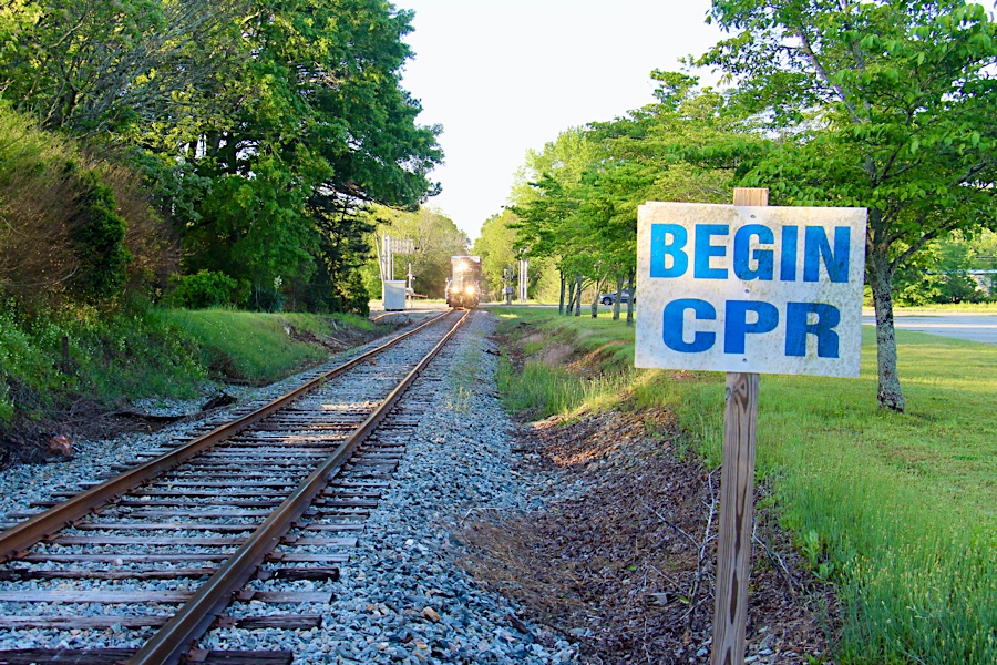
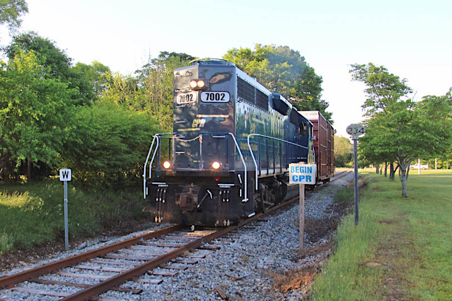
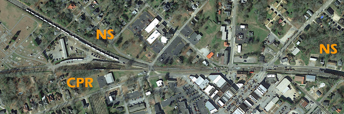
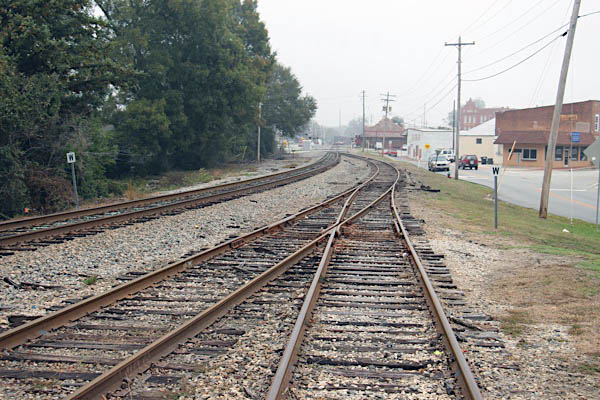
The line terminates at an interchange with the Norfolk Southern's active mainline between Atlanta and Macon, at Barnesville. Both the mainline and the CaterParrott branchline are former Central of Georgia routes, as noted above. CPR meets the mainline just southwest of the historic Barnesville depot, featured below. Lease authority for CaterParrott actually begins south of downtown, at milepost 234 just north of the U.S. Highway 41 crossing.
collection
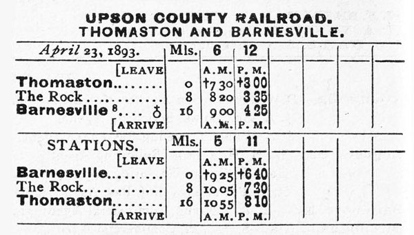
1893 Official Guide ad / collection
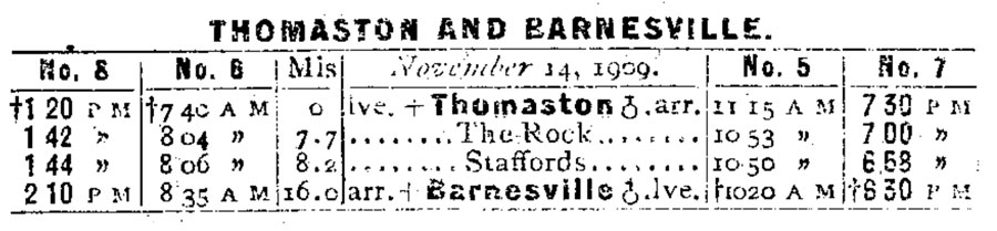
1910 Official Guide timetable / collection

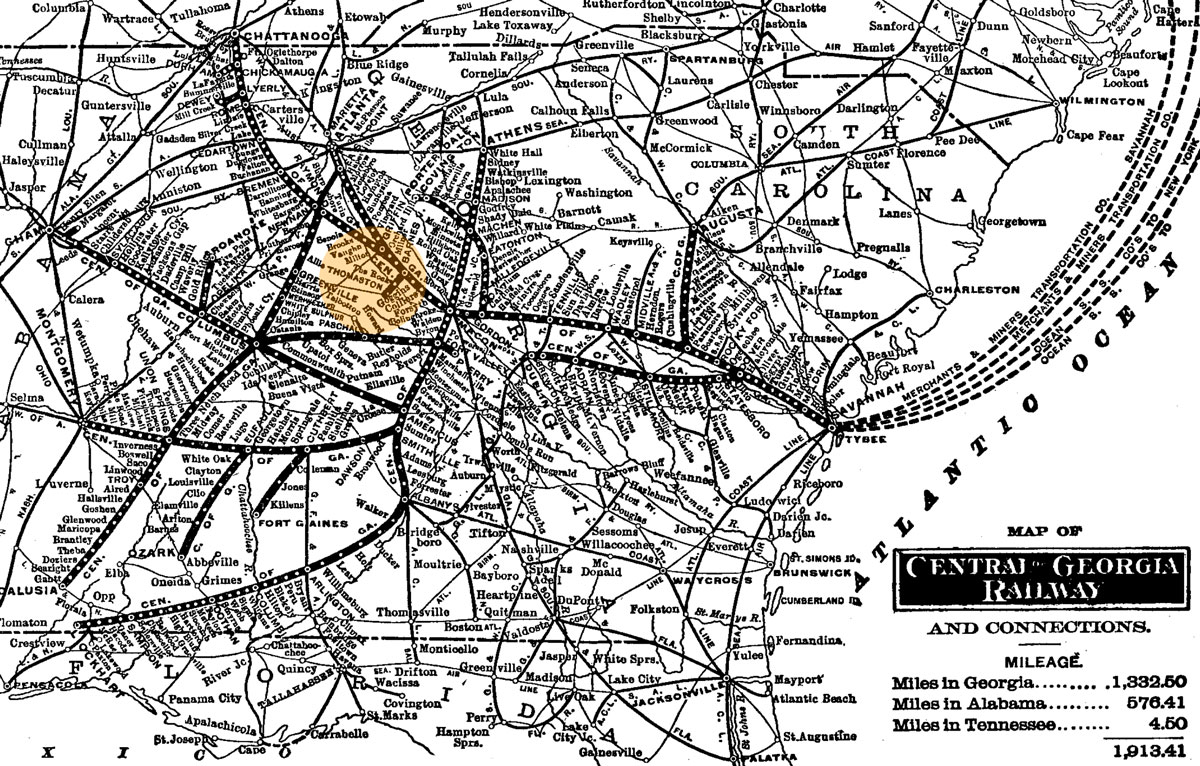
1910 Official Guide map / collection
 Thomaston
CPR timetable / collection
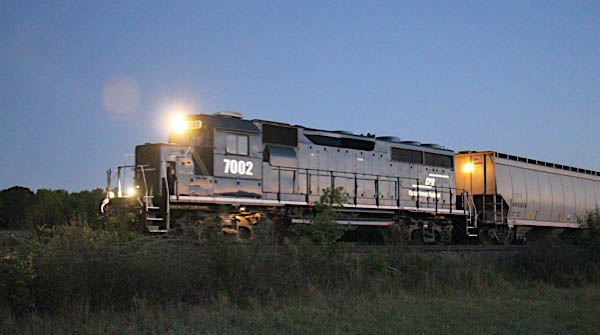
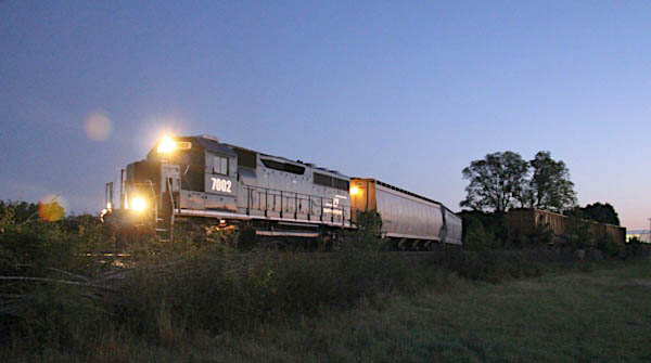
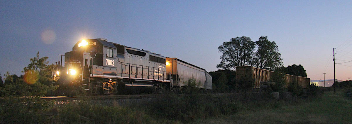
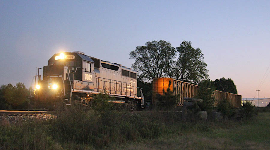
Nov 2018 / RWH
Thomaston, Ga / Nov 2018 / RWH

Click to see this location plotted on a Google Maps page
Thomaston, Ga / Nov 2018 / RWH
Thomaston, Ga / Nov 2018 / RWH
Thomaston, Ga / Nov 2018 / RWH
Thomaston, Ga / Nov 2018 / RWH
Thomaston, Ga / Nov 2018 / RWH
Thomaston, Ga / Nov 2018 / RWH
Thomaston, Ga / Nov 2018 / RWH
Thomaston, Ga / Nov 2018 / RWH
Thomaston, Ga / Nov 2018 / RWH
Thomaston, Ga / Nov 2018 / RWH
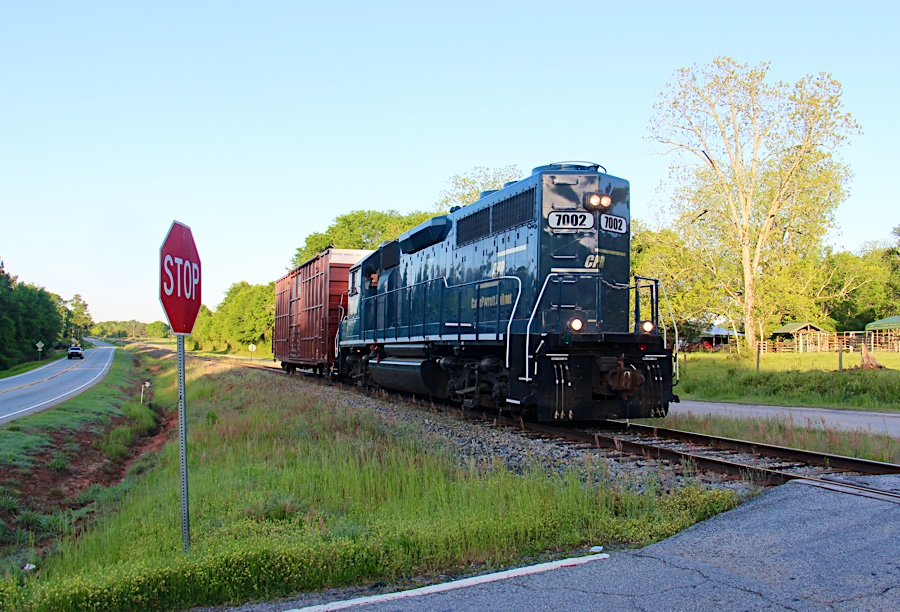
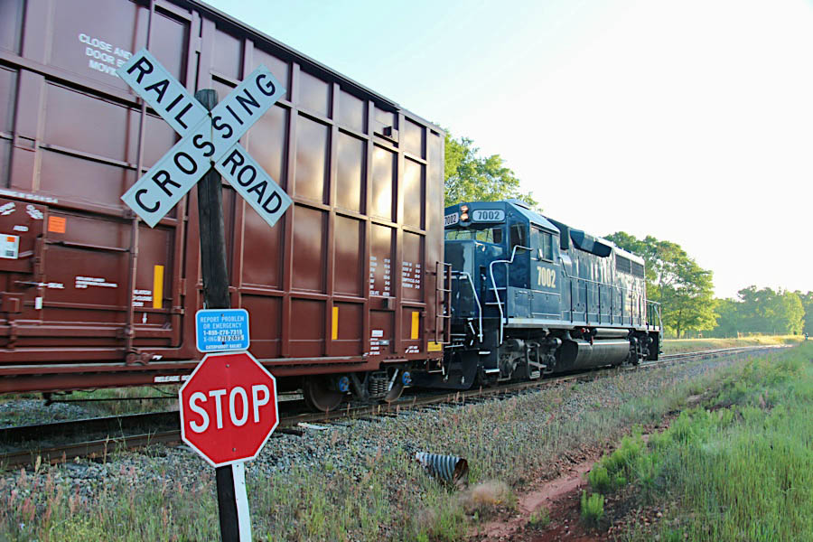
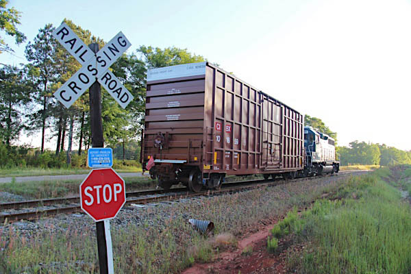
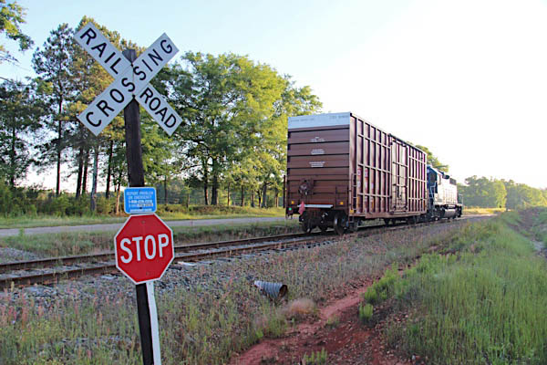
Peerless Road
Thomaston, Ga / Nov 2018 / RWH
Thomaston, Ga / Nov 2018 / RWH
Click to see this location plotted on a Google Maps page
Hugo Starling Drive
Thomaston, Ga / Aug 2019 / RWH
Click to see this location plotted on a Google Maps page
Thomaston, Ga / Aug 2019 / RWH
Thomaston, Ga / Aug 2019 / RWH
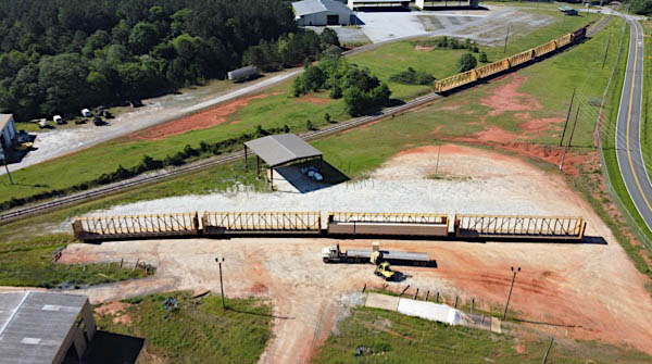
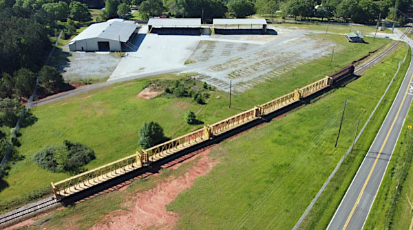
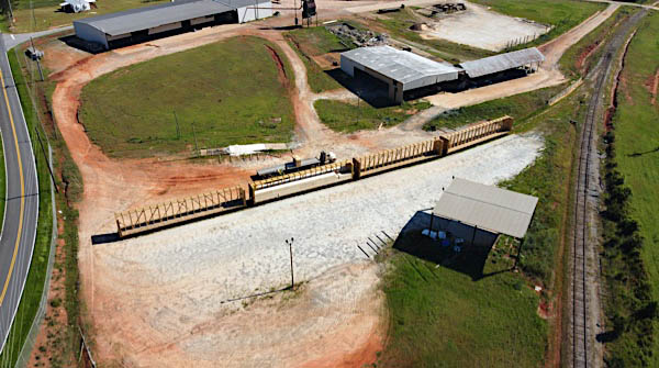
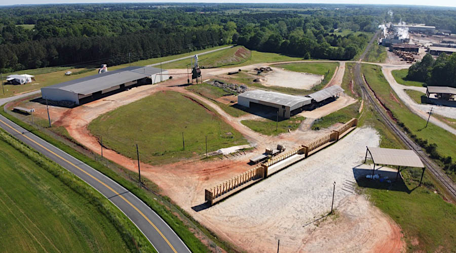
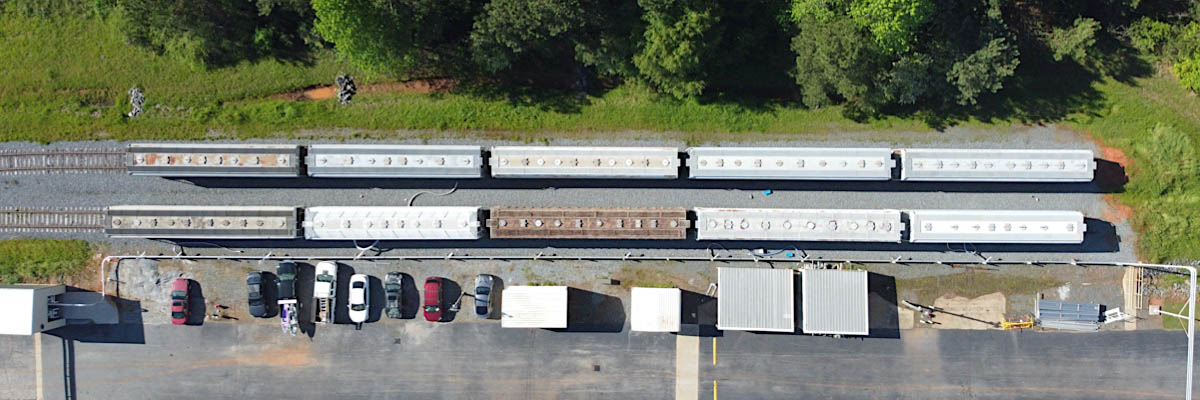
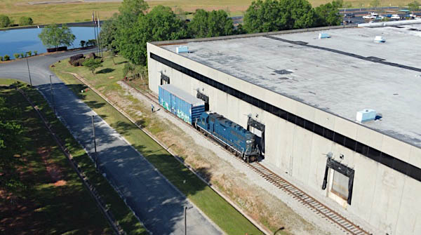
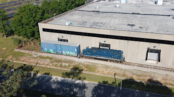
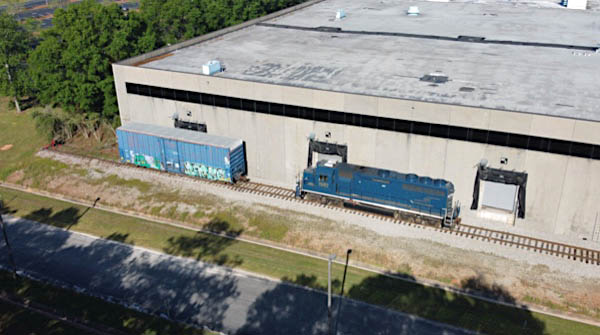
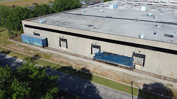
CaterParrott uses portions of a loop line that once served a variety of industries in northeaster Thomaston for railcar and locomotive storage. A recent example of storage featured a large batch of former CSX Transportation 6-axle road units stored for new owner Progress Rail Locomotive Leasing.
Thomaston, Ga / Aug 2019 / RWH
Thomaston, Ga / Aug 2019 / RWH
Thomaston, Ga / Aug 2019 / RWH
Thomaston, Ga / Aug 2019 / RWH
Thomaston, Ga / Aug 2019 / RWH
Thomaston, Ga / Aug 2019 / RWH
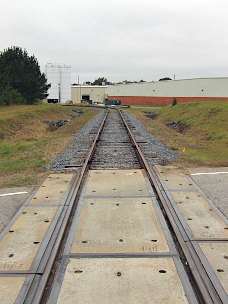
Solutions Parkway
Thomaston, Ga / Nov 2018 / RWH
northbound view / Nov 2018 / RWH
southbound view / Nov 2018 / RWH
Click to see this location plotted on a Google Maps page
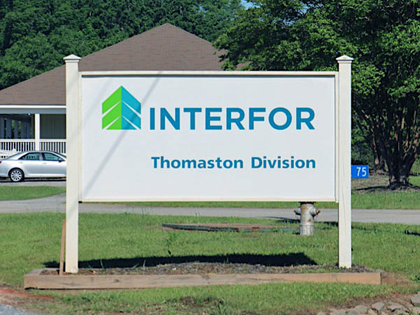
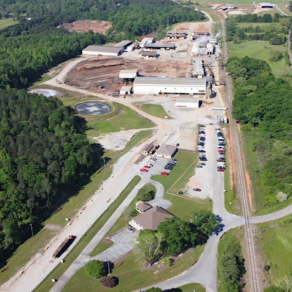
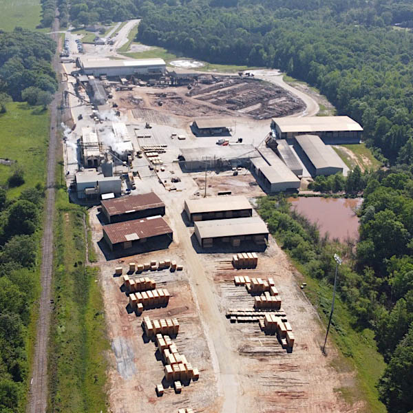
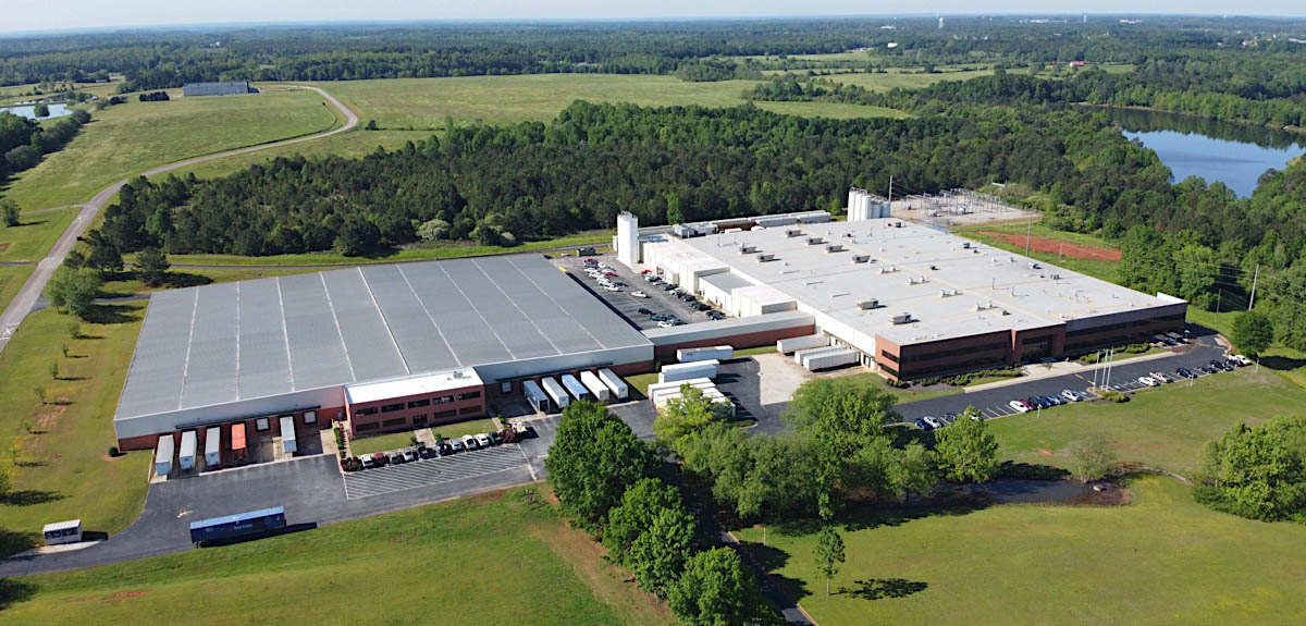
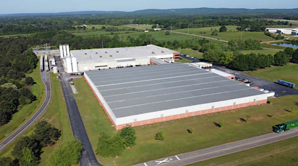
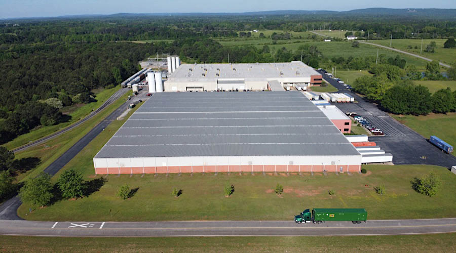
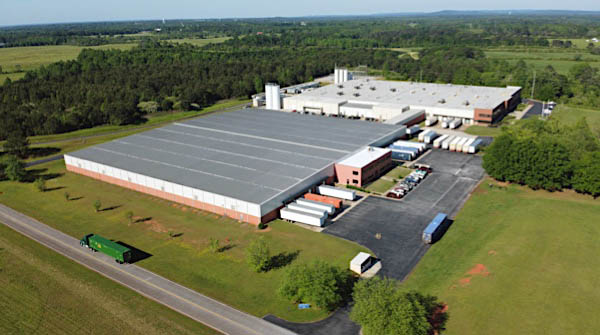
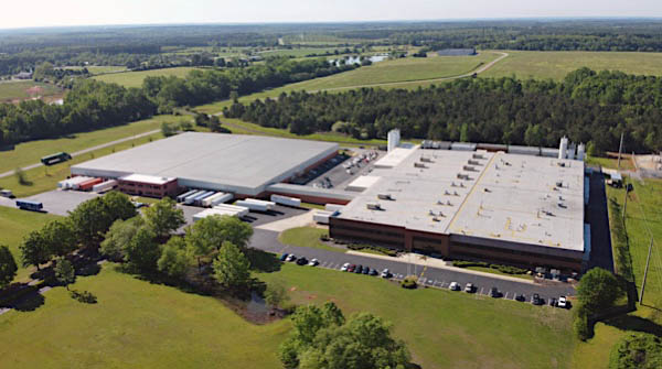
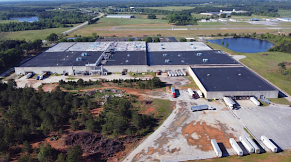
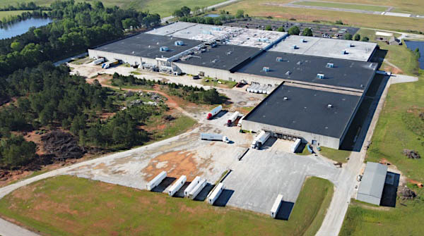
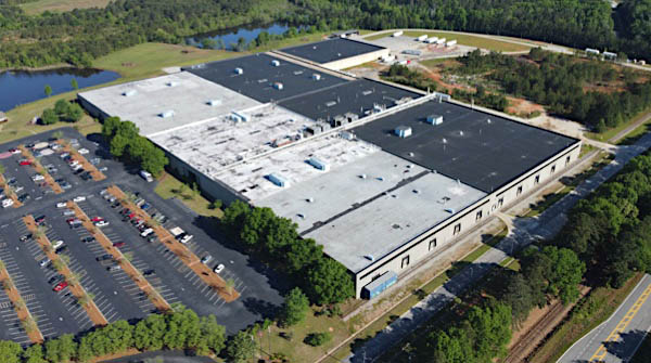
 Shipper Spotlight: Interfor Sawmill
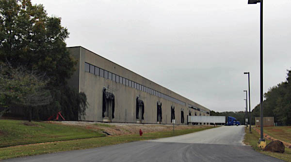
![]() With operations across North America and customers around the globe, Interfor is now one of the world's largest lumber providers. With annual capacity of approximately 3.0 billion board feet from world-class facilities, we serve the needs of customers, strengthen local economies and build value for our employees and our shareholders. And now we're embarking on a bold new vision, capitalizing on opportunity and growing into an even more robust future. Today we operate 17 sawmills across the United States and Canada and a coastal woodlands logging business in British Columbia. Our annual production capacity is approximately 3.0 billion board feet.
With operations across North America and customers around the globe, Interfor is now one of the world's largest lumber providers. With annual capacity of approximately 3.0 billion board feet from world-class facilities, we serve the needs of customers, strengthen local economies and build value for our employees and our shareholders. And now we're embarking on a bold new vision, capitalizing on opportunity and growing into an even more robust future. Today we operate 17 sawmills across the United States and Canada and a coastal woodlands logging business in British Columbia. Our annual production capacity is approximately 3.0 billion board feet.
Click to see the Interfor Sawmill facility plotted on a Google Maps page
Thomaston, Ga / Apr 2020 / RWH
Apr 2020 / RWH
Thomaston, Ga / Apr 2020 / RWH
Thomaston, Ga / Apr 2020 / RWH
Thomaston, Ga / Apr 2020 / RWH
Thomaston, Ga / Apr 2020 / RWH
Thomaston, Ga / Apr 2020 / RWH
Thomaston, Ga / Apr 2020 / RWH
Thomaston, Ga / Apr 2020 / RWH
Thomaston, Ga / Apr 2020 / RWH
Thomaston, Ga / Apr 2020 / RWH
Thomaston, Ga / Apr 2020 / RWH
Thomaston, Ga / Apr 2020 / RWH
Thomaston, Ga / Apr 2020 / RWH
Thomaston, Ga / Nov 2018 / RWH
Thomaston, Ga / Nov 2018 / RWH
Thomaston, Ga / Nov 2018 / RWH
Thomaston, Ga / Nov 2018 / RWH
Thomaston, Ga / Jun 2019 / RWH
Thomaston, Ga / Jun 2019 / RWH
Thomaston, Ga / Jun 2019 / RWH
Thomaston, Ga / Jun 2019 / RWH
Ben Hill Road
Thomaston, Ga / Jun 2019 / RWH
Click to see this location plotted on a Google Maps page
Thomaston, Ga / Jun 2019 / RWH
Thomaston, Ga / Jun 2019 / RWH
Technology Parkway
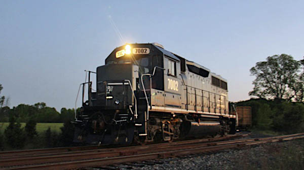
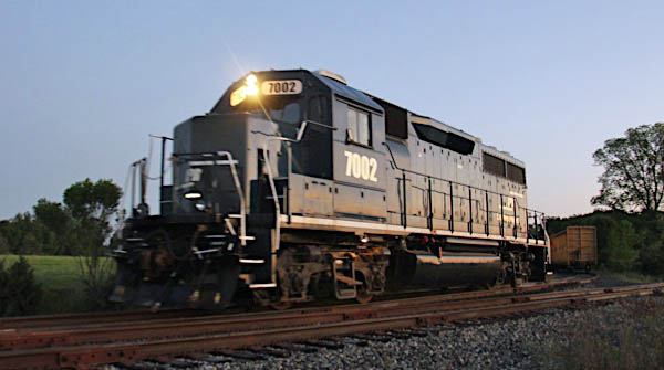
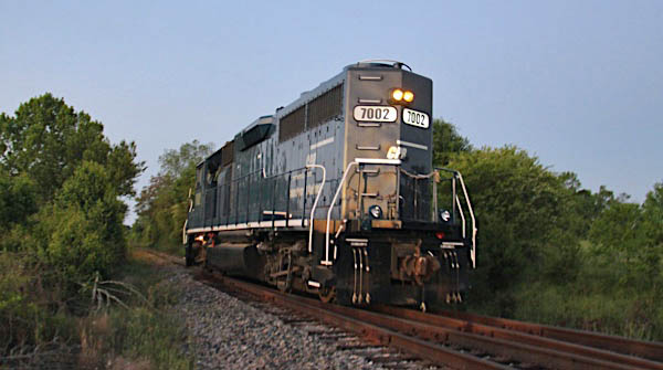
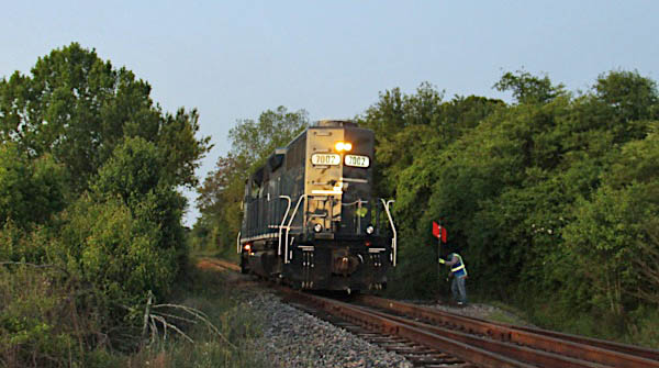
The Rock, Ga / Jun 2019 / RWH
The Rock, Ga / Jun 2019 / RWH
Click to see this location plotted on a Google Maps page
The Rock, Ga / Jun 2019 / RWH
The Rock, Ga / Jun 2019 / RWH
The Rock, Ga / Jun 2019 / RWH
The Rock, Ga / Jun 2019 / RWH
The Rock, Ga / Jun 2019 / RWH
The Rock, Ga / Jun 2019 / RWH
The Rock, Ga / Jun 2019 / RWH
The Rock, Ga / Jun 2019 / RWH
The Rock, Ga / Jun 2019 / RWH

The Rock, Ga / Jun 2019 / RWH
The Rock, Ga / Jun 2019 / RWH
The Rock, Ga / Jun 2019 / RWH
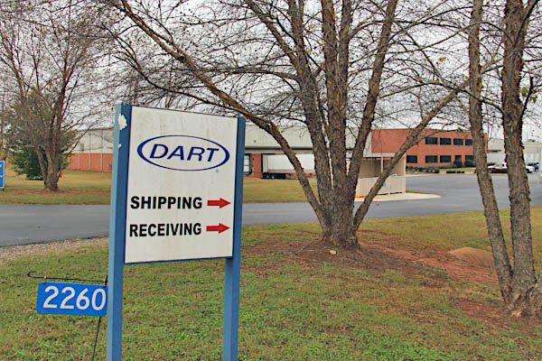
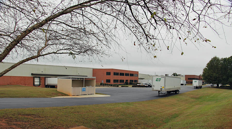
Shipper Spotlight: Dart Container Corporation
![]() The Dart story begins with a small machine shop in Mason, Michigan known as Dart Manufacturing Company. Established in 1937, this modest business prospered through the manufacture of such products as plastic key cases, steel tape measures, and identification tags for the armed services. Subsequent experimentation with expandable polystyrene in the late 1950s led to a line of high quality insulated foam cups, and Dart Container Corporation was born.
The Dart story begins with a small machine shop in Mason, Michigan known as Dart Manufacturing Company. Established in 1937, this modest business prospered through the manufacture of such products as plastic key cases, steel tape measures, and identification tags for the armed services. Subsequent experimentation with expandable polystyrene in the late 1950s led to a line of high quality insulated foam cups, and Dart Container Corporation was born.

Thomaston, Ga / Nov 2018 / RWH
Thomaston, Ga / Nov 2018 / RWH
Click to see this location plotted on a Google Maps page
Thomaston, Ga / Nov 2018 / RWH
CPR timetable / collection
Thomaston, Ga / Apr 2020 / RWH
Thomaston, Ga / Apr 2020 / RWH
Thomaston, Ga / Apr 2020 / RWH
Thomaston, Ga / Apr 2020 / RWH
Thomaston, Ga / Apr 2020 / RWH
Thomaston, Ga / Apr 2020 / RWH
Thomaston, Ga / Apr 2020 / RWH
Thomaston, Ga / Apr 2020 / RWH
Thomaston, Ga / Apr 2020 / RWH
Thomaston, Ga / Apr 2020 / RWH
Thomaston, Ga / Apr 2020 / RWH
Thomaston, Ga / Nov 2018 / RWH
Thomaston, Ga / Nov 2018 / RWH
Thomaston, Ga / Nov 2018 / RWH
Nov 2018 / RWH
Nov 2018 / RWH
Thomaston, Ga / Apr 2020 / RWH
Apr 2020 / RWH
Apr 2020 / RWH
The Rock, Ga / Apr 2020 / RWH
The Rock, Ga / Apr 2020 / RWH
The Rock, Ga / Apr 2020 / RWH

The Rock, Ga / Apr 2020 / RWH
The Rock, Ga / Apr 2020 / RWH
The Rock, Ga / Apr 2020 / RWH

The Rock, Ga / Nov 2018 / RWH
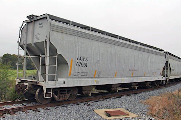
American Car & Foundry #67951
The Rock, Ga / Nov 2018 / RWH
The Rock, Ga / Nov 2018 / RWH
Click to see this location plotted on a Google Maps page
The Rock, Ga / Nov 2018 / RWH
The Rock, Ga / Nov 2018 / RWH
The Rock, Ga / Nov 2018 / RWH
The Rock, Ga / Jun 2019 / RWH
The Rock, Ga / Jun 2019 / RWH
The Rock, Ga / Jun 2019 / RWH
The Rock, Ga / Jun 2019 / RWH
The Rock, Ga / Jun 2019 / RWH
The Rock, Ga / Jun 2019 / RWH
The Rock, Ga / Jun 2019 / RWH

The Rock, Ga / Jun 2019 / RWH
The Rock, Ga / Apr 2020 / RWH
The Rock, Ga / Apr 2020 / RWH
The Rock, Ga / Apr 2020 / RWH

The Rock, Ga / Apr 2020 / RWH

The Rock, Ga / Apr 2020 / RWH
The Rock, Ga / Apr 2020 / RWH

The Rock, Ga / Apr 2020 / RWH
Delray Road

The Rock, Ga / Apr 2020 / RWH
Click to see this location plotted on a Google Maps page


The Rock, Ga / Apr 2020 / RWH
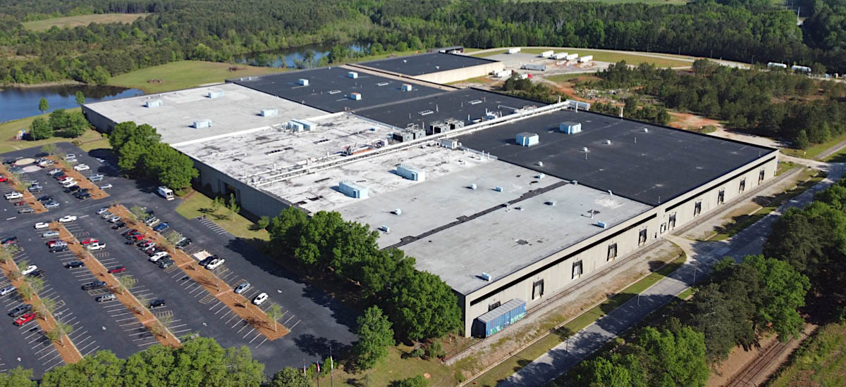
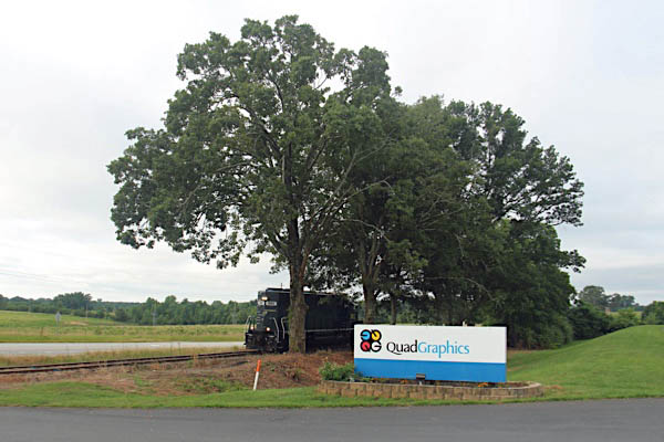
Shipper Spotlight: Quad Graphics
![]() Today, Quad is a leading global provider of print and media solutions. Our remarkable growth is powerful testament to our inimitable culture, visionary leadership team and employees worldwide who take pride in their work and are wholly invested in the success of our clients – and our company.
Quad employee brainstorming on white board.
Working together, we are driven to find a better way – and to deliver on our promise of Performance through Innovation.
As a company, we adapt to change – in fact, more often than not, we are the change. Where others see challenges, we see opportunities. We’re a high-tech company, but we succeed the old-fashioned way: through honesty, integrity, hard work, doing the right thing and always putting our clients first.
Today, Quad is a leading global provider of print and media solutions. Our remarkable growth is powerful testament to our inimitable culture, visionary leadership team and employees worldwide who take pride in their work and are wholly invested in the success of our clients – and our company.
Quad employee brainstorming on white board.
Working together, we are driven to find a better way – and to deliver on our promise of Performance through Innovation.
As a company, we adapt to change – in fact, more often than not, we are the change. Where others see challenges, we see opportunities. We’re a high-tech company, but we succeed the old-fashioned way: through honesty, integrity, hard work, doing the right thing and always putting our clients first.

The Rock, Ga / Jun 2019 / RWH
The Rock, Ga / Nov 2018 / RWH
The Rock, Ga / Aug 2019 / RWH
CPR timetable / collection
The Rock, Ga / Apr 2020 / RWH
Click to see this location plotted on a Google Maps page
The Rock, Ga / Apr 2020 / RWH
The Rock, Ga / Apr 2020 / RWH
The Rock, Ga / Apr 2020 / RWH
The Rock, Ga / Apr 2020 / RWH
The Rock, Ga / Nov 2018 / RWH
The Rock, Ga / Nov 2018 / RWH
The Rock, Ga / Nov 2018 / RWH
The Rock, Ga / Nov 2018 / RWH
The Rock, Ga / Nov 2018 / RWH
The Rock, Ga / Nov 2018 / RWH
The Rock, Ga / Nov 2018 / RWH
The Rock, Ga / Nov 2018 / RWH
The Rock, Ga / Nov 2018 / RWH
The Rock, Ga / Nov 2018 / RWH
The Rock, Ga / Nov 2018 / RWH
The Rock, Ga / Nov 2018 / RWH
The Rock, Ga / Nov 2018 / RWH
The Rock, Ga / Jun 2019 / RWH
The Rock, Ga / Jun 2019 / RWH
The Rock, Ga / Apr 2020 / RWH
The Rock, Ga / Apr 2020 / RWH
The Rock, Ga / Aug 2019 / RWH
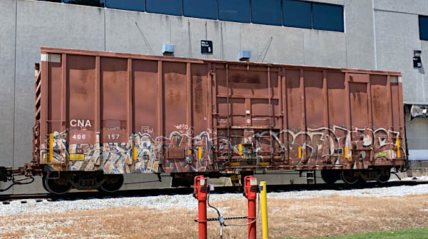
Canadian National #406157
Hi-cube boxcar / The Rock, Ga / Aug 2019 / RWH
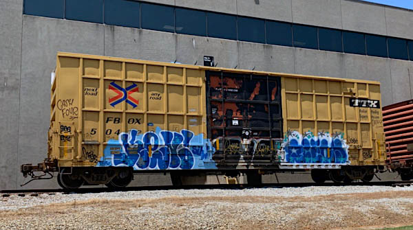
Trailer Train #504120
Hi-cube boxcar / The Rock, Ga / Aug 2019 / RWH
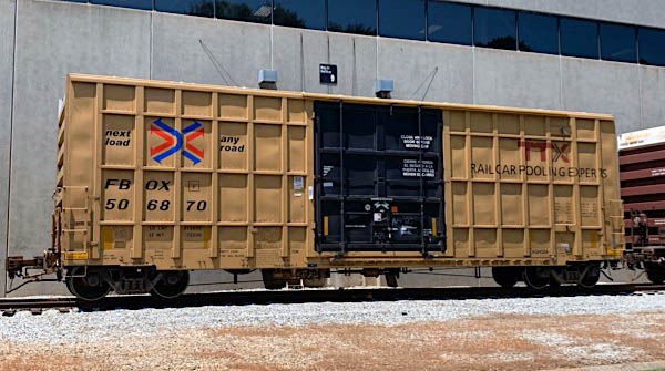
Trailer Train #506870
Hi-cube boxcar / The Rock, Ga / Aug 2019 / RWH
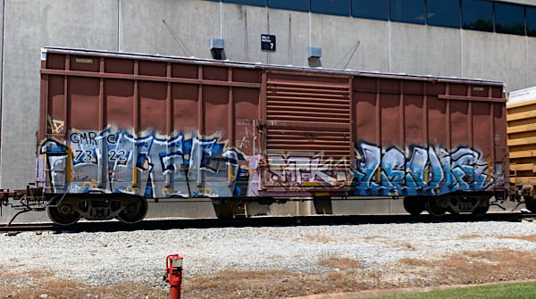
Green Mountain #7322
Hi-cube boxcar / The Rock, Ga / Aug 2019 / RWH
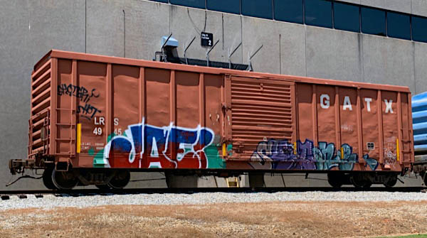
Laurinburg & Southern #4945
boxcar / The Rock, Ga / Aug 2019 / RWH
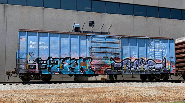
Maine Central #31850
boxcar / The Rock, Ga / Aug 2019 / RWH
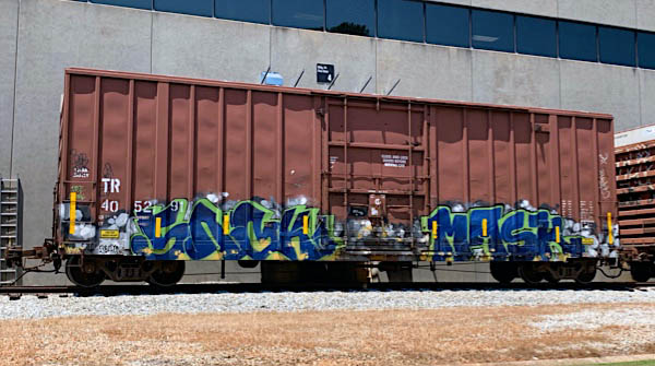
Tomahawk Railway #405291
Hi-cube boxcar / The Rock, Ga / Aug 2019 / RWH
The Rock, Ga / Apr 2020 / RWH
The Rock, Ga / Apr 2020 / RWH
The Rock, Ga / Apr 2020 / RWH
The Rock, Ga / Apr 2020 / RWH
The Rock, Ga / Apr 2020 / RWH
The Rock, Ga / Apr 2020 / RWH

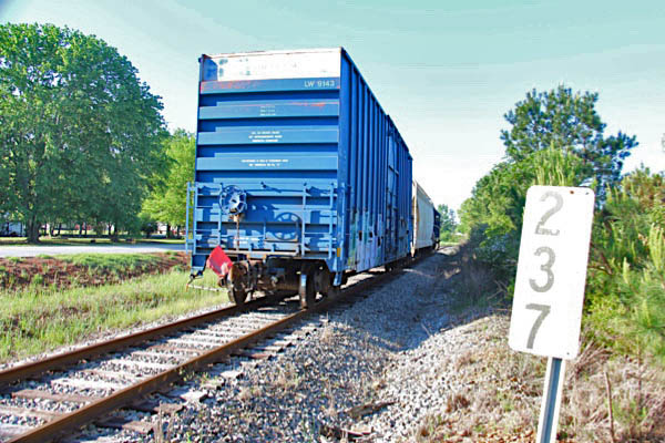
Louisville & Wadley #9143
Hi-cube boxcar / The Rock, Ga / Apr 2020 / RWH
Mud Bridge Road
The Rock, Ga / Apr 2020 / RWH
Click to see this location plotted on a Google Maps page
The Rock, Ga / Apr 2020 / RWH
The Rock, Ga / Apr 2020 / RWH
The Rock, Ga / Apr 2020 / RWH


The Rock, Ga / Apr 2020 / RWH
The Rock, Ga / Apr 2020 / RWH
The Rock, Ga / Apr 2020 / RWH
The Rock, Ga / Apr 2020 / RWH
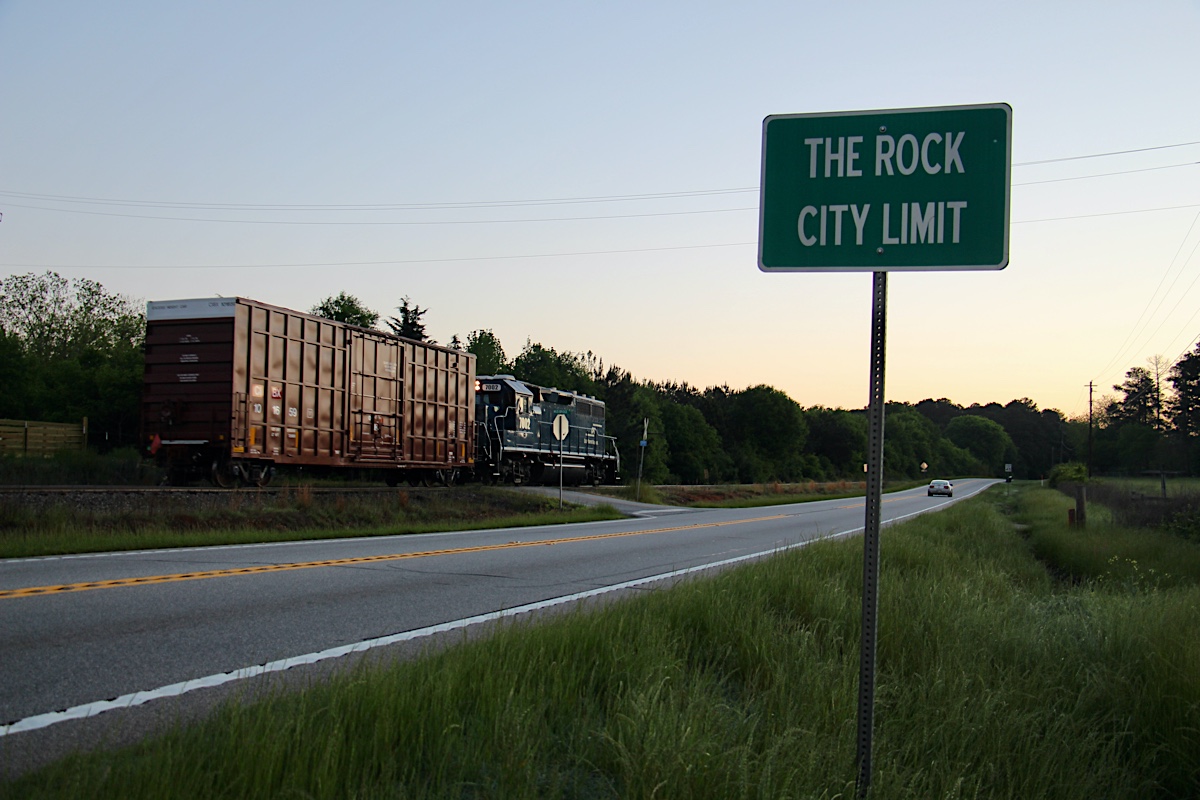
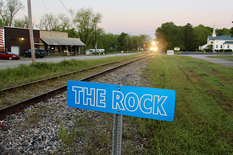
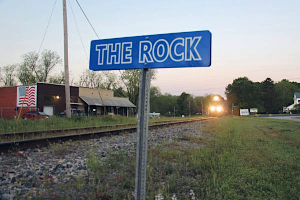
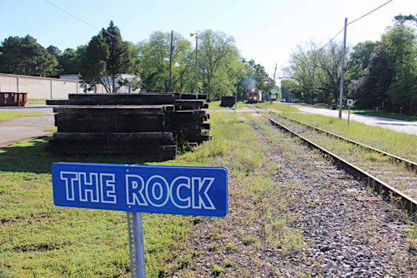
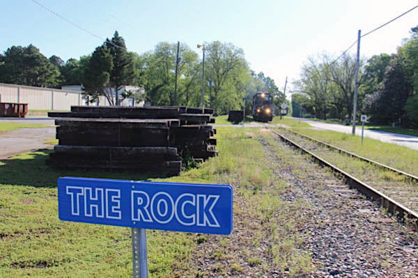
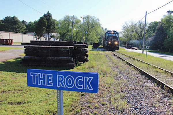
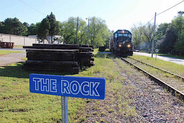
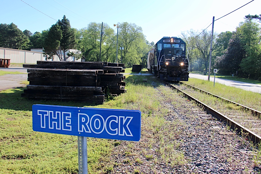
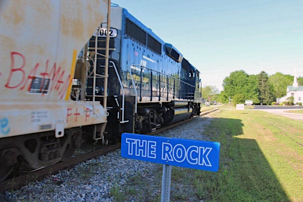
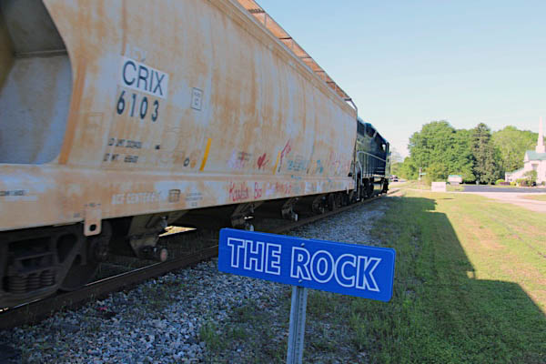
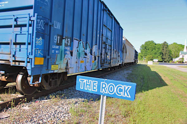
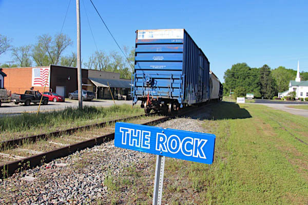
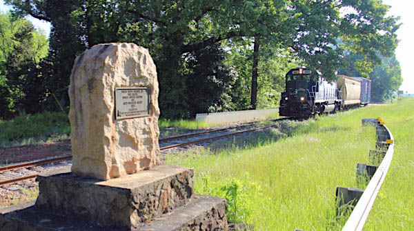
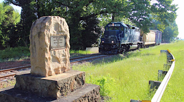
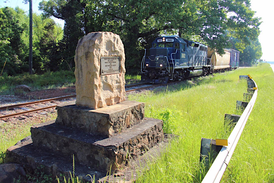
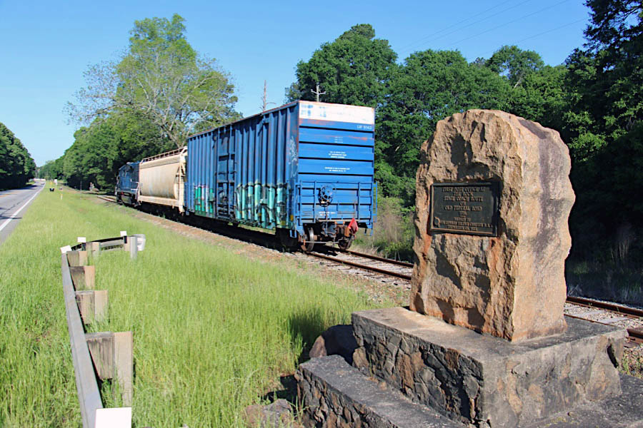
 The Rock
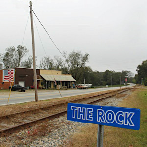
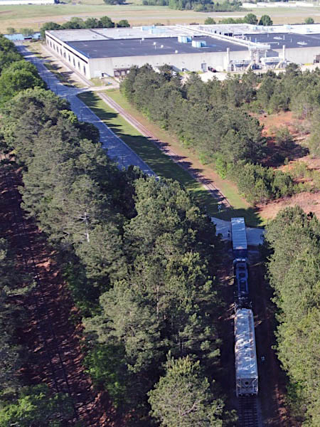
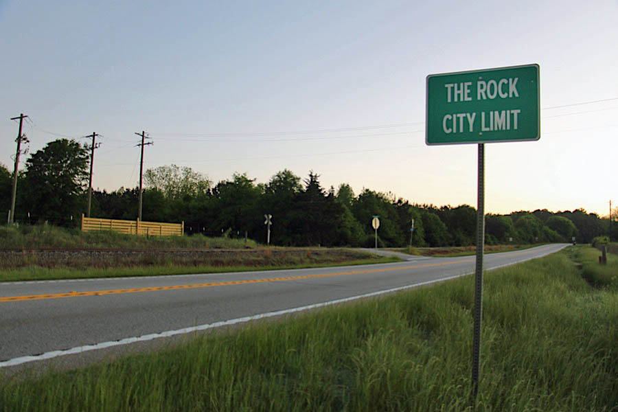
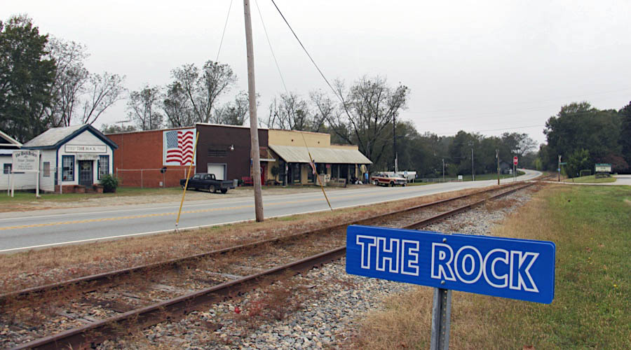
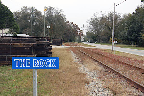
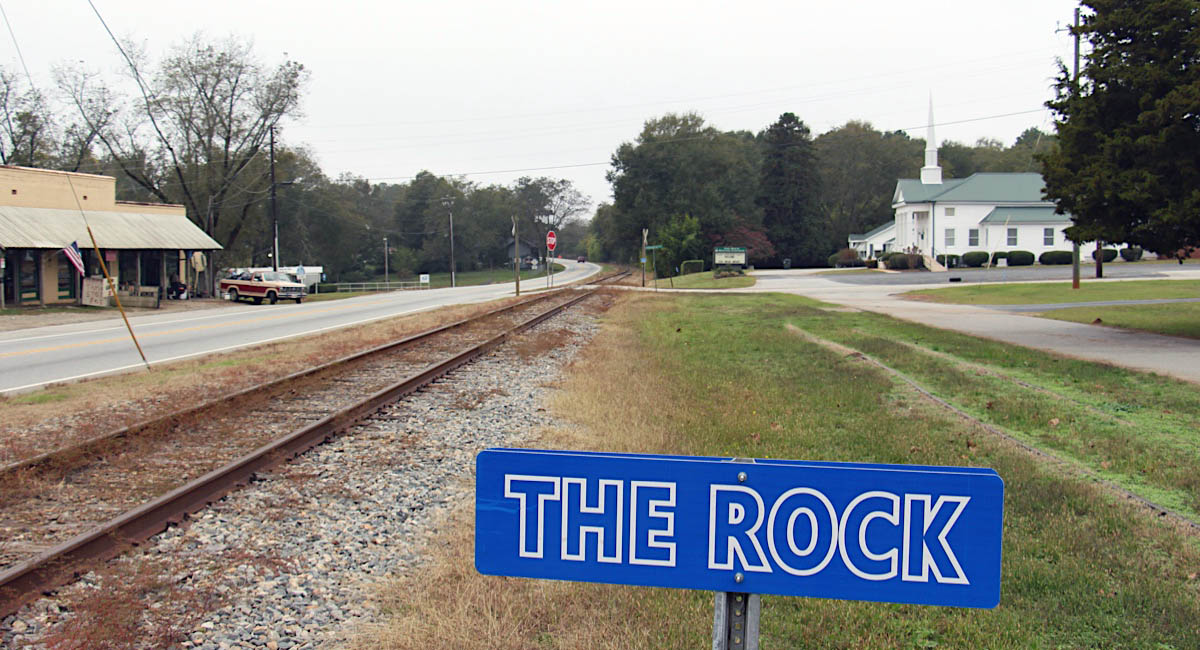
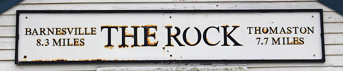
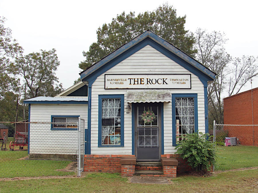
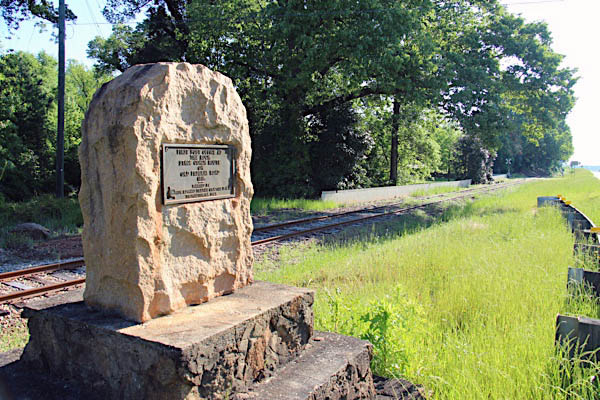
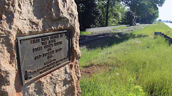
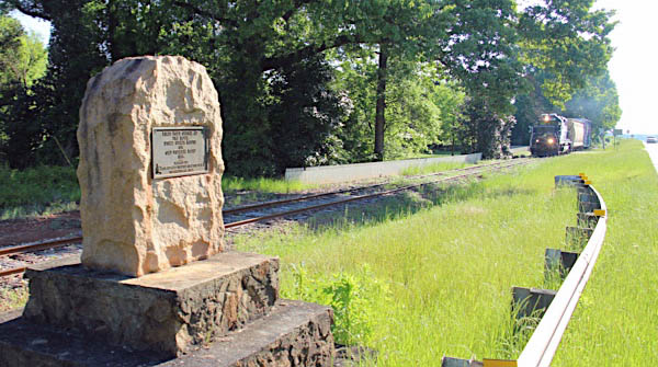
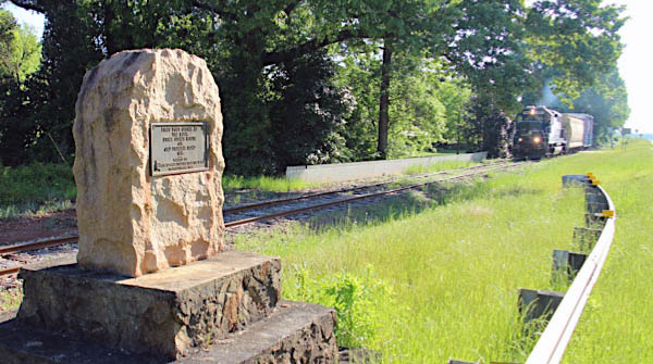
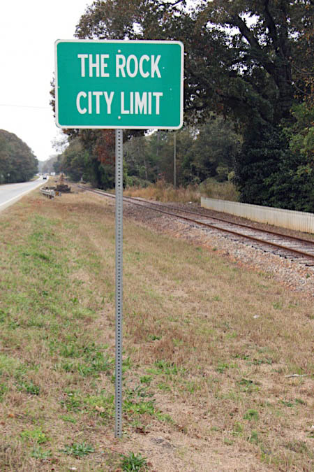
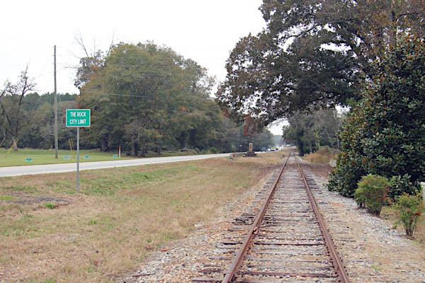
Located in nearly the center of the state in Upson County, The Rock, Georgia, has a unique history resulting in its unique name. The town is eight miles east of Thomaston, between Thomaston and Barnesville, on Ga. Hwy. 36 and basically one hour from everywhere (Macon, Columbus, Atlanta). Most days the population is slightly less than 200; however, on weekends thousands visit The Rock Ranch.
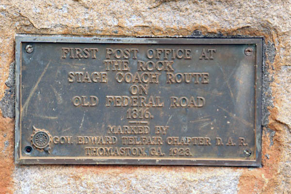
On the eastern edge of the town is a monument sitting on top of the remnant of a large granite boulder that had a cavern in which the early stage coach drivers and later trains traveling on the Thomaston-Barnesville highway left mail. The words of Dr. James Anderson to a stagecoach driver in 1816, named the town, “Put my mail in the hole in that rock.” It was enough to simply address mail to “The Rock” in Georgia and the mail would make it to its intended destination. People came by horse and buggy to “the rock” to get their mail. The original rock was dynamited to widen the muddy wagon trail – now Georgia State Highway 36. The historical marker denotes the stone’s service as the original "post office." It is located on the left, directly across from the first drive of The Rock Ranch. Without the granite rock and to ensure mail would reach the right people, a post office had to be built and a town that needed a name - the natural name was “The Rock.”
CPR timetable / collection
1910 Official Guide / collection
Nov 2018 / RWH
The Rock, Ga / Nov 2018 / RWH
The Rock, Ga / Nov 2018 / RWH
The Rock, Ga / Nov 2018 / RWH
The Rock, Ga / Nov 2018 / RWH
Click to see this location plotted on a Google Maps page
The Rock, Ga / Nov 2018 / RWH
Nov 2018 / RWH
The Rock, Ga / Nov 2018 / RWH
The Rock, Ga / Apr 2020 / RWH
The Rock, Ga / Apr 2020 / RWH
The Rock, Ga / Apr 2020 / RWH
The Rock, Ga / Apr 2020 / RWH
The Rock, Ga / Apr 2020 / RWH
The Rock, Ga / Apr 2020 / RWH
The Rock, Ga / Apr 2020 / RWH
Nov 2018 / RWH
The Rock, Ga / Nov 2018 / RWH
Nov 2018 / RWH
Click to see this location plotted on a Google Maps page
The Rock, Ga / Apr 2020 / RWH
The Rock, Ga / Apr 2020 / RWH
The Rock, Ga / Apr 2020 / RWH
The Rock, Ga / Apr 2020 / RWH
The Rock, Ga / Apr 2020 / RWH
Fambro Road
The Rock, Ga / Nov 2018 / RWH
The Rock, Ga / Nov 2018 / RWH
The Rock, Ga / Nov 2018 / RWH
Click to see this location plotted on a Google Maps page


The Rock, Ga / Apr 2020 / RWH
The Rock, Ga / Apr 2020 / RWH
Click to see this location plotted on a Google Maps page

The Rock, Ga / Apr 2020 / RWH
The Rock, Ga / Apr 2020 / RWH

Apr 2020 / RWH
The Rock, Ga / Apr 2020 / RWH
The Rock, Ga / Apr 2020 / RWH
The Rock, Ga / Apr 2020 / RWH
The Rock, Ga / Apr 2020 / RWH
Click to see this location plotted on a Google Maps page
The Rock, Ga / Apr 2020 / RWH
The Rock, Ga / Apr 2020 / RWH
The Rock, Ga / Apr 2020 / RWH

The Rock, Ga / Apr 2020 / RWH

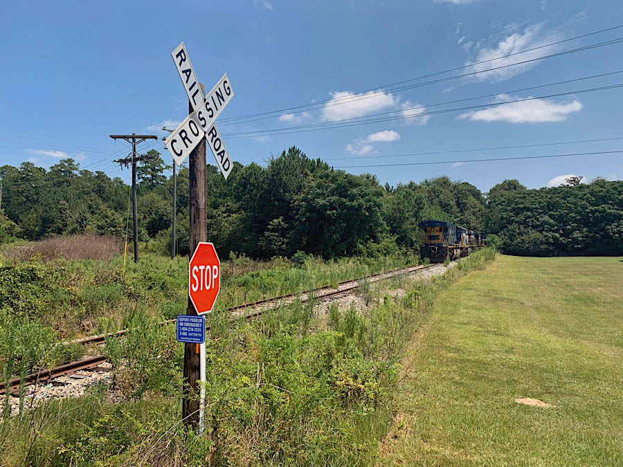
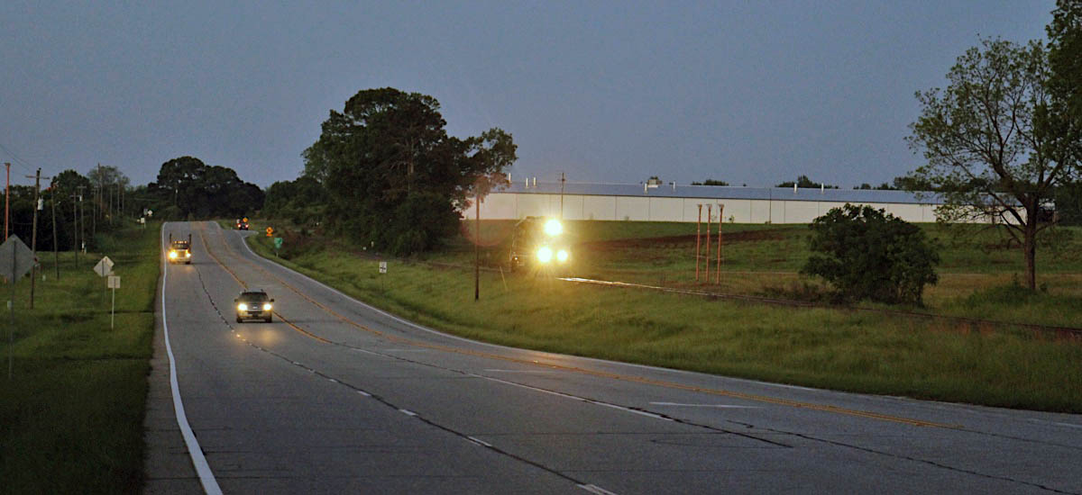
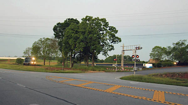
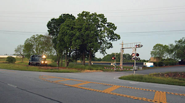
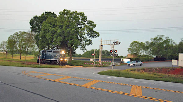
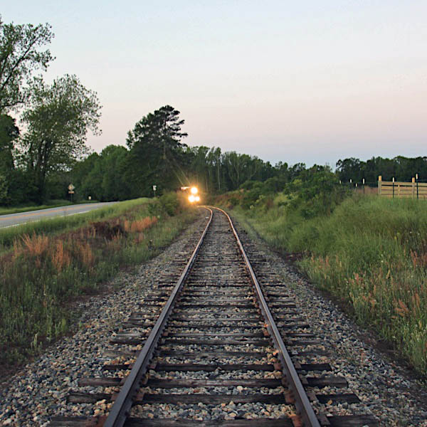
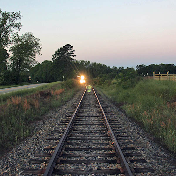
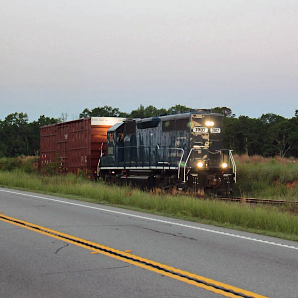
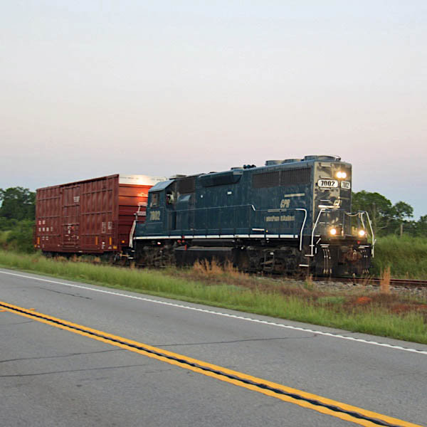
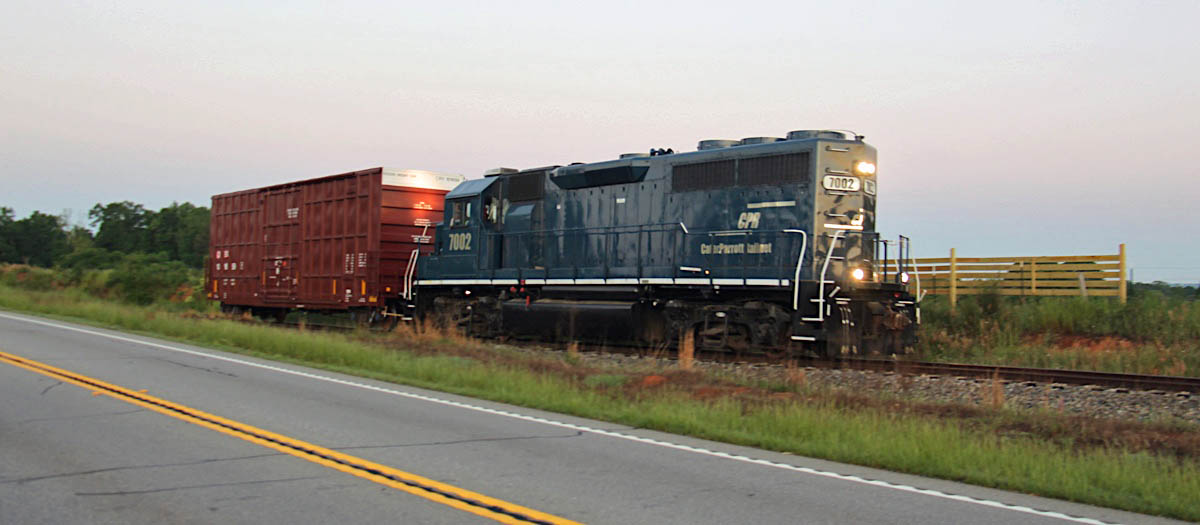
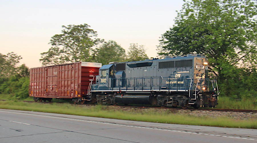
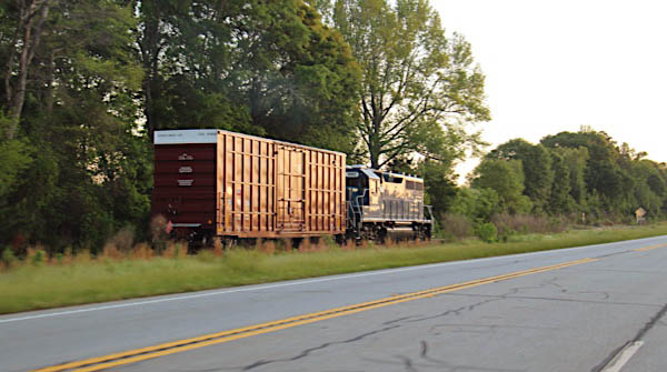
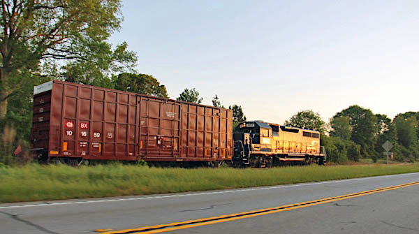
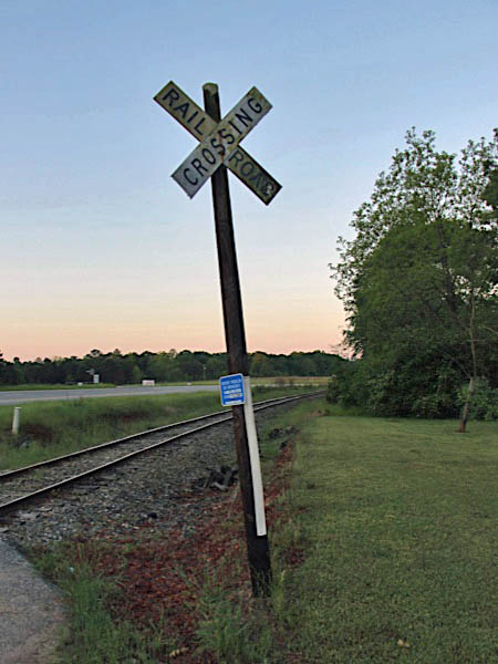
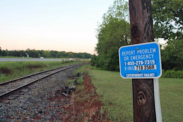
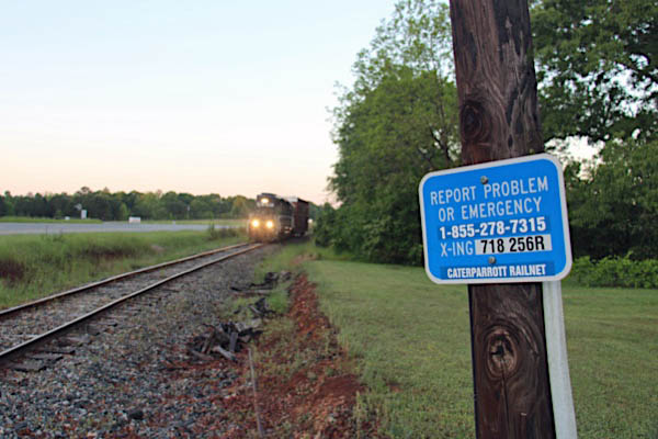
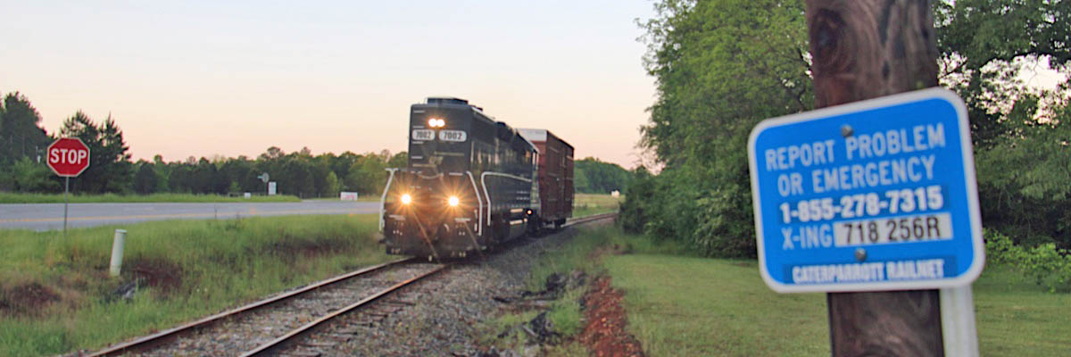
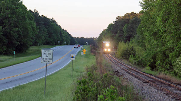
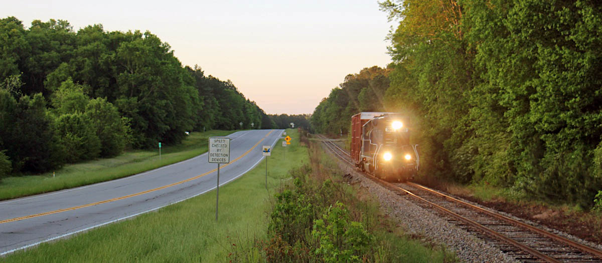
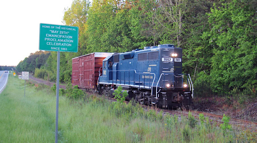
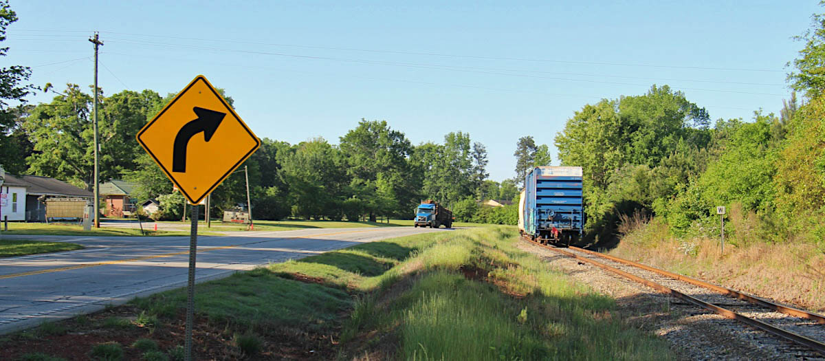
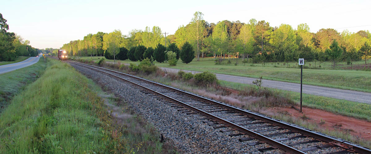
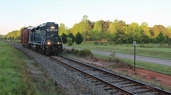
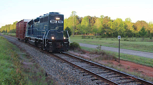
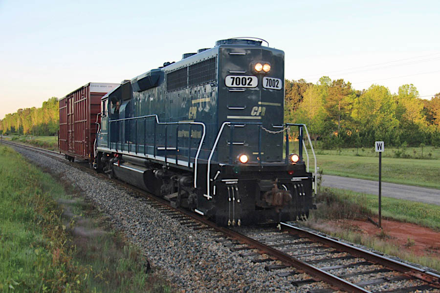
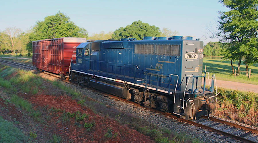
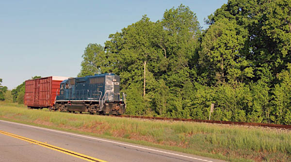
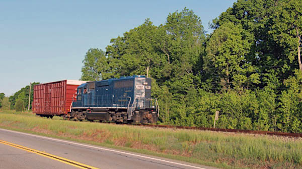
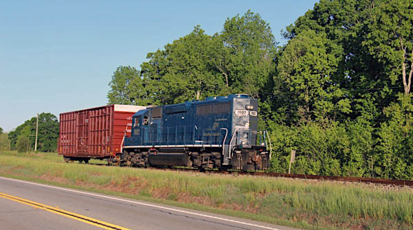
 The Thomaston line is a delight to railfan. That a quality state highway follows the branchline nearly the entire route is only the first of many treats. The line is accessible and easily followed by even the most novice Foamer. North of The Rock -- possibly the best village name ever -- the terrain turns hilly and the grades become a bit more roller coaster. Clearly neither its predecessors nor the Central wanted to spend any more money on grading than was necessary to connect the dots. But it makes for delightful chasing. Ample grade crossings provide plenty of horn action as well as vantage points for public photography. Three active shippers keep CPR crews moving two and sometimes three times per week, even if traffic is often limited to a few carloads in and out. Memories of carloadings lost in the last quarter century loom large in Thomaston proper, but the CPR people in recent years are proving you can find ways to make money even in a southern Rust Belt town. Locomotive and car storage fees no doubt provide a solid income for capital improvements, while current shippers enjoy responsive car-spotting by attentive crews. For a shortline fan like this guy, these sixteen miles provide both ends of the spectrum: the feel of slow, meandering Georgia locals from a bygone era; clean and crisp modern power making quick work of pickups and dropoffs. Long live the Thomaston Division!
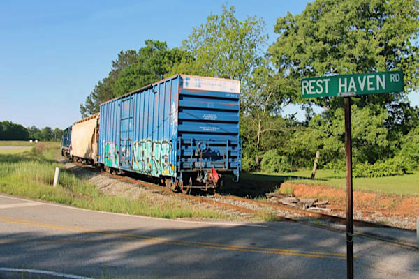
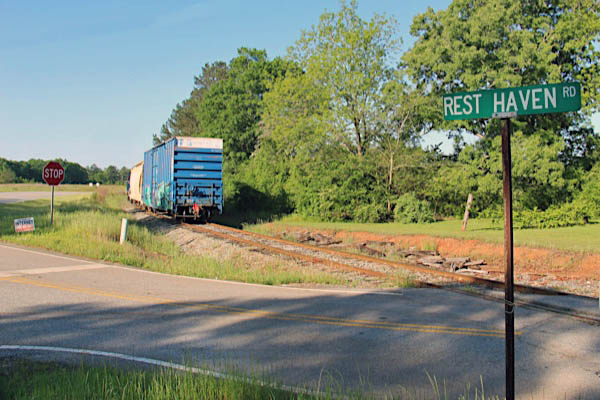
Rest Haven Road
Barnesville, Ga / Apr 2020 / RWH
Barnesville, Ga / Apr 2020 / RWH
Barnesville, Ga / Apr 2020 / RWH
Barnesville, Ga / Apr 2020 / RWH
Click to see this location plotted on a Google Maps page
Barnesville, Ga / Apr 2020 / RWH
Barnesville, Ga / Apr 2020 / RWH
Barnesville, Ga / Apr 2020 / RWH
Barnesville, Ga / Apr 2020 / RWH
Barnesville, Ga / Apr 2020 / RWH

Barnesville, Ga / Apr 2020 / RWH
Barnesville, Ga / Apr 2020 / RWH
Barnesville, Ga / Apr 2020 / RWH
Barnesville, Ga / Apr 2020 / RWH
Barnesville, Ga / Apr 2020 / RWH
Barnesville, Ga / Apr 2020 / RWH
Upson / Lamar County Line
Apr 2020 / RWH
Barnesville, Ga / Apr 2020 / RWH
Barnesville, Ga / Apr 2020 / RWH
Barnesville, Ga / Apr 2020 / RWH
Barnesville, Ga / Apr 2020 / RWH

Barnesville, Ga / Apr 2020 / RWH

Barnesville, Ga / Apr 2020 / RWH

Barnesville, Ga / Apr 2020 / RWH
Raneita Road
Barnesville, Ga / Nov 2018 / RWH
Click to see this location plotted on a Google Maps page
Barnesville, Ga / Nov 2018 / RWH
Barnesville, Ga / Nov 2018 / RWH
Barnesville, Ga / Nov 2018 / RWH
Barnesville, Ga / Apr 2020 / RWH
Barnesville, Ga / Apr 2020 / RWH
Barnesville, Ga / Apr 2020 / RWH
Barnesville, Ga / Apr 2020 / RWH
Dani Road
Barnesville, Ga / Apr 2020 / RWH
Click to see this location plotted on a Google Maps page
Barnesville, Ga / Apr 2020 / RWH
Barnesville, Ga / Apr 2020 / RWH
Barnesville, Ga / Apr 2020 / RWH
McCollum Road
Barnesville, Ga / Apr 2020 / RWH
Barnesville, Ga / Apr 2020 / RWH

Barnesville, Ga / Apr 2020 / RWH
Williams Road
Barnesville, Ga / Apr 2020 / RWH


Barnesville, Ga / Apr 2020 / RWH
Barnesville, Ga / Apr 2020 / RWH
Barnesville, Ga / Apr 2020 / RWH
Barnesville, Ga / Apr 2020 / RWH
Barnesville, Ga / Apr 2020 / RWH
Barnesville, Ga / Apr 2020 / RWH
Barnesville, Ga / Apr 2020 / RWH
Barnesville, Ga / Apr 2020 / RWH
Barnesville, Ga / Apr 2020 / RWH
Click to see this location plotted on a Google Maps page
Barnesville, Ga / Apr 2020 / RWH
Barnesville, Ga / Apr 2020 / RWH
Barnesville, Ga / Apr 2020 / RWH
Barnesville, Ga / Apr 2020 / RWH
Barnesville, Ga / Apr 2020 / RWH
Barnesville, Ga / Apr 2020 / RWH
Barnesville, Ga / Apr 2020 / RWH
Barnesville, Ga / Apr 2020 / RWH
Country Kitchen Road
Barnesville, Ga / Apr 2020 / RWH
Click to see this location plotted on a Google Maps page
Barnesville, Ga / Apr 2020 / RWH
Barnesville, Ga / Apr 2020 / RWH
Barnesville, Ga / Apr 2020 / RWH
Click to see this location plotted on a Google Maps page
Barnesville, Ga / Apr 2020 / RWH
Barnesville, Ga / Apr 2020 / RWH
Barnesville, Ga / Apr 2020 / RWH
 Barnesville
![]() With the advent of the railroad, Barnesville continued to prosper. One of Barnesville's first citizens, Benjamin Mosley Milner, helped build the first railroad in Georgia. The Monroe Railroad and Banking Company was chartered December 23, 1833 by the Georgia Legislature to establish a line between Macon and Forsyth. The Macon and Western R. R. line to Barnesville was completed in 1841 connecting the village to the main line at Forsyth. The spur line between Barnesville and Thomaston was laid in 1847. The train to Thomaston was known as "the Tom Cat". In later years, the line to Thomaston was operated by the Central of Georgia R. R. The Central, when completed in 1843, was the longest line built and owned by one corporation in Georgia. Other trains which were associated with service through Barnesville were the "Nancy Hanks I and II" providing service between Atlanta and Savannah; the "Goober" providing service to Griffin and on to Atlanta beginning in the late 1880s; the "Dixie Flyer" providing service between Atlanta and Miami, Florida and the "Dummy", a spur line to Zebulon.
With the advent of the railroad, Barnesville continued to prosper. One of Barnesville's first citizens, Benjamin Mosley Milner, helped build the first railroad in Georgia. The Monroe Railroad and Banking Company was chartered December 23, 1833 by the Georgia Legislature to establish a line between Macon and Forsyth. The Macon and Western R. R. line to Barnesville was completed in 1841 connecting the village to the main line at Forsyth. The spur line between Barnesville and Thomaston was laid in 1847. The train to Thomaston was known as "the Tom Cat". In later years, the line to Thomaston was operated by the Central of Georgia R. R. The Central, when completed in 1843, was the longest line built and owned by one corporation in Georgia. Other trains which were associated with service through Barnesville were the "Nancy Hanks I and II" providing service between Atlanta and Savannah; the "Goober" providing service to Griffin and on to Atlanta beginning in the late 1880s; the "Dixie Flyer" providing service between Atlanta and Miami, Florida and the "Dummy", a spur line to Zebulon.
Both the Atlanta to Macon and the spur lines running through Barnesville are still being used today for freight shipping. The freight trains make several stops daily at various manufacturing plants to deliver supplies and transport finished goods to distributors. Both of these lines are located on their original beds.
The railroad brought new sources of growth: new merchants, new residents and new ideas. The population of Barnesville had grown to approximately 400 by the end of 1849 with 45 families. The center of the community was the depot. Everyone came to town or left town from the place which was the heart of the community. People came to town to see the trains arrive or to greet passengers. The business district grew up around the depot. As the village grew, a freight depot in addition to a passenger depot was built. The freight depot was later moved into the old Georgia Knitting Mills building which fronted the railroad tracks just east of the passenger depot. Today this building is used as a fertilizer warehouse by Akin's and Feed and Seed.
CPR timetable / collection
1910 Official Guide / collection

Nov 2018 / RWH
Highway 41
Barnesville, Ga / Nov 2018 / RWH
Click to see this location plotted on a Google Maps page
Barnesville, Ga / Nov 2018 / RWH
Barnesville, Ga / Nov 2018 / RWH

Barnesville, Ga / Nov 2018 / RWH
Barnesville, Ga / Nov 2018 / RWH
Barnesville, Ga / Nov 2018 / RWH
Barnesville, Ga / Apr 2020 / RWH
Barnesville, Ga / Apr 2020 / RWH
Barnesville, Ga / Apr 2020 / RWH
Rose Avenue
northbound / Apr 2020 / RWH
southbound / Apr 2020 / RWH
Click to see this location plotted on a Google Maps page
Barnesville, Ga / Apr 2020 / RWH
Barnesville, Ga / Apr 2020 / RWH
Barnesville, Ga / Apr 2020 / RWH
Barnesville, Ga / Apr 2020 / RWH
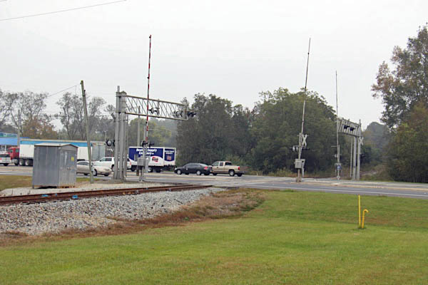
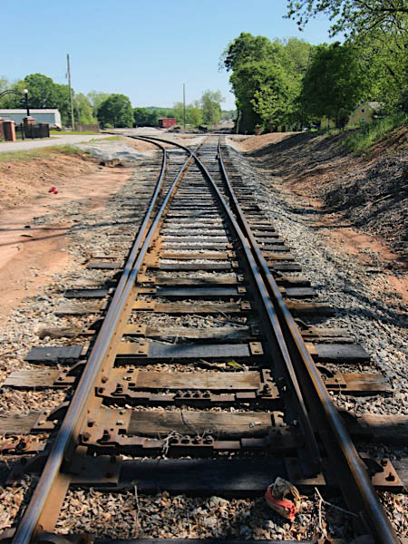
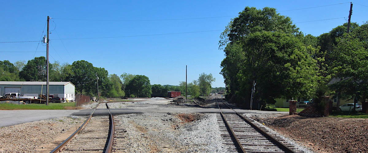
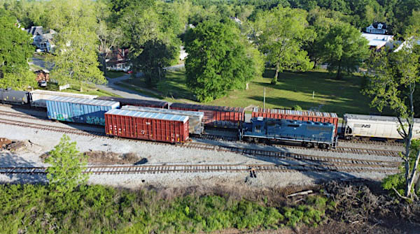
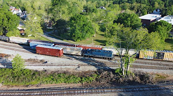
Interchange
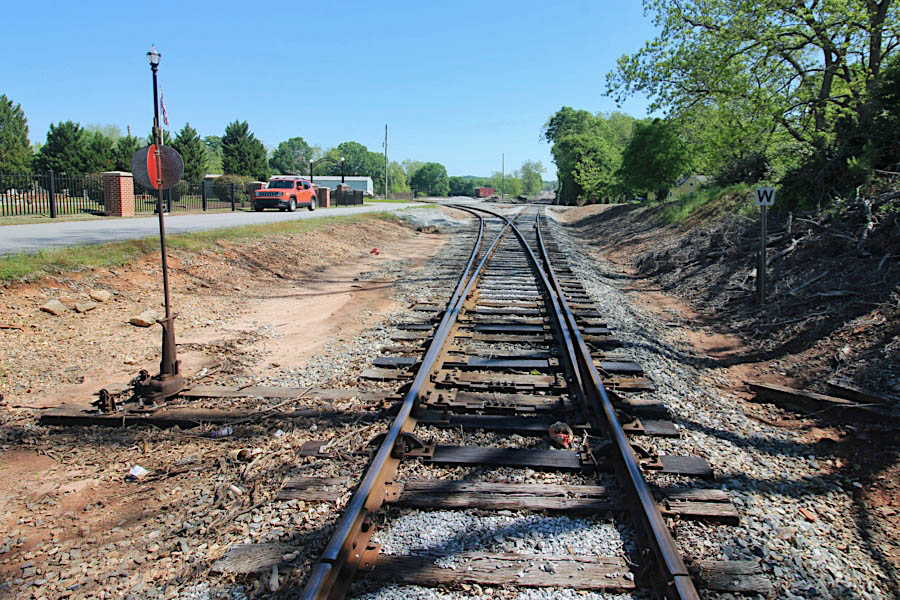
Barnesville, Ga / Apr 2020 / RWH
Click to see this location plotted on a Google Maps page
Barnesville, Ga / Apr 2020 / RWH
Barnesville, Ga / Apr 2020 / RWH

Barnesville, Ga / Apr 2020 / RWH
Barnesville, Ga / Apr 2020 / RWH

Barnesville, Ga / Apr 2020 / RWH

Barnesville, Ga / Apr 2020 / RWH
Barnesville, Ga / Apr 2020 / RWH
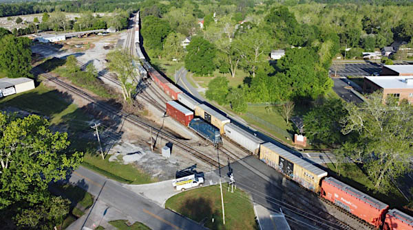
Barnesville interchange area overhead / Google Maps
Barnesville, Ga / Apr 2020 / RWH
Barnesville, Ga / Apr 2020 / RWH
Barnesville, Ga / Apr 2020 / RWH
Barnesville, Ga / Nov 2018 / RWH
Barnesville, Ga / Nov 2018 / RWH
Barnesville, Ga / Nov 2018 / RWH
Click to see this location plotted on a Google Maps page
Barnesville, Ga / Nov 2018 / RWH
Barnesville, Ga / Nov 2018 / RWH
Barnesville, Ga / Nov 2018 / RWH
Barnesville, Ga / Nov 2018 / RWH
Barnesville, Ga / Nov 2018 / RWH
Barnesville, Ga / Nov 2018 / RWH
Barnesville, Ga / Nov 2018 / RWH
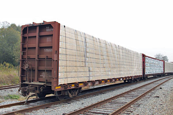
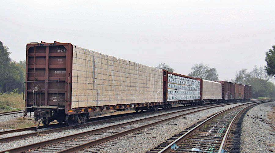
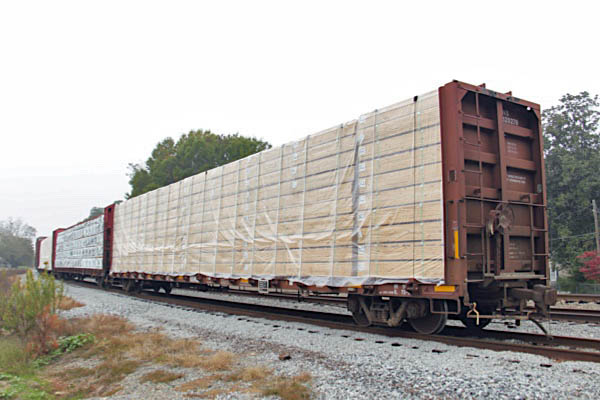
Norfolk Southern #120279
bulkhead flatcar / Barnesville, Ga / Nov 2018 / RWH
Barnesville, Ga / Nov 2018 / RWH

Barnesville, Ga / Apr 2020 / RWH
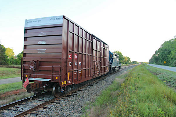
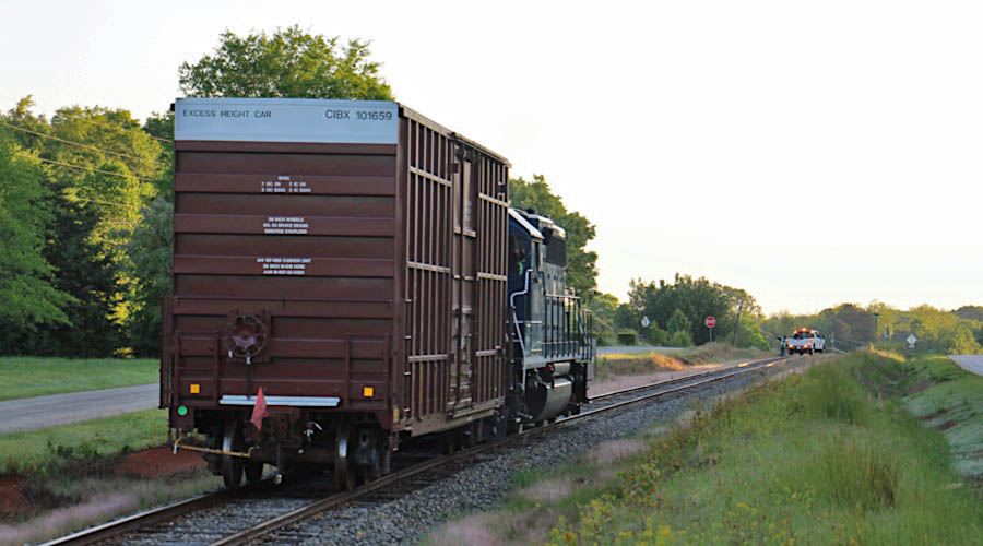
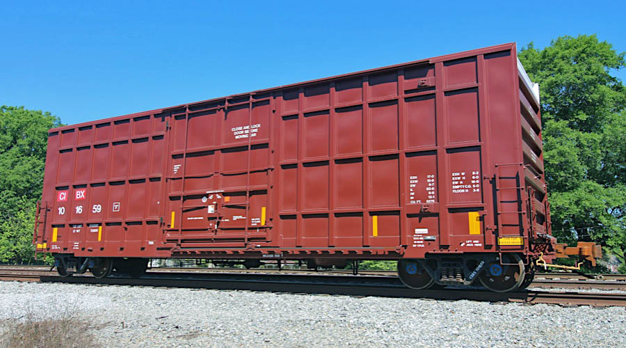
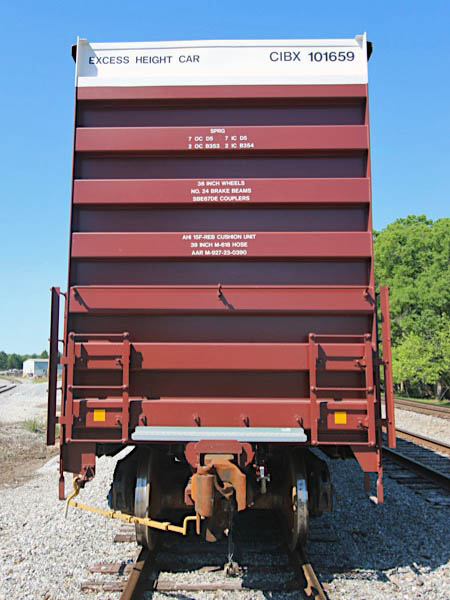
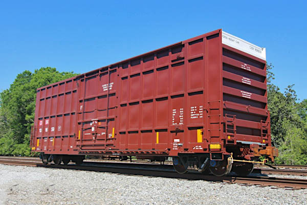
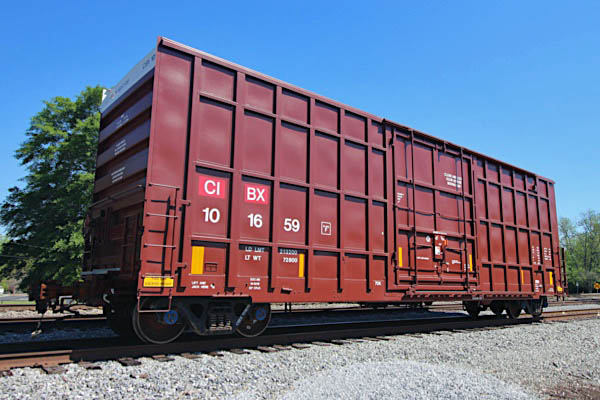
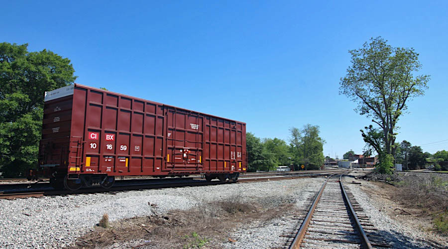
 CIT Group/Capital Finance #101659
Spotted as an outbound empty on the interchange track for Norfolk Southern pickup, CIT Group/Capital Finance #101659 is a typical example of hi-cube paper-service boxcars handled on the Thomaston Division for shipper Quad Graphics, above. Number 101659 was built in Mexico in 2019, making it less than a year old in these photographs.
CIT Group/Capital Finance #101659
Hi-cube boxcar / Barnesville, Ga / Apr 2020 / RWH
Apr 2020 / RWH
Barnesville, Ga / Apr 2020 / RWH
Barnesville, Ga / Apr 2020 / RWH


Barnesville, Ga / Apr 2020 / RWH
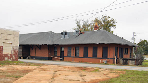
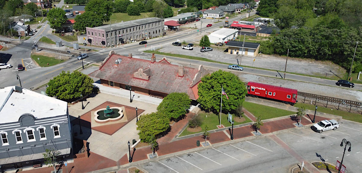
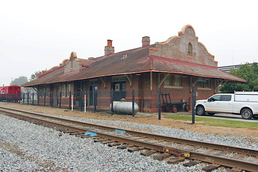
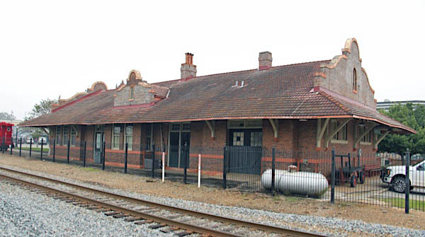
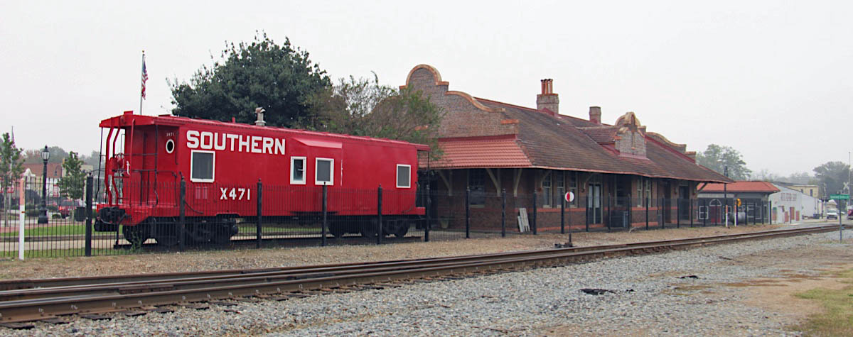
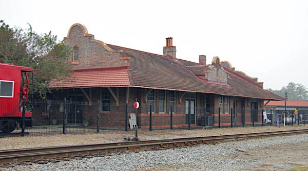
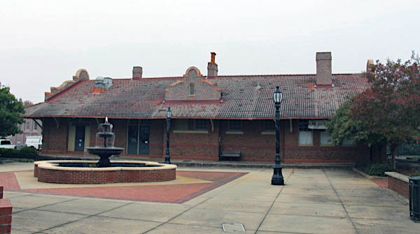
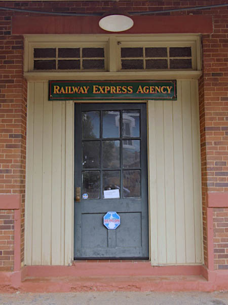
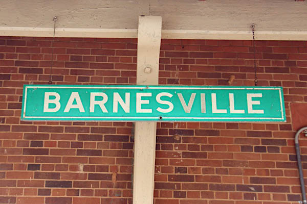
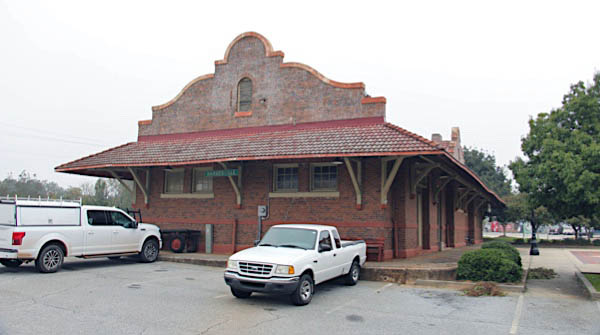
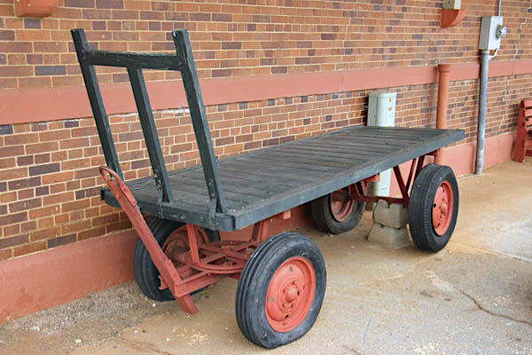
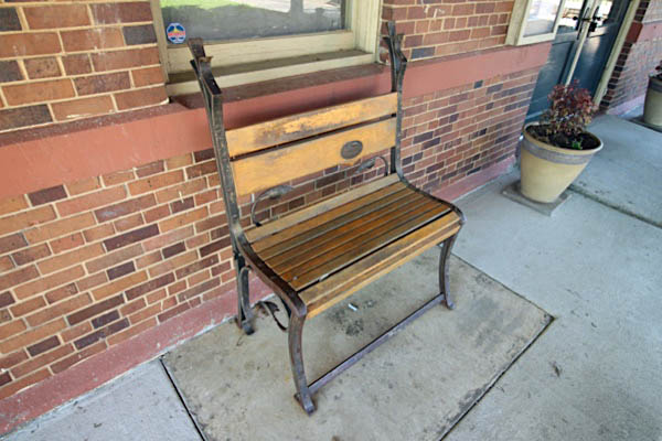
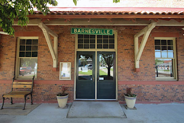
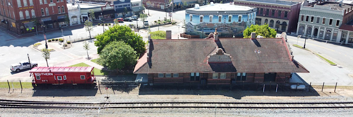
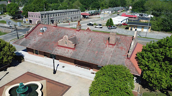
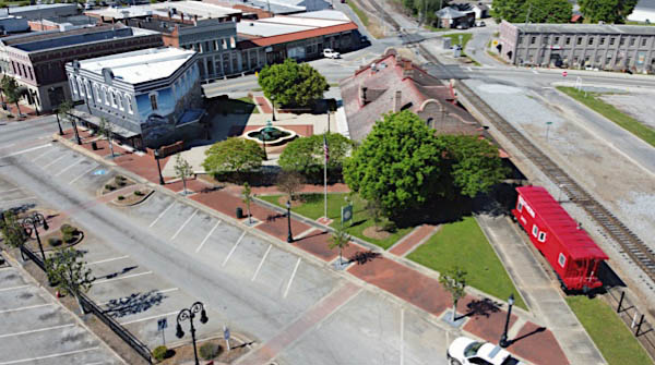
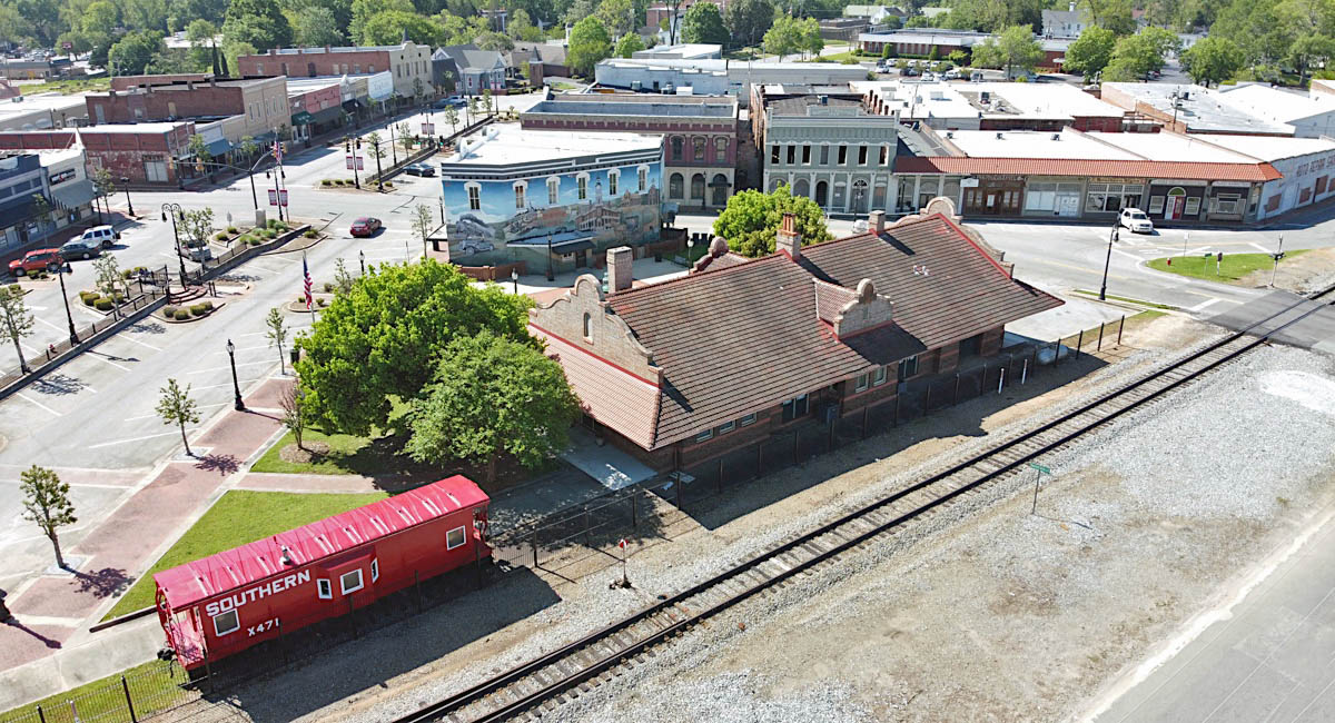
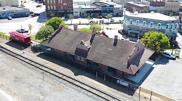
Barnesville depot
BARNESVILLE, Ga. – Trains first reached the Lamar County seat in 1841 during the Macon and Western Railroad’s construction of a line between Forsyth and Atlanta. The line was completed in 1846.
Previously, the Monroe Railroad, chartered on Dec. 23, 1833, laid tracks between Macon and Forsyth in the 1830s, with trains beginning operations in December 1838. Daniel Tyler purchased the railroad in 1845 and organized the Macon and Western Railroad, which in 1871 was consolidated into the Central of Georgia.
In 1856, the Thomaston and Barnesville Railroad opened between the two cities. In 1860, the line was reorganized into the Upson County Railroad and was subsequently destroyed in the Civil War. The railroad was rebuilt in the decade following the Civil War. Starting in the 1870s, the railroad was controlled by the Central of Georgia.
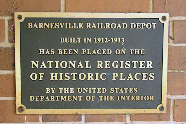
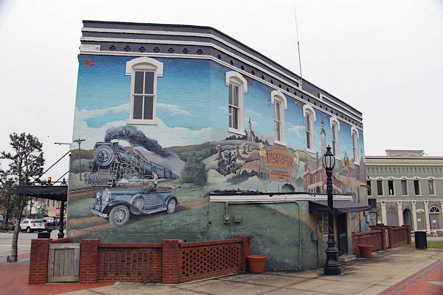
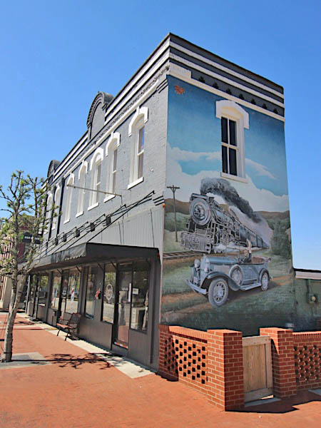
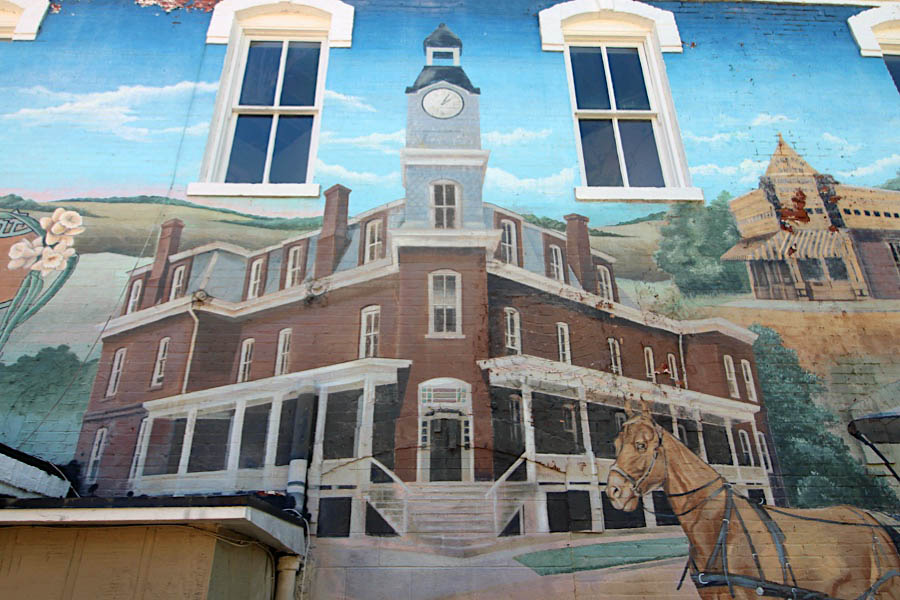
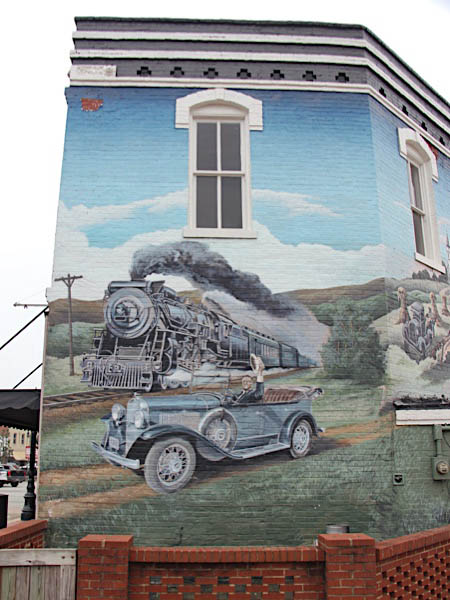
The Central of Georgia built the current railroad depot in downtown Barnesville in 1912-13. Today, the building is used as an art gallery. A mural on a nearby building depicts President Franklin Delano Roosevelt riding on a car with a train in the background.
Barnesville, Ga / Apr 2020 / RWH
Click to see this location plotted on a Google Maps page
Barnesville, Ga / Nov 2018 / RWH
Barnesville, Ga / Nov 2018 / RWH
Barnesville, Ga / Nov 2018 / RWH
Barnesville, Ga / Nov 2018 / RWH
Barnesville, Ga / Nov 2018 / RWH
Barnesville, Ga / Nov 2018 / RWH

See also our Central of Georgia surviving depots scrapbook in Mainlines
Barnesville, Ga / Nov 2018 / RWH
Barnesville, Ga / Nov 2018 / RWH
Barnesville, Ga / Nov 2018 / RWH
Barnesville, Ga / Nov 2018 / RWH
Barnesville, Ga / Nov 2018 / RWH
Barnesville, Ga / Apr 2020 / RWH
Barnesville, Ga / Apr 2020 / RWH
Barnesville, Ga / Apr 2020 / RWH
Barnesville, Ga / Apr 2020 / RWH
Barnesville, Ga / Apr 2020 / RWH
Barnesville, Ga / Apr 2020 / RWH
Barnesville, Ga / Apr 2020 / RWH

Barnesville, Ga / Apr 2020 / RWH

Barnesville, Ga / Apr 2020 / RWH
Barnesville, Ga / Nov 2018 / RWH
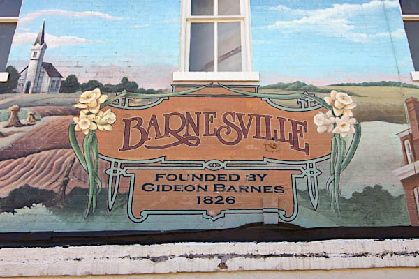
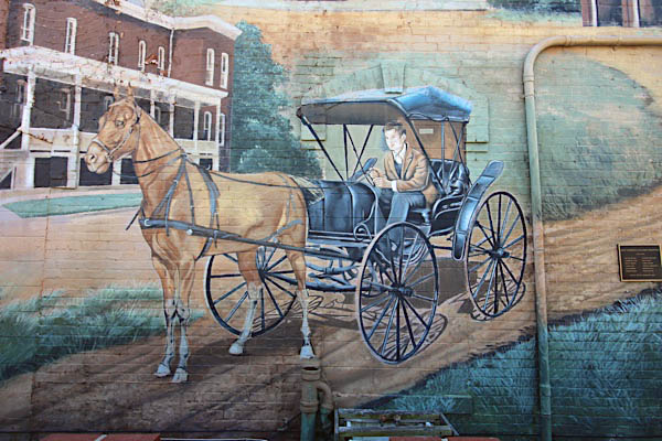
Artist Shannon Lake unveiled a building-wide mural celebrating the history of Barnesville in 2007. On one end is President Roosevelt, who visited the town in 1938. FDR has been painted at the wheel of his convertible, grinning and waving to the viewer. Unfortunately, he also appears to be unaware that he's driving straight into the path of an onrushing, steam-belching locomotive that's coming up behind him. It wasn't meant to be that way, but it sure looks as if FDR is about to get flatten1ed.
Click to see the mural courtyard area plotted on a Google Maps page
Barnesville, Ga / Apr 2020 / RWH
Barnesville, Ga / Apr 2020 / RWH
Barnesville, Ga / Apr 2020 / RWH
Barnesville, Ga / Apr 2020 / RWH

Barnesville, Ga / Apr 2020 / RWH
Apr 2020 / RWH
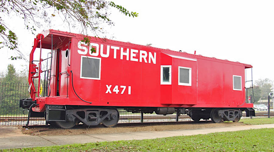
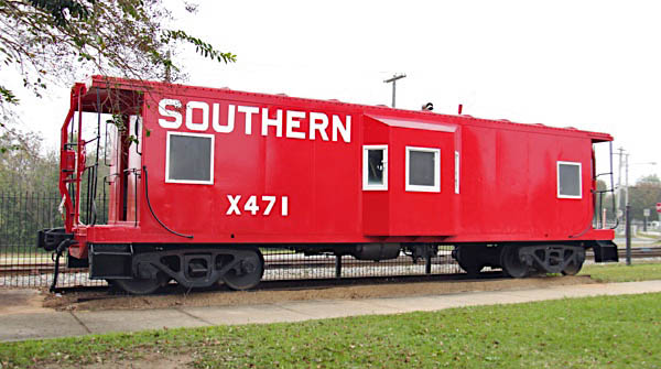
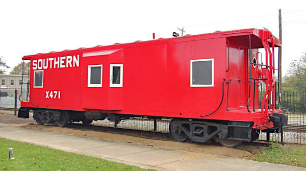
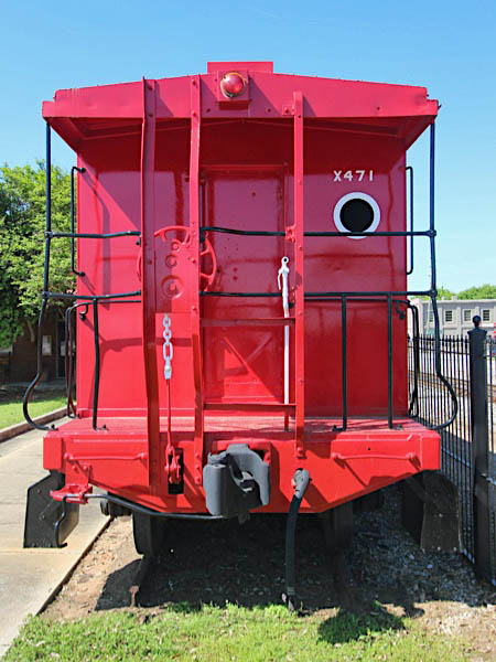
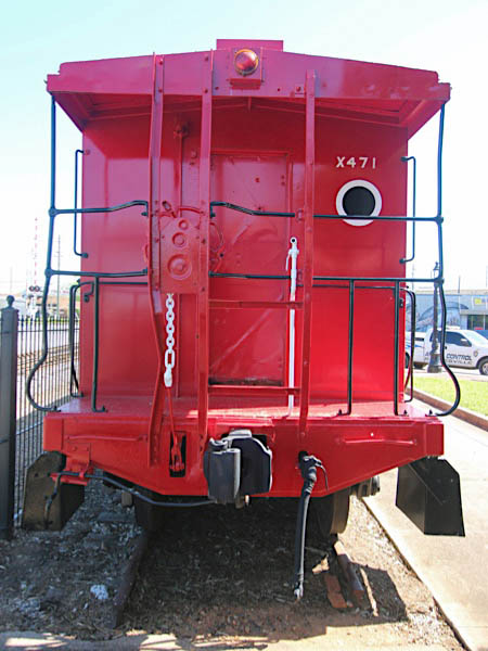
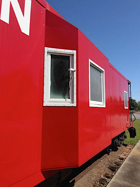
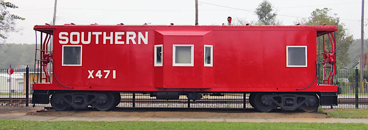
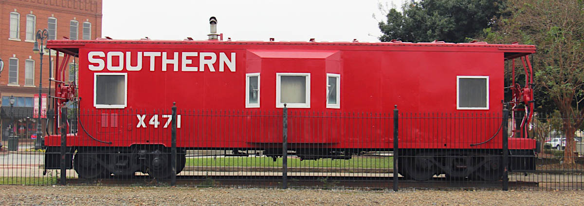
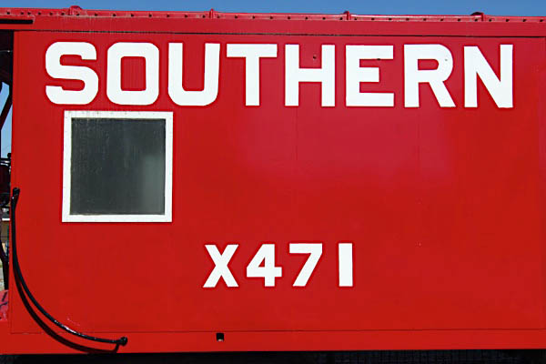
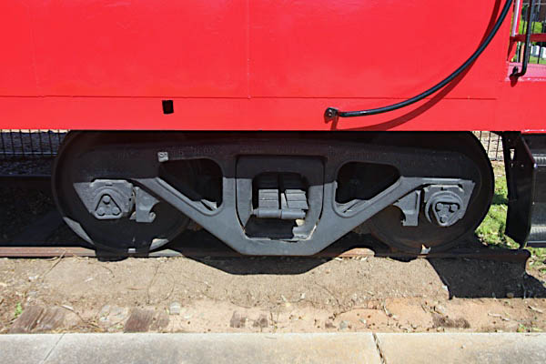
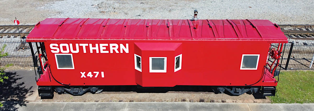
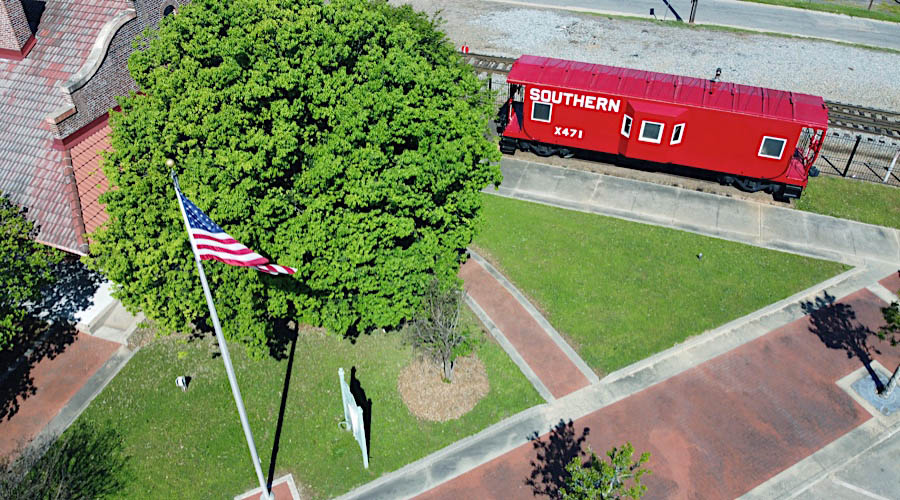
Southern Railway #X471
bay window caboose / Barnesville, Ga / Nov 2018 / RWH
Barnesville, Ga / Nov 2018 / RWH
Barnesville, Ga / Nov 2018 / RWH
Apr 2020 / RWH
Barnesville, Ga / Nov 2018 / RWH


Apr 2020 / RWH

Barnesville, Ga / Apr 2020 / RWH
Barnesville, Ga / Apr 2020 / RWH
Barnesville, Ga / Apr 2020 / RWH