 |
Southern Railway Louisiana |

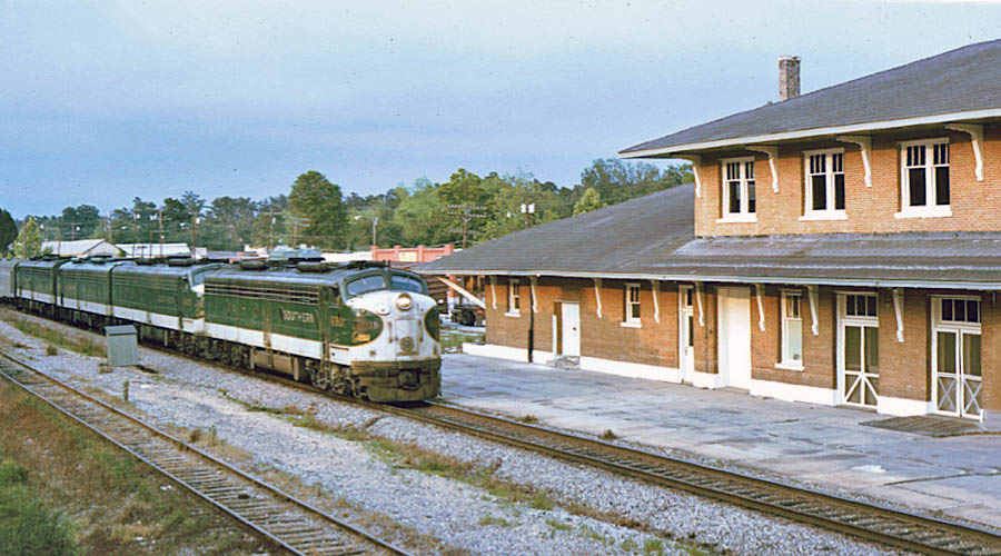
Southerner on Lake Pontchartrain / collection

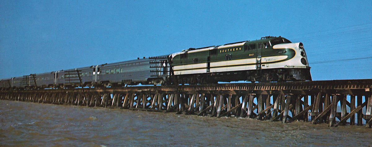
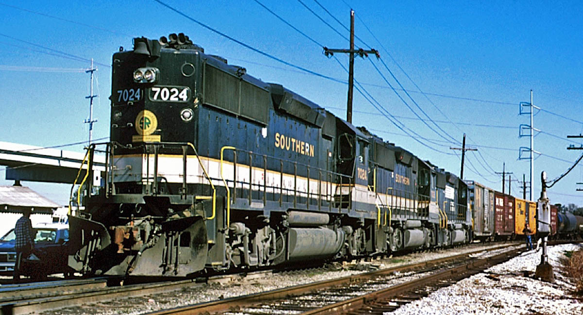
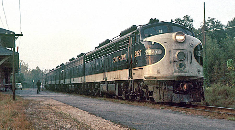
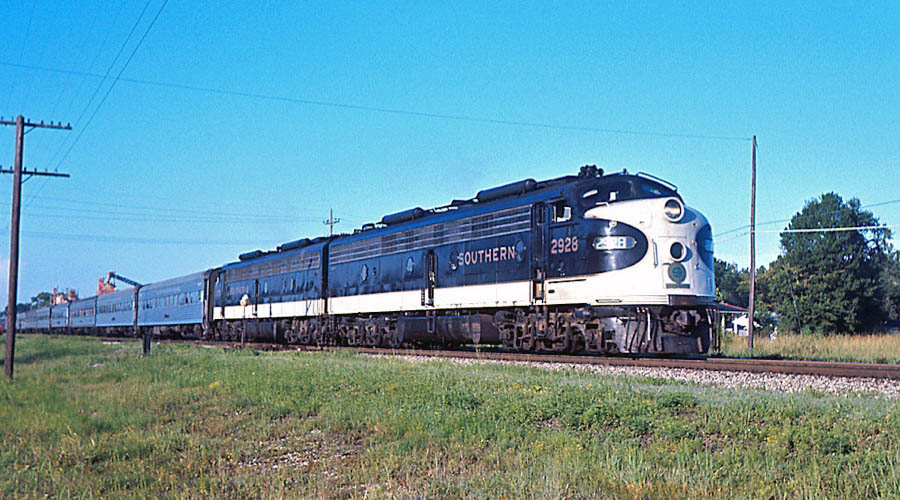
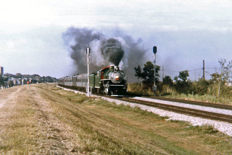
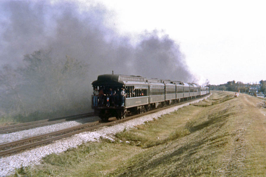
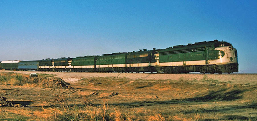
 The [train] was an extra-fare mainline train running daily north and south, superior to all other trains between Washington and New Orleans. It was a splendid craft, beautiful from the white smokebox of the engine through its Pullman-green length to the open observation platform of the club car. The windows in the washrooms were leaded glass. The seats were plush, the aisles carpeted, the end bulkheads painted with scenes of the French Quarter and of the great plantation houses of Louisiana. The dining car, specializing in Creole cuisine, was one of the finest restaurants in the South, its starched and haughty waiters trained in French service. The [train] had its own stationery, its own linens and plates and silverware. Passengers could send telegrams to their boardrooms or wives or mistresses while rolling through the countryside at seventy and eighty miles an hour. A steward was on call night and day to take dictation, and the letter stamped and mailed at the next stop.
Howard Bahr — Pelican Road — 2008
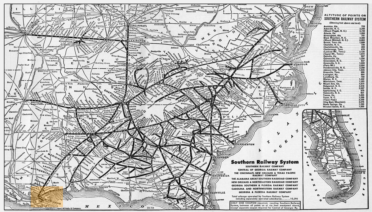
1964 Southern system map / collection
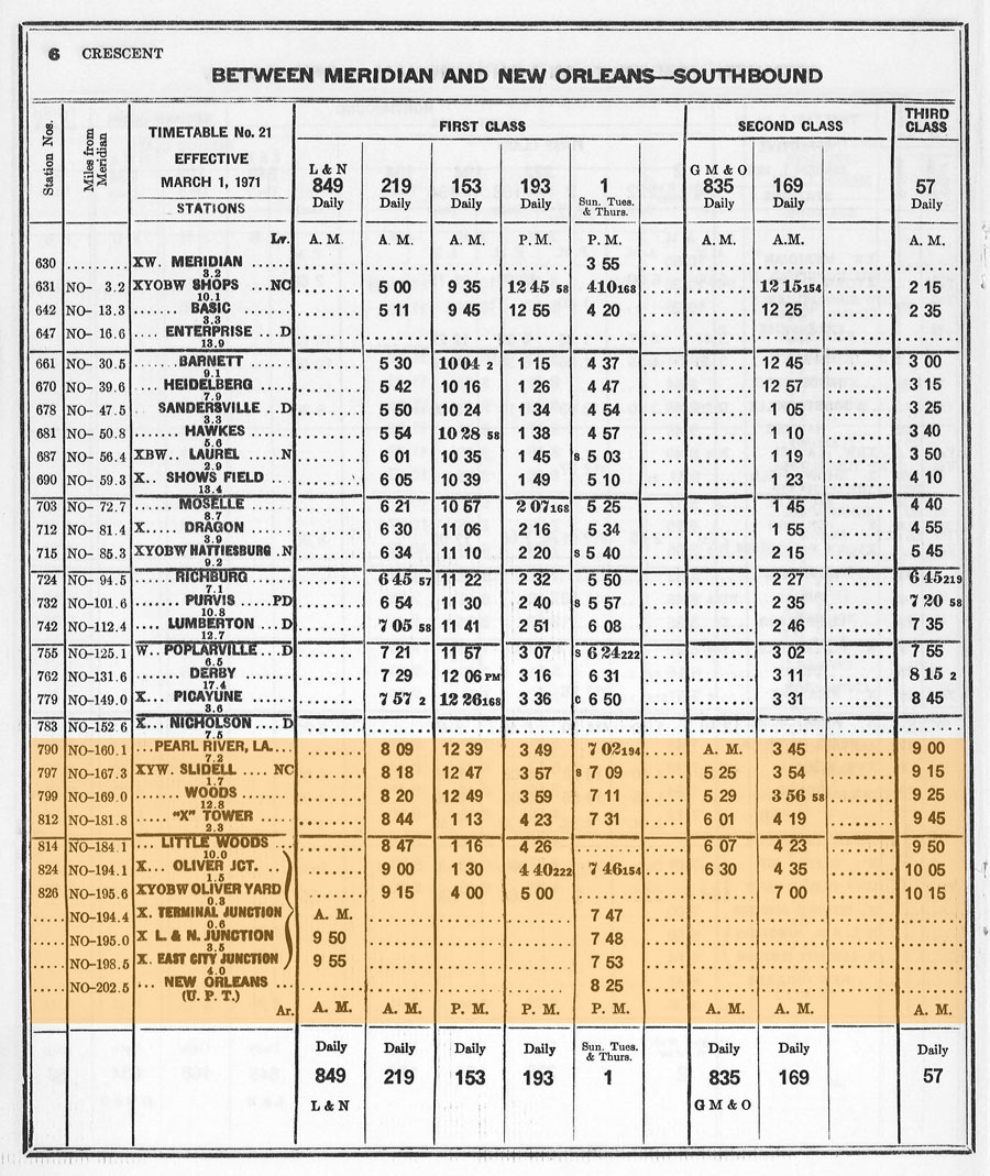
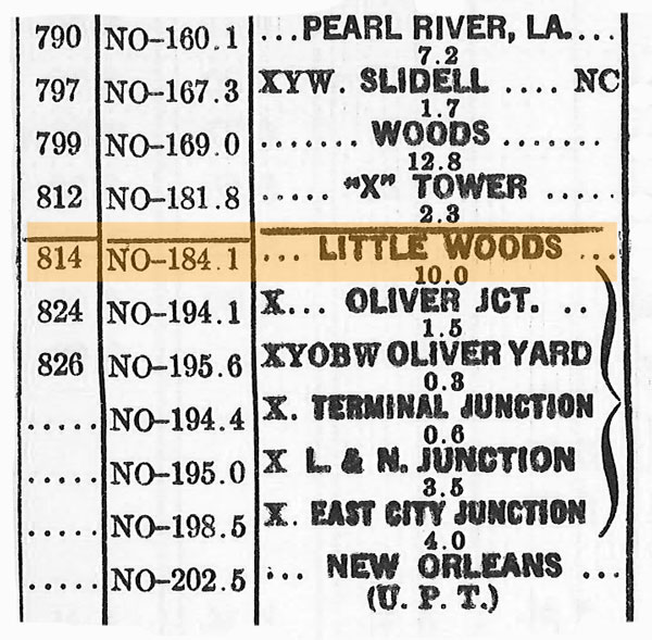
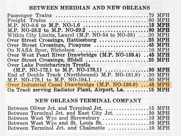
1971 Crescent Division timetable / collection

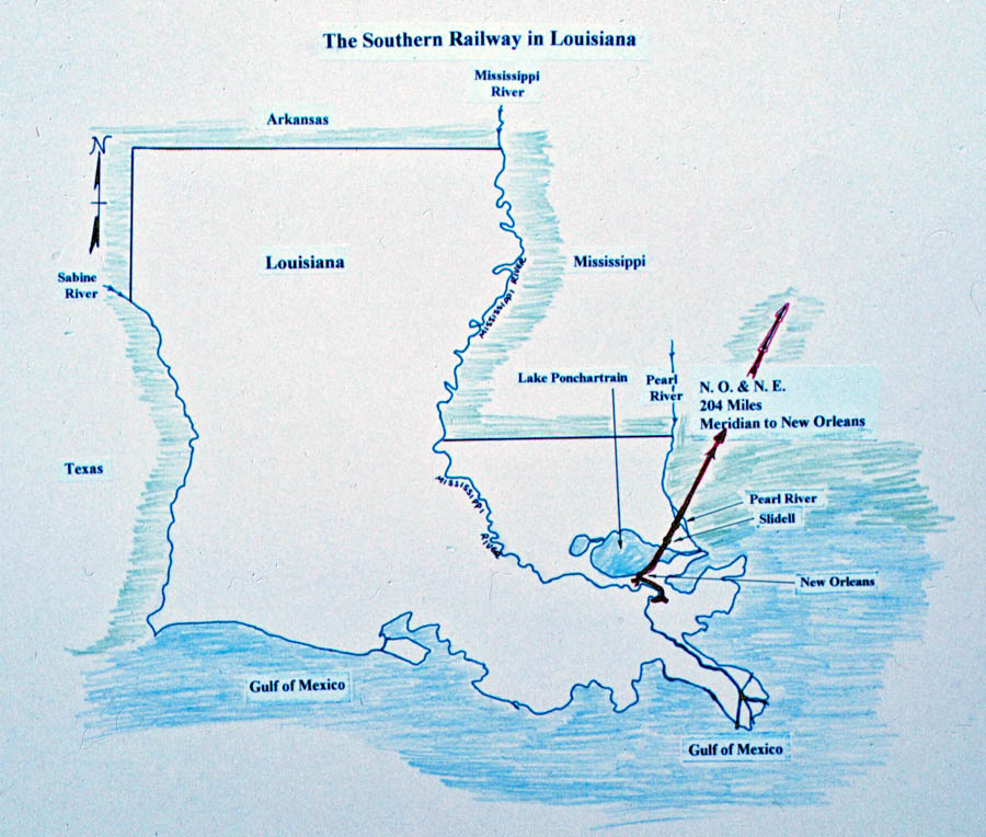
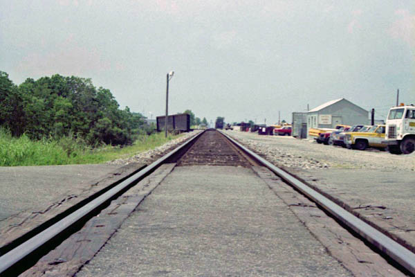
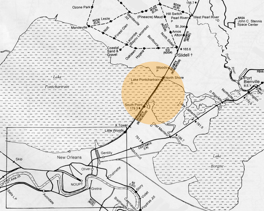
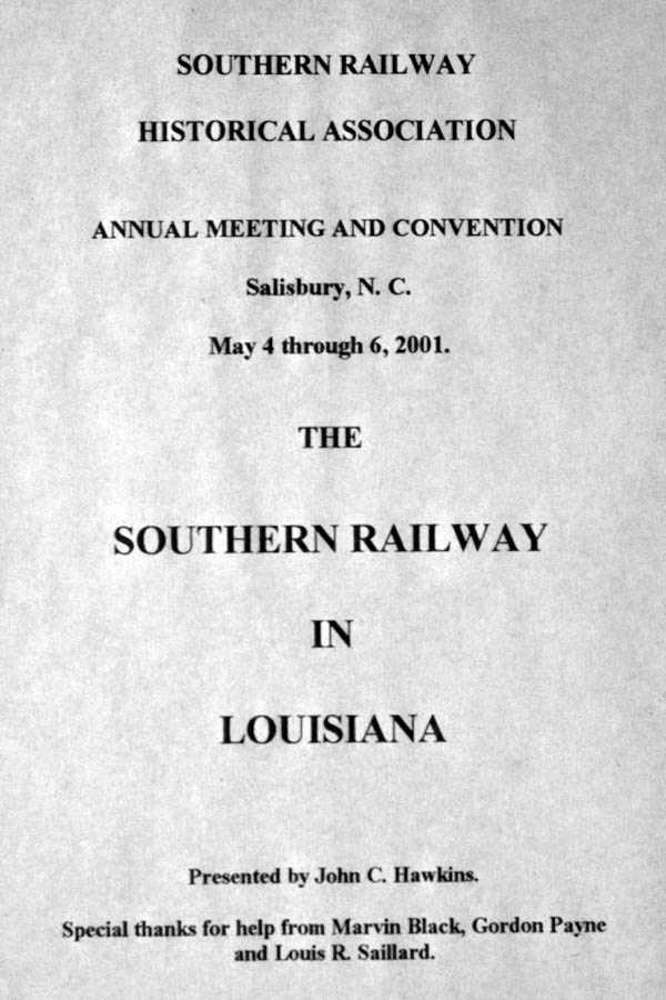 John was president of the Southern Railway Historical Association for a few years, and during that period he developed a slideshow he matter-of-factly titled "The Southern Railway in Louisiana." This was a subject my father knew something about. Having grown up in the Crescent City in the 1930s and 40s, and with family in Atlanta they would often visit via train, he had ample opportunity to get to known the southwestern-most portion of the Southern's empire — 42 miles of railroading in the Bayou State. For the slideshow, dad documented the mainline from the Mississippi state line all the way to Oliver Yard in New Orleans, including Pearl River, Slidell, Lake Pontchartrain, Little Woods, and the footprint of the former Terminal Station. The show was first presented at the Historical Association's annual meeting in Salisburg, NC, in 2001, but was later presented to other groups at other locations around the southeast. I have recreated the presentation here in this scrapbook, supplimenting dad's work with my own photography of Louisiana locations as well as the extensive photographic work of Michael Palmieri — who graciously allowed me access to his collection of Southern Railway materials for this page. Dad was very proud of his slideshow. I think he felt is shed some needed light on a far corner of Southern's impressive system, one that was often overshadowed by Birmingham, Chattanooga, the "Rathole," the Piedmont region, and other well-known Southern territory. With the possible exception of Palatka, Florida, one cannot get more southern on the Southern than New Orleans.
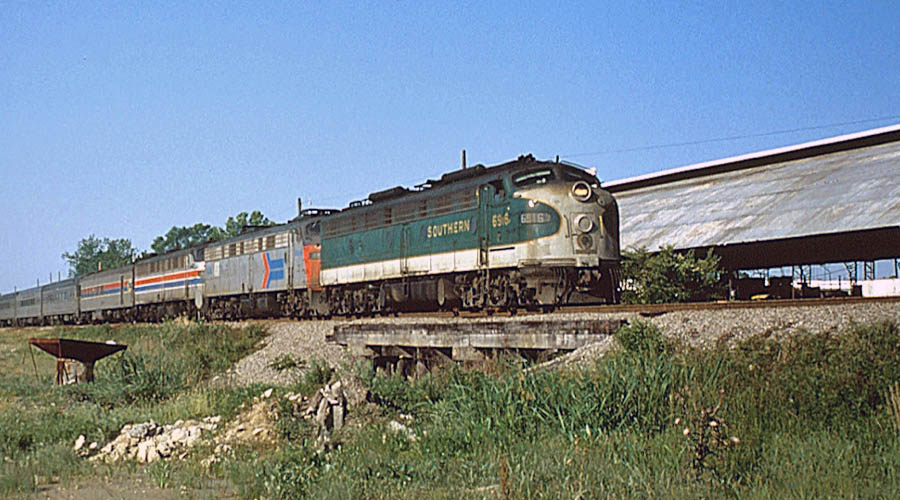
Jefferson, La / Jan 1986 / Michael Palmieri
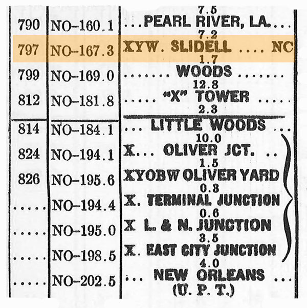
 N. O. & N. E.
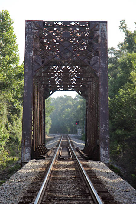
 The Southern Railway made it to the state of Lousiana, and therefore to the city of New Orleans by acquiring control of the New Orleans & Northeastern Railroad. Chartered in 1870 and built with British capital between Meridian, Ms, and New Orleans, the NO&NE was 196 miles long and opened for service in November of 1883. The road took a southwesterly route from Meridian to the Louisiana state line, connecting Laurel, Hattiesburg, Lumberton, Poplarville, and Picayune along the way. At the state line, the route crossed the muddy Pearl River and continued on a southwesterly approach to New Orleans through Slidell.
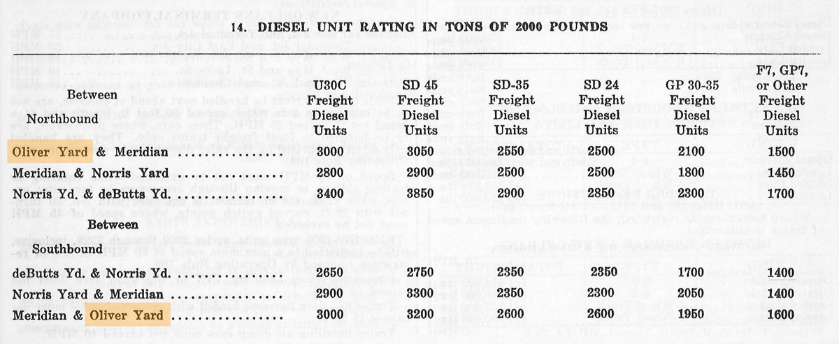
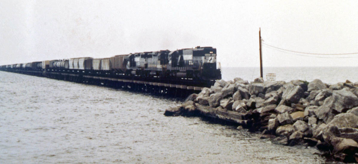
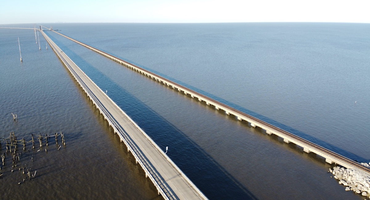
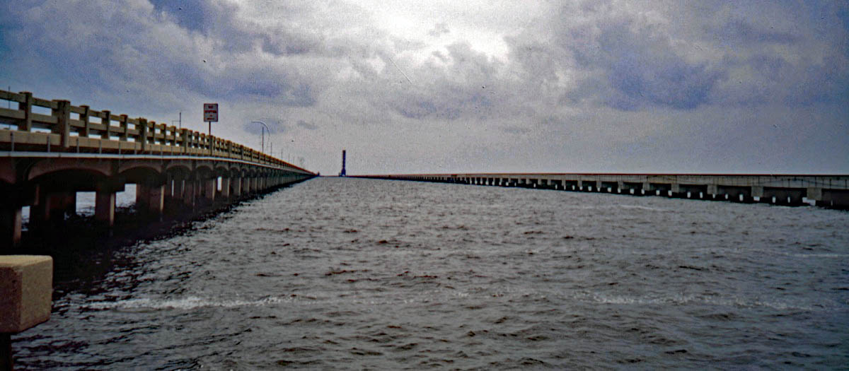
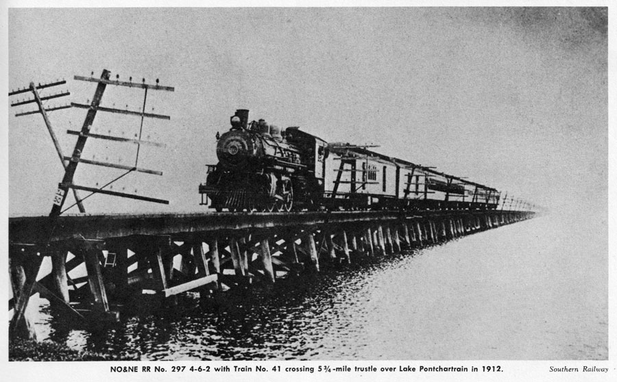
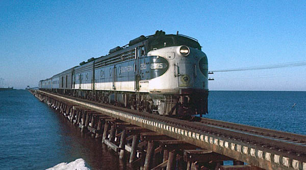
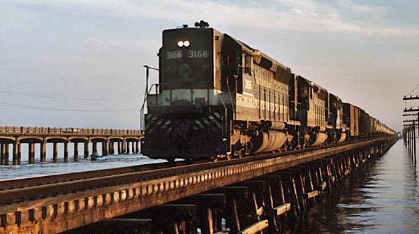
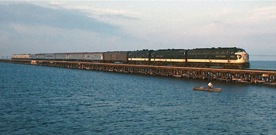
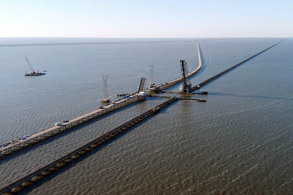
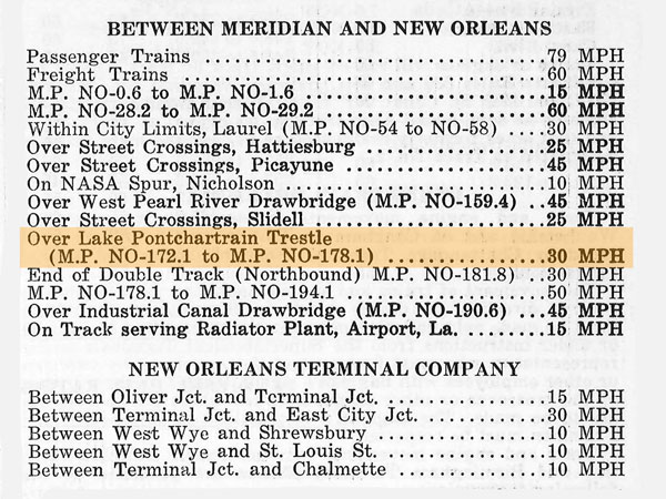
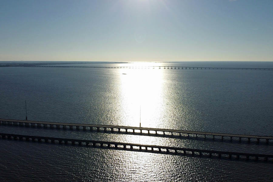
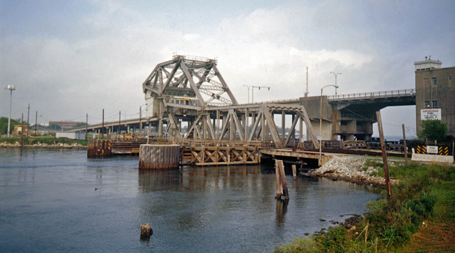
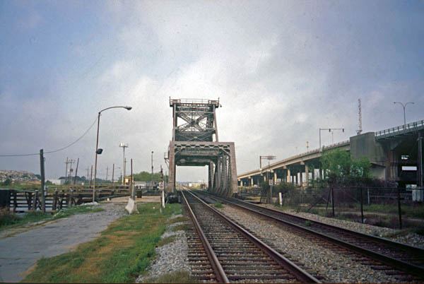
![]() Likely the most notable feature of the NO&NE mainline was its ambitious crossing of Lake Pontchartrain. The original wooden bridge over an eastern arm of the 630 square-mile brackish lake was nearly 22 miles long, making it one of the longest railroad bridges in the world. By the turn of the century, the untreated portion over the approaching swampland was replaced with earthen fills. This left 5 miles of permanent treated trestle over the lake, to later include a drawbridge. Furthermore, as the mainline toward the Crescent City was built following the natural curve of the lakshore, the route south of the crossing created one of the longest continuous sections of the curvature trackage in the country.
Likely the most notable feature of the NO&NE mainline was its ambitious crossing of Lake Pontchartrain. The original wooden bridge over an eastern arm of the 630 square-mile brackish lake was nearly 22 miles long, making it one of the longest railroad bridges in the world. By the turn of the century, the untreated portion over the approaching swampland was replaced with earthen fills. This left 5 miles of permanent treated trestle over the lake, to later include a drawbridge. Furthermore, as the mainline toward the Crescent City was built following the natural curve of the lakshore, the route south of the crossing created one of the longest continuous sections of the curvature trackage in the country.
In 1916 the Southern took control of the New Orleans & Northeastern and a year later removed the regional line from the Queen & Crescent Route — a combination of railroads that provided service between Cincinatti, Chattanooga, Birmingham, and New Orleans. The NO&NE survived on paper for decades as a subsidiary in the Southern system, as did the New Orleans Terminal Company: 18 miles of main belt trackage and other terminal facilities in and around the Big Easy.
1910 New Orleans & North-eastern Official Guide ad / collection
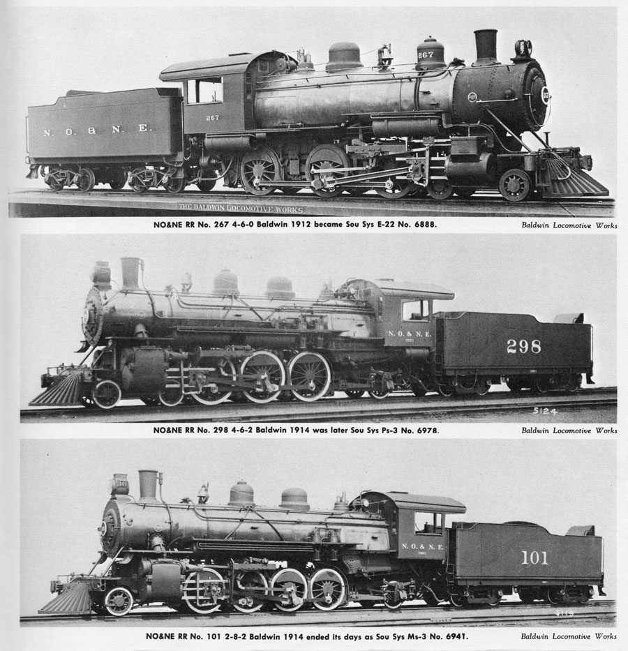
from Southern Railway System: Steam Locomotives and Boats
- Richard E. Prince / collection
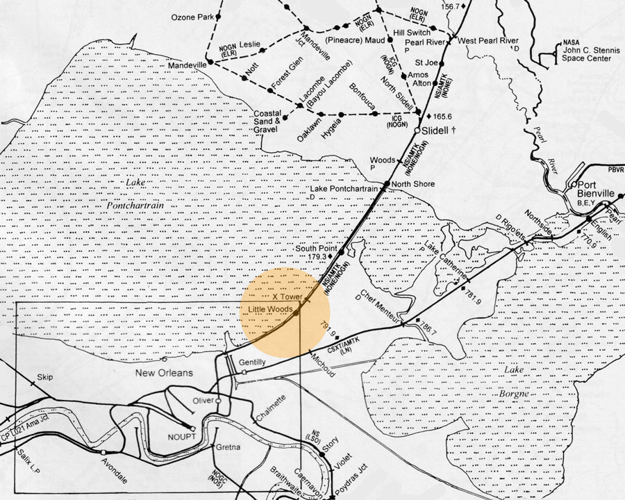
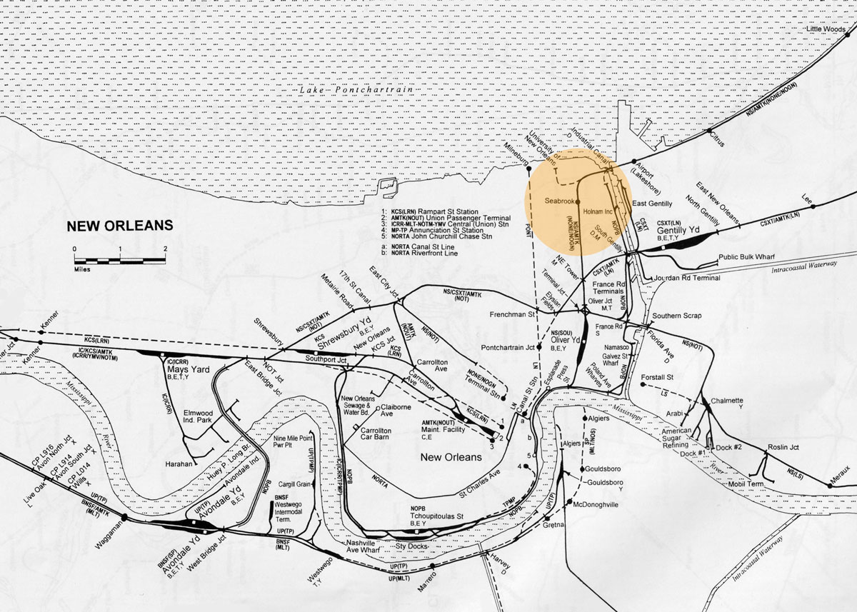
Southern in Louisiana area map / JCH
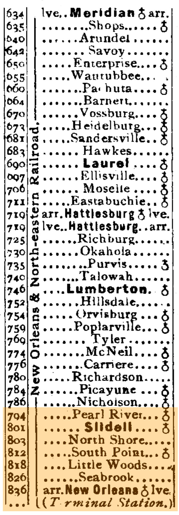
1910 timetable / collection
North Shore, La / Jul 1991 / RWH
HawkinsRails thanks railfan photographer and friend Michael Palmieri for use of his images on this page

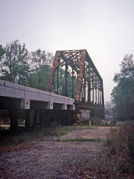
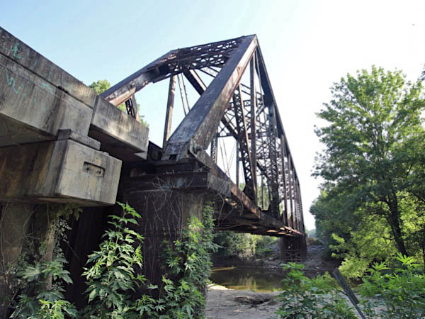
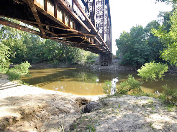
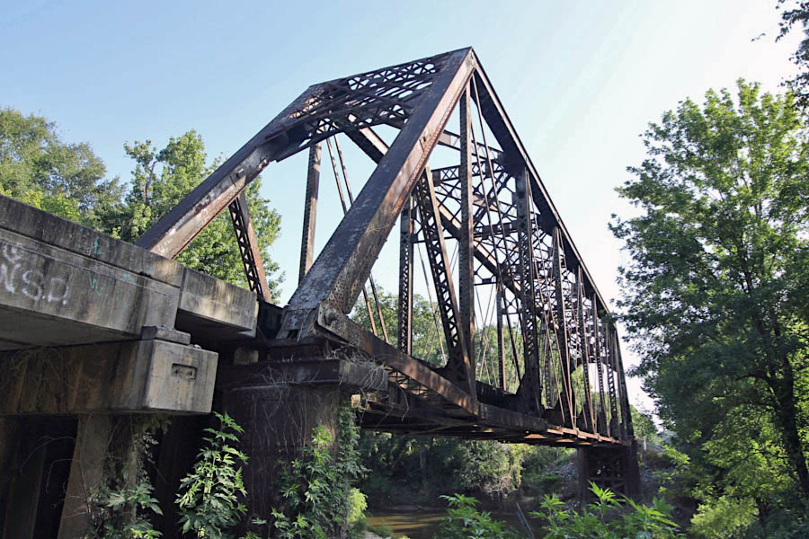
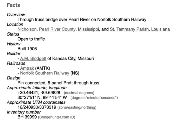
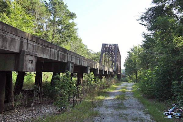
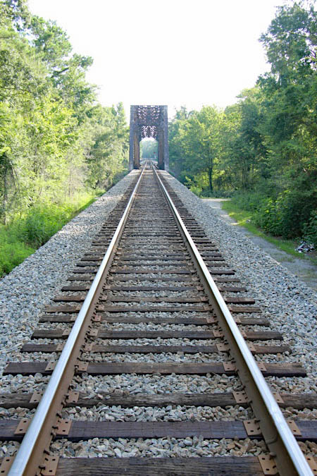
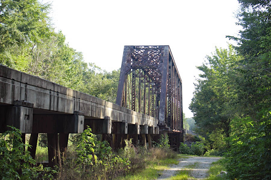
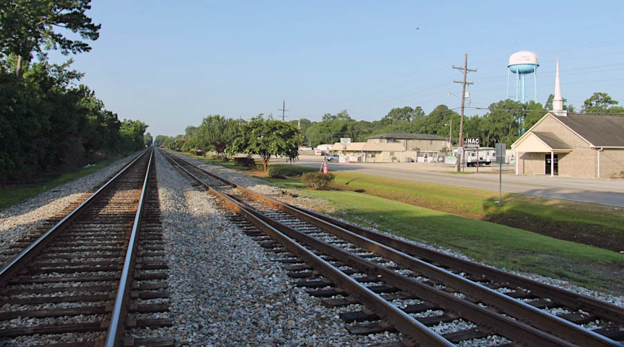
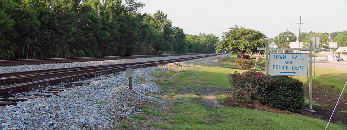
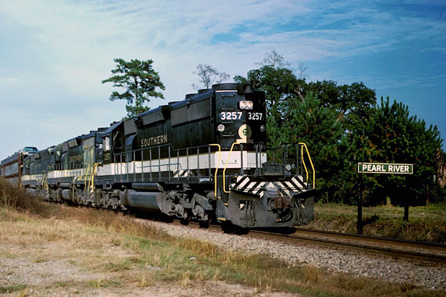
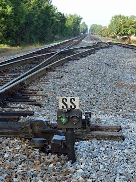
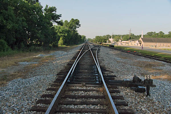
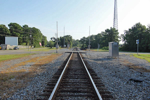
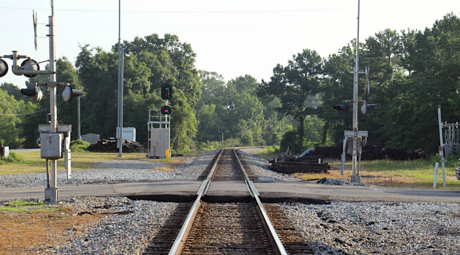
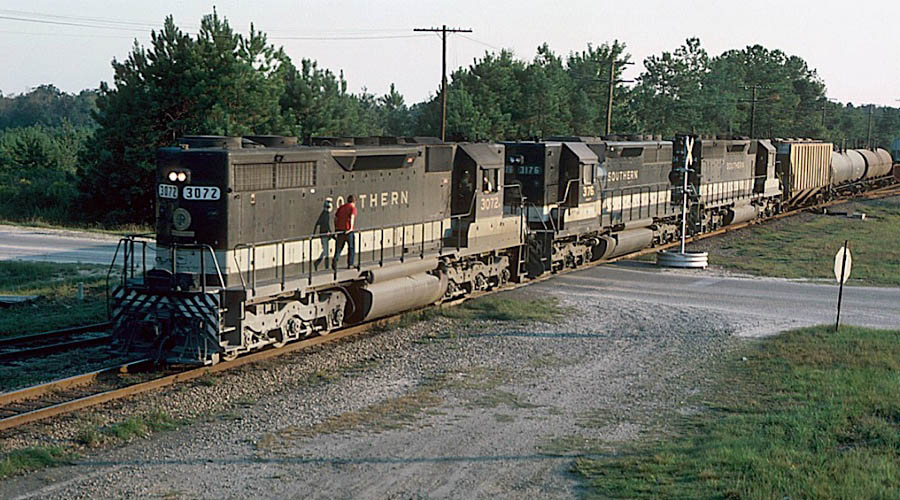
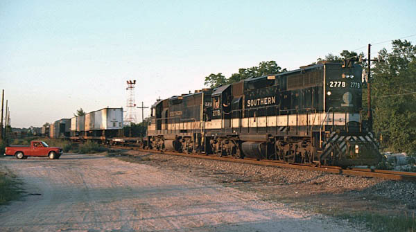
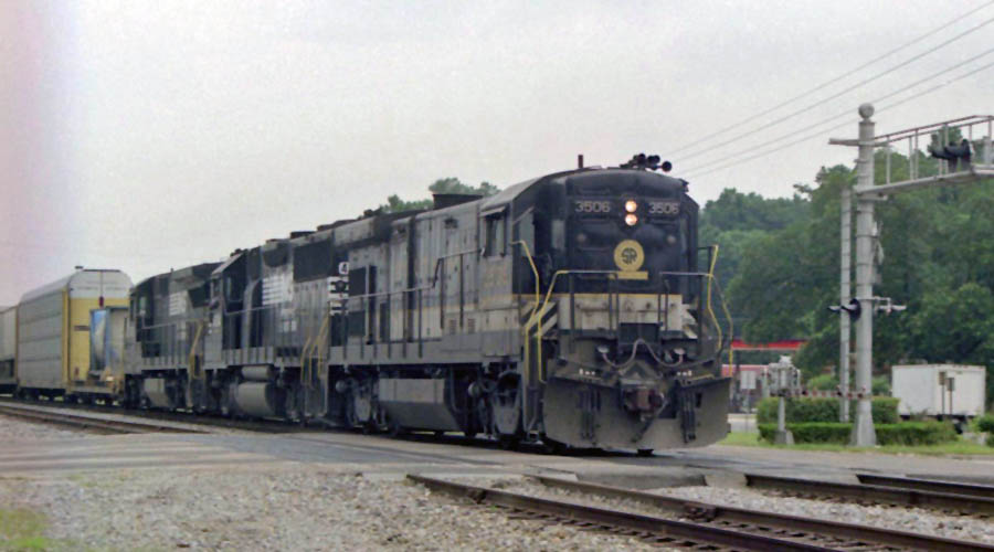
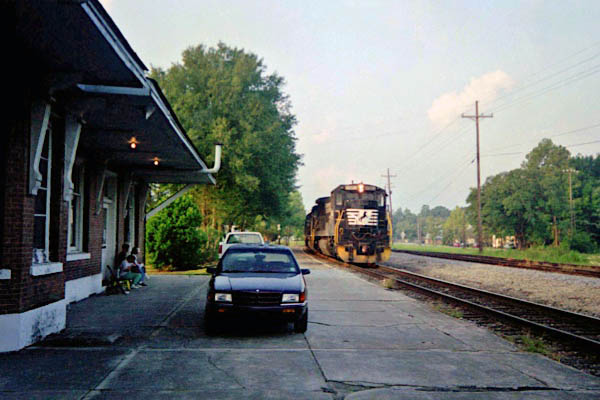
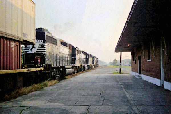
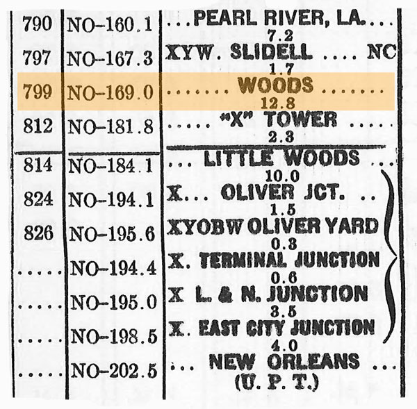
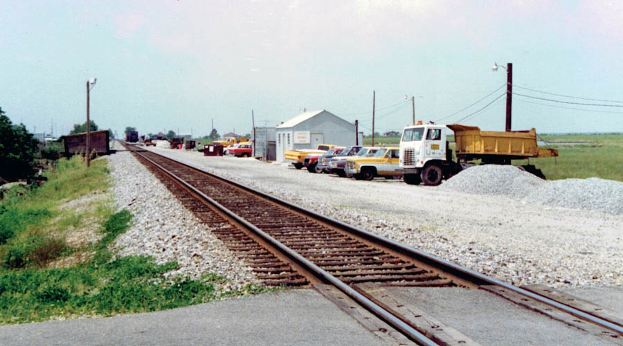
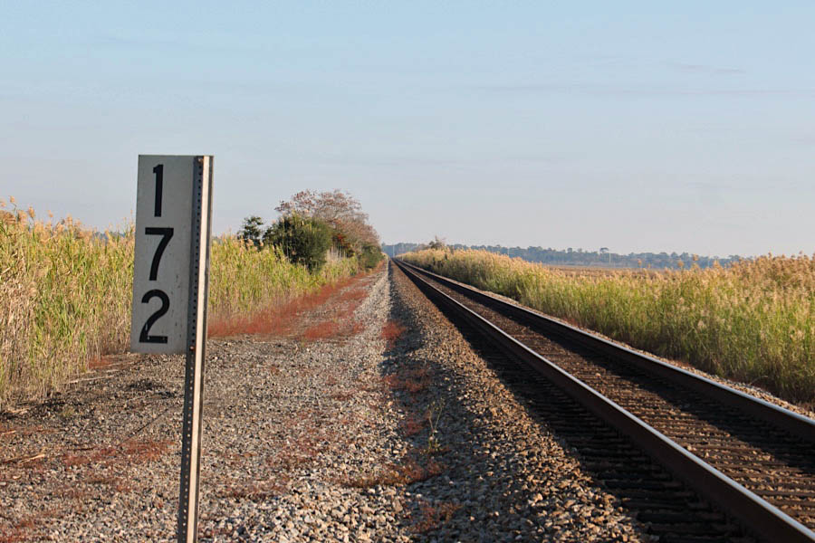
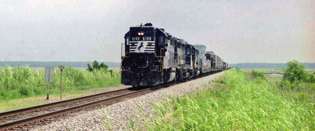
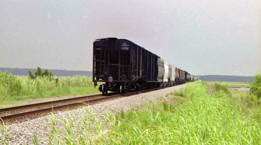
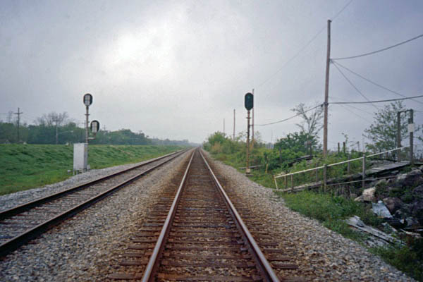
 Pearl River
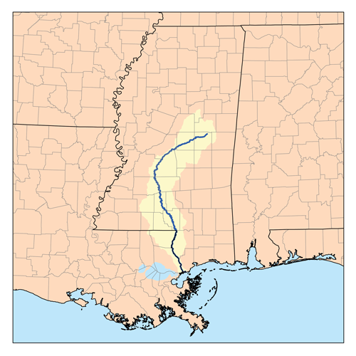 The Pearl River is a river in the U.S. states of Mississippi and Louisiana. It forms in Neshoba County, Mississippi from the confluence of Nanih Waiya and Tallahaga creeks and has a meander length of 444 miles. The lower part of the river forms part of the boundary between Mississippi and Louisiana. The river watershed contains large areas of bottomland hardwood swamp and cypress swamp, providing habitat for many species of wildlife, including sturgeon and black bears. As recently as 2008, endangered Ivory-billed woodpeckers were reportedly sighted here. The mouth of the river creates important marsh habitat along salinity gradients; these marshes have been the subject of many scientific studies. It is considered to be one of the most critical areas of natural habitat remaining in Louisiana.
Pearl River, La / 2001 / JCH
Pearl River, La / Jul 2019 / RWH
Pearl River, La / Jul 2019 / RWH

Click to see the Pearl River bridge plotted on a Google Maps page
Pearl River, La / Jul 2019 / RWH
Jul 2019 / RWH
Pearl River, La / Jul 2019 / RWH
Pearl River, La / Jul 2019 / RWH
RWH
Pearl River, La / Jul 2019 / RWH
1971 timetable / collection
Pearl River, La / Jul 2019 / RWH
 In 1859, Pearl River was founded as a small railroad town. In 1886, a train station was constructed and two years later the first store was established. The community’s name was originally Halloo. It was changed to Pearl, later to Pearlville and then to Pearl River in 1888. On May 24, 1906, Governor Newton Crain Blanchard granted the request of Mayor G.W. Fuller to incorporate the Village of Pearl River. Pearl River became a town in 1964. We have some of the best fresh water fishing and hunting in the State of Louisiana. The Pearl River is a scenic river that runs through the Honey Island Swamp. It’s also a recreational river with natural sandy beaches which were formed by the river which makes it heavenly bliss.
Pearl River, La / Jul 2019 / RWH
Click to see the Pine Street crossing plotted on a Google Maps page
Pearl River, La / Jul 2019 / RWH
Pearl River, La / Oct 1978 / Michael Palmieri
Pearl River, La / Jul 2019 / RWH
Pearl River, La / Jul 2019 / RWH
Pearl River, La / Jul 2019 / RWH
Pearl River, La / Jul 2019 / RWH
Pearl River, La / Oct 1974 / James H. Selzer Jr. / Michael Palmieri collection
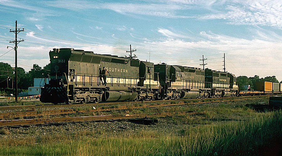
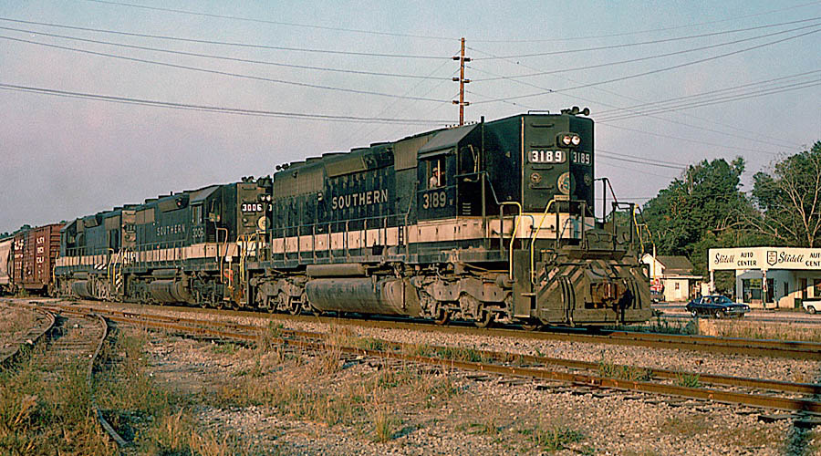
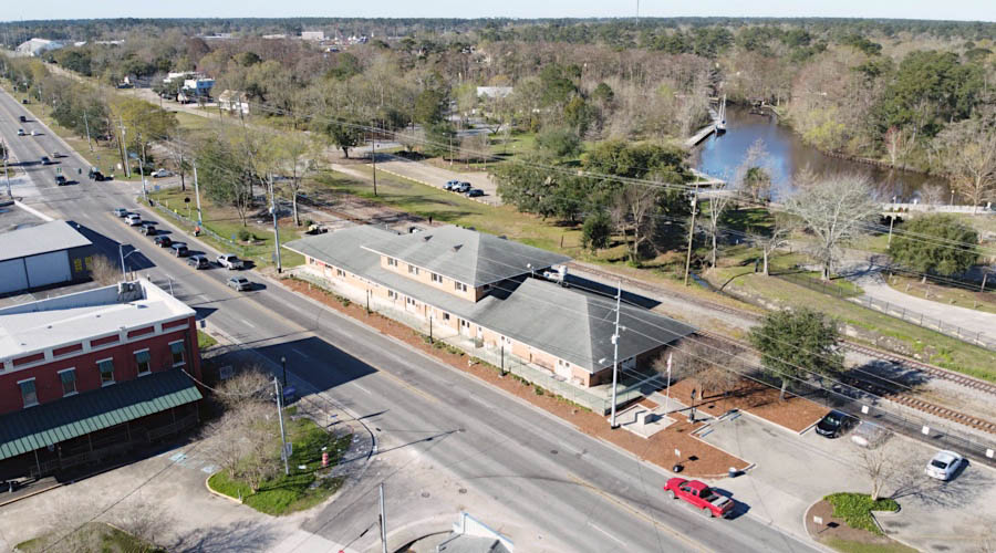
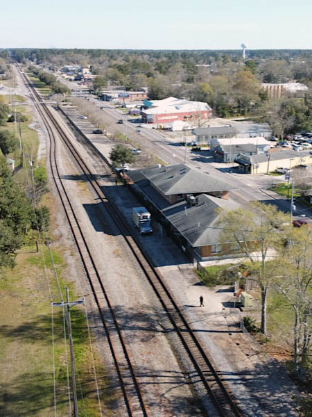
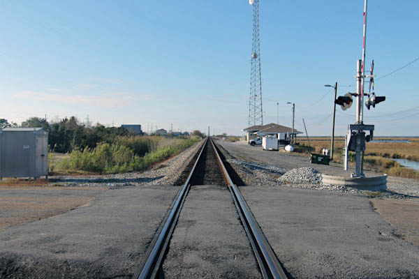
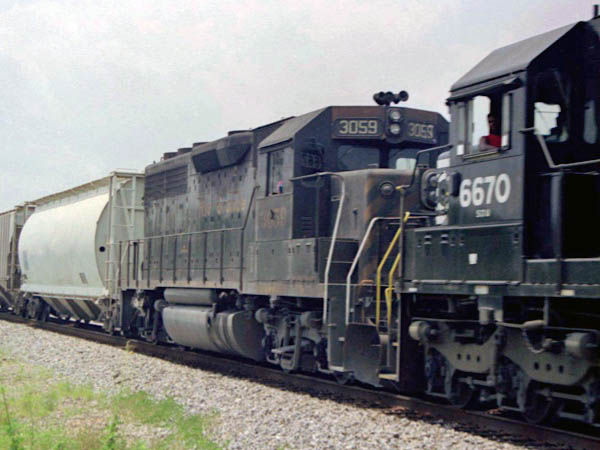
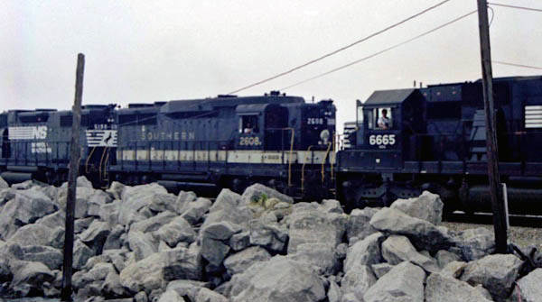
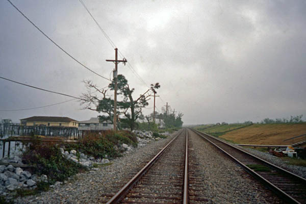
 Slidell
1971 timetable / collection
Slidell, La / May 1979 / Michael Palmieri
Slidell, La / Jul 1990 / RWH
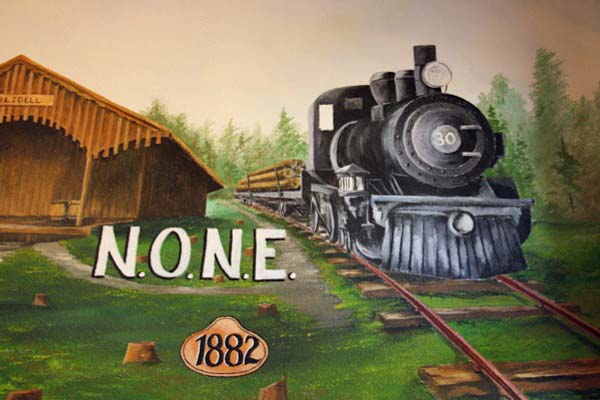
![]() Slidell, Louisiana was founded around 1882 during construction of a major new railroad from New Orleans to Meridian, Mississippi, connecting there with Cincinnati, Ohio and eventually with New York, NY. The New Orleans and Northeastern (N.O.N.E.) Railroad established a building camp at first high ground north of Lake Pontchartrain which eventually grew into the city. Slidell was chartered as a town in 1888 by the Louisiana legislature.
Slidell, Louisiana was founded around 1882 during construction of a major new railroad from New Orleans to Meridian, Mississippi, connecting there with Cincinnati, Ohio and eventually with New York, NY. The New Orleans and Northeastern (N.O.N.E.) Railroad established a building camp at first high ground north of Lake Pontchartrain which eventually grew into the city. Slidell was chartered as a town in 1888 by the Louisiana legislature.
Sometime prior to Slidell’s formal incorporation in 1888, its first streets were laid out in a grid pattern, mostly east of the railroad, running three blocks along the road by four blocks deep. Bonfouca Street, now Bayou Lane, lay in the short stretch between the railroad and the bayou. East of the tracks, the north-south streets were Bayou (now Front), First, Second, Third and Fourth. The east-west streets were Fremaux, Erlanger, Bouscaren and Cousin.
Erlanger, slightly wider than the others and designated as an avenue, was named by Baron Frederick Erlanger, head of the banking syndicate which financed the railway. Baron Erlanger named the town for his deceased father-in-law, John Slidell, who had been a prominent state, national and confederate political figure. Col. Leon J. Fremaux, a prominent Louisiana engineer and planner, drew the original plans for Slidell and named Fremaux Avenue for himself. Bouscaren Street was named for G. Bouscaren, the chief engineering officer of the railroad. Cousin Street took its name from the locally prominent Cousin family.
In the thirty or so years after its founding, Slidell developed a creosote plant, one of the country’s largest brick manufacturing facilities, a large lumber mill and a shipyard. The Slidell shipyard contributed significantly to the national effort in both World Wars. Slidell residents worked in New Orleans ship, tank and airplane construction during World War II.
Slidell, La / Oct 1970 / James Selzer Jr. / Michael Palmieri collection
Slidell, La / Oct 1971 / James Selzer Jr. / Michael Palmieri collection
Slidell, La / Nov 1978 / James Selzer Jr. / Michael Palmieri collection
Slidell, La / Dec 2016 / RWH
Click to see the Slidell depot plotted on a Google Maps page
Slidell, La / Dec 2016 / RWH
Slidell, La / Dec 2016 / RWH
Slidell, La / Dec 2016 / RWH
Slidell, La / Dec 2016 / RWH
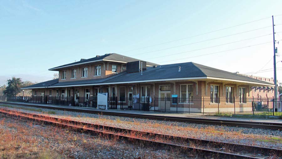
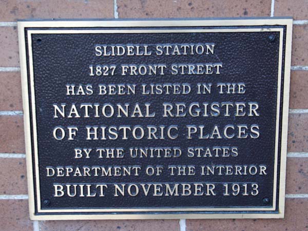
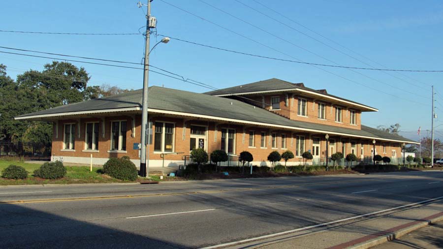
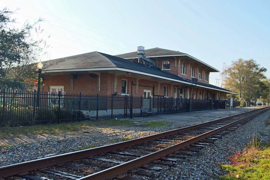
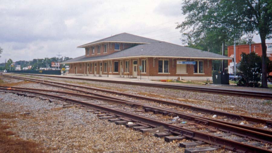
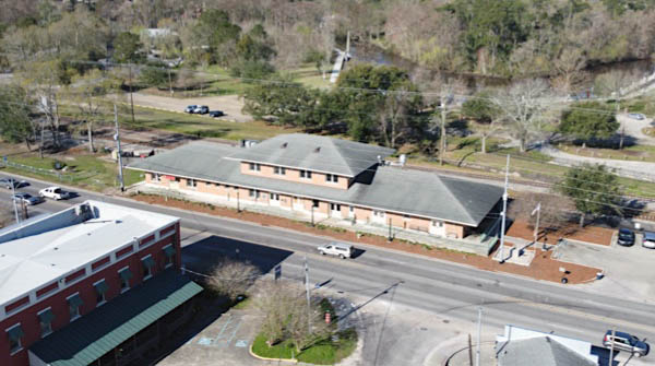
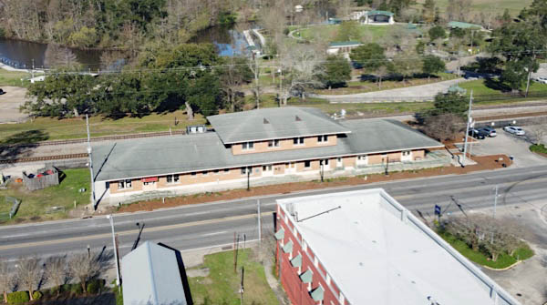
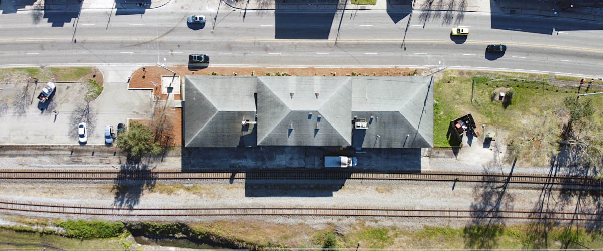
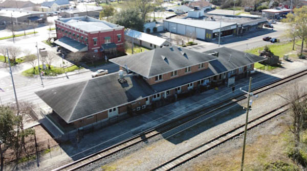
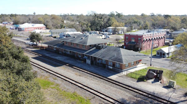
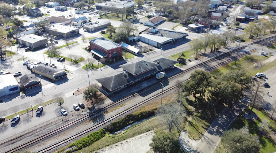
The brick Olde Towne Railroad Depot in Slidell was built around 1903 for the New Orleans & Northeastern and New Orleans & Great Northern railroad, supplanting an earlier wooden passenger depot which was located on the west side of the tracks between Maine and Pennsylvania Streets. In the early 1990s, the city of Slidell submitted a grant application to the Louisiana Department of Transportation and Development (LDOTD) to receive funding under the Intermodal Surface Transportation Enhancement Act (ISTEA) of 1991 to renovate, preserve and operate the depot.
Before renovations began, the Norfolk Southern Railway donated the depot and about two acres of land to the city, and resolutions were made authorizing the mayor to enter into agreements with the LDOTD for depot renovation. Later that same year, the building was put on the National Register of Historic Places, protecting the historic character of the building.
Slidell, La / Dec 2016 / RWH
Slidell, La / 2000 / JCH
Slidell, La / 2000 / JCH
Slidell, La / JCH
Slidell, La / JCH
Slidell, La / Feb 2020 / RWH
Slidell, La / Feb 2020 / RWH
Slidell, La / Feb 2020 / RWH
Slidell, La / Feb 2020 / RWH
Slidell, La / Feb 2020 / RWH
Slidell, La / Feb 2020 / RWH
Slidell, La / Feb 2020 / RWH
Slidell, La / Feb 2020 / RWH

See also our Amtrak Crescent Southern States scrapbook for more Slidell photos
Slidell, La / Oct 1970 / James Selzer Jr. / Michael Palmieri collection
Slidell, La / Aug 1971 / James Selzer Jr. / Michael Palmieri collection
Slidell, La / May 1975 / James Selzer Jr. / Michael Palmieri collection
Slidell, La / Apr 1979 / Michael Palmieri
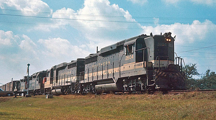
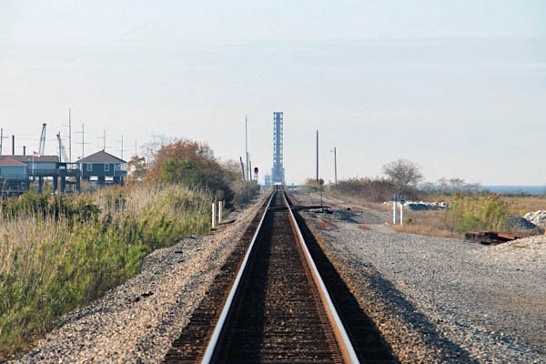
 North Shore
1971 timetable / collection

from SPV Comprehensive Railroad Atlas
/ collection
North Shore, La / Jul 1990 / RWH
North Shore, La / Jul 1990 / RWH
North Shore, La / Jul 1990 / RWH
Click to see the Carr Drive crossing plotted on a Google Maps page
North Shore, La / Dec 2016 / RWH
North Shore, La / Dec 2016 / RWH
North Shore, La / Dec 2016 / RWH
North Shore, La / Dec 2016 / RWH
North Shore, La / Jul 1990 / RWH

North Shore, La / Jul 1990 / RWH

North Shore, La / Jul 1990 / RWH
North Shore, La / Jul 1990 / RWH
North Shore, La / Jul 1990 / RWH
North Shore, La / Jul 1990 / RWH
North Shore, La / Jul 1990 / RWH
North Shore, La / Jul 1990 / RWH
North Shore, La / Jul 1990 / RWH
North Shore, La / Jul 1990 / RWH
North Shore, La / Jul 1990 / RWH
North Shore, La / Jul 1990 / RWH
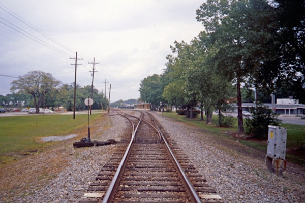
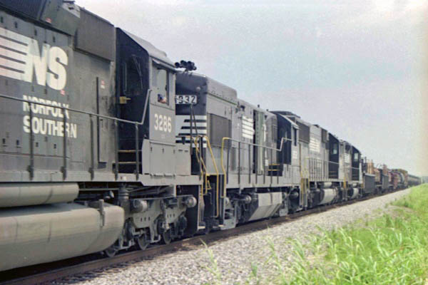
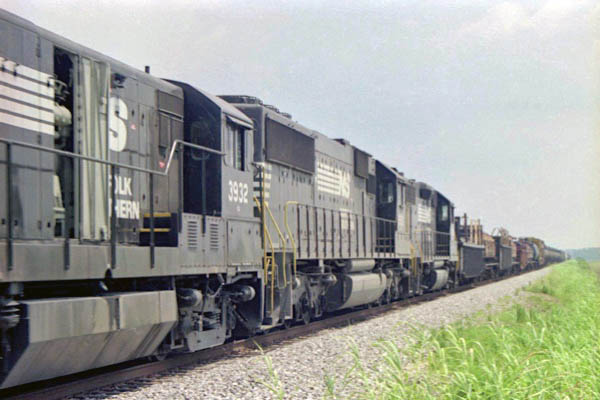
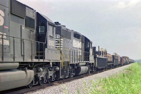
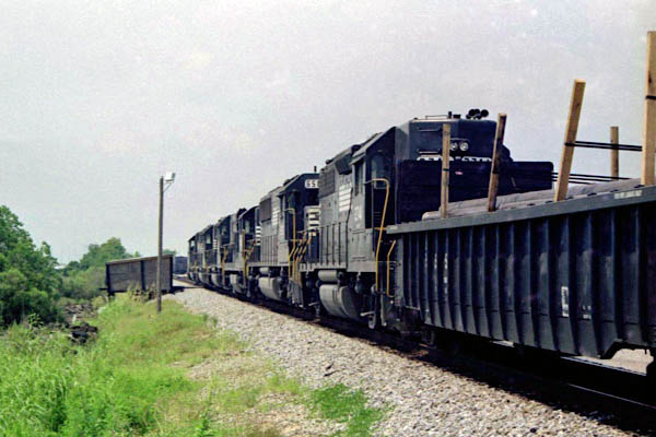
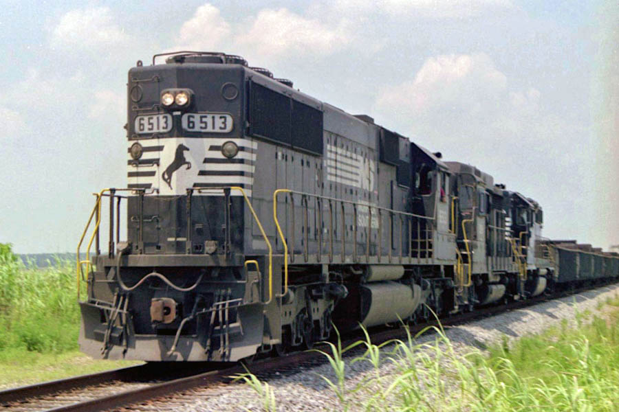
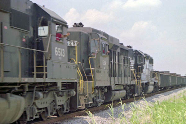
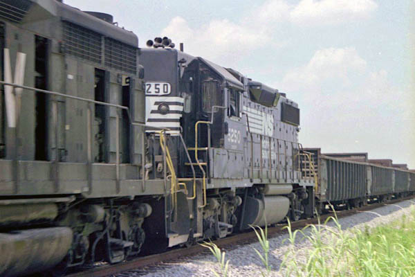
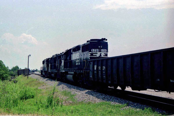
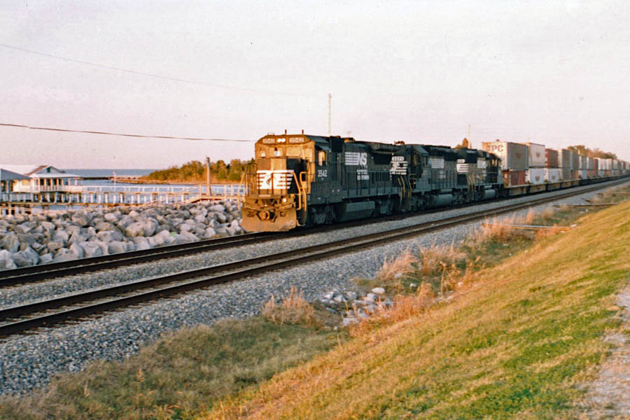
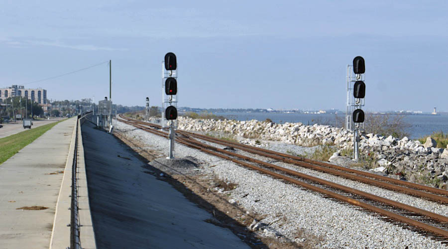
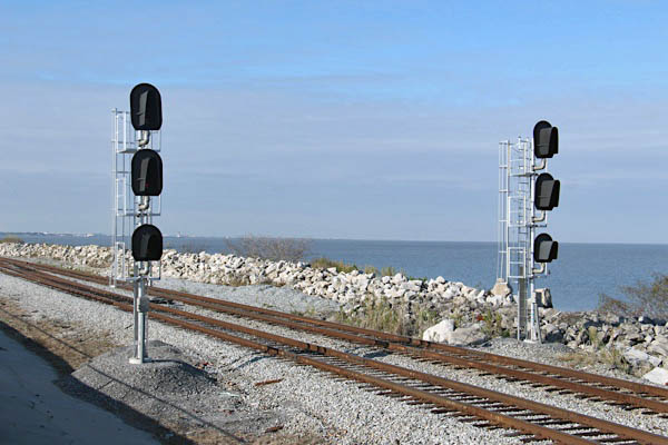
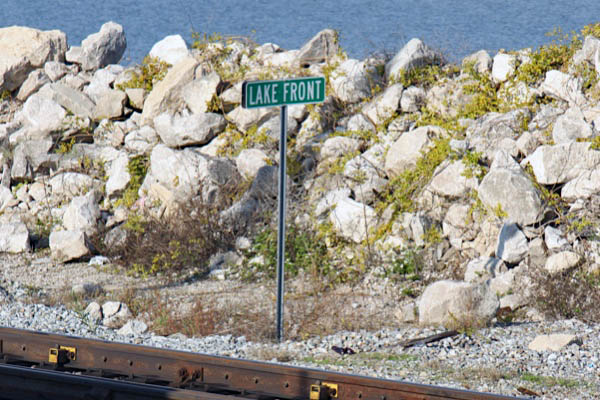
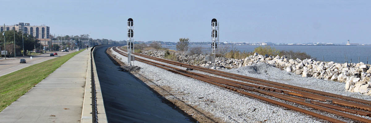
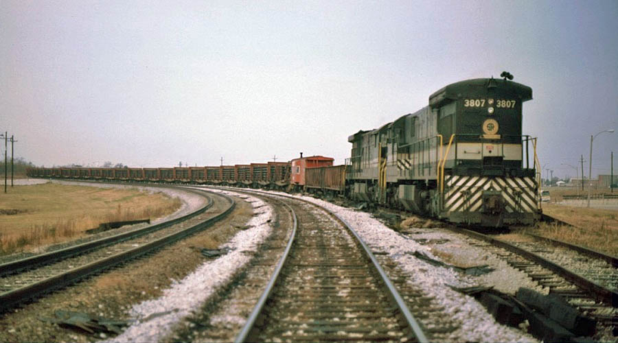
 The tangent Southern mainline between Woods siding and North Shore, Louisiana, was a favorite spot for train-chasing pal Jory Sharp and me during our high school years. We spent many an hour there waiting and watching. The shots above, all from the summer of 1990, represent a typical day on the busy NO&NE landbridge over the brackish swamps between Lake Pontchartrain's shoreline and the dense woods south of Slidell. After the northbound Crescent cleared the area in the morning, it would be one manifest freight after another throughout the humid summer days — a superhighway of loose-car railroading only a handful of years into the Norfolk Souther merger. Although many units already wore the new Thoroughbred logo and stripes, holdout Southern and Norfolk & Western units were not uncommon in those years. Southbound freights would be slowing down as they passed us south of Woods, readying themselves for on-ramping the 5 mile lake trestle; but northbound movements were usually picking up speed coming off the lake, making a sprint up the long tangent to downtown Slidell and a municipal slow order. When you think "Southern Serves the South," you don't typically think of reedy swamps and brackish marshlands. But here in the southwesternmost corner of Mr. Spencer's built-up empire, the Southern walked across the waters at the start or end of every train with Oliver Yard on its orders. Even without any shade, North Shore was a mainline sanctuary for two young high schoolers in love with diesel fumes and black paint.
North Shore, La / Jul 1990 / RWH
Click to see this lakefront location plotted on a Google Maps page
North Shore, La / Jul 1990 / RWH
North Shore, La / Jul 1990 / RWH
North Shore, La / Jul 1990 / RWH
North Shore, La / Jul 1990 / RWH
North Shore, La / Jul 1990 / RWH
Lake Pontchartrain
North Shore, La / Feb 2020 / RWH
from SPV Comprehensive Railroad Atlas
/ collection

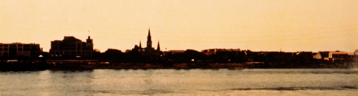
 Lake Pontchartrain, southeastern Louisiana. The lake is 40 miles long and 25 miles wide at its widest point, with an area of 630 square miles and a mean depth of 10 to 16 feet. It is more a tidal lagoon than a lake, since it connects eastward through Lake Borgne with the Gulf of Mexico by a narrow passage called The Rigolets. Its waters are brackish, although salinity can be reduced dramatically by an influx of floodwaters from the Mississippi River via the Bonnet Carre Spillway. The lake teems with game fish and aquatic birds, including pelicans. The city of New Orleans lies along its southern and eastern shore; Fontainebleau State Park and many small resorts also are located around the lakeshore. The first European to view the lake was the French Canadian explorer Pierre Le Moyne d’Iberville, who passed through the region in 1699 and named the lake for Louis II, count of Pontchartrain.
North Shore, La / Feb 2020 / RWH
North Shore, La / c 2000 / JCH
from Southern Railway System: Steam Locomotives and Boats
- Richard E. Prince / collection
North Shore, La / Oct 1970 / James Selzer Jr. / Michael Palmieri collection
North Shore, La / Oct 1974 / Michael Palmieri
North Shore, La / Oct 1970 / James Selzer Jr. / Michael Palmieri collection
North Shore, La / Mar 1979 / James Selzer Jr. / Michael Palmieri collection
North Shore, La / Mar 1979 / James Selzer Jr. / Michael Palmieri collection
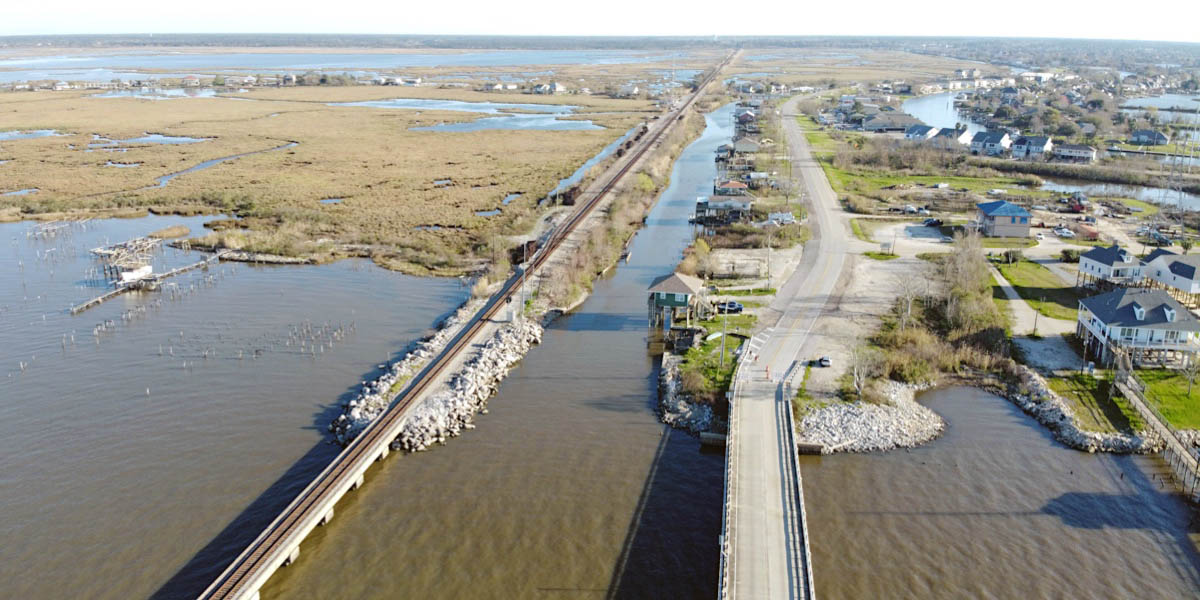
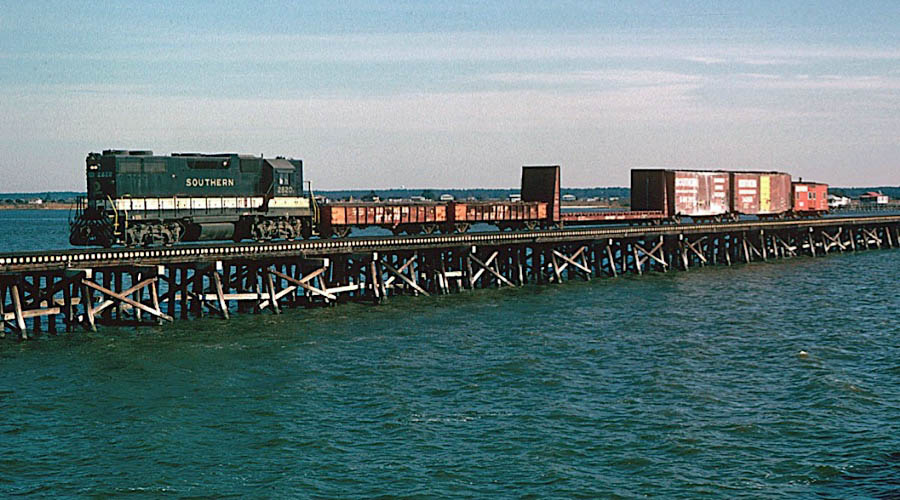
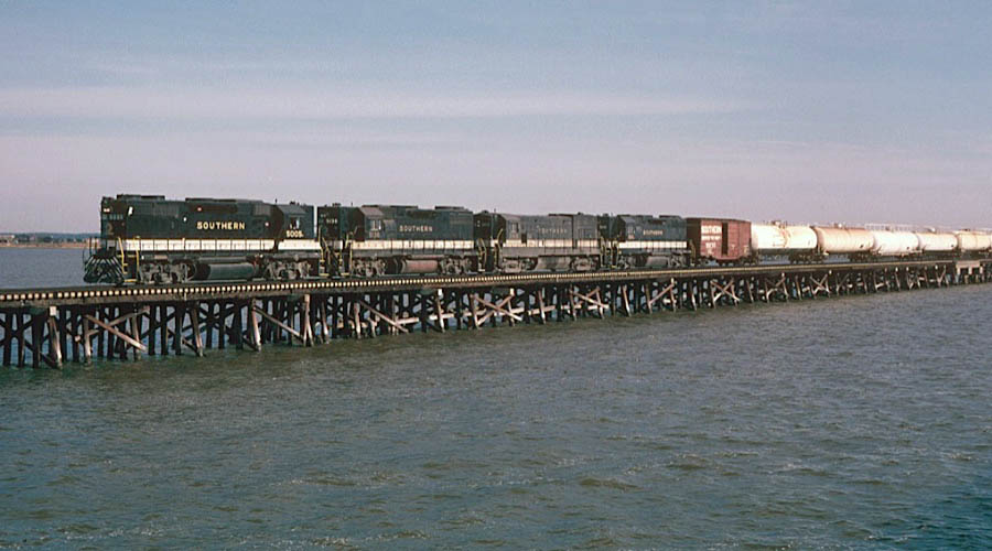
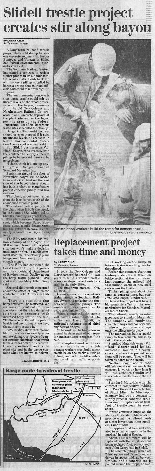
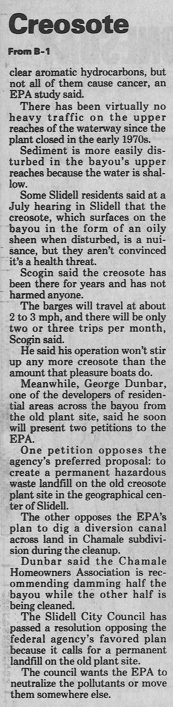
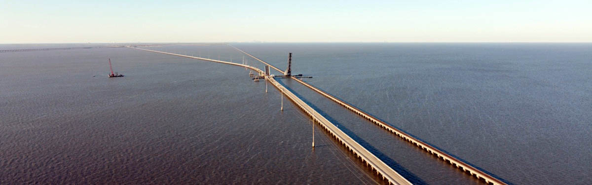
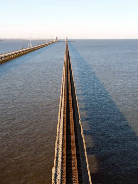
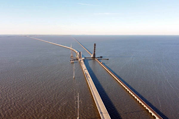
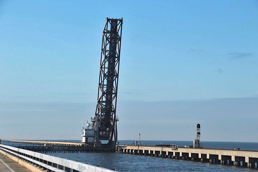
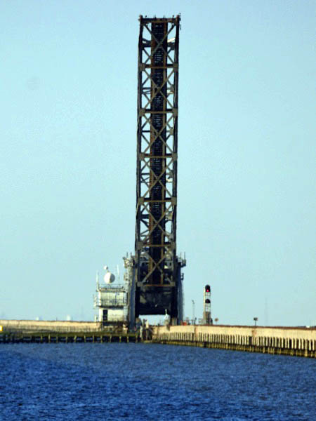
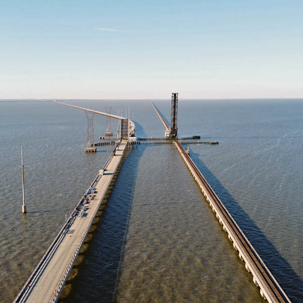
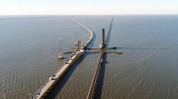
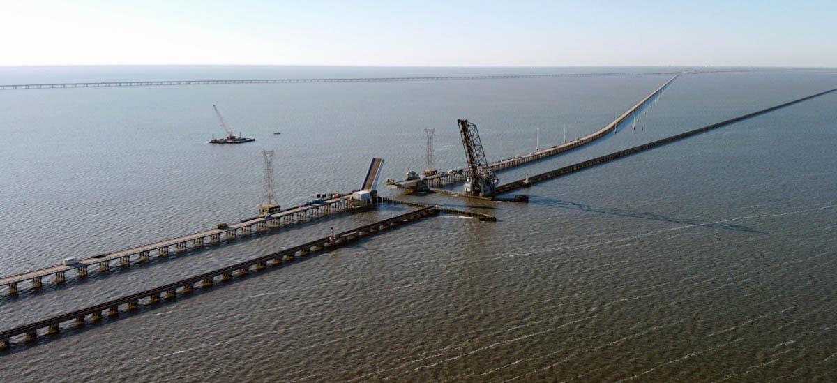
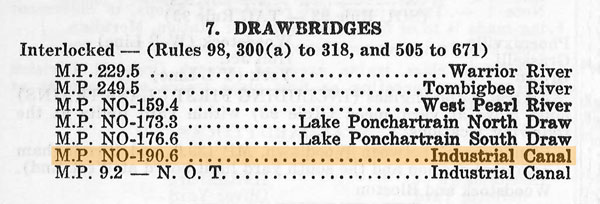
Replacement of the NS wooden trestle was an extended, multi-year project which began in 1985 and was completed on Friday, 24 May 1996. During the reconstruction of the structure, the south swing span at milepost 176.6 was completely removed, while the north swing span (M.P. 173.3) was replaced with a lift bridge. The lift bridge was prefabricated along Bayou Liberty in Slidell, and floated into place on 10 July 1986.
A total of 30,742 feet of bridge were replaced, using 180 million pounds of concrete. After the wooden trestle was replaced, the railroad began replacing the old concrete firebreaks, the oldest of which were put in place after a bridge fire in 1954.
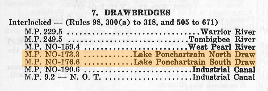
Both drawbridges were listed in Alabama Division TT No. 5 dated 18 September 1988, but only the North Draw (173.3) was listed in No. 7, dated 29 October 1989. I don’t have, or cannot find, No. 6, so the closest I can do is narrow the removal of the South Draw (176.6) to 1988-89.
In 2016 control of North Draw was transferred to the bridgetender at Wheeler Lake in Decatur, Alabama.
Mike Palmieri - Fort Worth, Texas
from New Orleans Times Picayune
- Oct 1986 / collection
collection
Lake Pontchartrain, La / Feb 2020 / RWH
Click to see the North Lift Bridge plotted on a Google Maps page
Lake Pontchartrain, La / Feb 2020 / RWH
Lake Pontchartrain, La / Feb 2020 / RWH
Lake Pontchartrain, La / Feb 2020 / RWH
1971 timetable / collection
1971 timetable / collection
Lake Pontchartrain, La / Dec 2016 / RWH
Feb 2020 / Jack Hawkins
Lake Pontchartrain, La / Feb 2020 / RWH
Lake Pontchartrain, La / Feb 2020 / RWH
Lake Pontchartrain, La / Feb 2020 / RWH
 Article
NS Forces Collaborate to Keep Longest Bridge in Shape
January 2020
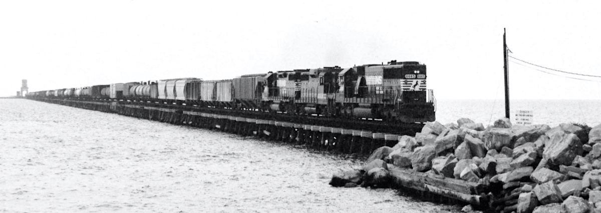
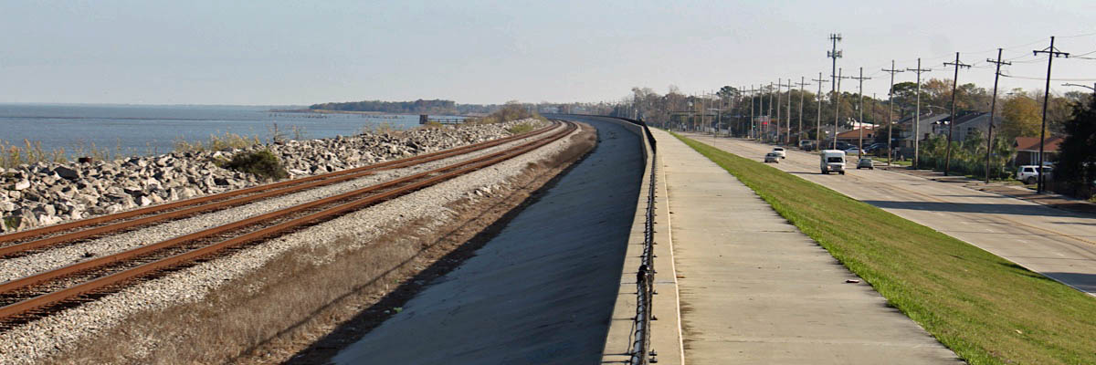
At 5.8 miles long, Norfolk Southern’s Lake Pontchartrain Bridge in Louisiana is the longest railroad bridge in the country and the longest railroad bridge over water in the world. Packed with 180 million pounds of concrete and 102 miles of steel and concrete pilings, it is a major rail thoroughfare of the South, with freight and passenger trains traversing it daily between Slidell and the port of New Orleans.
Train tonnage is not the only weight this bridge carries. It also bears the extreme Louisiana heat, humidity, wind, salt, water, and sun. The bridge has weathered many storms, including the wrath of Hurricane Katrina in 2005, when teams of our workers rallied in the aftermath to reconstruct the mangled bridge’s track and ballast in an impressive 16 days.
These extreme climate factors make regular maintenance of the bridge imperative to keep it intact and trains on the track, and ensuring this crucial span’s operability poses a challenge unlike any other bridge on our system.
 Our T&S-1 super tie and surfacing gang recently proved themselves up to the task. For just over a week in late December, the gang’s roughly 65 members – some of our finest Engineering Department employees – converged on the bridge to replace over 8,500 railroad ties. The overhaul was the first of this magnitude since the post-Katrina rebuild, and the project required all hands on deck. With skill and grit, the T&S-1 crew worked methodically to overhaul the bridge.
Because the New Orleans climate is more humid than most places across our network, ties weather more rapidly. To increase tie life on the bridge, NS uses dual-treated ties designed to increase their longevity by up to 10 years. No matter the primary treatment material – copper naphthenate or creosote – the ties also are treated with life-extending borate. “The borate penetrates the center of the tie while the creosote or copper naphthenate protects the shell,” explains John Fleps, AVP maintenance of way and structures.
T&S-1 is deemed a “super” tie gang because of the increased variety and type of track equipment used. However, in addition to the standard equipment and materials needed to repair and replace ties – such as tie-handling machines, ballast tampers, spike pullers, trucks and cranes – this open-water job required help from watercraft.
Flanking tugboats assisted in the delivery and disposal of scrap materials to a nearby barge, and, as a precaution, NS brought in lifeboats for fall protection that followed the gang as it worked the bridge. While safety is always top of mind on the railroad, the gang’s awareness for their own personal safety and each other’s was heightened because of the limited space beside the track.
Pontchartrain Morning
Lake Pontchartrain, La / Feb 2020 / RWH

Pontchartrain Evening
Village De L'Est, La / collection
 Little Woods
1971 timetable / collection
from SPV Comprehensive Railroad Atlas
/ collection
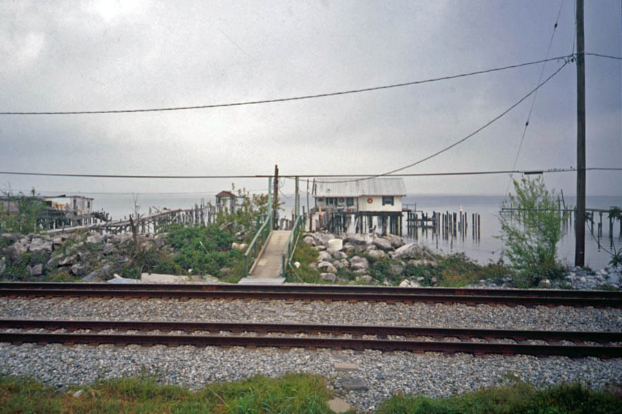
Little Woods, La / 2000 / JCH
Little Woods, La / 2000 / JCH
Little Woods, La / 2000 / JCH
Little Woods, La / c 2000 / Gordon Payne
Click to see the Little Woods lakefront area plotted on a Google Maps page
Little Woods, La / Dec 2016 / RWH
Little Woods, La / Dec 2016 / RWH
Little Woods, La / Dec 2016 / RWH
Little Woods, La / Dec 2016 / RWH
Little Woods, La / Dec 2016 / RWH
The longest continuous curve in the USA is probably the Pontchartrain curve between Ruddock and Tunity in Louisiana on the Illinois Central Railroad, skirting the western shore of Lake Pontchartrain. It is 9.45 miles long with only slight changes of radius. The Southern Railway, shortly before entering New Orleans, skirts the same lake on a curve nearly 9 miles long.
John Marshall - Guinness Rail Records - 1985
Little Woods, La / 1980s / collection
Little Woods, La / 1980s / collection
Seabrook
from SPV Comprehensive Railroad Atlas
/ collection
1971 timetable / collection
Industrial Canal
Seabrook, La / 2000 / JCH
2000 / JCH
1971 timetable / collection
Click to see the Seabrook lift bridge area plotted on a Google Maps page
Seabrook, La / c 1975 / James Selzer Jr. / Michael Palmieri collection
During WWII the U.S. Government built an aircraft assembly plant along Lake Pontchartrain in New Orleans and the Southern Railway constructed a 1-mile spur to serve it. Here, Consolidated Vultee (later known as Convair) built about 220 PBY-5 CATALINA amphibious patrol planes. Unlike most aircraft plants, this one had no runways; so each finished plane was moved down a ramp into the lake where it took off! After the war the plant was sold to American Standard and was used to manufacture plumbing fixtures. Up into the 1980’s the plant was served by the northbound local out of New Orleans, but later it was switched by a yard job. In this undated view (above) the local was pulling out of the plant, crossing Leon C. Simon Dr. and about to cross Franklin Ave. The spur was removed after the plant closed.
Michael Palmieri
Seabrook, La / Jan 1978 / Michael Palmieri
Seabrook, La / Dec 1978 / Michael Palmieri
Seabrook, La / Nov 1974 / Michael Palmieri
Seabrook, La / Oct 1978 / Michael Palmieri
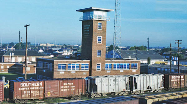
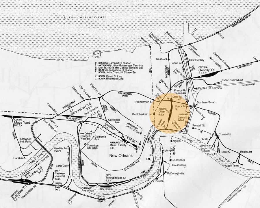
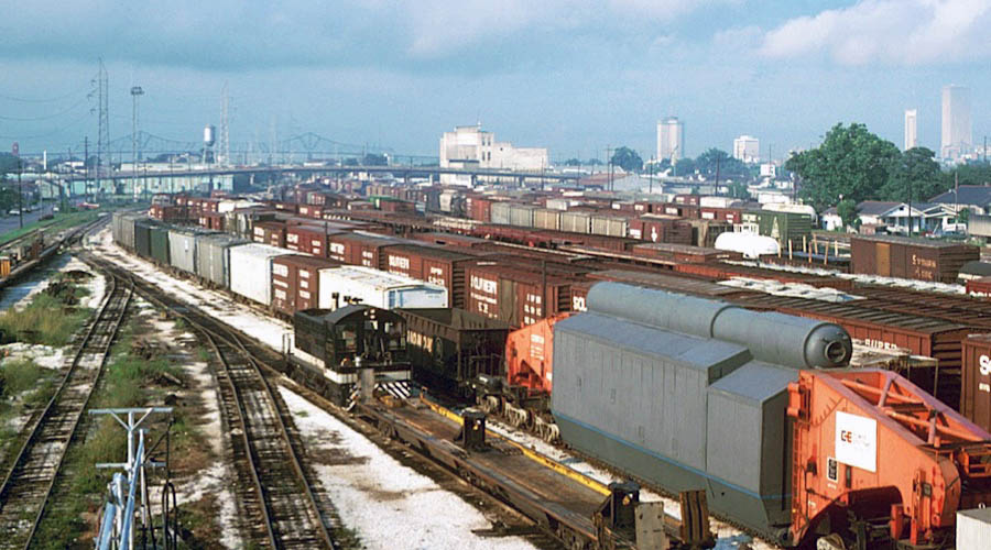
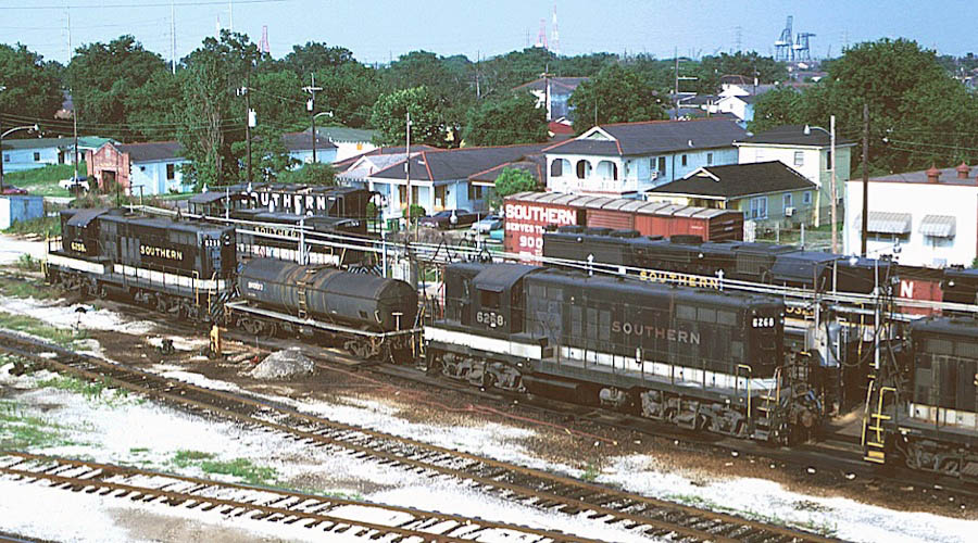
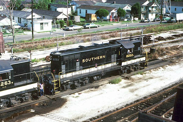
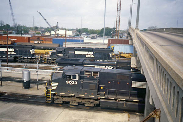
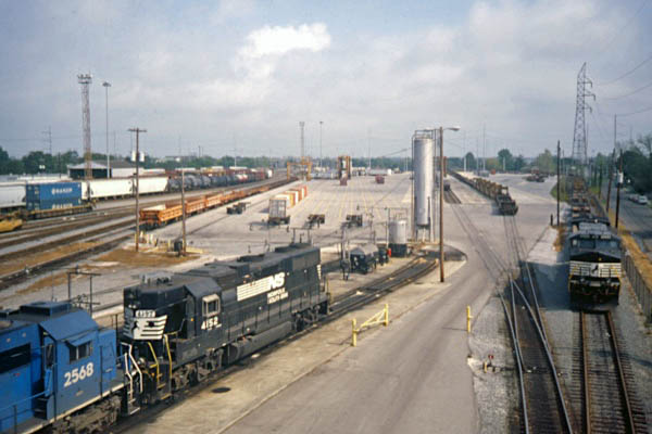
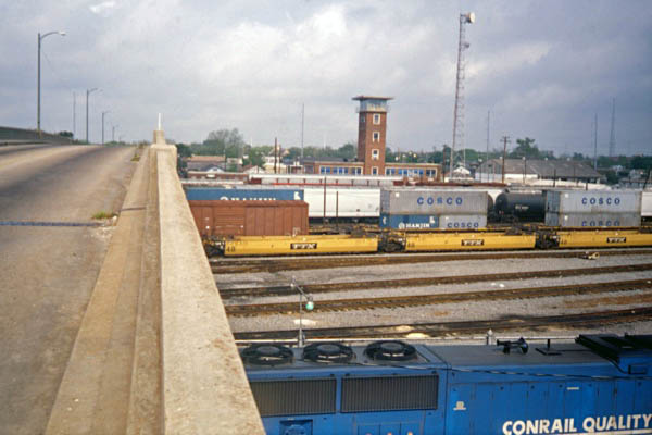
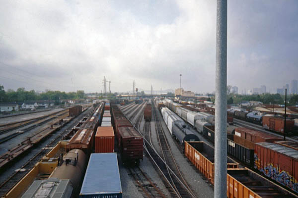
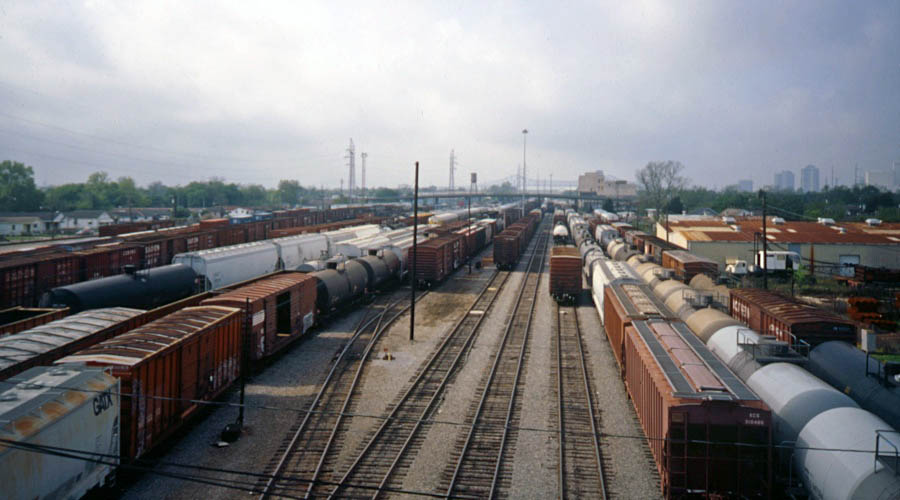
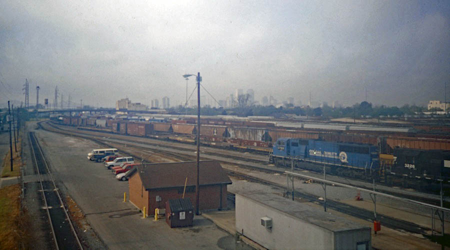
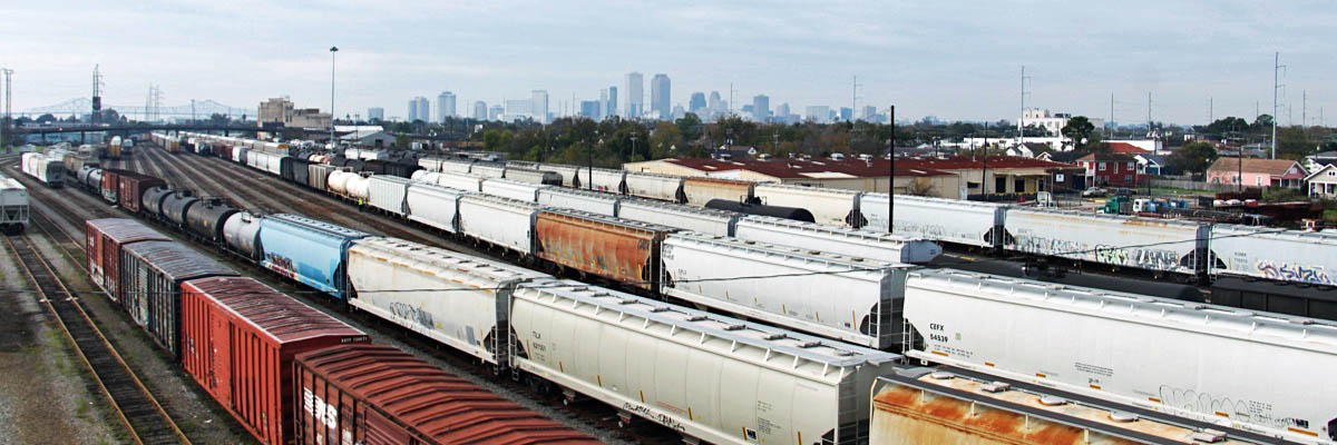
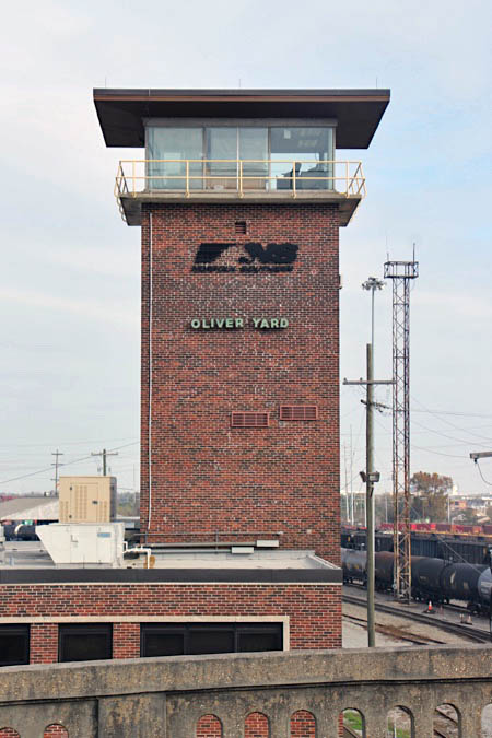
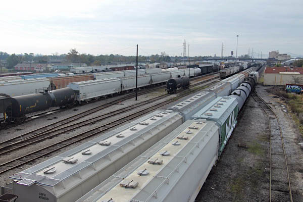
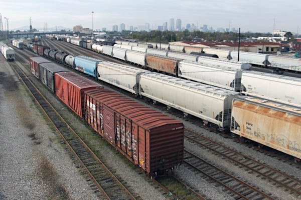
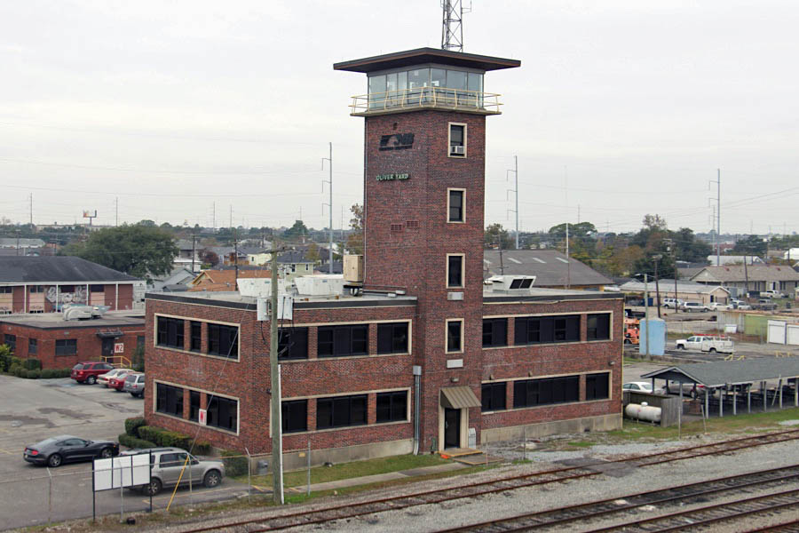
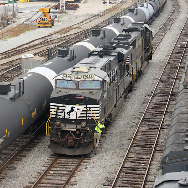
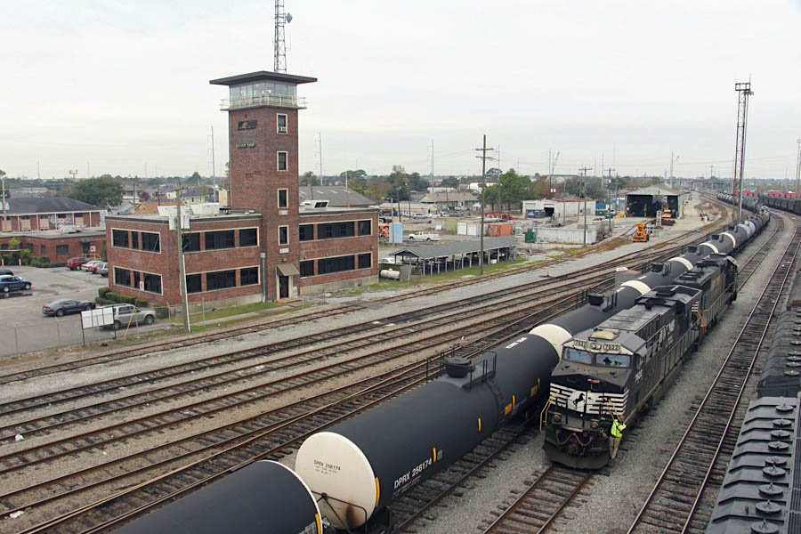
 Oliver Yard
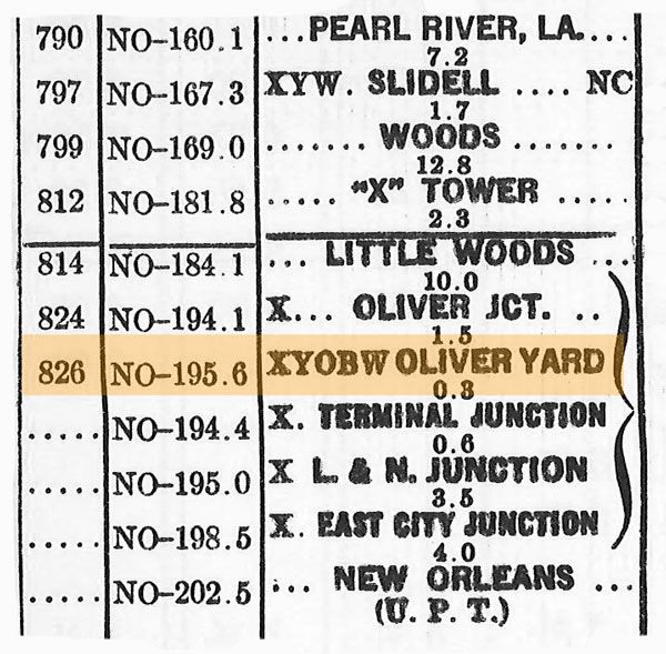
1971 timetable / collection
New Orleans, La / Jun 1974 / Michael Palmieri
from SPV Comprehensive Railroad Atlas
/ collection
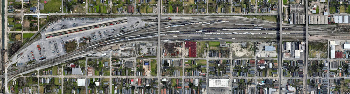
Oliver Yard overhead / Google Maps
Click to see the Oliver Yard area plotted on a Google Maps page
New Orleans, La / Jun 1975 / Michael Palmieri
New Orleans, La / Jun 1981 / Michael Palmieri
New Orleans, La / Sep 1980 / Michael Palmieri
1971 Crescent Division timetable / collection
New Orleans, La / Jul 1990 / RWH
New Orleans, La / May 2000 / JCH
New Orleans, La / May 2000 / JCH
New Orleans, La / May 2000 / JCH
New Orleans, La / May 2000 / JCH
New Orleans, La / May 2000 / JCH
New Orleans, La / May 2000 / JCH
New Orleans, La / May 2000 / JCH
New Orleans, La / Dec 2016 / RWH
New Orleans, La / Dec 2016 / RWH
New Orleans, La / Dec 2016 / RWH
New Orleans, La / Dec 2016 / RWH
New Orleans, La / Dec 2016 / RWH
Dec 2016 / RWH
New Orleans, La / Dec 2016 / RWH
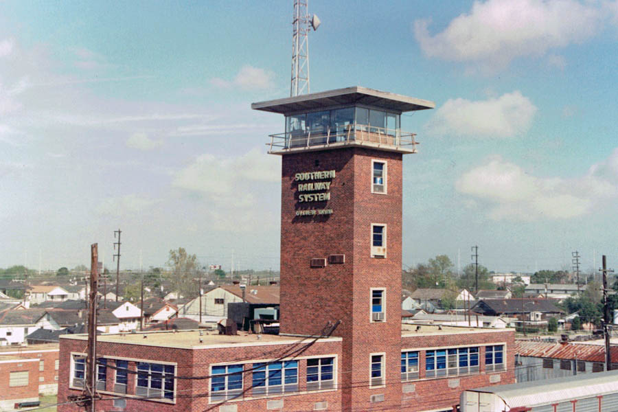
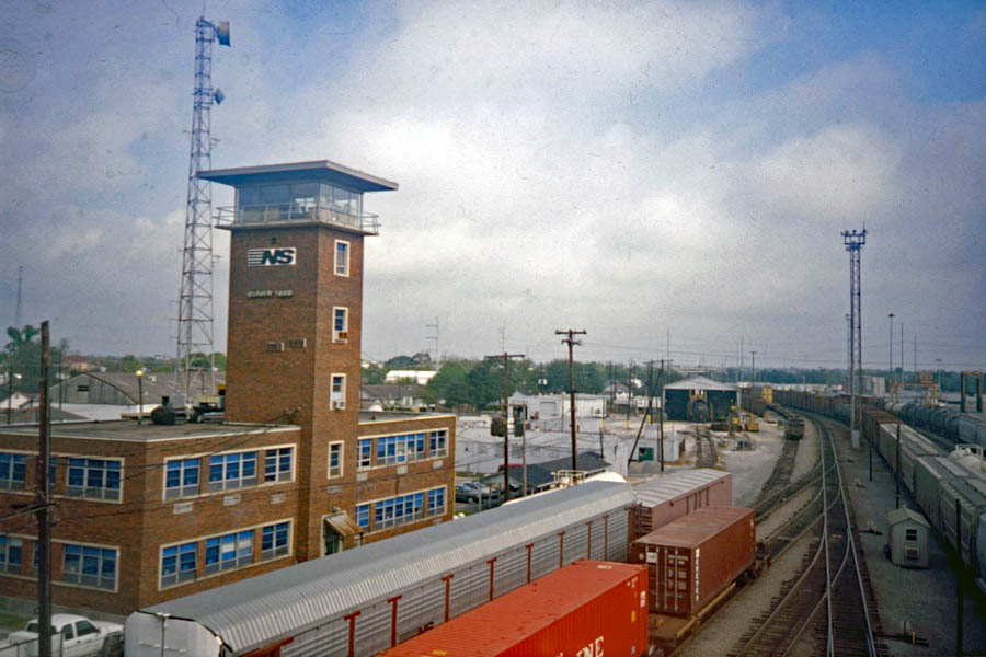
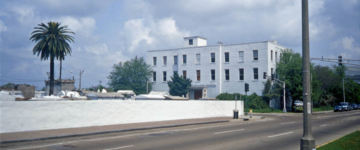
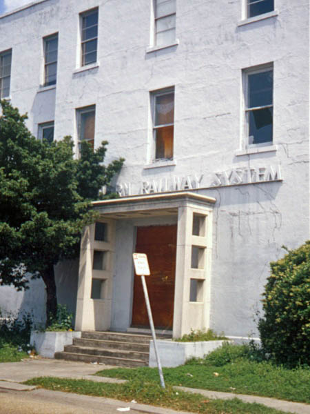
Southern Railway office
New Orleans, La / May 2000 / JCH
Click to see this location plotted on a Google Maps page
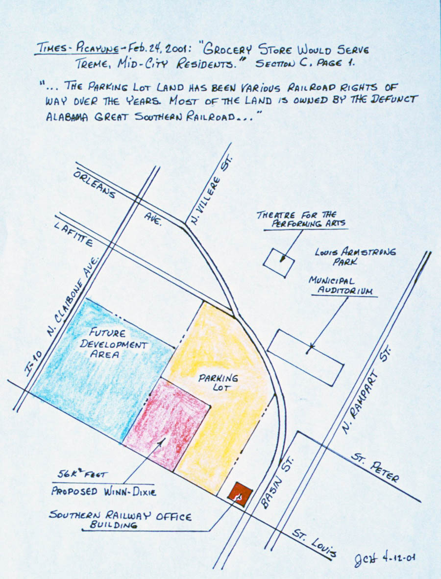
Southern Rwy office area map / JCH
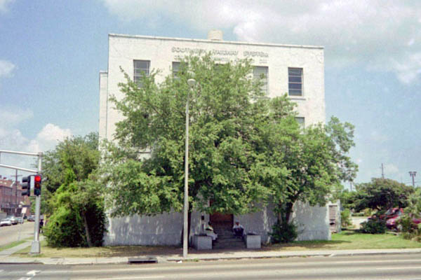
New Orleans, La / May 2000 / JCH
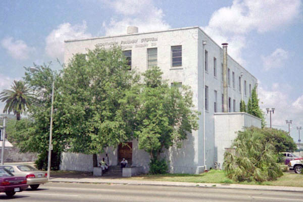
New Orleans, La / May 2000 / JCH
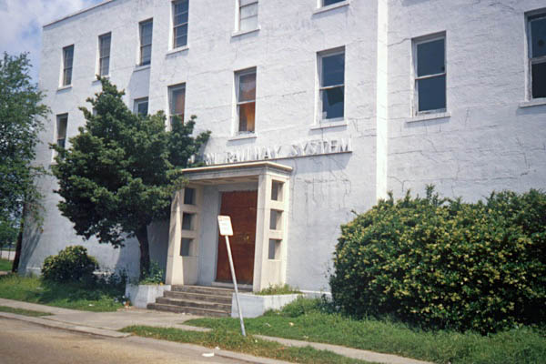
New Orleans, La / May 2000 / JCH

New Orleans, La / May 2000 / JCH
New Orleans, La / May 2000 / JCH
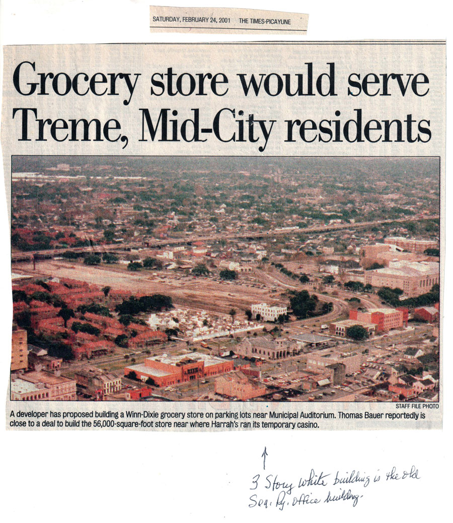
from New Orleans Times-Picayune
- Feb 2001 / collection
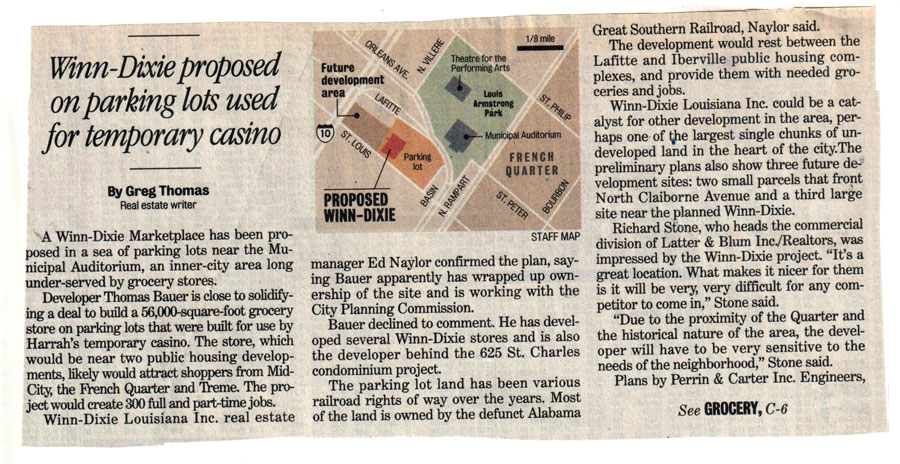
from New Orleans Times-Picayune
- Feb 2001 / collection
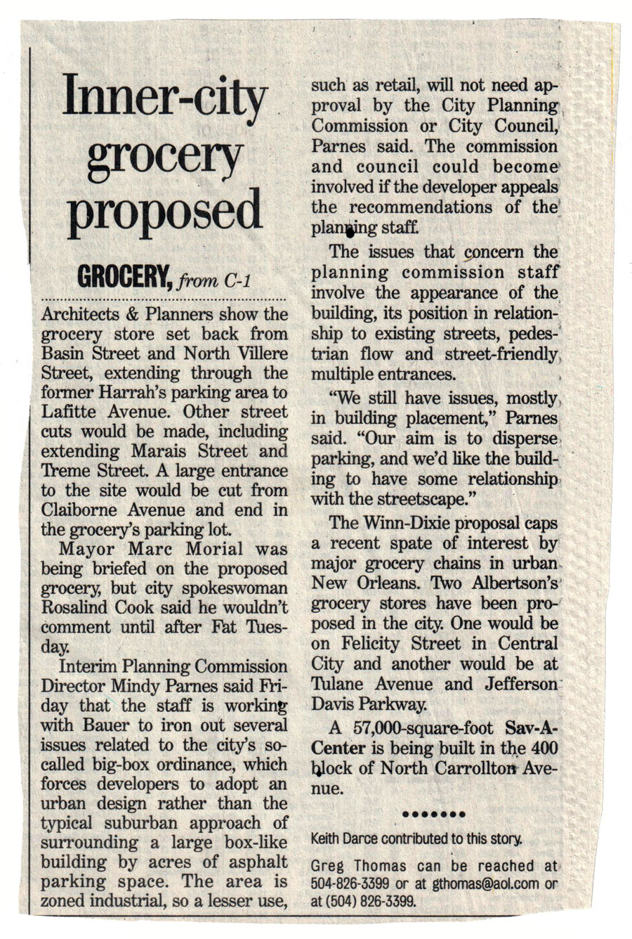
from New Orleans Times-Picayune
- Feb 2001 / collection
New Orleans!
New Orleans, La / May 2000 / JCH
When you enter the city of New Orleans, there is an exhilarating euphoria you feel that makes you keenly aware that you are in the presence of life enjoying itself.
Michael Murphy

collection
New Orleanians dance when there is no music; we talk too much, laugh too loud, live too large and, frankly, we're suspicious of those who don't.
Chris Rose
collection
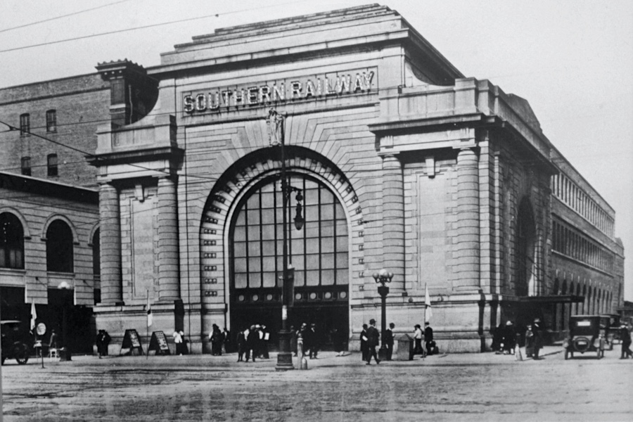
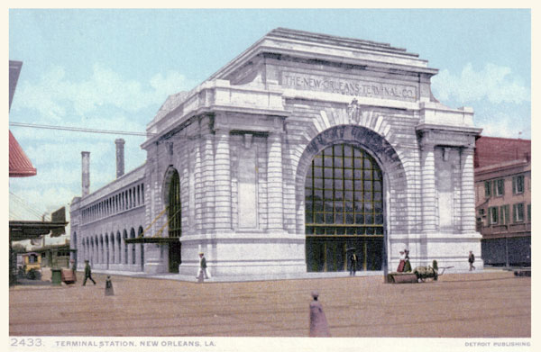
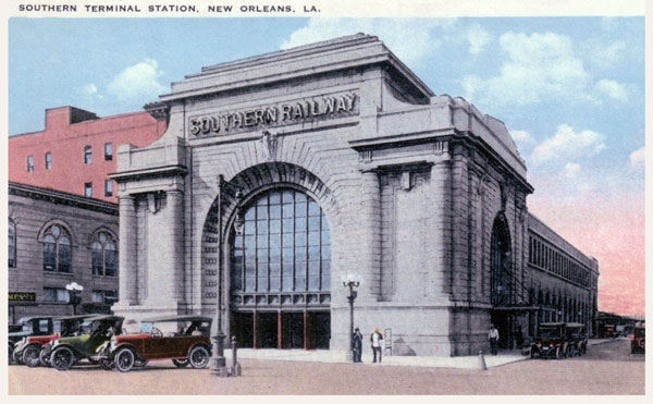
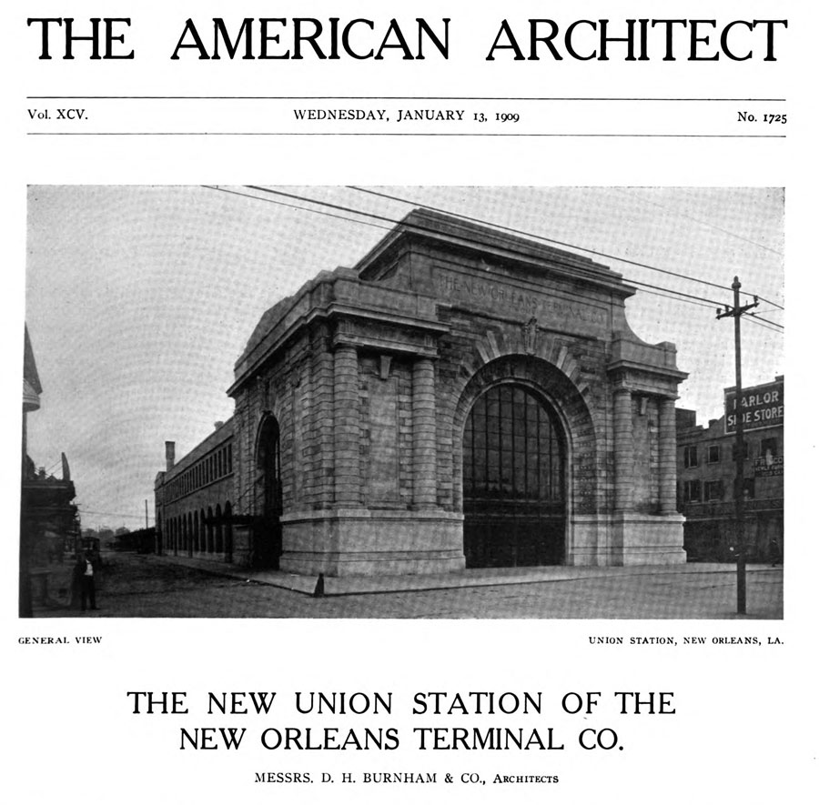
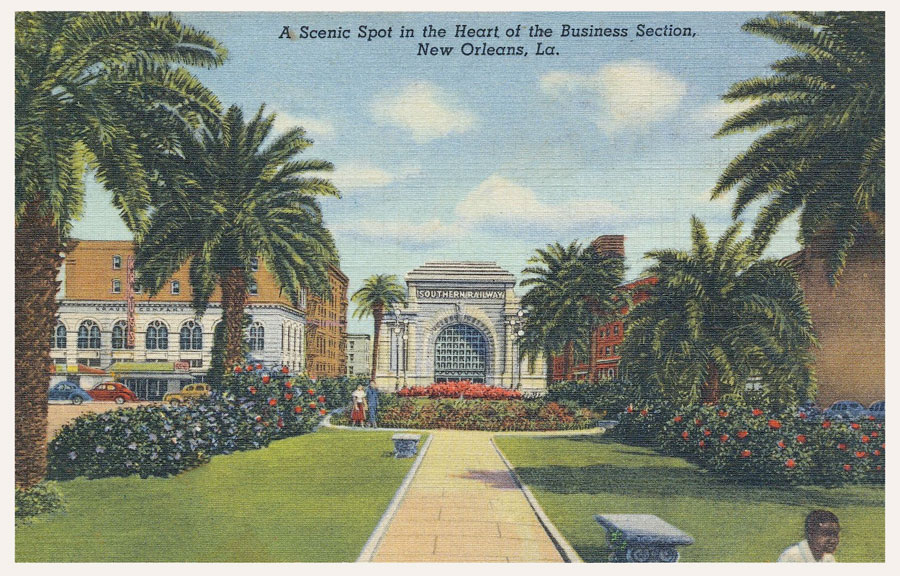
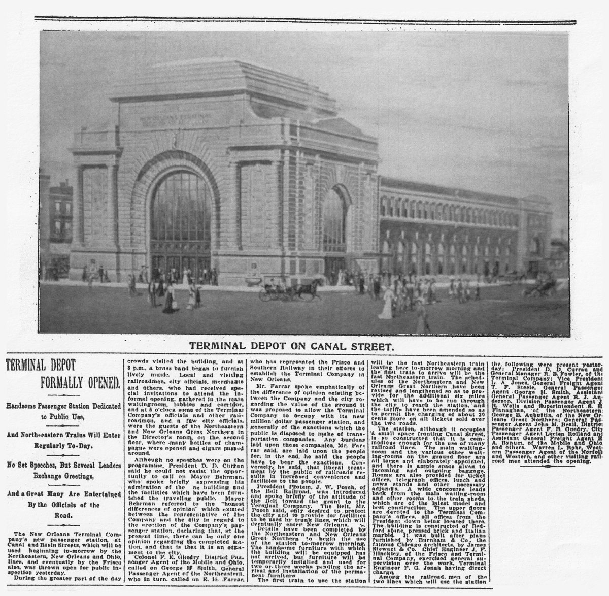
Terminal Station
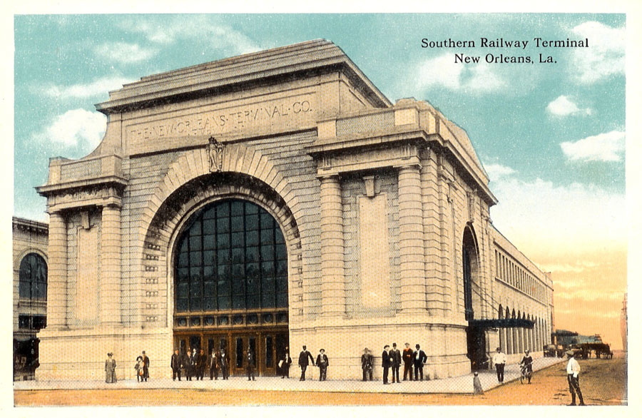
postcard / collection
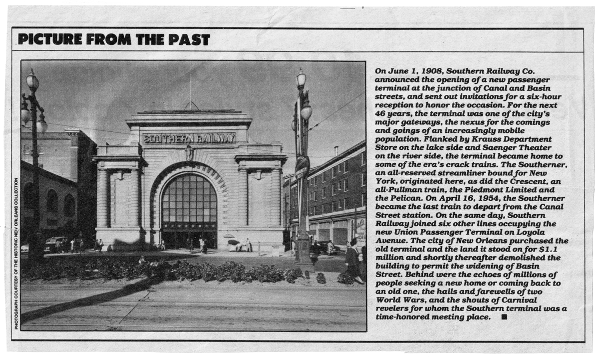
The Southern Railroad Terminal, also known as the Terminal Station, was constructed at 1125 Canal Street in 1908. The building was designed by Daniel Burnham, the architect for Washington D.C.'s Union Station. The station served the Southern Railway's subsidiaries, the New Orleans and Northeastern Railroad Company and the New Orleans Terminal Company. In the 1940's, the station's signature train was "The Southerner," which departed New Orleans daily for the east coast.

from SPV Comprehensive Railroad Atlas
/ collection
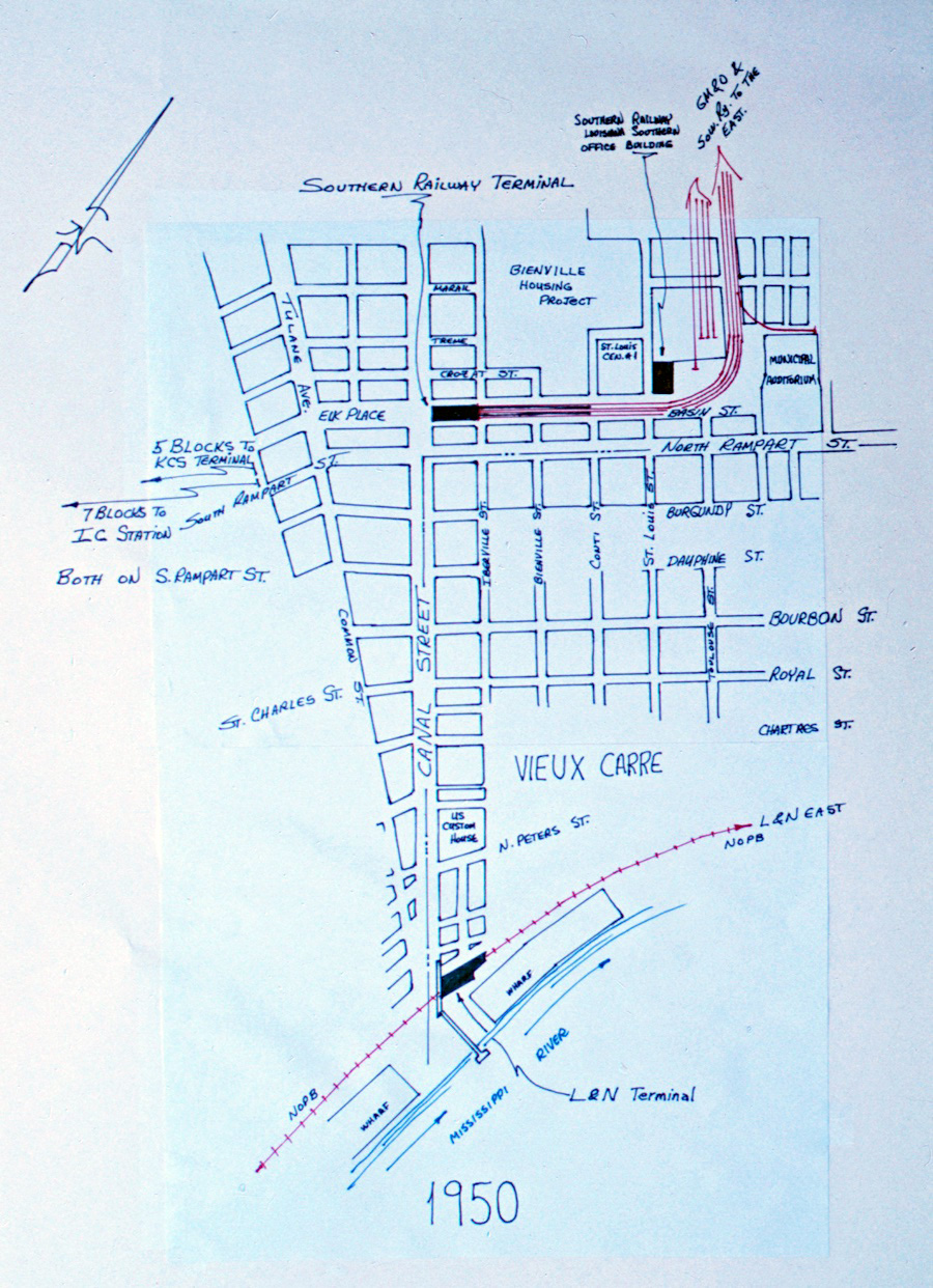
1950 Terminal Station area street map / JCH
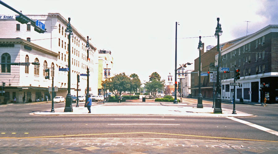
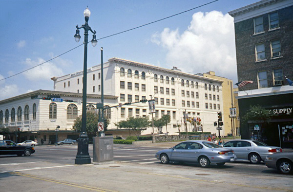
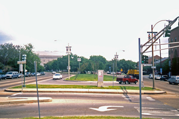
Click to see the Terminal Station former location plotted on a Google Maps page
Terminal Station / New Orleans, La / collection
postcard / collection
postcard / collection
collection
Article
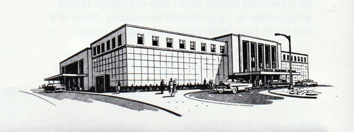
The New Union Station of the New Orleans Terminal Co.
The American Architect — January 1909
On Canal street, the main business thoroughfare of New Orleans, and close to the commercial center of the city, is the new Union station of the New Orleans Terminal Co. The station building is 82 feet wide by 235 feet long. The work was commenced in midsummer, 1907, and is now practically complete. This may be cited as an example of the rapidity of modern building construction. Well-organized methods, mechanical skill and executive ability are accomplishing remarkable results throughout the country, and the fact that a structure of this magnitude, from its beginning to its completion, can be safely and satisfactorily erected in less than eighteen months is a matter worthy of note.
The architecture of the building, as will be seen, is a sane adaptation of the modern French. The building typifies in a large sense the purpose for which it was erected, and in this respect teaches, in a quiet way, a lesson to more pretentious structures erected for a similar purpose. The problem of the adaption of design to purpose, location and climate is often difficult. We feel that in the present instance, the results achieved are eminently satisfactory. The setting of the building is such that the architectural excellence of its lines can be viewed to good advantage. On each side of this terminal there is a street 45 feet in width, while the main façade faces a wide parked approach, some two blocks long.
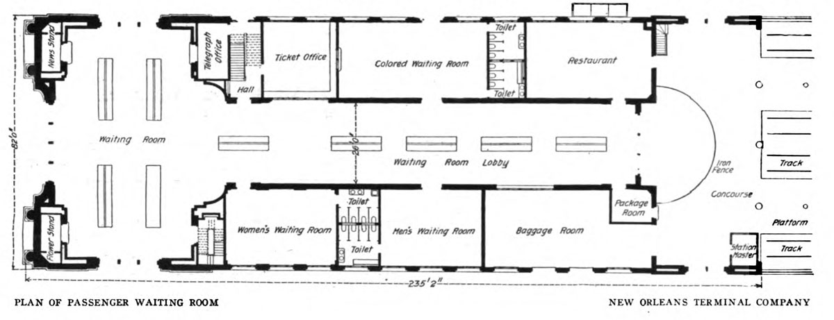
Through the main entrance, the archway of which is 30 feet wide by 40 feet high, the traveler enters the main waiting room. This room is 40 feet wide, 80 feet long, and has a clear height to the central dome of 52 feet. On the side streets there are arched entrances 3o feet high. As will be seen by reference to the plans, this waiting room is accessible on all sides by large open- ings, thus providing the most desirable feature in railway terminals, ease of ingress and egress by large num- bers without undue crowding and confusion during the so-called "rush hours" of daily traffic.
Centrally through the building is the main waiting-room lobby, while grouped on each side are the various rooms and offices necessary to the prompt and efficient transaction of passenger railway service. The concourse, placed at the end of the waiting room, has exits to the side streets to avoid interference with outgoing traffic. It is 80 feet long by 35 feet wide. The foundation, the setting of which was much complicated by the necessity of taking care of an old drainage canal, some 22 feet in width and which runs length-wise under the building, is of concrete on piling.
The lower courses of the Canal street exterior and the main structure on the side streets are of granite, the upper of Bedford stone. The remainder of the building is of brick and stone. The brick used is of a specially made gray color harmonizing with the stone, the ensemble being a most restful and artistic result. The interior construction of the main waiting room shows a central dome, from which barrel vaults extend to eath of the four sides of the room.
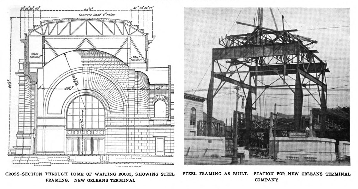
To a height of 12 feet above the floor, the side walls are finished in marble; above is cement, in imitation of stone, treated to harmonize with the marble. Here, again, one notices the satisfactory treatment of color values and the restful character of the tones employed. The floor of the main waiting room is mosaic tiled, as are also the smaller waiting rooms and offices. These smaller rooms have plaster walls.
The main waiting room has a steel frame to carry the dome and attic roof. To adapt this to the floor plan and superstructure was an interesting engineering problem. The solution has been to support this steel frame at four points only, the supporting columns being symmetrically placed as indicated on the first floor plans. Reference to the sectional view of waiting room will show that these four points are well within the lines of the attic walls, and these are carried by cantilever members and suitable girders. Above these girders, and resting on them, are the steel roof trusses, of which there are six — three in each direction. These carry a concrete roof 6 inches thick, including a skim coat of 1 inch, the concrete spans being arched between I-beam purlins as shown.
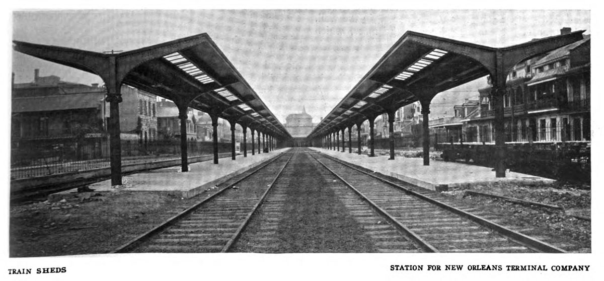
There are four tracks entering the station. These are protected by inverted umbrella sheds, 704 feet long. The cast-iron supporting columns are anchored to concrete blocks. The tracks are separated from the streets by an ornamental iron fence.
Messrs. D. H. Burnham & Co., of Chicago, were the architects of the building.
The American Architect and Building News #95 — January 1909 — Public Domain
postcard / collection
from New Orleans Picayune
- May 1908 / collection
Canal Street front / New Orleans, La / May 2000 / JCH
Canal angle view / New Orleans, La / May 2000 / JCH
outbound right of way / New Orleans, La / May 2000 / JCH
New Orleans Times-Picayune / collection
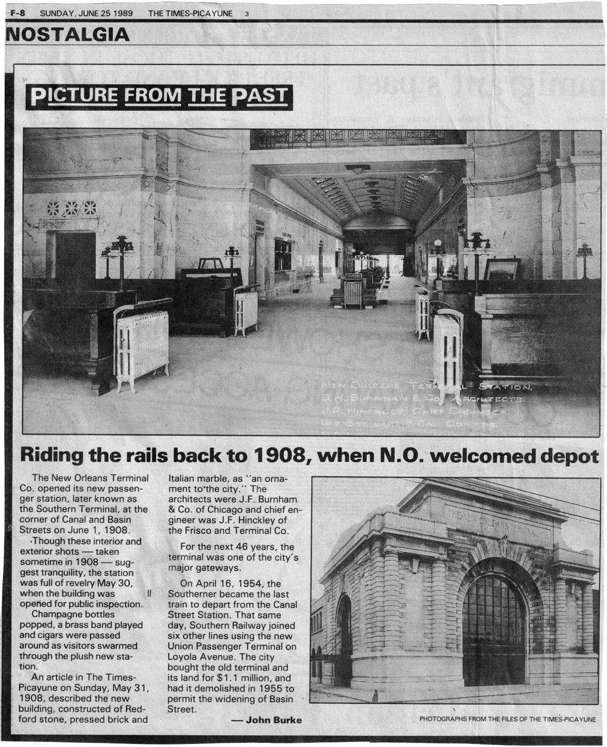
New Orleans Times-Picayune - Jun 1989 / collection
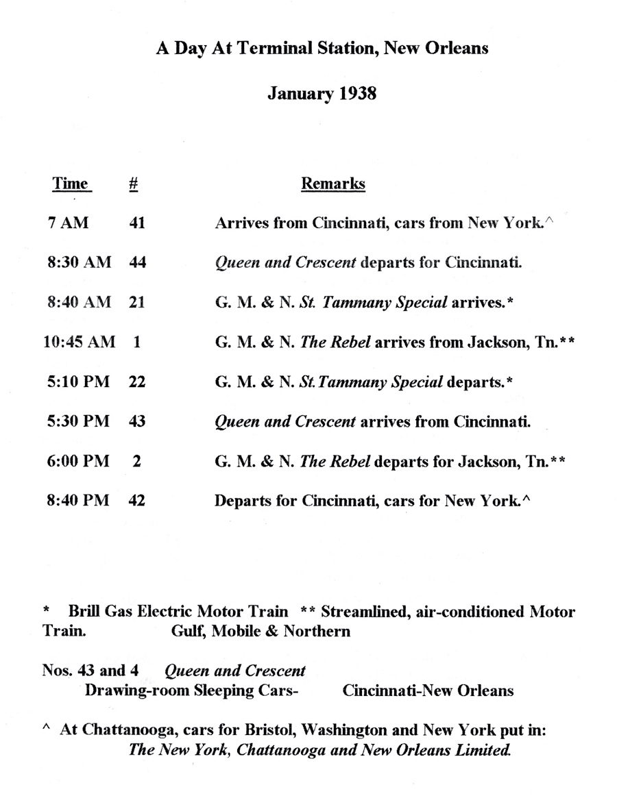
1938 Terminal Station notes / JCH
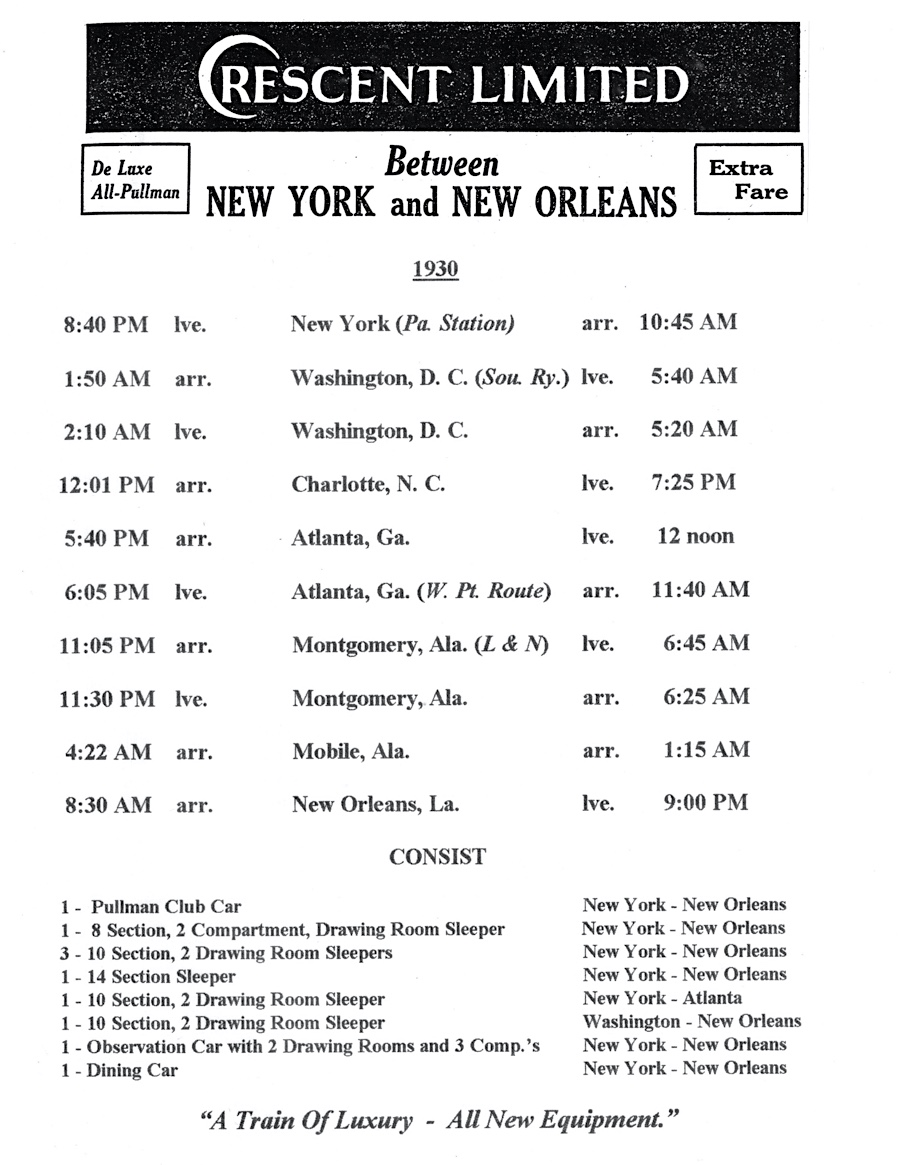
1930 Crescent Limited notes / JCH
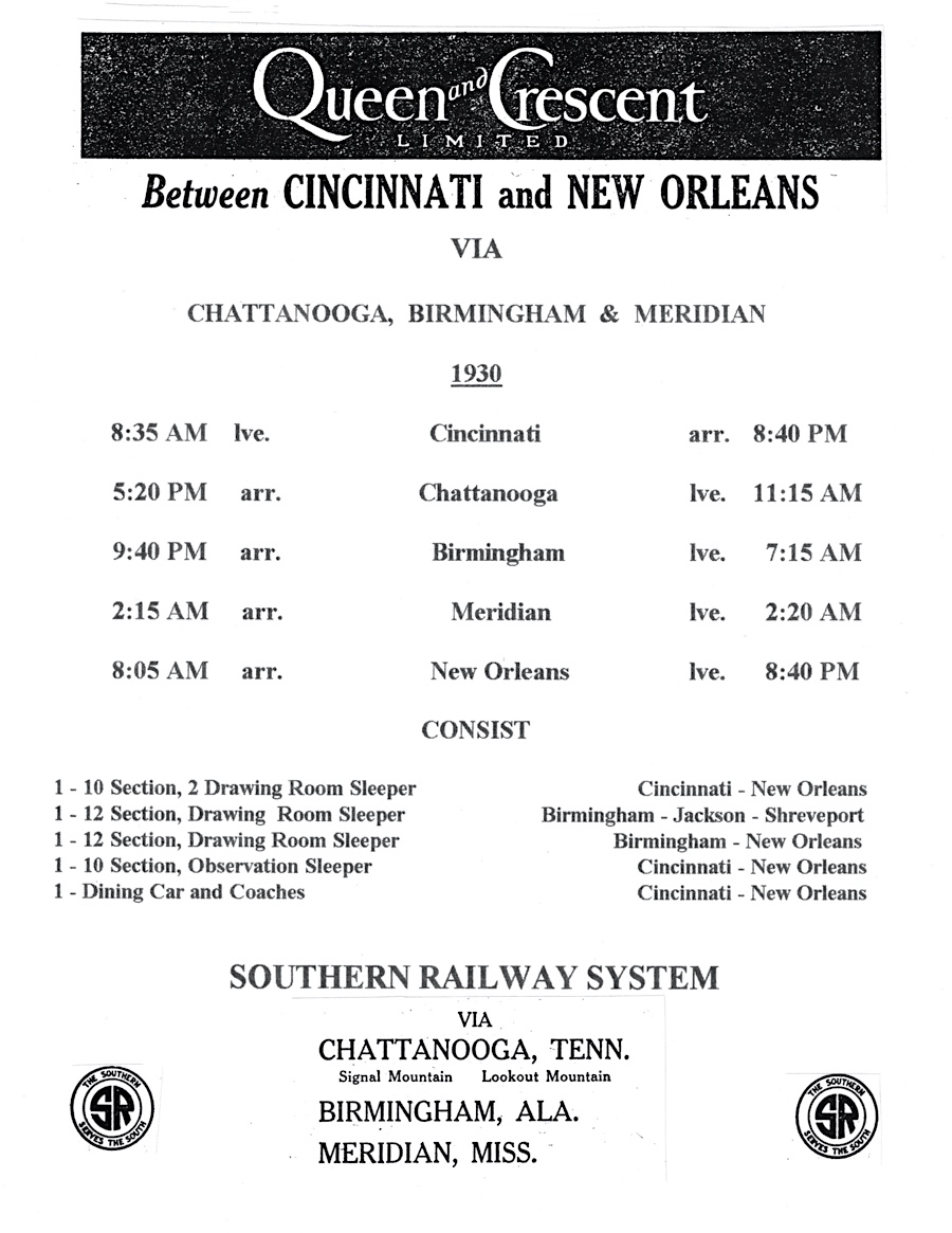
1930 Queen & Crescent notes / JCH
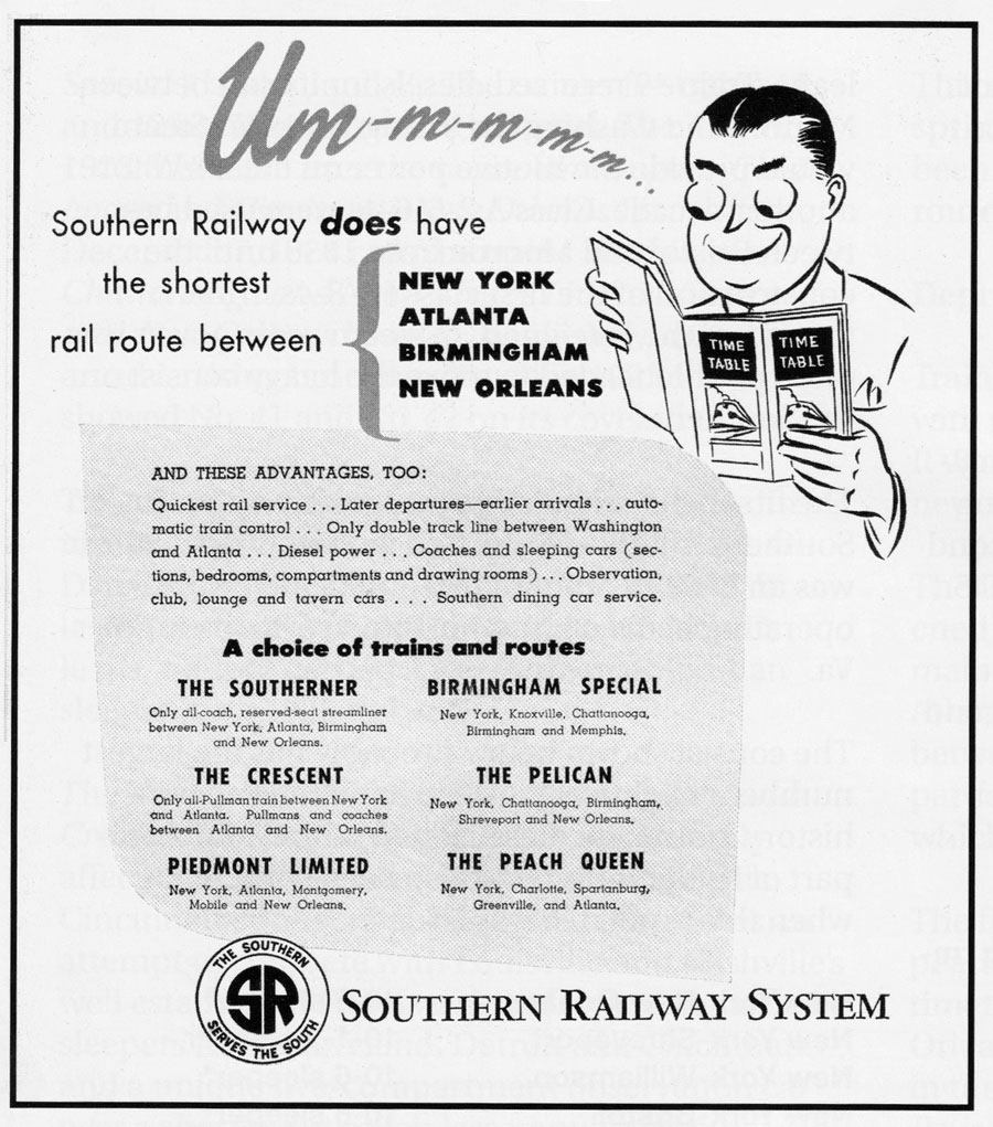
The Southerner
New Orleans, La / Oct 1950 / William Harry / Michael Palmieri collection
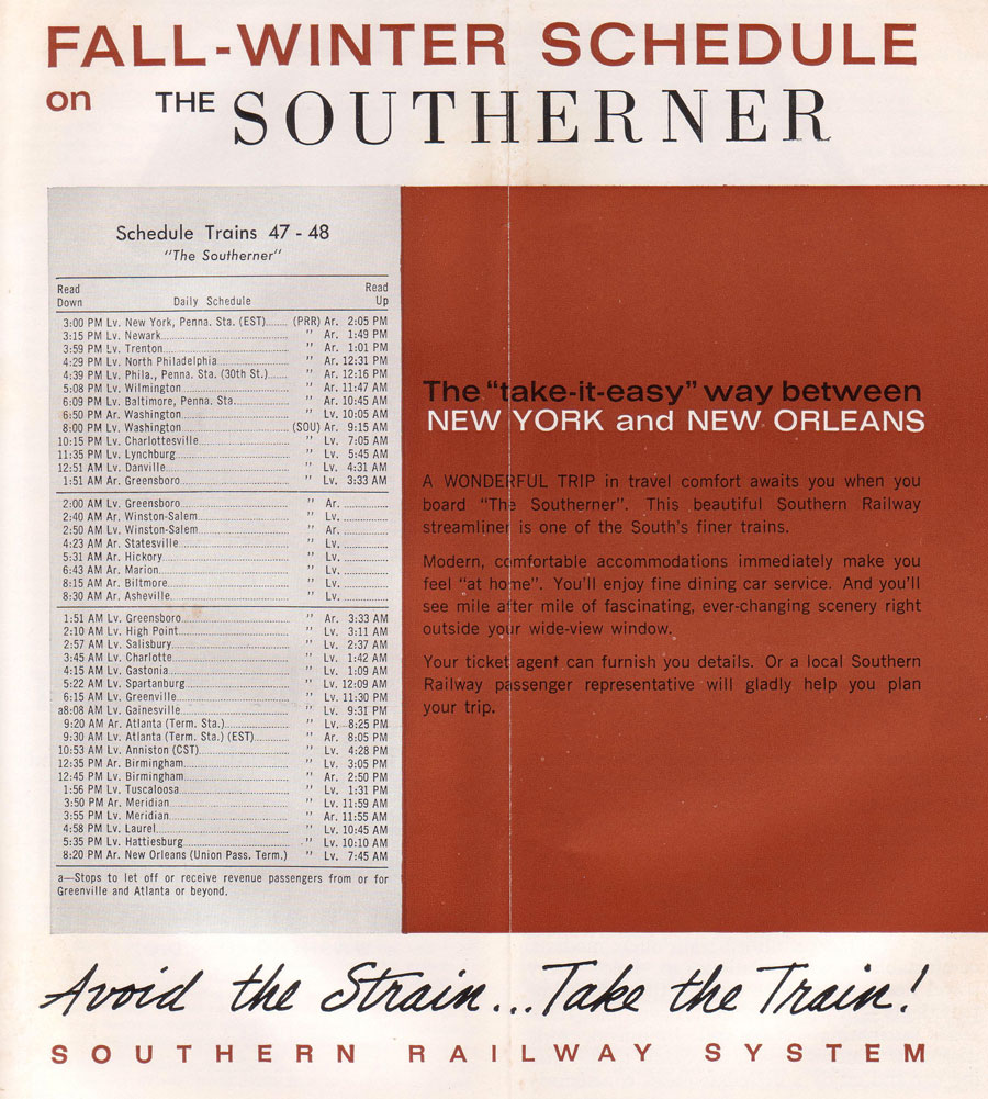
Southerner timetable ad / collection
New Orleans, La / Jul 1977 / Michael Palmieri
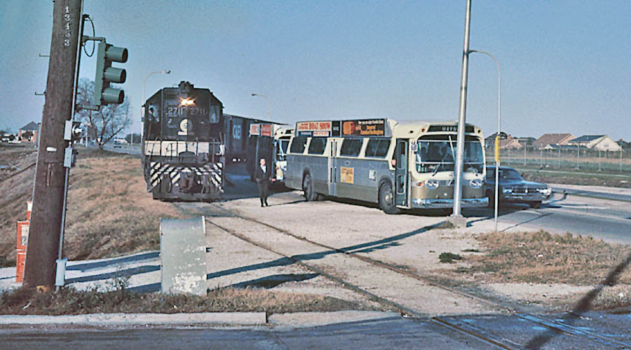
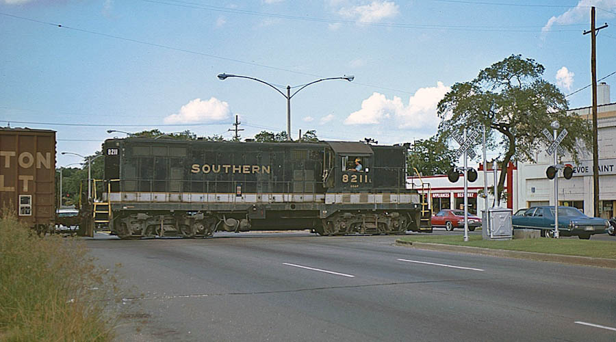
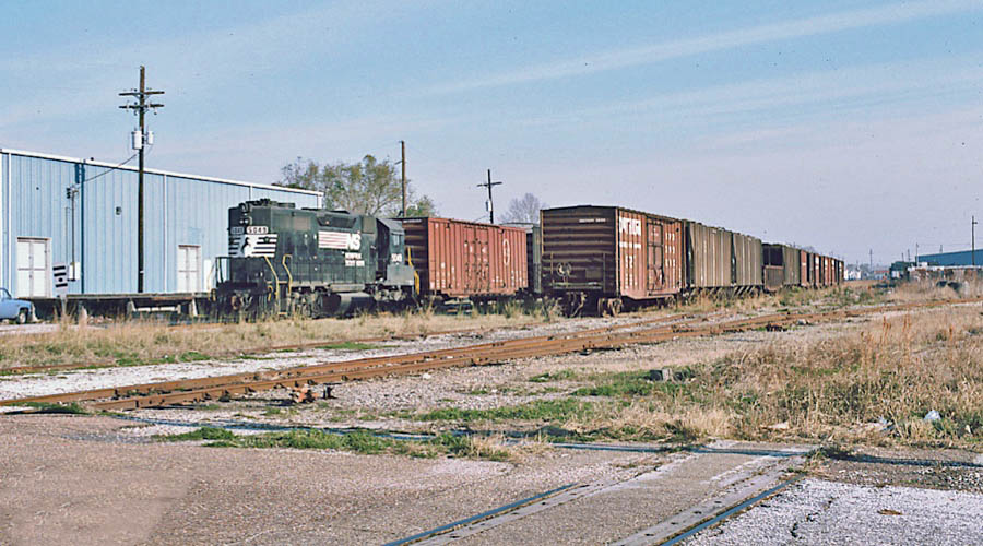
Southern Railway GP7 8211 crosses North Carrollton Avenue while working on the Bernadotte Branch (above). This was one of four GP7's (8210-8213) built in May 1950 for the Southern's Georgia Southern & Florida subsidiary. Prior to the opening of New Orleans Union Passenger Terminal in 1954, this line was used by Southern and GM&O passenger trains for access to the Southern's Terminal Station on Basin Street at Canal Street.
Norfolk Southern GP38-2 5049 was working on the railroad's St. Louis Street branch at North St. Patrick Street (below). Up until 1954, this line was used by Southern and GM&O passenger trains for access to Terminal Station on Canal Street, and the tracks on the right of the geep were the remnants of Bernadotte Yard. Notice the Southern Railway whistle post on the left.
Michael Palmieri
New Orleans, La / Jan 1988 / Michael Palmieri
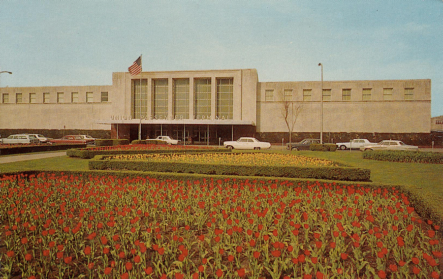
Union Passenger Terminal
collection
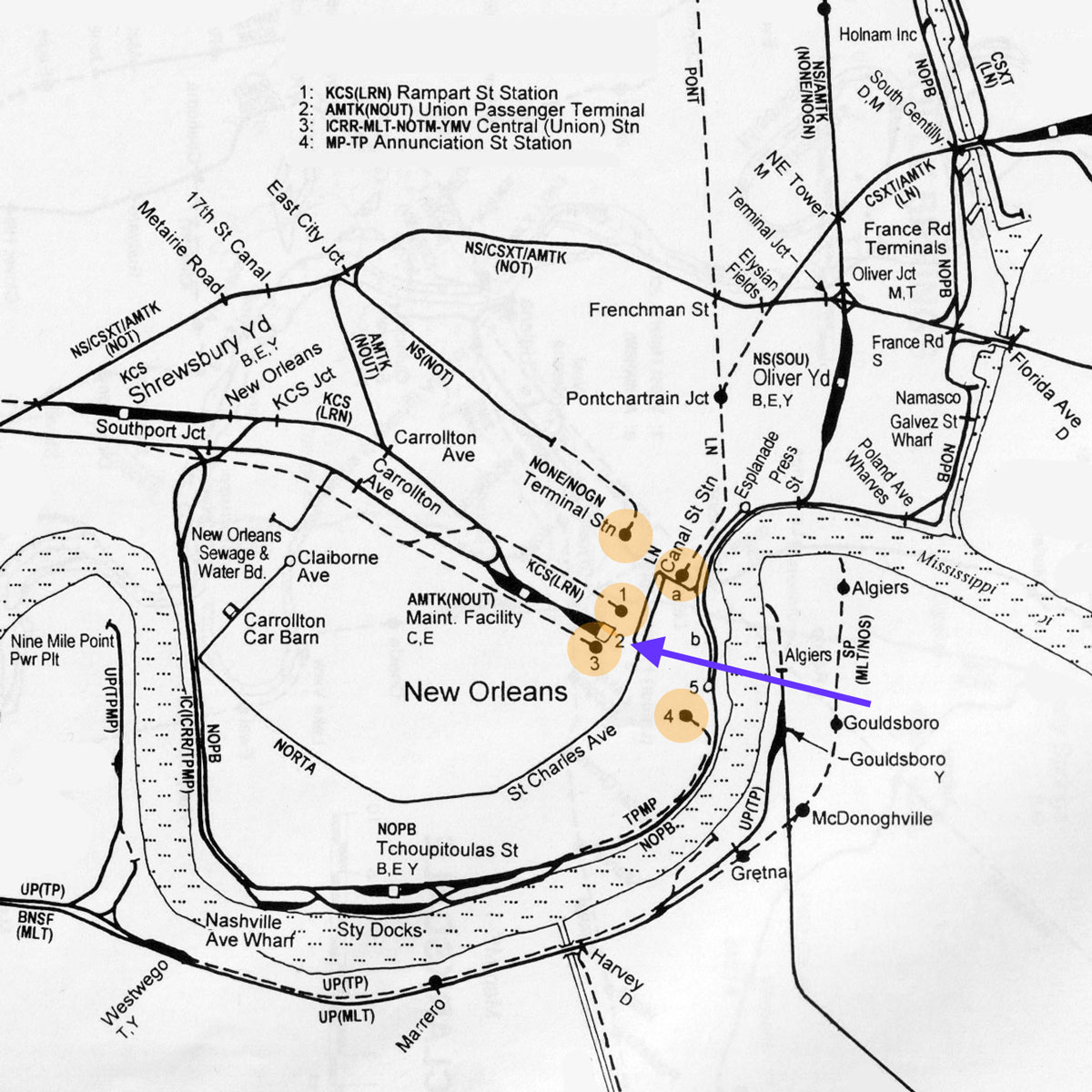
After World War II, New Orleans was still a city containing no less than 5 major railroad passenger terminals. In addition to Southern's Terminal Station, the Louisville & Nashville, Illinois Central, Kansas City Southern, and Missouri Pacific each had terminal facilities in the greater downtown area (see map below). By the mid 1950s, Southern Railway joined an arrangement with the other major carriers to participate in a new Union Passenger Terminal, to be located on Loyola Avenue near the IC and KCS stations (purple arrow below). With this new arrangement, Southern's Terminal Station on Canal Street was demolished in 1956 after all of Southern's trains were relocated to NOUPT. The Canal Street property was sold to the city of New Orleans for street widening purposes and the development of a "Garden of the Americas" in the remaning neutral ground.
adapted from SPV Comprehensive Railroad Atlas / collection
New Orleans Union Passenger Terminal
postcard / collection
See also our complete New Orleans Union Passenger Terminal scrapbook in Mainlines
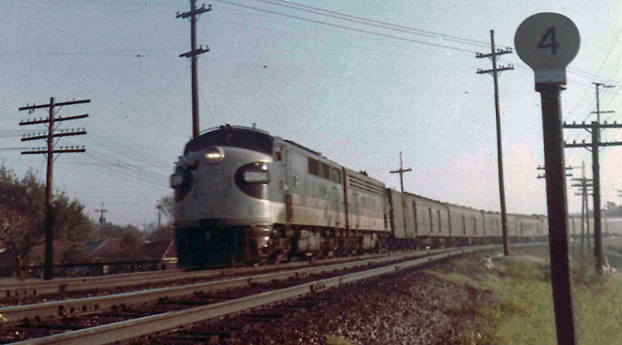
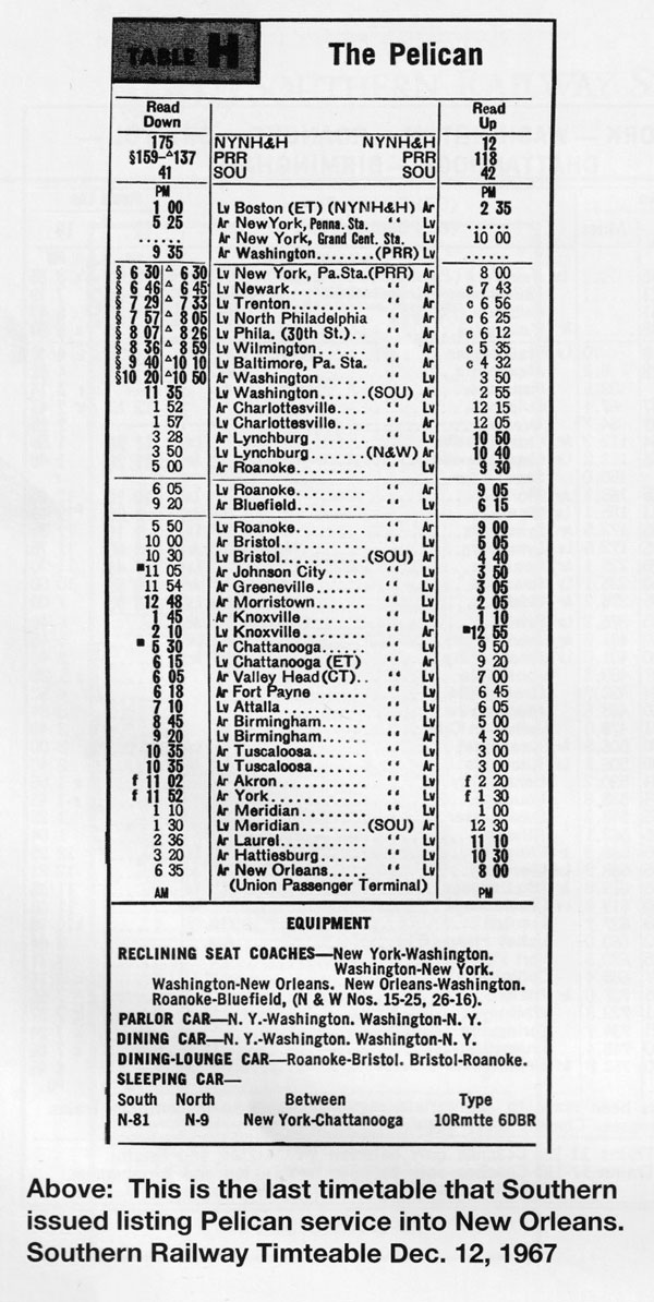
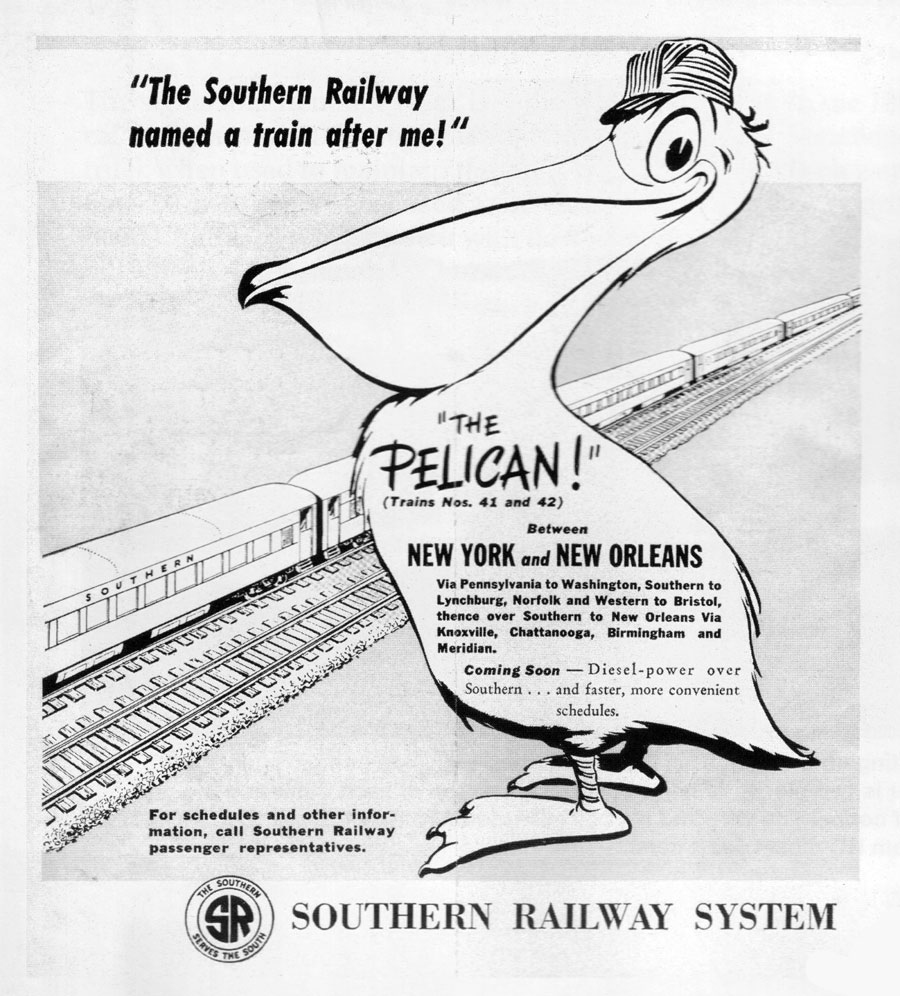
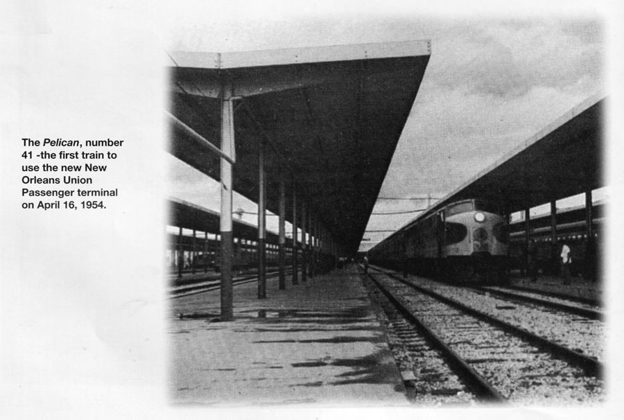
The Pelican
New Orleans, La / Nov 1964 / Michael Palmieri
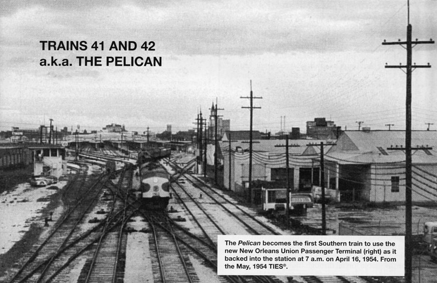
from TIES magazine
— Nov-Dec 2001 / collection
from TIES magazine
— Nov-Dec 2001 / collection
from TIES magazine
— Nov-Dec 2001 / collection
from TIES magazine
— Nov-Dec 2001 / collection
from TIES magazine
— Nov-Dec 2001 / collection
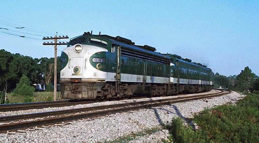
The Southern Crescent
New Orleans, La / May 1974 / Michael Palmieri
The Southern Crescent
New Orleans, La / Apr 1977 / Michael Palmieri
1974 Southern Crescent timetable / collection
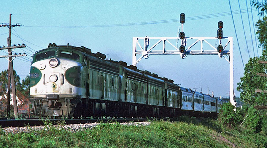
The Southern Crescent
New Orleans, La / Apr 1977 / Michael Palmieri
The Southern Crescent
New Orleans, La / Jan 1979 / Michael Palmieri
The second-to-last southbound Southern Crescent had just arrived at New Orleans Union Passenger Terminal on 30 January 1979 with three E-units and ten cars (above). The train’s consist was E8A’s 6900, 6914 and 6907 with deadhead diner 3308 and Amtrak sleeper-lounge 3203 CRYSTAL STREAM, baggage car 3589, coach 842, Amtrak sleeper-lounge 3202 LAUREL STREAM, coach 816, 10-6 sleepers 3403 HOLSTON RIVER and Amtrak 2604 PACIFIC CAPE, diner 3307 and dome-coach 1613. The final SOUTHERN CRESCENT arrived on 1 February with six E8A’s and 14 cars.
Michael Palmieri
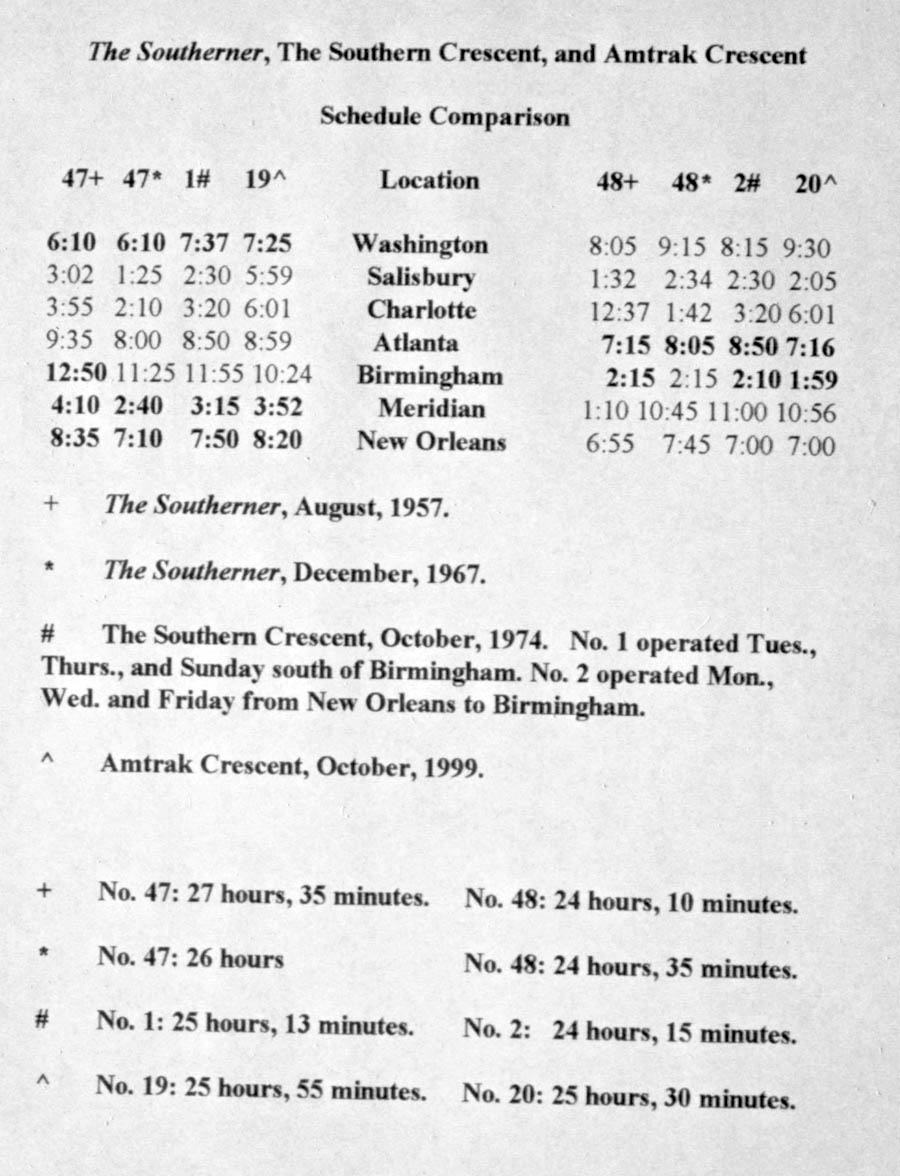
schedule comparison notes / JCH
See also our complete Amtrak Crescent Route Scrapbook here in Mainlines
Queen & Crescent
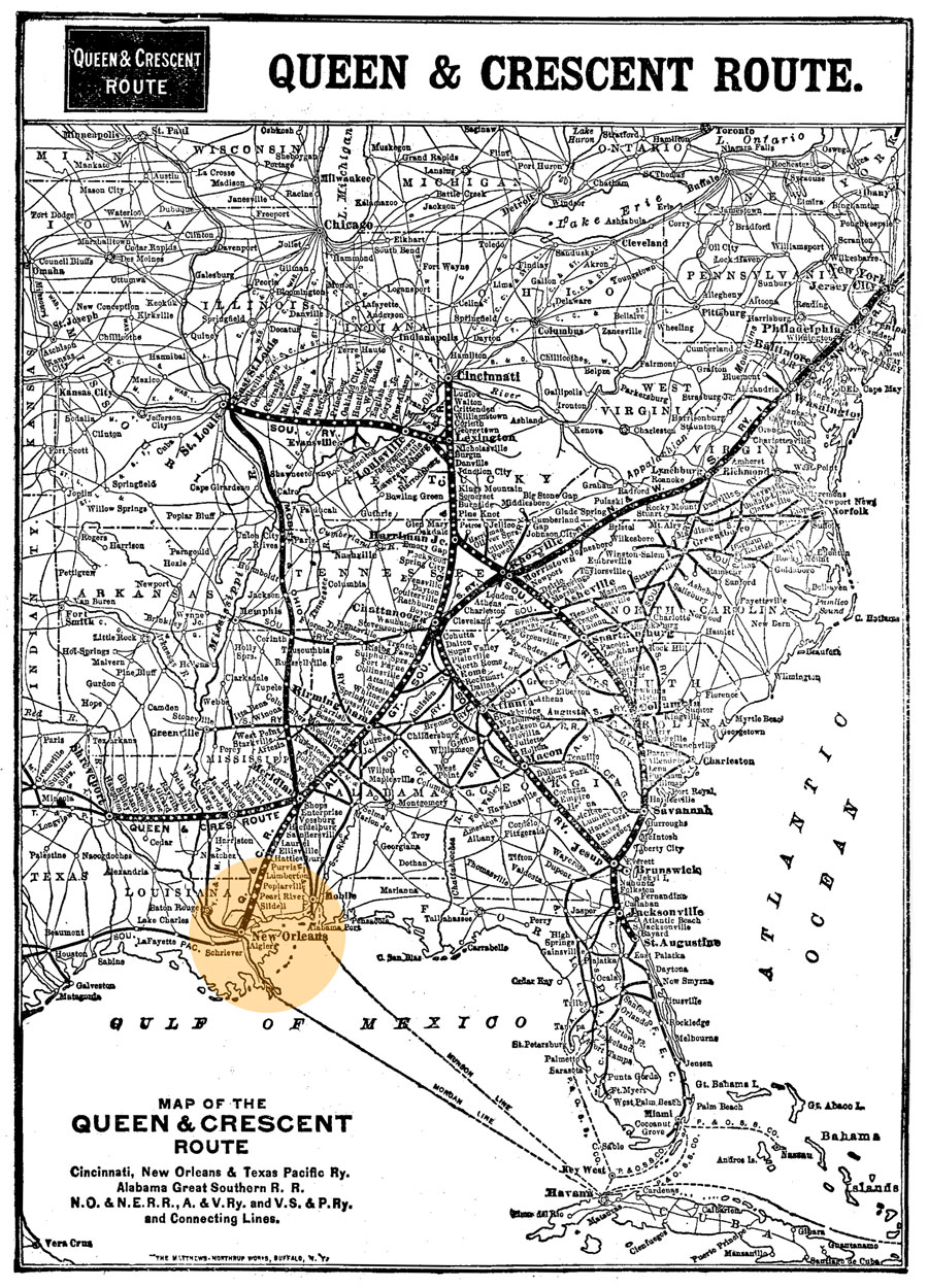
1910 Official Guide map / collection
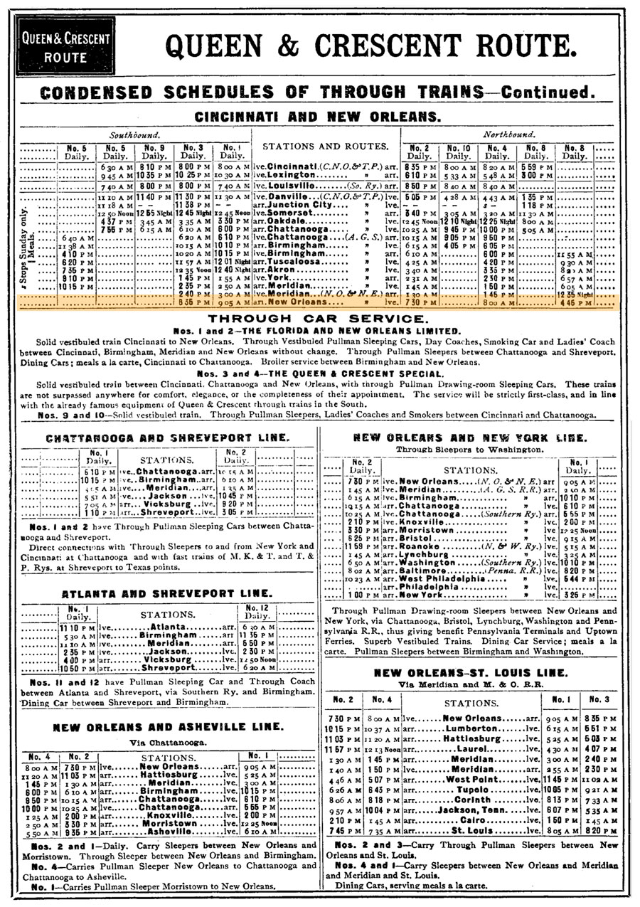
1910 Official Guide ad / collection
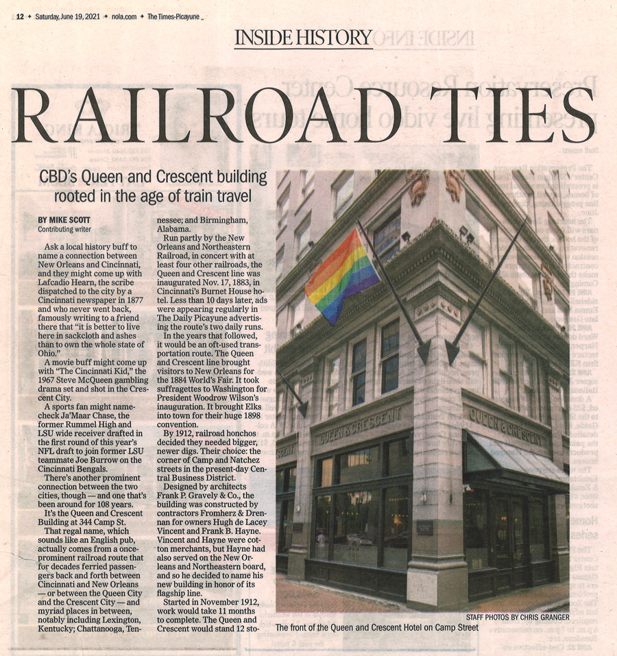
from New Orleans Times-Picayune
- Jun 2021 / collection
Louisiana Southern
The Louisiana Southern Railway Company was a shortline operation in souteastern Louisiana, chartered in 1897 as a successor to several short lines which had operated along the Mississippi River, including the Mississippi, Terre aux Boeuf, & Lake; the New Orleans & Gulf; and New Orleans & Southern. In 1952 the Southern Railway purchased the line, incorporating it into its New Orleans operations.
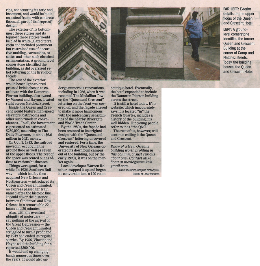
Louisiana Southern #504
New Orleans, La / Nov 1951 / collection
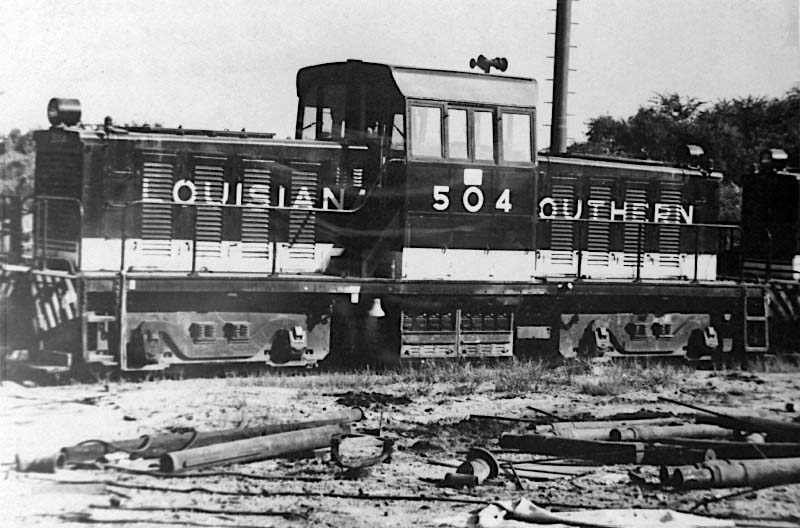
Surviving LAS route map / JCH
See also our complete Louisiana Southern Railway scrapbook in Shortlines
 Lagniappe
Two interesting pieces of Southern Railway equipment assigned to New Orleans for many years deserve mention here. Southern #2100 was a rare Electro-Motive model NW5 heavy yard switcher; only a few were produced nationally and only one was purchased by the Southern. It worked the New Orleans area for years before retirement and sale to a New England shortline. Southern #903006 was a 150-ton crane built by Bucyrus and assigned to New Orleans for years, dispatched all over the southwestern region to work wreck cleanup and other MOW duties.
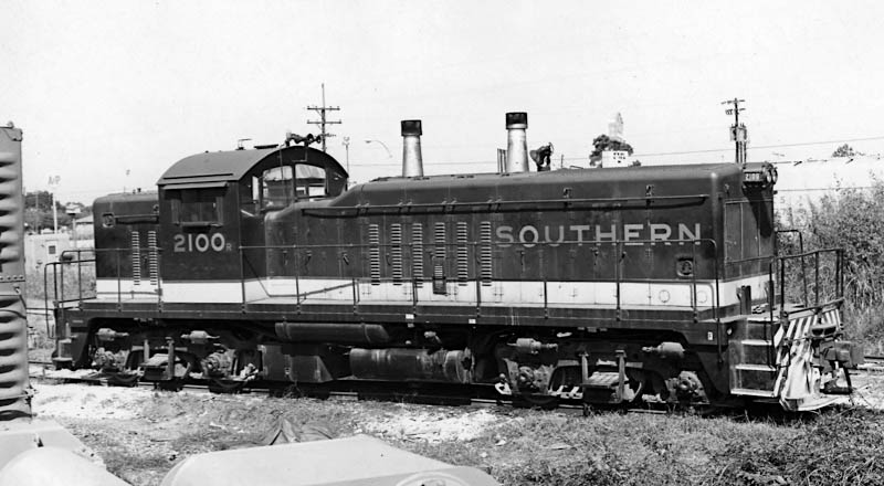
Southern Railway #2100
New Orleans, La / Oct 1973 / collection
See our Southern Odds and Ends scrapbook for complete #2100 coverage
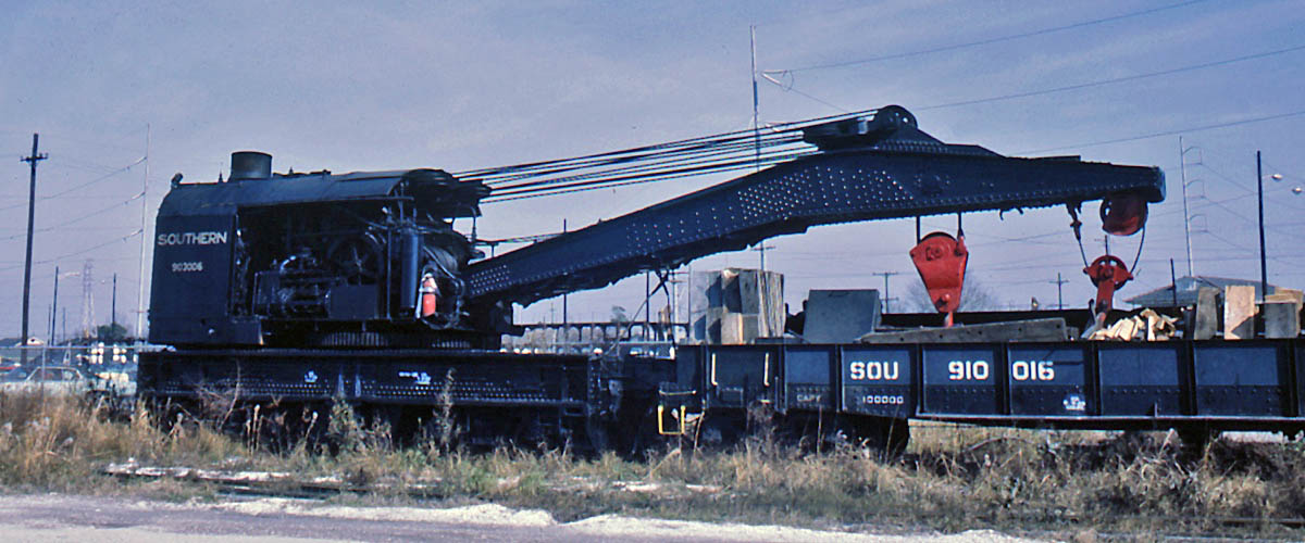
Southern Railway #903006
New Orleans, La / Jan 1970 / collection
See our Southern Service Equipment scrapbook for more MOW cranes and equipment