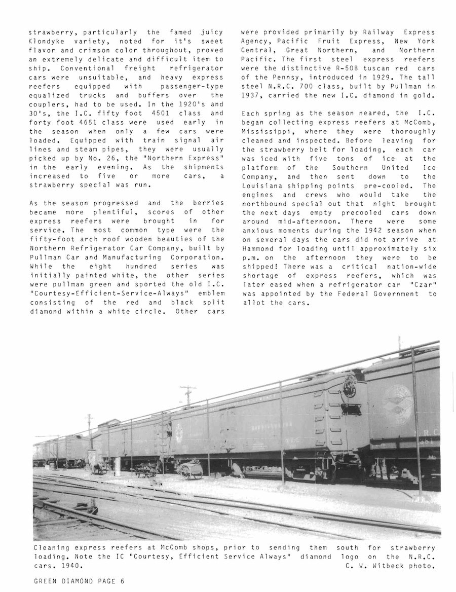
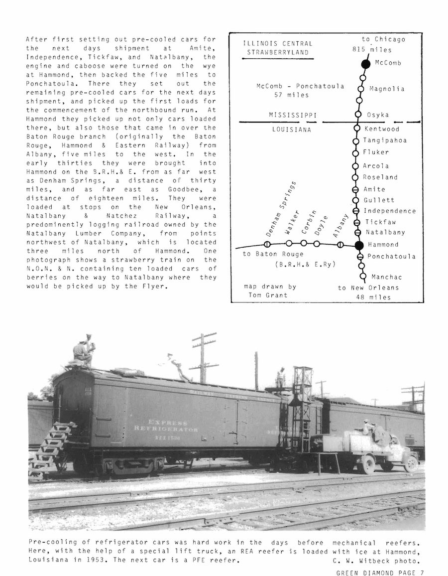
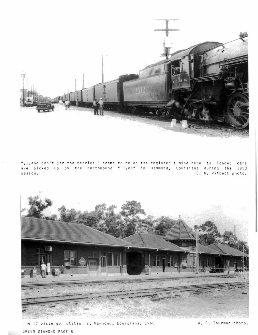
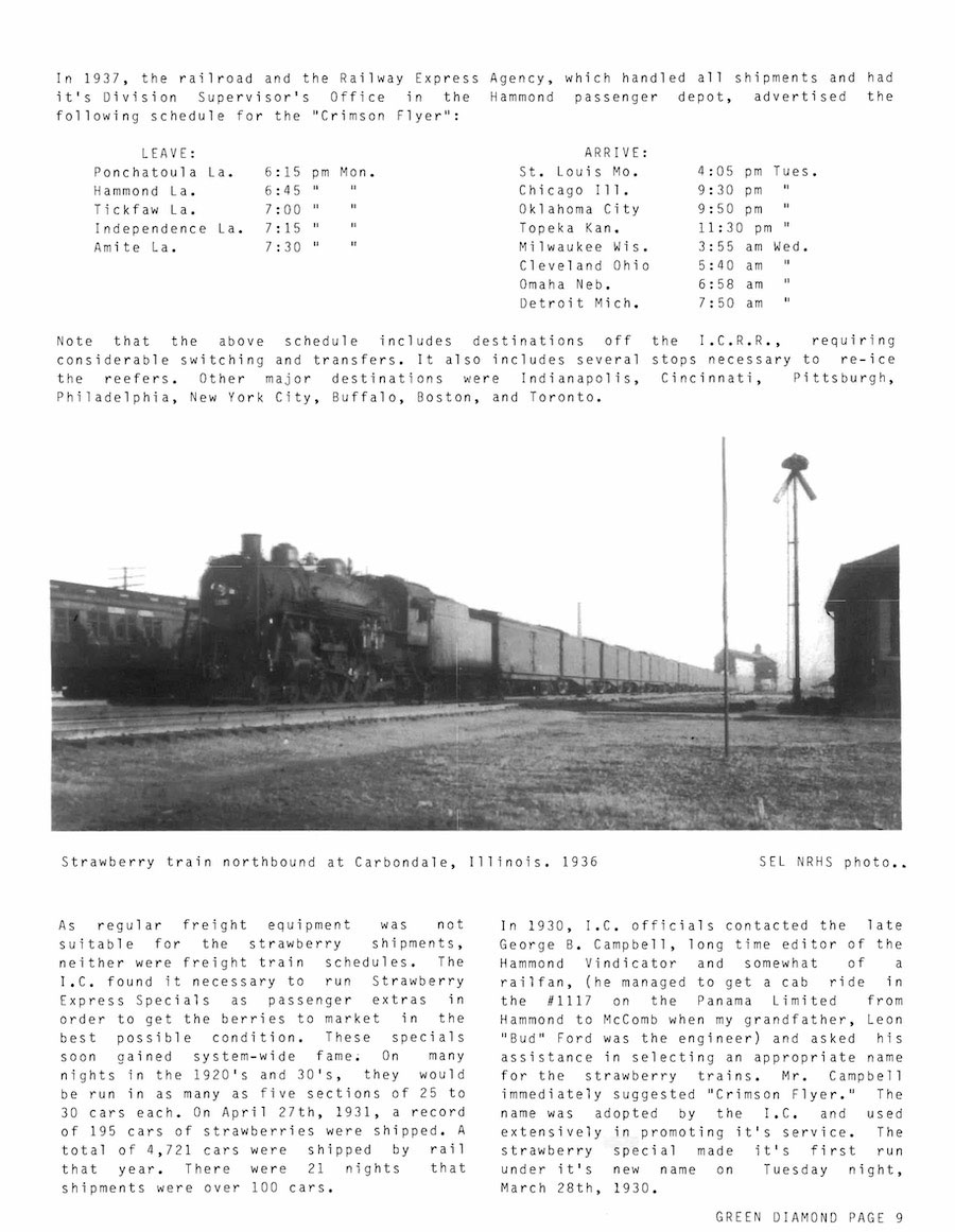
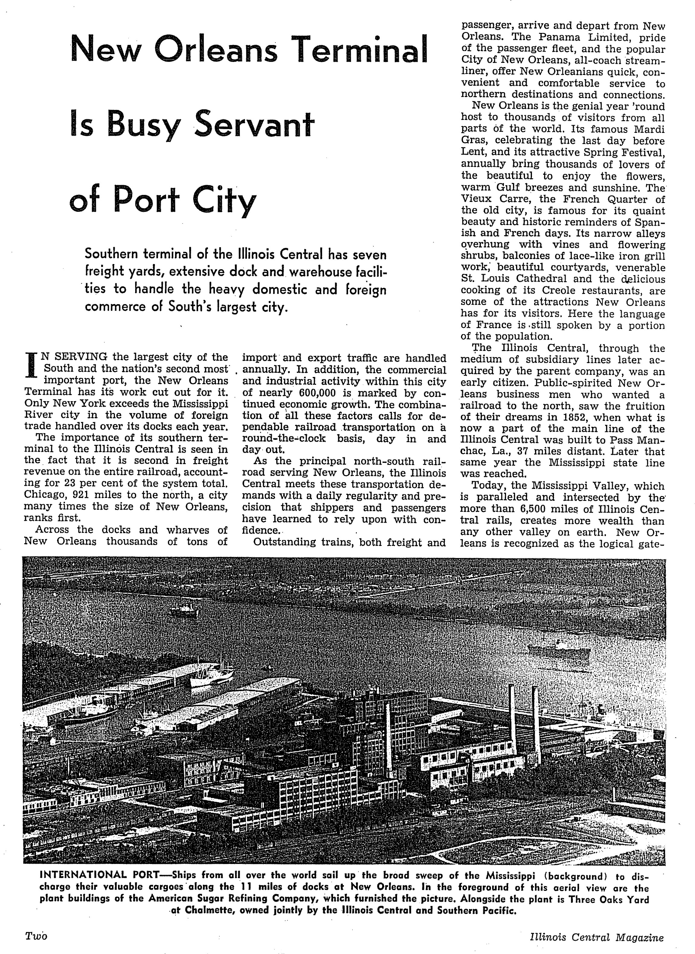
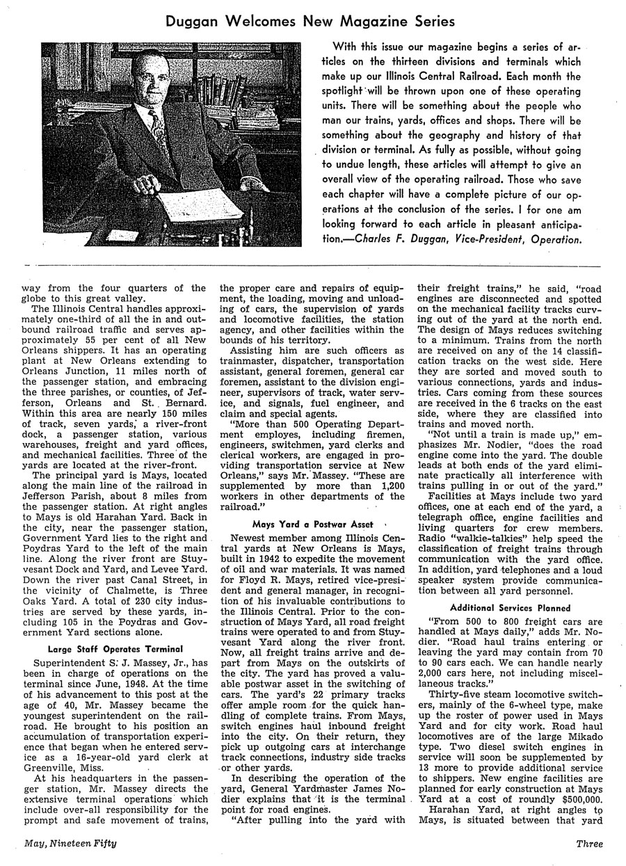
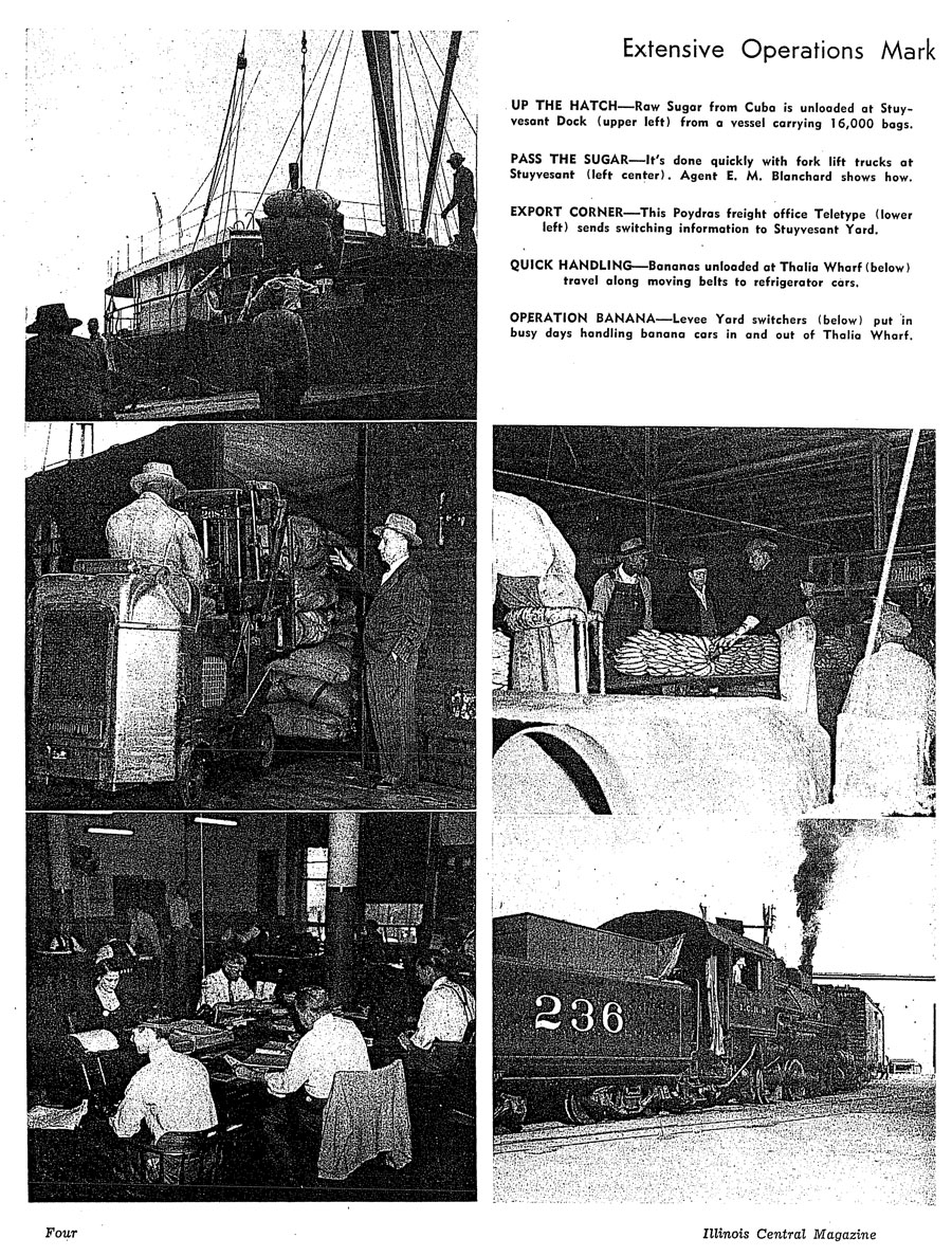
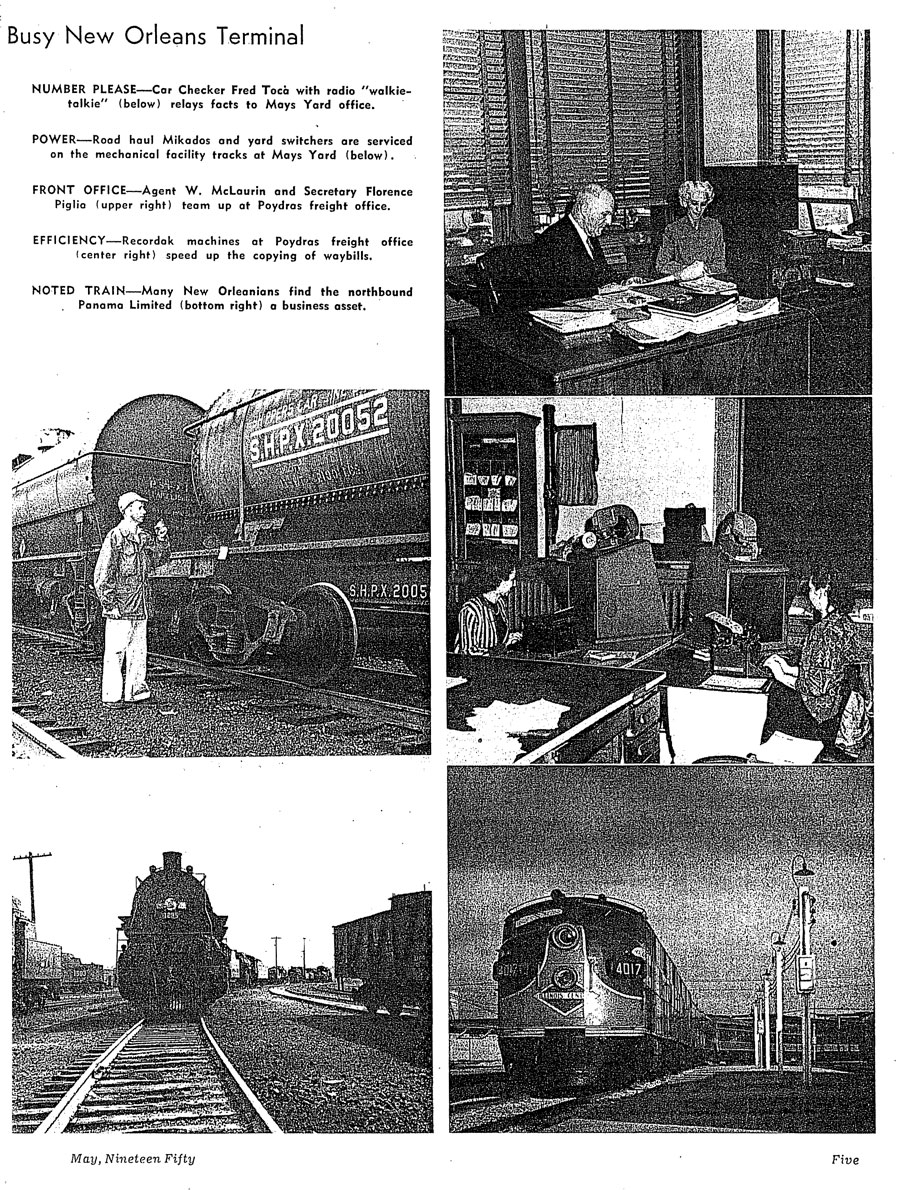
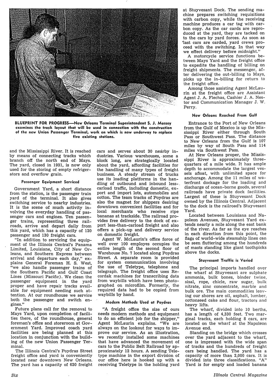
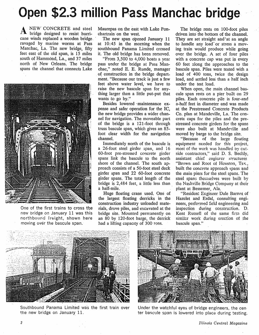
 |
Illinois Central Louisiana |


Hammond, La / 1953 / collection
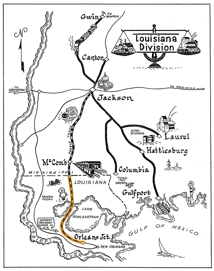
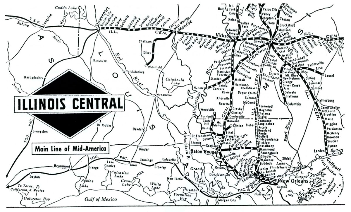
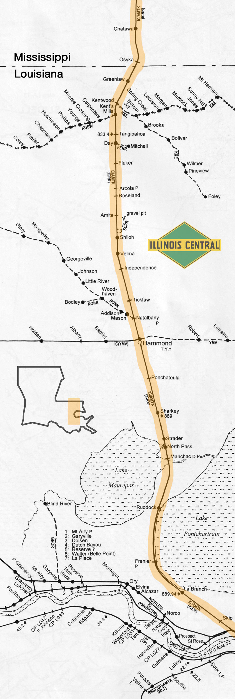
Louisiana Division map / from Illinois Central Magazine
- Sep 1950 / collection

jump to a
flag stop
- New Orleans
- Union Station
- Union Terminal
- Carrollton
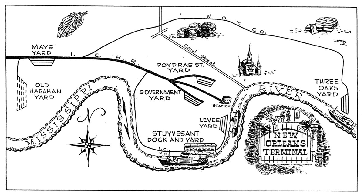
- Mays Yard
- Manchac
- Ponchatoula
- Hammond
- Independence
collection
 New Orleans
Louisiana Division map / from Illinois Central Magazine
- May 1950 / collection
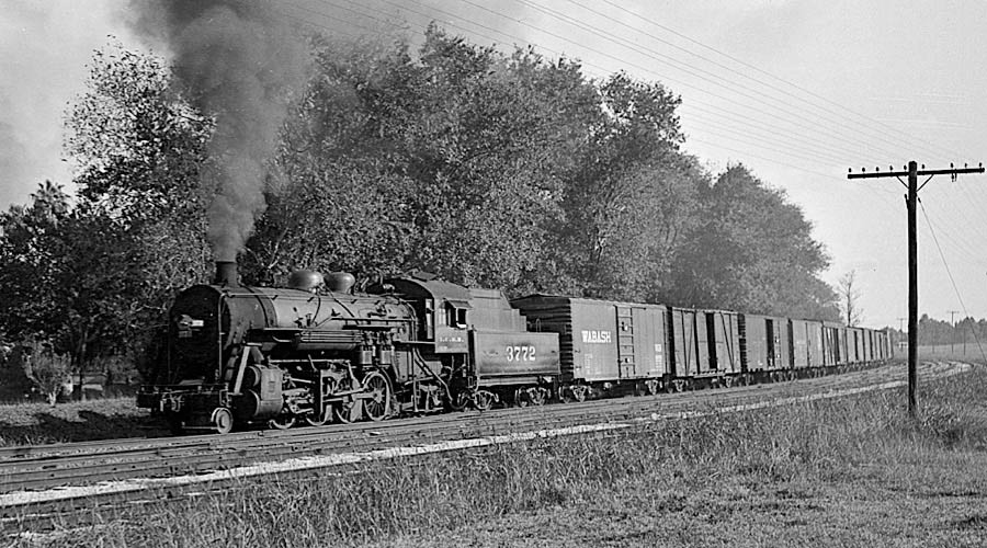
Illinois Central #3772
Mays Yard transfer / New Orleans, La /
Nov 1950 / Michael Palmieri collection
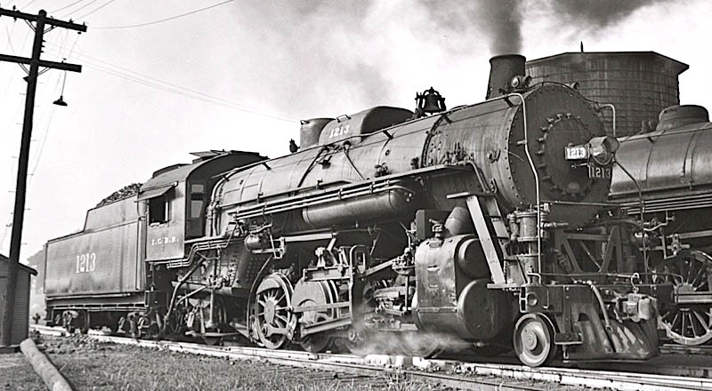
Illinois Central #1213
New Orleans, La / Jun 1955 / Michael Palmieri collection
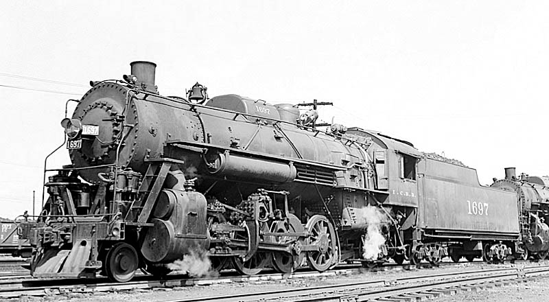
Illinois Central #1697
New Orleans, La / May 1954 / Michael Palmieri collection
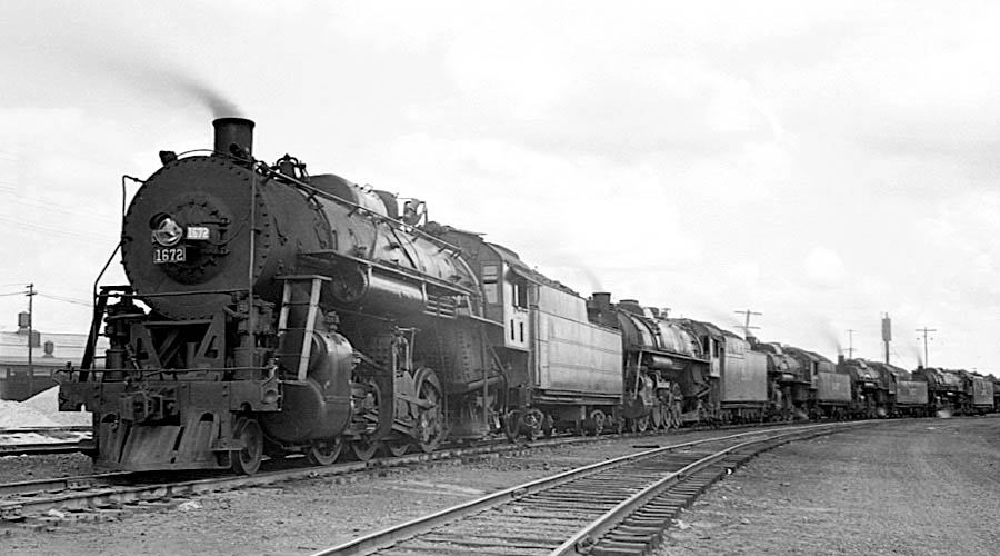
Illinois Central #1672
New Orleans, La / Jan 1955 / Michael Palmieri collection
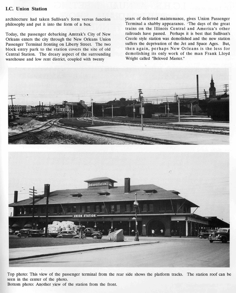
Union Station

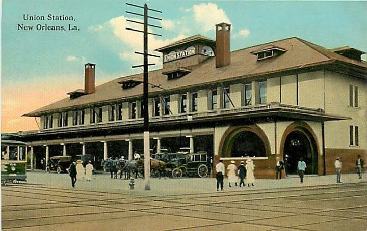
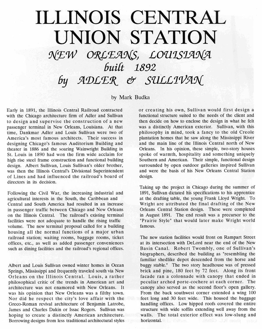
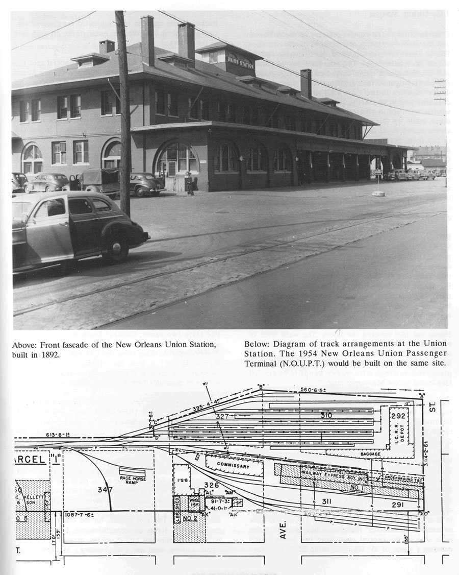
New Orleans Union Station was a railroad station in New Orleans, Louisiana. It was designed by Louis H. Sullivan for the Illinois Central Railroad and opened on June 1, 1892. It was located on South Rampart Street, in front of the current New Orleans Union Passenger Terminal.
Union Station was the only train station architect Sullivan designed. It was constructed in the architect’s well-known ‘Chicago School’ style and decorated with his iconic ornament. Adler and Sullivan’s head draftsman Frank Lloyd Wright was involved in the final work under Sullivan’s supervision. Union Station was a three story hip-roofed structure with a cupola, including office and waiting areas, with a broad portico with central columns and arched entryways at each end of the entrance. Union Station and the other stations were demolished in 1954 and replaced by the current New Orleans Union Passenger Terminal.
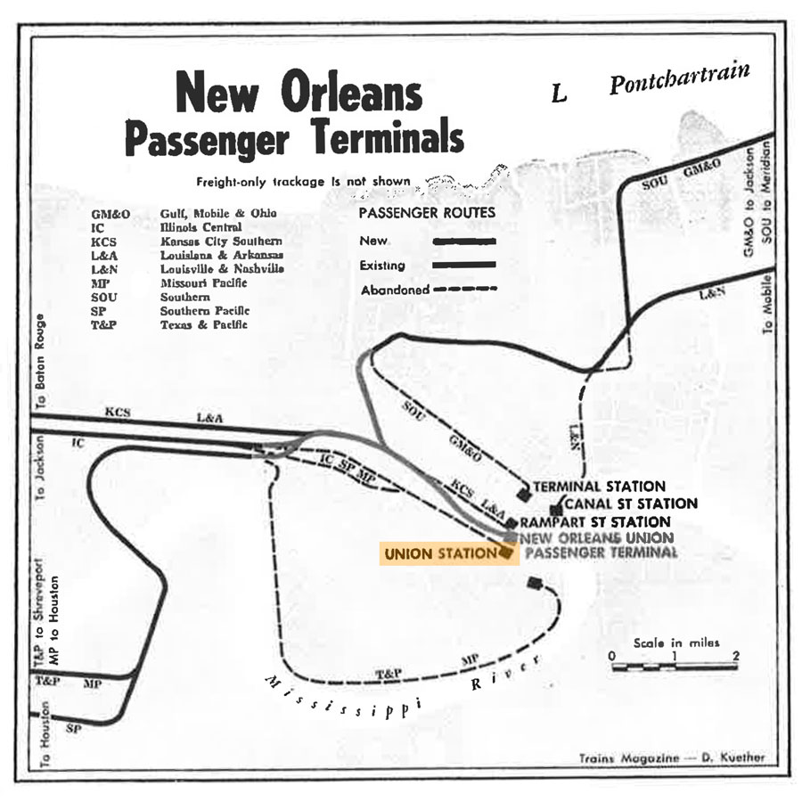
NOUPT was built next to the old Union Station. Parts of the station property also are over what once was the turning basin for the New Basin Canal. The main lead track to the terminal follows the path of the old canal (which was filled in) and the Pontchartrain Expressway/I-10. In the late 1960s, tracks 7-12 were shortened to half tracks in order to accommodate Greyhound Lines in the terminal, sharing the terminal with the remaining passenger trains and later, Amtrak. This helped to create an intermodal facility.
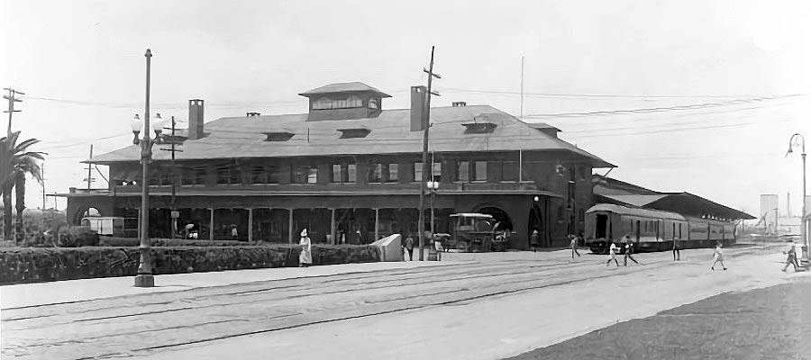
New Orleans, La / c 1920 / collection
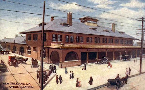
postcard / collection
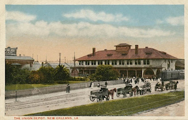
postcard / collection
from TRAINS magazine - 1954 / collection
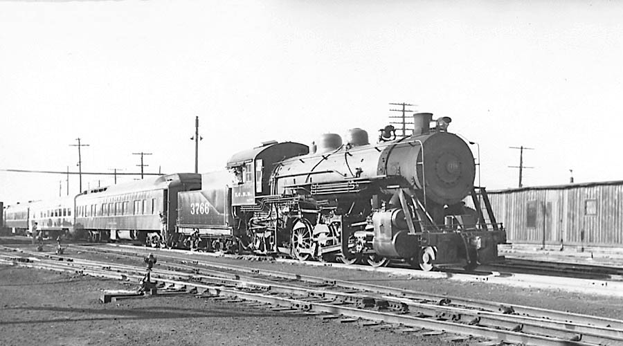
Illinois Central #3766
switching Union Station / New Orleans, La /
Nov 1949 / Michael Palmieri collection
from Illinois Central Historical Society Green Diamond #35 / collection
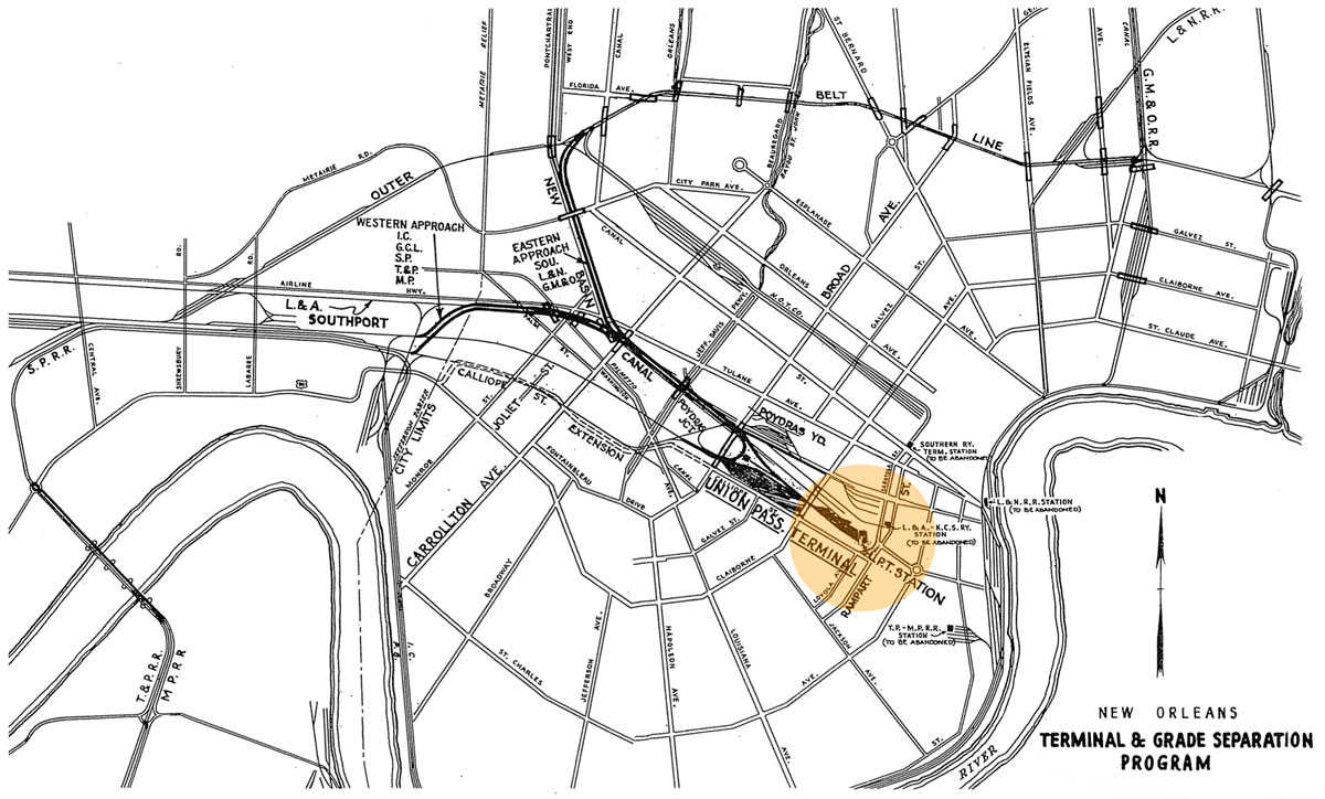
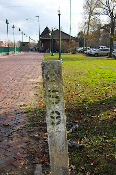
New Orleans Union Passenger Terminal
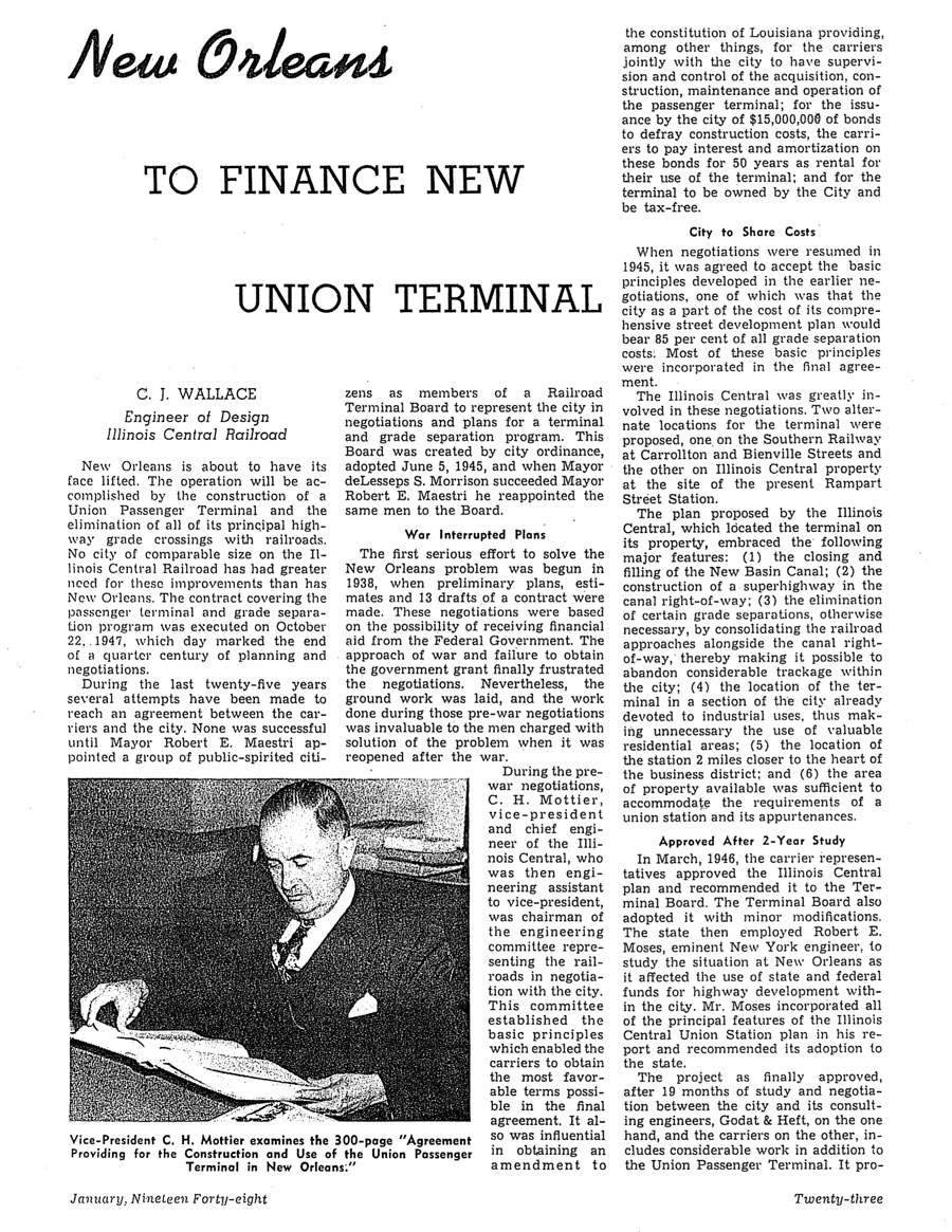
from Illinois Central Magazine
- Jan 1948 / collection
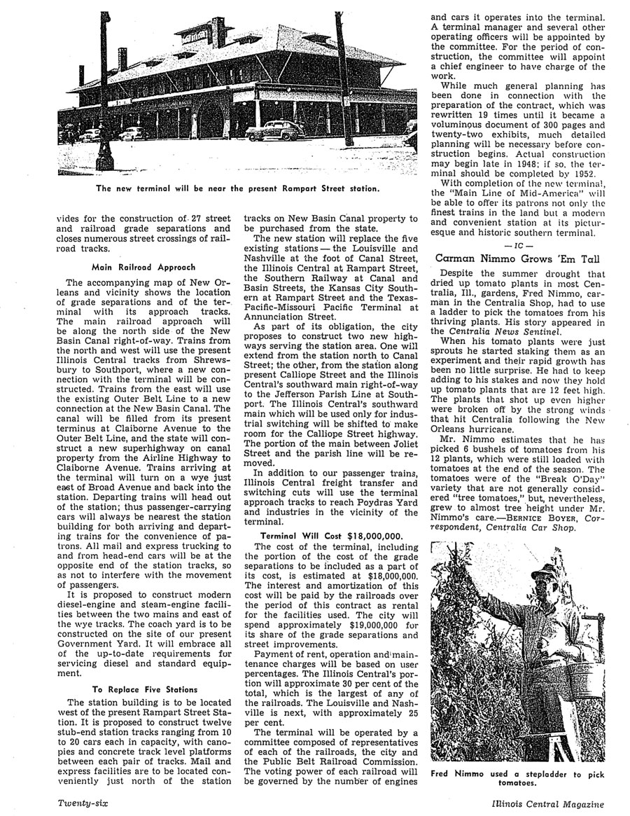
from Illinois Central Magazine
- Jan 1948 / collection

See also our complete New Orleans Union Passenger Terminal scrapbook here in Mainlines
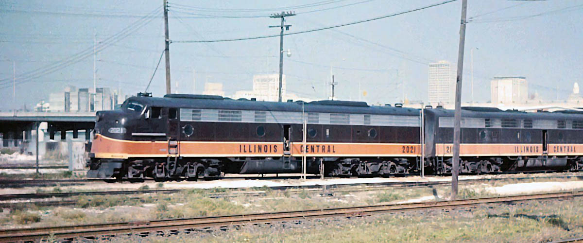
Illinois Central #2021
New Orleans, La / Apr 1971 / Michael Palmieri collection
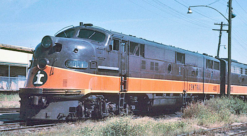
Illinois Central #4001
New Orleans, La / Oct 1970 / James Selzer Jr.
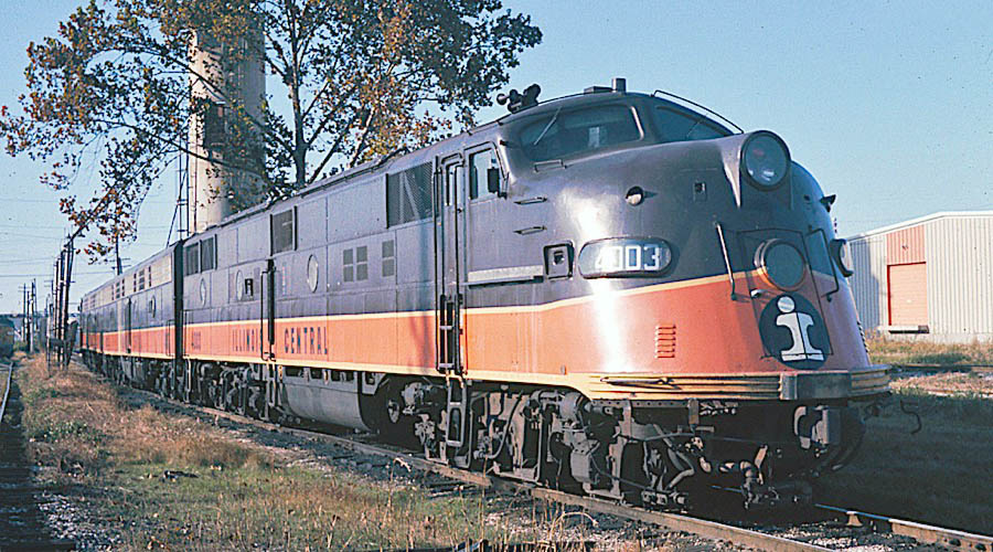
Illinois Central #4003
New Orleans, La / Nov 1970 / James Selzer Jr.
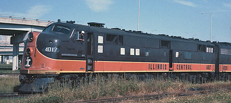
Illinois Central #4017
New Orleans, La / Oct 1970 / James Selzer Jr.
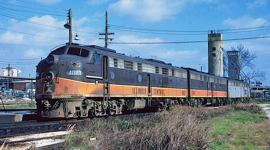
Illinois Central #4023
New Orleans, La / Feb 1974 / Michael Palmieri
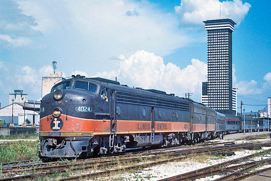
Illinois Central #4024
New Orleans, La / Jul 1973 / James Selzer Jr.
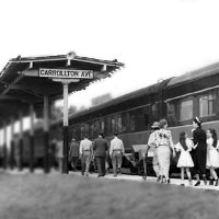
Carrollton Avenue station
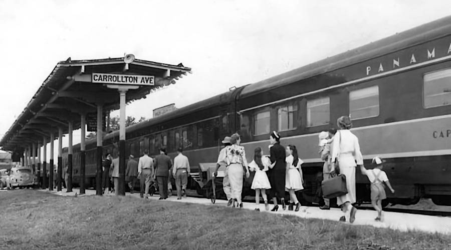
New Orleans, La / May 1950 / Paul Alimia collection 
 Clippings
from Illinois Central Magazine
- May 1950 / collection
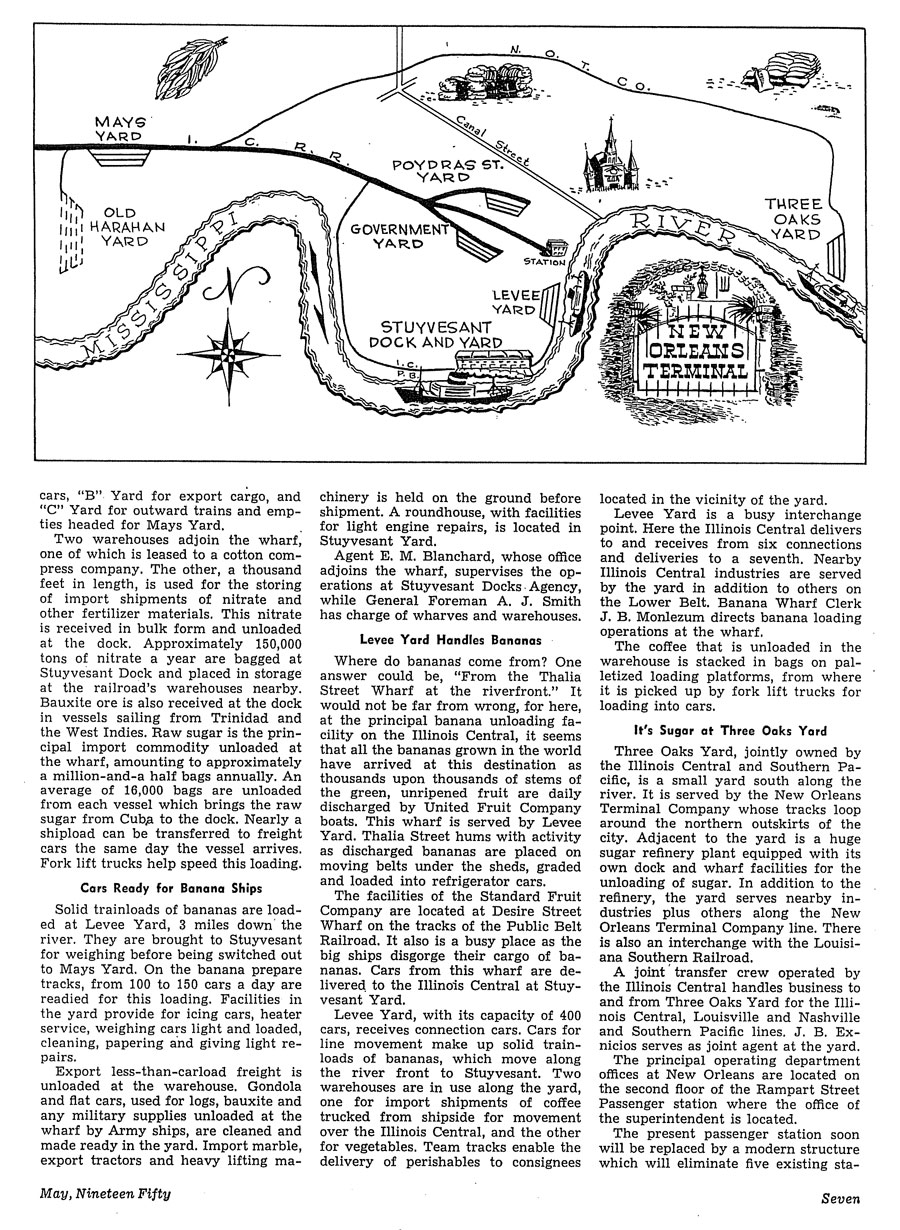
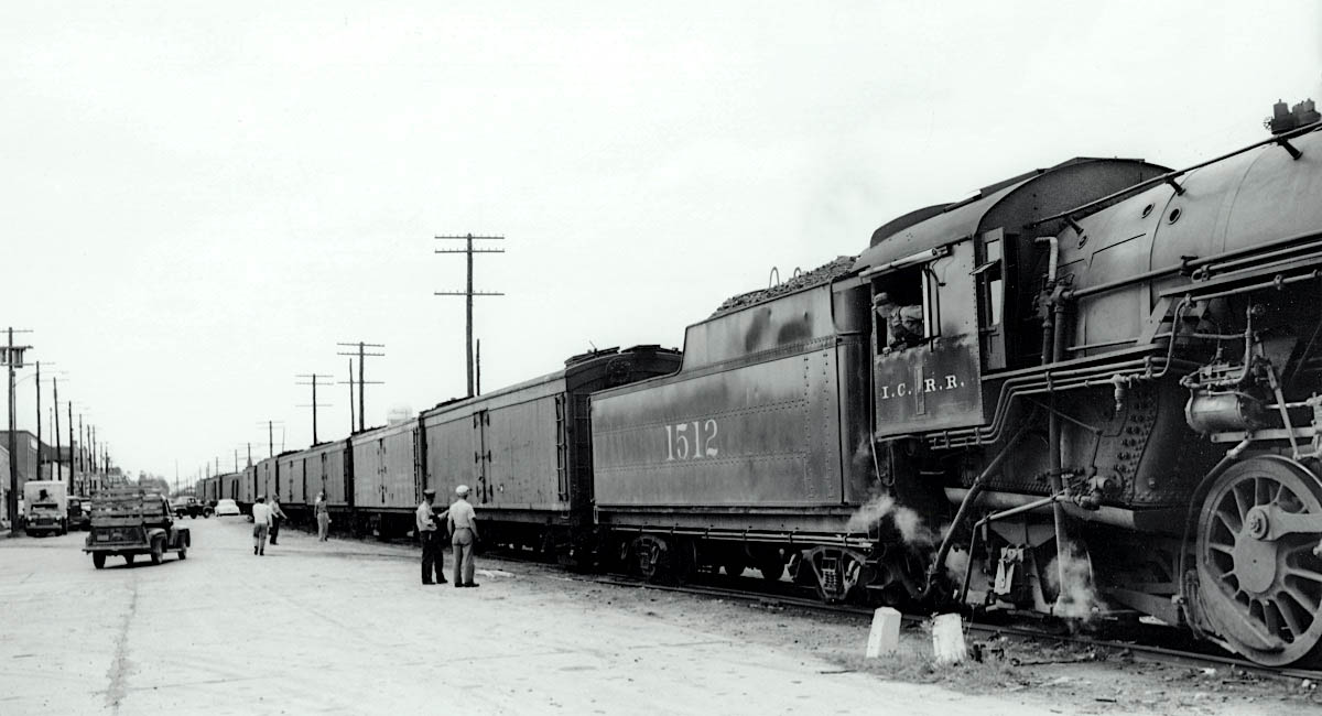
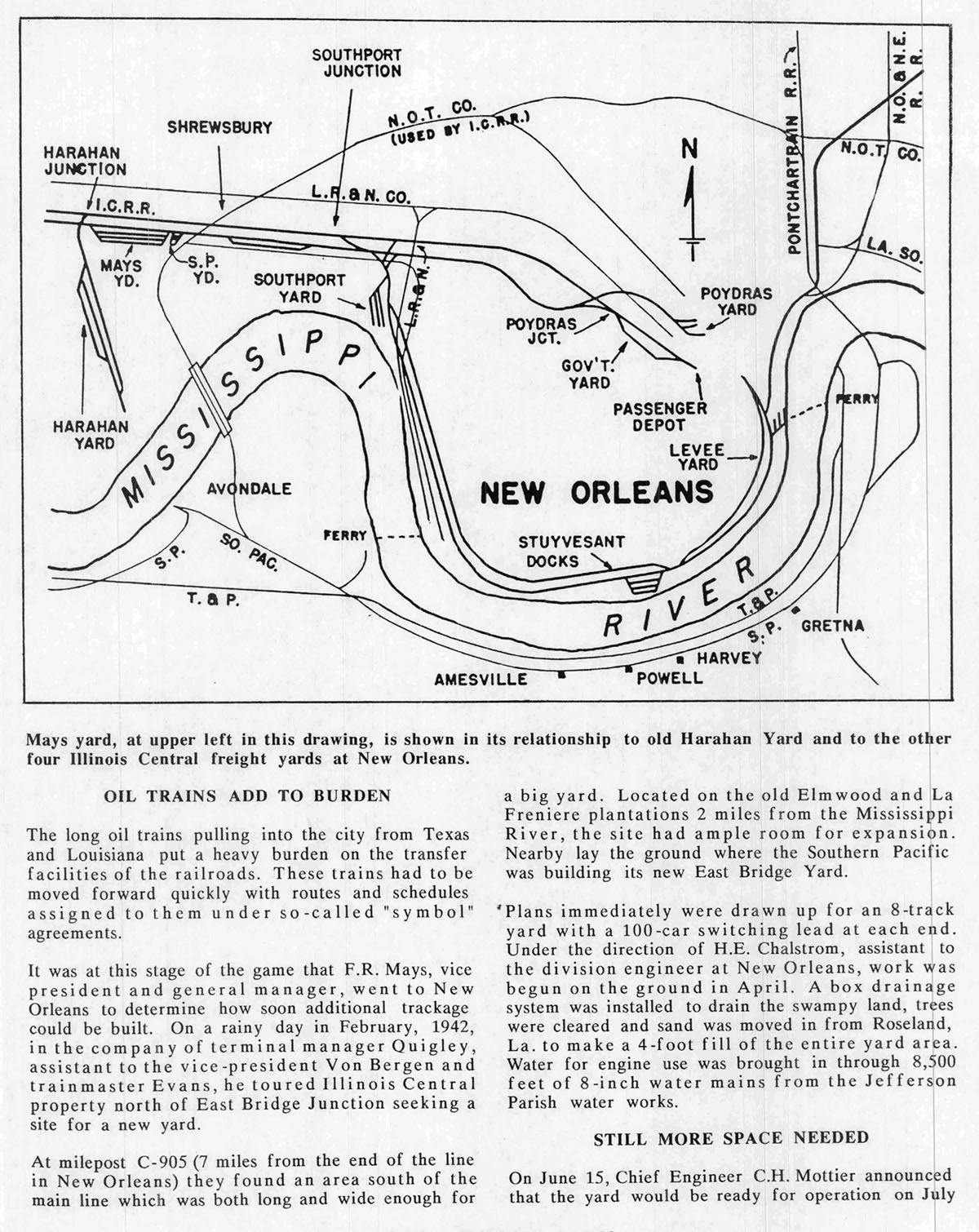
Mays Yard
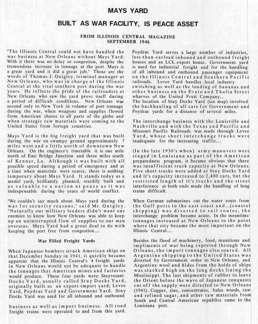
from Illinois Central Historical Society Green Diamond #33 / collection
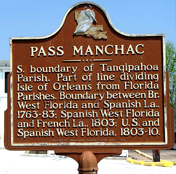
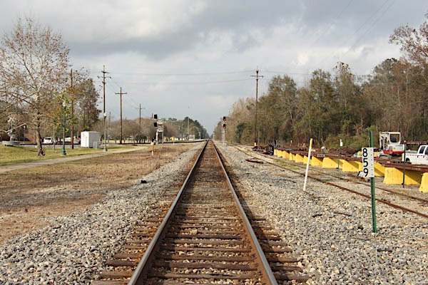
Pass Manchac

Manchac, La / May 2015 / RWH
 Dr. John R. Swanton, a linguist who worked with Native American languages, suggested that the name Manchac is derived from Imashaka, which is a Choctaw word meaning "the rear entrance." An early Choctaw language dictionary written by Cyrus Byington defines the word im as a preposition meaning "place" and ashaka meaning "the back side or rear."
Willie Akers carried the same name as his father who founded the city of Ponchatoula. In the year 1871 Willie moved to Manchac with his family and built a house near a section of high ground that the locals called Jones Island. Then in the year 1857 Willie was appointed as the first postmaster of Manchac and served as the local telegraph operator. When the New Orleans, Jackson & Great Northern railroad was commissioned in 1852, Manchac was one of the stations originally planned, which were generally at ten-mile intervals. Willie Akers' father, William Akers, was the founder and first mayor of the town of Ponchatoula, the next station to the north. Manchac straddles the railway, which, at the start of the 21st century, is part of the Canadian National Railway system.
IC mainline route / RWH

Manchac, La / May 2015 / RWH

Manchac, La / May 2015 / RWH

Manchac, La / Sep 1979 / Michael Palmieri
Click to see the current Pass Manchac railroad bridge plotted on a Google Maps page
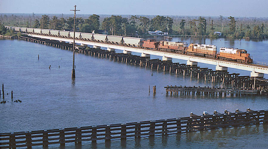
Manchac, La / Sep 1979 / Michael Palmieri
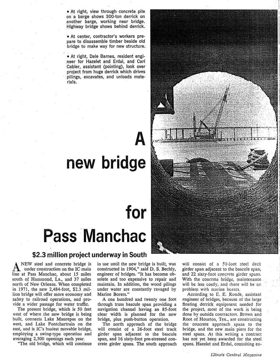
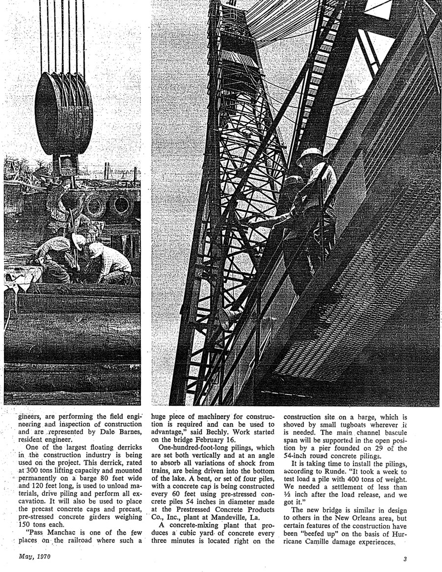
from Illinois Central Magazine
- May 1970 / collection
from Illinois Central Magazine / collection
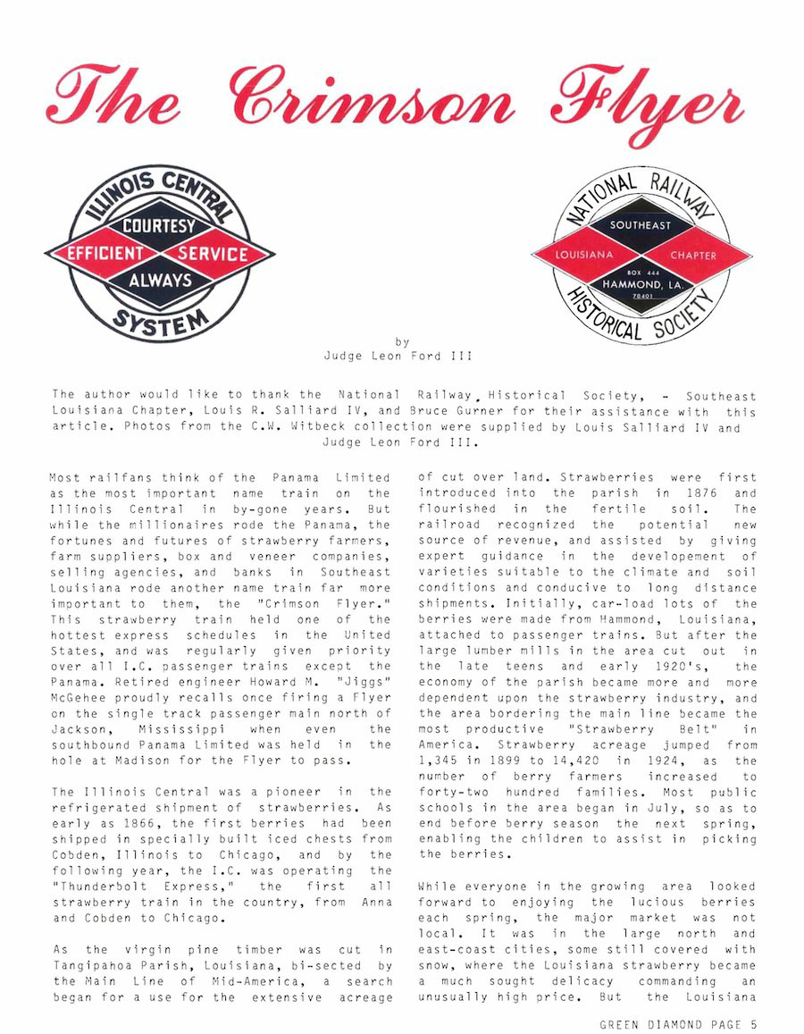
from Crimson Flyer NRHS newsletter - May 2005 /
posted with permission / collection

Ponchatoula
 onchatoula, the oldest incorporated city in Tangipahoa Parish, is host to the popular Ponchatoula Strawberry Festival every spring. The city is northwest of Lake Pontchartrain and abundantly grows local produce including the famous Louisiana strawberries. The area offers beautiful sites in addition to tasty eats - the city derives its name from the Choctaw Indian language meaning "hair to hang" because of the abundance of Spanish moss on the ancient oak trees found throughout the area. It's also been nicknamed America's Antique City and is stocked with numerous art, antique and hand-crafted items that you can shop for in historic buildings in the downtown area. Visitors enjoy delicious food and culture while just being outside Baton Rouge, Northshore area and New Orleans.

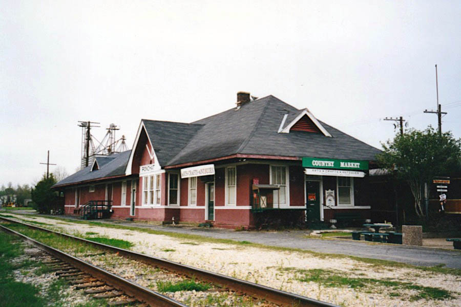
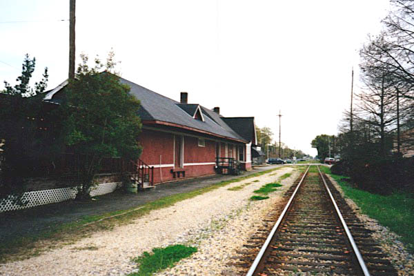
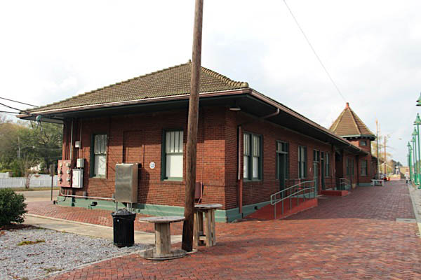
Ponchatoula, La / Mar 2001 / JCH
Click to see the Ponchatoula depot plotted on a Google Maps page
Ponchatoula, La / Mar 2001 / JCH
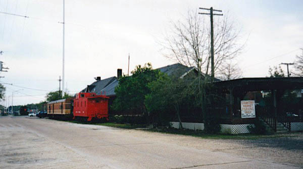
Ponchatoula, La / Mar 2001 / JCH
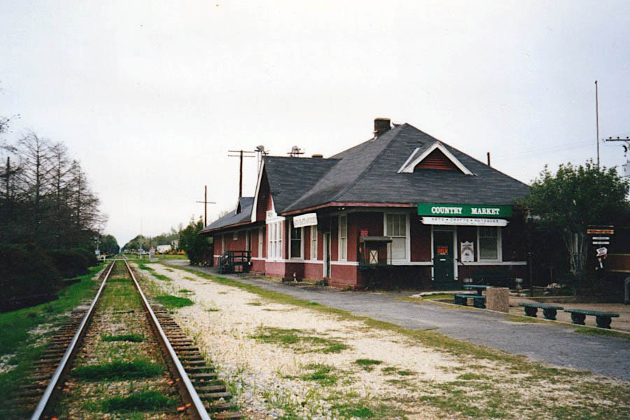
Ponchatoula, La / Mar 2001 / JCH
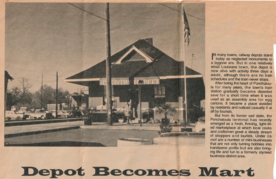
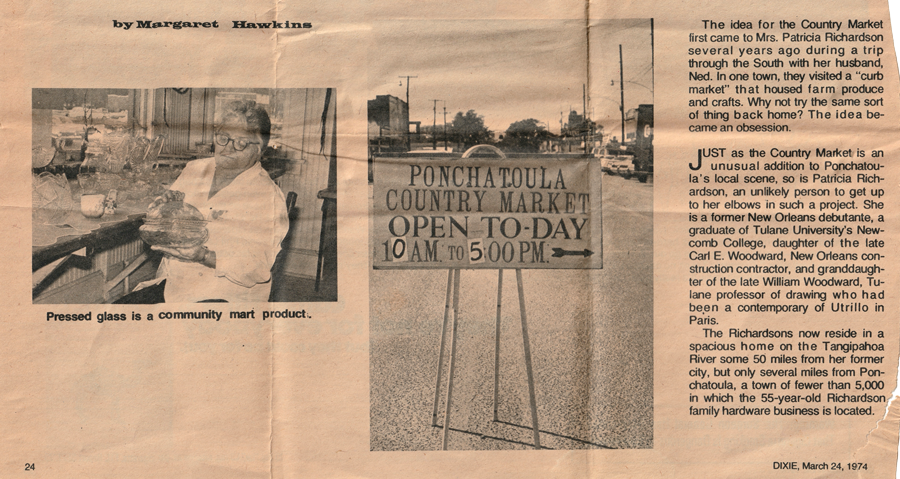
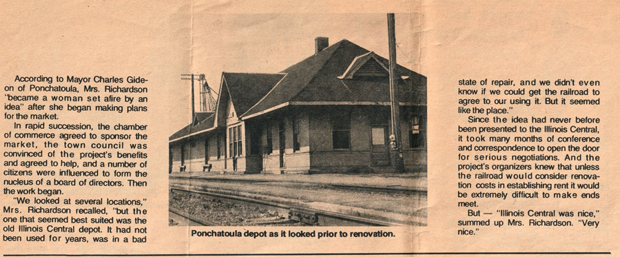
from DIXIE Magazine - by Margaret Hawkins -
Mar 1974 / collection
See also our complete Louisiana Cypress Lumber Company featured scrapbook in Industrials
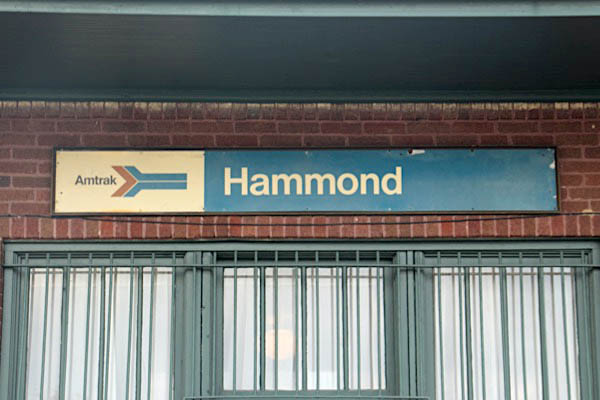
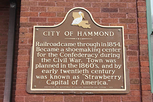
Hammond
 oday, Hammond is the largest city in Tangipahoa Parish. Hammond began as a settlement of Swedish immigrant Peter Hammond. However, the coming of the New Orleans, Jackson, and Great Northern Railroad ensured its existence in the coming years. The train's arrival in 1854 prompted land speculation and brought many new people to the area.
Our city grew up around the junction of Thomas Street and the railroad tracks, and the downtown became a shipping center for the prosperous timber industry. In the 1890s, a hardy variety of strawberries was developed, and local farmers were able to ship their strawberry crops to points all over the nation from Downtown Hammond. As the farmers and merchants began to prosper, they began to replace their downtown wooden structures with proud brick buildings. These buildings have remained in Downtown Hammond through the years, giving the city the unique flavor it has today.
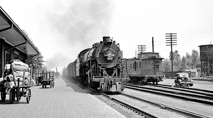
Illinois Central #2431
Hammond, La / May 1951 / Michael Palmieri collection

Illinois Central #4018
Hammond, La / Aug 1969 / JCH
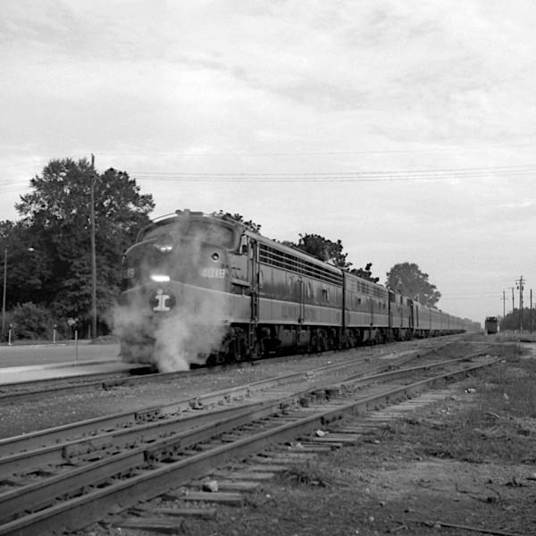
Hammond, La / Aug 1969 / JCH
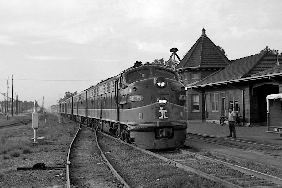
Illinois Central #4035
Hammond, La / Aug 1969 / JCH
Hammond, La / Aug 1969 / JCH
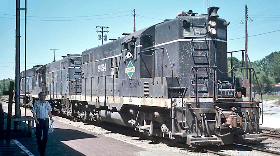
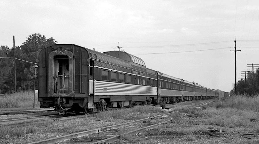
Illinois Central #9054
Hammond, La / Apr 1974 / James Selzer Jr.
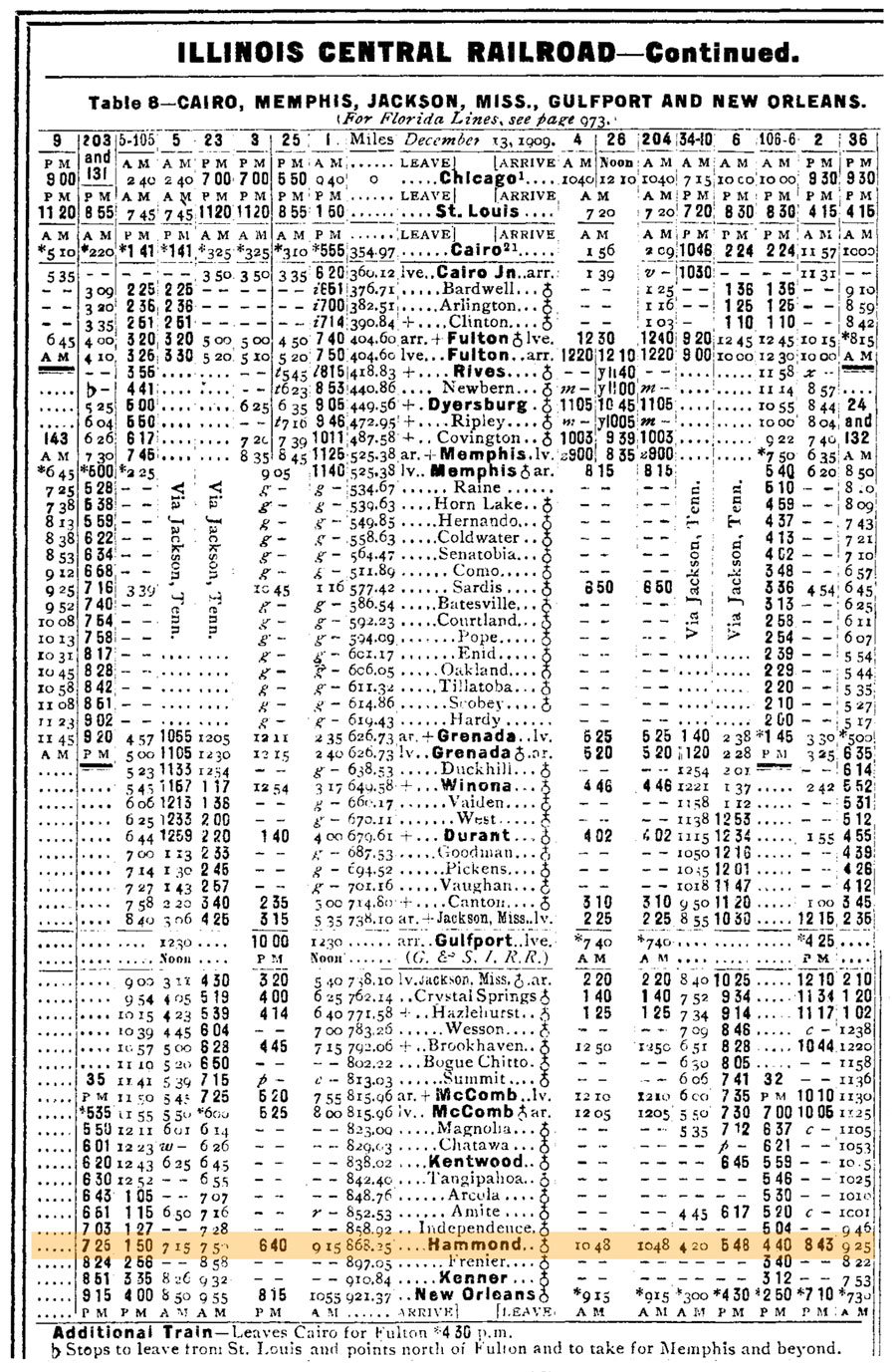
1910 Official Guide timetable / collection
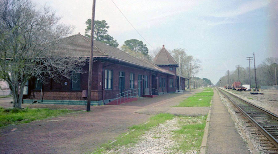
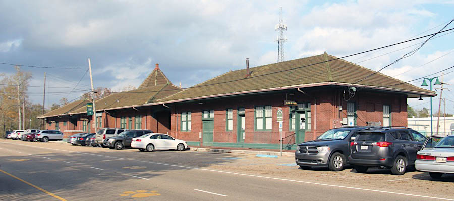
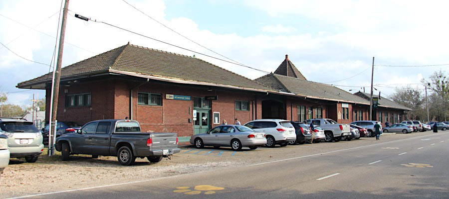
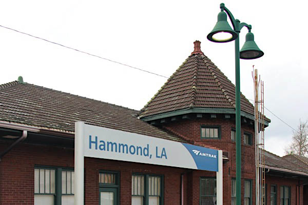
Hammond, La / Mar 2003 / JCH
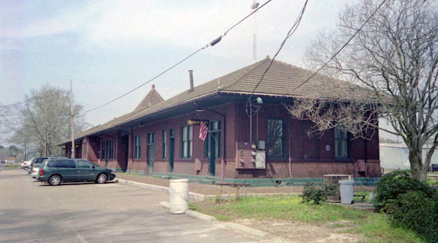
Hammond, La / Mar 2003 / JCH
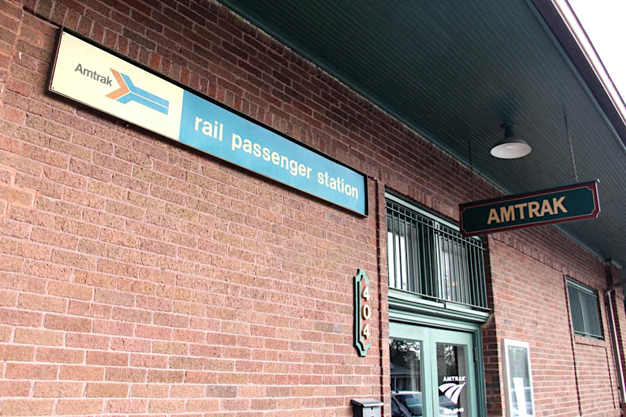
Click to see the Hammond station plotted on a Google Maps page
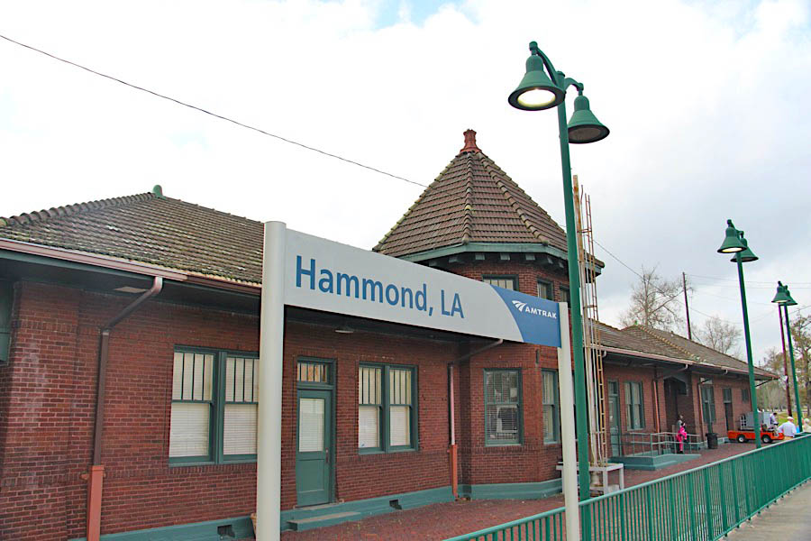
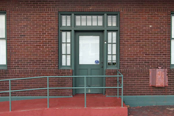
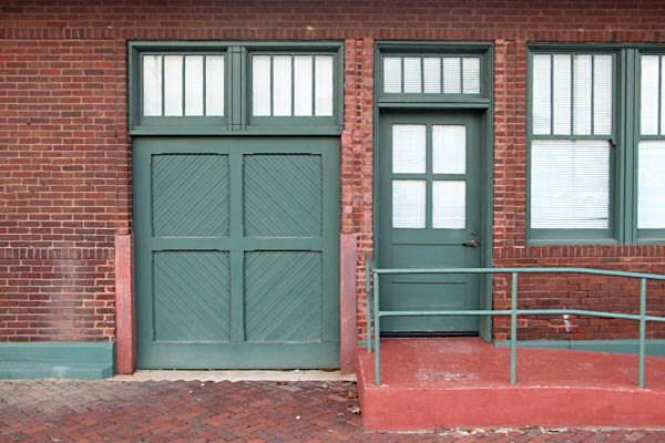
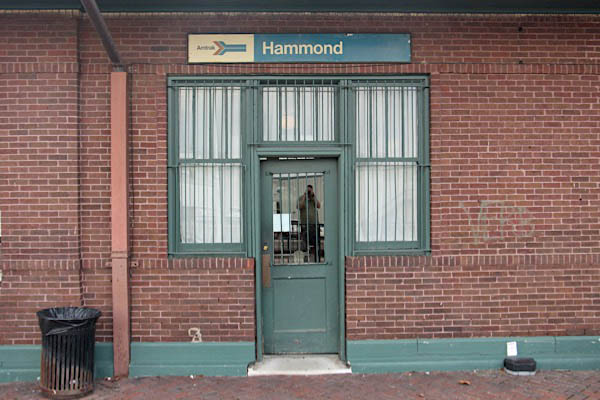
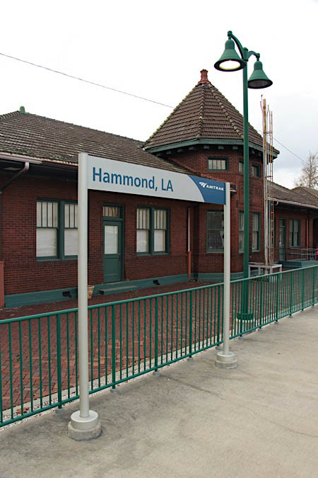
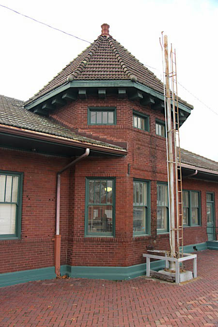
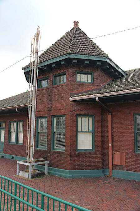
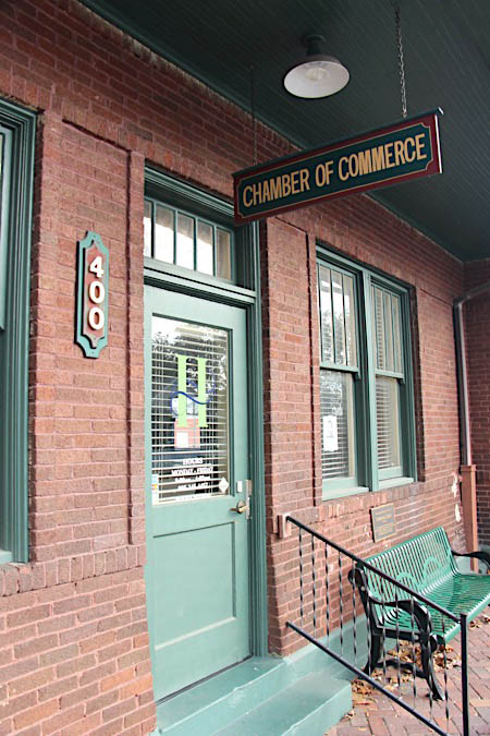
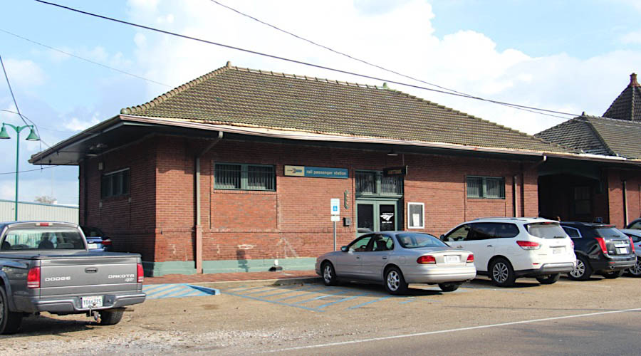
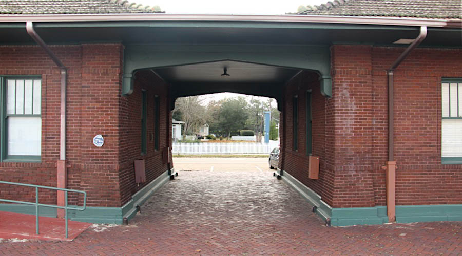
he current Amtrak station in Hammond was built by the Illinois Central Railroad in 1912 and designed by the railroad’s in-house architects. The depot is listed on the National Register of Historic Places as a component of the Hammond Historic district. Built of deep brown-red brick, the station is in the Queen Anne revival style, with a dominant octagonal tower and elaborate molding and archways and boasts the original cove molded ceiling.
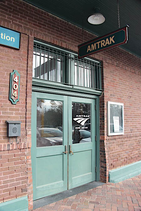
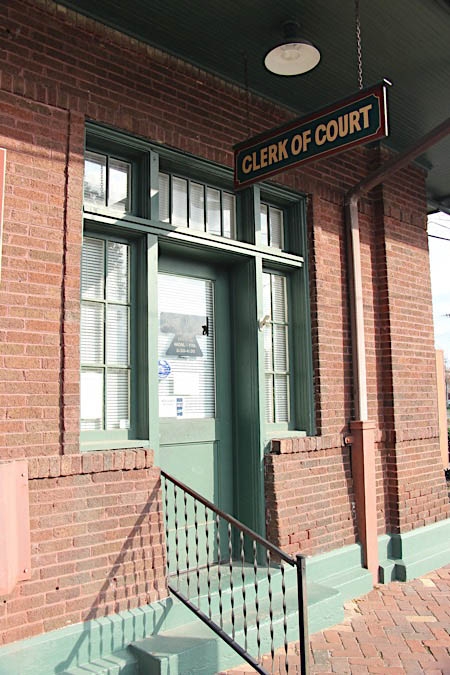
The station complex is currently owned by the Hammond Chamber of Commerce. It was renovated for the Chamber’s use by Holly & Smith Architects in 2008. The main station building houses the chamber, the former restaurant houses a Court Clerk, and the former freight house, extensively remodeled, houses the current Amtrak waiting room and ticketing facilities.
 The station complex is currently owned by the Hammond Chamber of Commerce. It was renovated for the Chamber’s use by Holly & Smith Architects in 2008. The main station building houses the chamber, the former restaurant houses a Court Clerk, and the former freight house, extensively remodeled, houses the current Amtrak waiting room and ticketing facilities.
Hammond is the largest city in Tangipahoa Parish. The city derives its name from its first inhabitant, Peter Hammond, a Swedish immigrant. He purchased the land 55 miles outside of New Orleans intending to produce masts and pine-resin products for the blossoming New Orleans maritime industry.
In 1854 the New Orleans, Jackson & Great Northern Railroad reached Hammond, establishing “Hammond Crossing”, a flag stop a block away from the current depot. The railroad immediately began to bring economic benefits to Hammond, prompting Peter Hammond to sign a contract with the railroad requiring that all trains passing through Hammond call on the station.
The railroad brought to Hammond the economic success he was hoping for. In 1859, Charles Emery Cates moved to Hammond and established a shoe factory. The factory was destroyed during the Civil War after producing 45,000 shoes for the soldiers of the Confederate Army.
Hammond, once an agricultural center, soon grew to a center of manufacturing, thanks to the presence of the railroad (then Illinois Central, now CN) and its location between Baton Rouge and New Orleans. This location has led to its continued growth as a joint suburb to both cities. Hammond is home to Southeastern Louisiana University as well as the Tangipahoa African American Heritage Museum and Black Veteran Archives.
Hammond, La / Dec 2016 / RWH

Hammond, La / Dec 2016 / RWH
Hammond, La / Dec 2016 / RWH
Hammond, La / Dec 2016 / RWH
Dec 2016 / RWH
Dec 2016 / RWH
Dec 2016 / RWH
Dec 2016 / RWH
Hammond, La / Dec 2016 / RWH
Hammond, La / Dec 2016 / RWH
Hammond, La / Dec 2016 / RWH
Hammond, La / Dec 2016 / RWH
Hammond, La / Dec 2016 / RWH
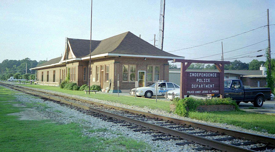
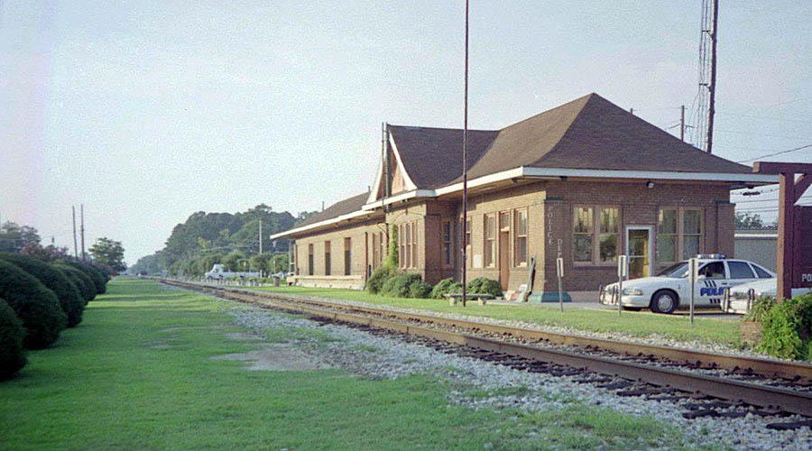
Independence
 ndependence has gone through quite a few changes over the years, but some things that remain the same are the unique people, amazing cultural heritage, and fascinating history. Gaston Raoul established the Southern Car Company to manufacture railroad rolling stock, and the town originally known as Uncle Sam began to establish around his plant in 1837. After the Civil War, Major Henry McComb moved the car works to McComb Mississippi. The New Orleans and Nashville Railroad Company took on the town as a project, and envisioned a thriving future for the community, featuring a college, theatre, market, and churches. While most of these goals were not achieved, the town did continue to grow and thrive in its own way.
The Railroad Company hoped dairy farming would take off. However, during the 1830s, citizens recognized the slightly acidic soil of Independence was perfect for growing strawberries. Soon the area was attracting many settlers to grow luscious berries in the fertile ground, and a new railroad company came as well.
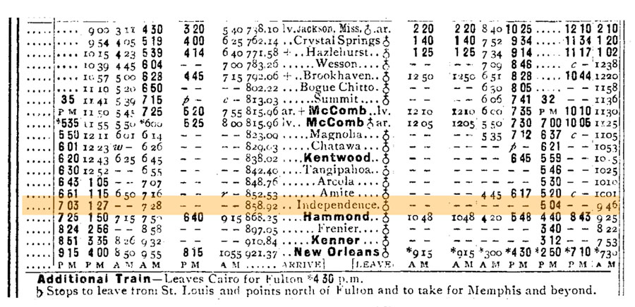
1910 Official Guide timetable / collection
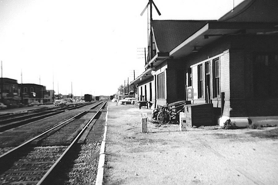
Independence, La / Apr 1958 / Fred Goff
Independence, La / May 2002 / JCH
Click to see the Independence depot plotted on a Google Maps page
Independence, La / May 2002 / JCH
Clippings
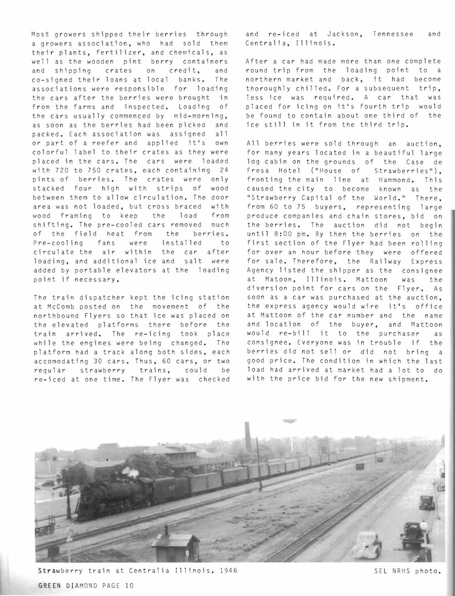
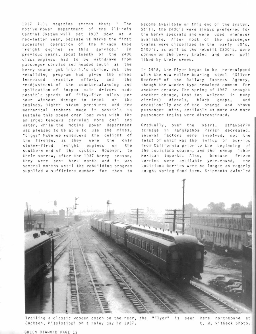
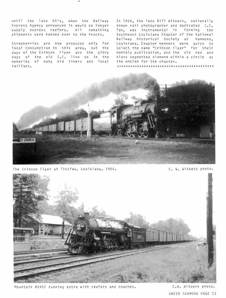
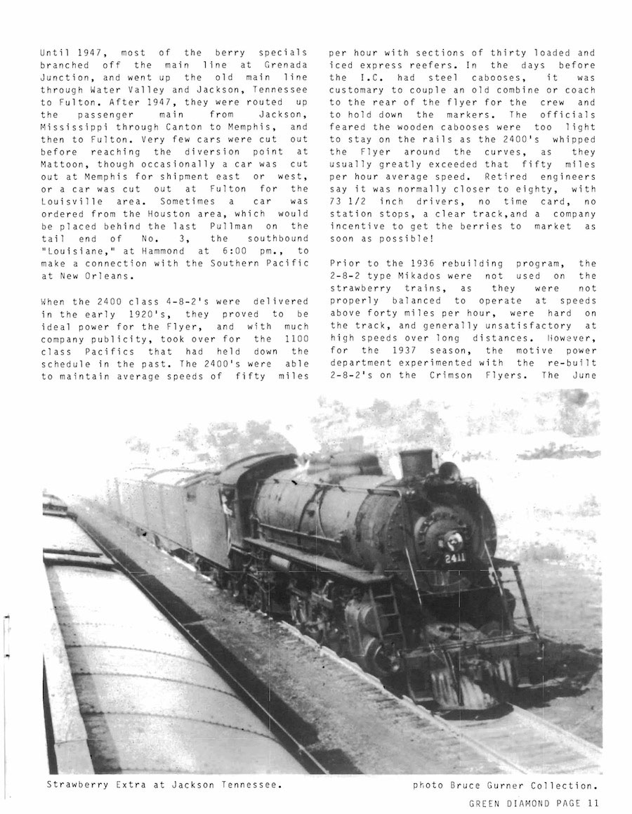
from Illinois Central Historical Society Green Diamond #24 / collection