 |
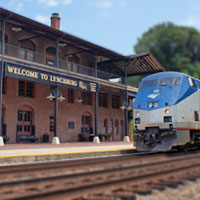
Amtrak's Crescent Northern States |
jump to a
flag stop
- Philadelphia
- Charlottesville
- Lynchburg
- Greensboro
- High Point
- Salisbury
- Charlotte
- Gainesville
- Atlanta
- Anniston
- Birmingham
- Tuscaloosa
- Meridian
- Laurel
- Hattiesburg
- Picayune
- Slidell
- New Orleans
RWH
RWH
 Philadelphia, Pa

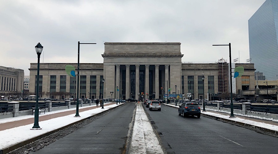
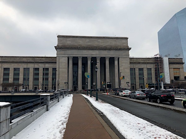
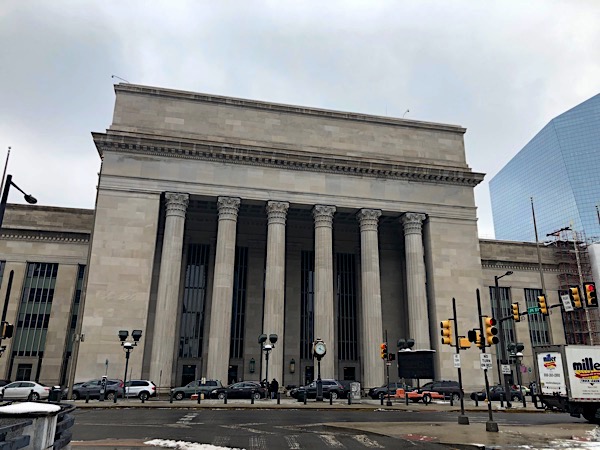
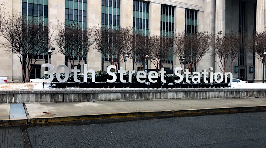
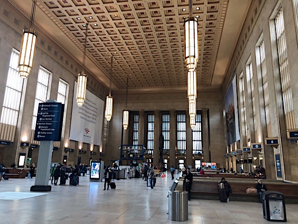
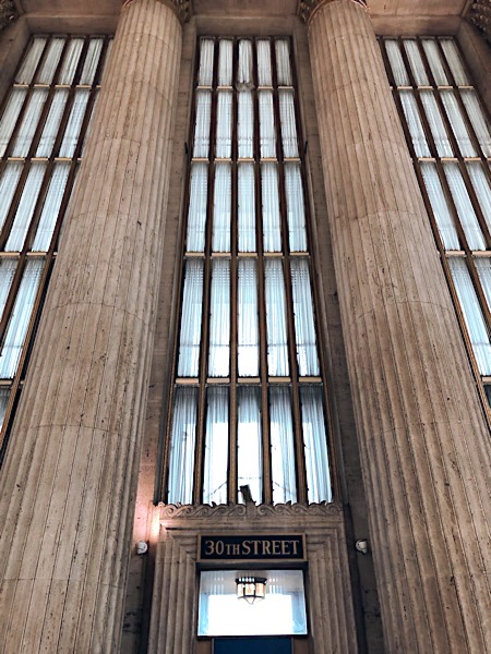
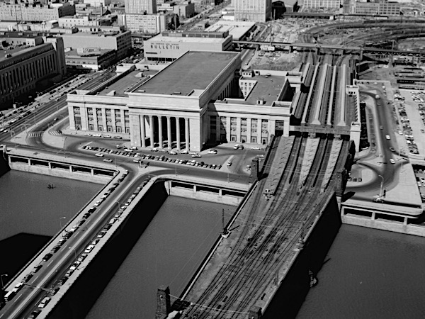 Philadelphia's famed 30th Street Station was built between 1929 and 1933 by the Pennsylvania Railroad (PRR) to replace the Broad Street Station that had become much too congested to support the city's growth. Designed by Alfred Shaw of Graham, Anderson, Probst and White, the enormous, eight-story steel frame building has been listed on the National Register of Historic Places since 1978. It is an example of some of the railroad industry's most monumental construction and is architecturally interesting for its use, adaptation and transformation of the Neoclassical style into a more modern, streamlined Art Deco style. The exterior of the building features typical neoclassical elements such as seventy-one-foot-high Corinthian columns forming impressive porticoes on the east and west facades, rendered in Alabama limestone.
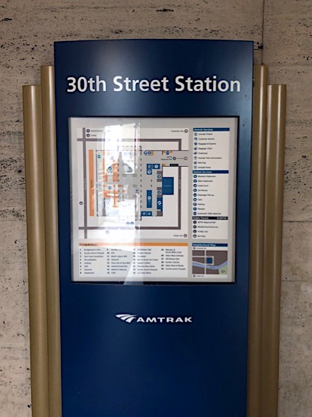
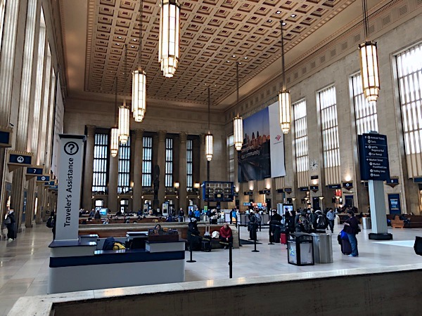
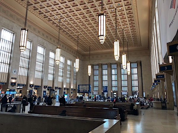
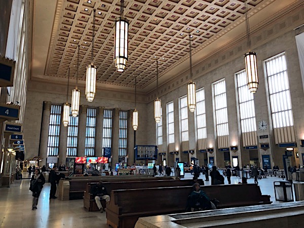
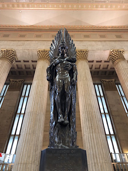
The interior of the station, meanwhile, is notable and unique for both its stylistic and functional elements. The main concourse measures 290 by 135 feet with a 95-foot-high coffered ceiling and beautiful Art Deco chandeliers. It is lined by gilded and ornamented columns that contrast with the more austere, classical look of the façade as well as by five-story-high cathedral-like windows. The floor, made of Tennessee marble, completes the sense of opulence of this impressive room.
Philadelphia, Pa / Feb 2019 / RWH
Philadelphia, Pa / Feb 2019 / RWH
Philadelphia, Pa / Feb 2019 / RWH
Philadelphia, Pa / Feb 2019 / RWH
RWH
Philadelphia, Pa / Feb 2019 / RWH
Click to see Philadelphia's 30th Street Station plotted on a Google Maps page
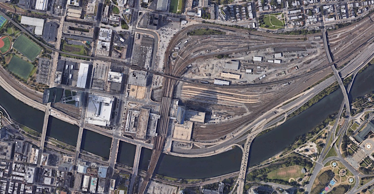
30th Street station overhead / Google Maps
Philadelphia, Pa / Feb 2019 / RWH
Feb 2019 / RWH
Feb 2019 / RWH

See also our Pennsylvanian regional route scrapbook for more Philadelphia photos
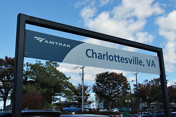
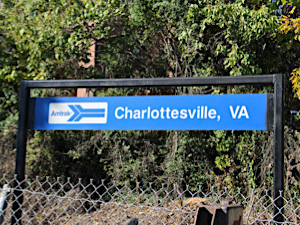
Charlottesville, Va
Charlottesville, Va / Aug 1989 / JCH
Charlottesville, Va / Aug 1989 / JCH
Charlottesville, Va / Aug 1989 / JCH
 A Monacan village, Monasukapanough, was the first human settlement on these lands. What started as a Monacan hunting path grew into Three Notch'd Road, a trade route used by European settlers to shuttle goods between Richmond and the Appalachian Mountains. Today we call this Monacan hunting path U.S. Route 250. Without it, Charlottesville would not have become what it is today.
One of the first men to build upon this early infrastructure was Thomas Jefferson. Jefferson is undeniably the most famous figure in local history. He founded the University of Virginia down the mountain from Monticello, his mountaintop plantation. He inherited this mountaintop land, some 5,000 acres, from his father at the age of 26. He then used the labor of enslaved Africans to cultivate tobacco and construct the plantation house. Albemarle County was home to James Monroe too. Monroe, like Jefferson, also went on to become a U.S. president. James Madison lived just 26 miles northeast of Charlottesville, so we like to claim him too. Jefferson and Monroe, however, were practically next-door neighbors.
In 1850, Charlottesville welcomed its first railroad service, a technology that would later dramatically expand shipping through the area and bring more growth. Then, like any community in the South, the area lost many of its sons and brothers to the Civil War. Unlike many communities, however, the town itself was left largely unscathed--despite its central role in the manufacturing of Confederate uniforms. By 1887, the city had received its first horse drawn streetcars and kept an extra horse on hand to help cars climbing Vinegar Hill, a rough stretch of Main Street. In 1888, Charlottesville incorporated and annexed surrounding land to create a city of nearly 800 acres.
Charlottesville, Va / Nov 2016 / RWH
Charlottesville, Va / Nov 2016 / RWH
Click to see the Charlottesville station area plotted on a Google Maps page
Charlottesville, Va / Nov 2016 / RWH
Charlottesville, Va / Nov 2016 / RWH
Charlottesville, Va / Nov 2016 / RWH
Charlottesville, Va / Nov 2016 / RWH
Charlottesville, Va / Nov 2016 / RWH
Charlottesville, Va / Nov 2016 / RWH
Charlottesville, Va / Nov 2016 / RWH
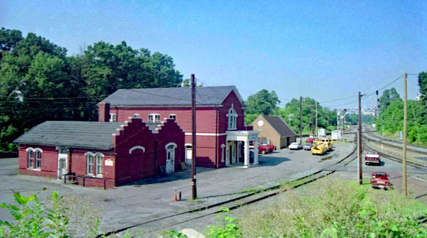
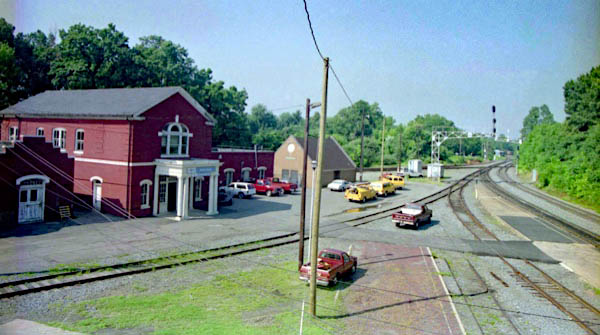
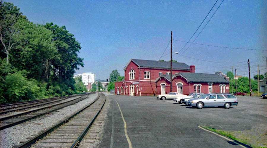
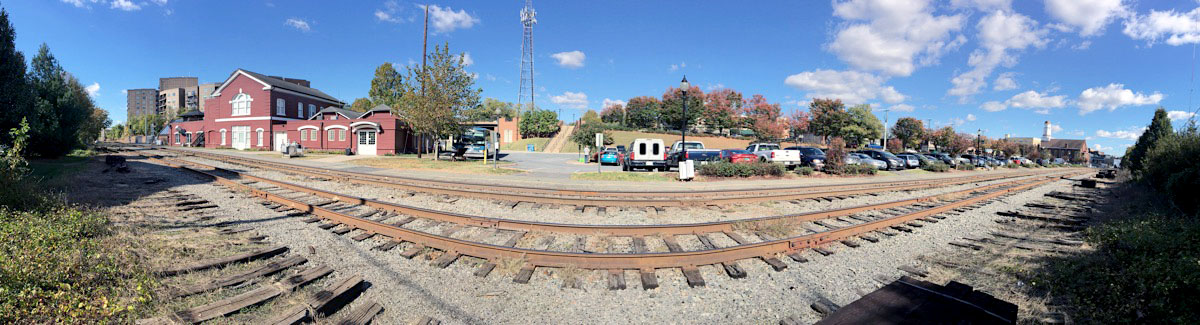
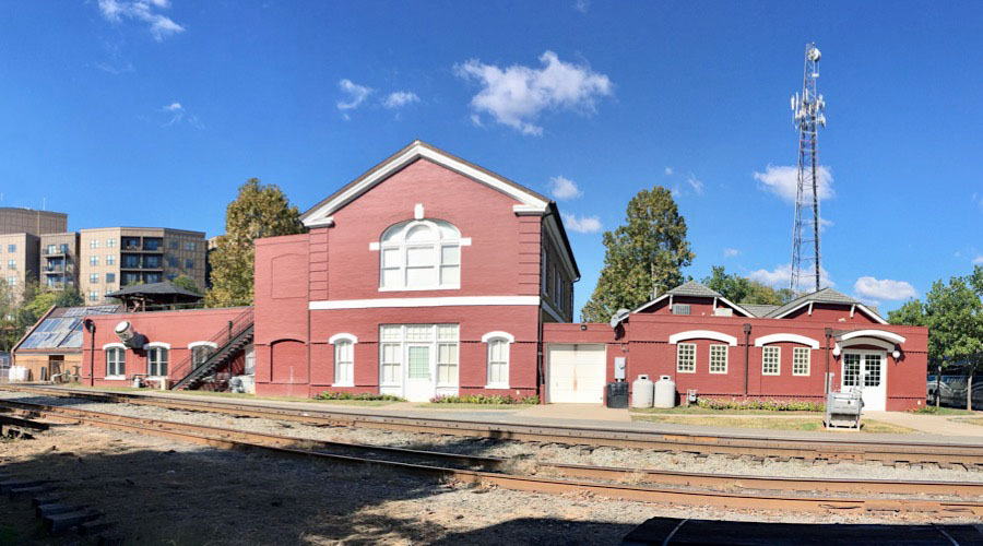
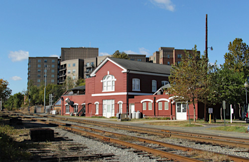
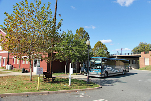
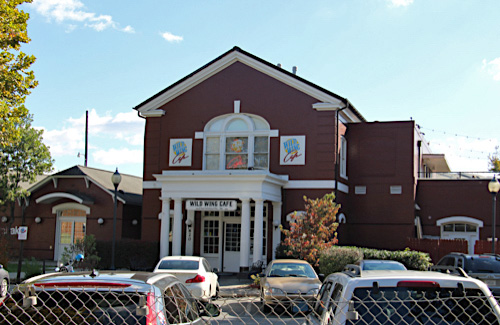
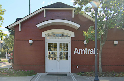
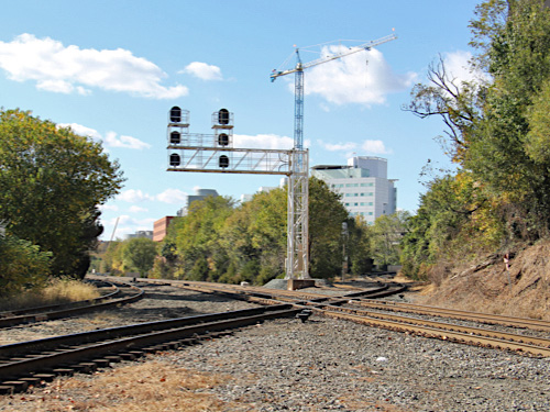
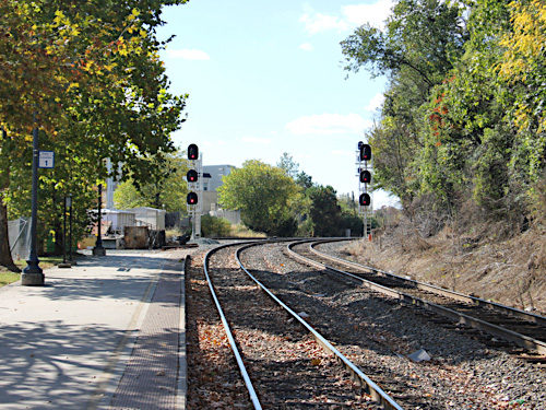
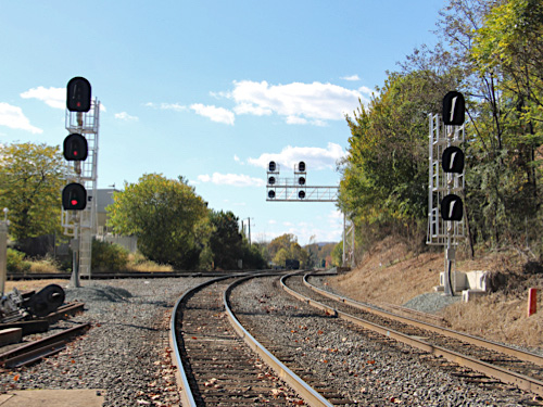
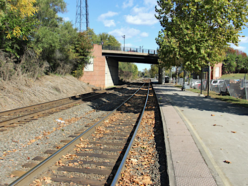
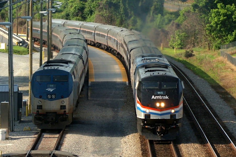
![]() Charlottesville’s Union Station was constructed in 1885 and sits between the University of Virginia and downtown Charlottesville. In 1999, Amtrak and the city of Charlottesville dedicated the newly renovated depot following a $700,000 effort. Amtrak moved out of the original station and into the former Railway Express Agency building built in the 1890s. The new facility has a more modern waiting area, ticket counter and restroom, as well as better parking lot access and the addition of a full-service restaurant. One of the unique features of this station is that its two trains serve the station on two separate tracks on either side of the station. The lines cross just south of the building.
Charlottesville’s Union Station was constructed in 1885 and sits between the University of Virginia and downtown Charlottesville. In 1999, Amtrak and the city of Charlottesville dedicated the newly renovated depot following a $700,000 effort. Amtrak moved out of the original station and into the former Railway Express Agency building built in the 1890s. The new facility has a more modern waiting area, ticket counter and restroom, as well as better parking lot access and the addition of a full-service restaurant. One of the unique features of this station is that its two trains serve the station on two separate tracks on either side of the station. The lines cross just south of the building.
Prior to this station’s construction, Charlottesville was a major rail hub, served by many trains daily. The first train service to Charlottesville was operated by the Louisa Railroad Company, which later became the Central Virginia Railroad (later Chesapeake & Ohio, now CSX). In the mid 1880s, Virginia Midland Railroad (later Southern Railway, now Norfolk Southern) created a perpendicular north-south route. This produced competition between the two rail companies and strengthened the local economy. Hotels and restaurants went up along West Main Street for the many new railroad workers, including those at a railcar repair shop.
See also our Amtrak Cardinal scrapbook, which also calls at Charlottesville
Charlottesville, Va / Nov 2016 / RWH
HawkinsRails thanks railfan friend Garland Harper for use of his Charlottesville and Lynchburg Crescent photos

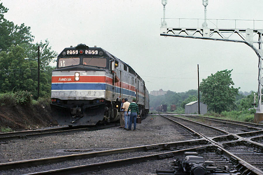
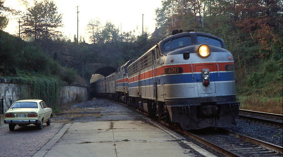
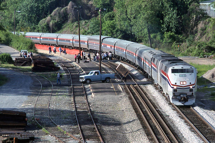
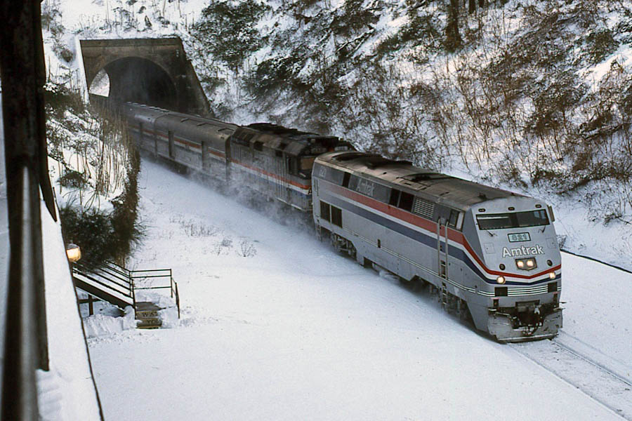
Charlottesville, Va / Nov 1980 / Garland Harper
Charlottesville, Va / May 1982 / Garland Harper
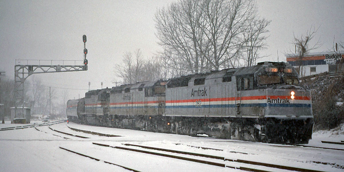
Charlottesville, Va / Feb 1993 / Garland Harper
Lynchburg, Va
 James River Bridge
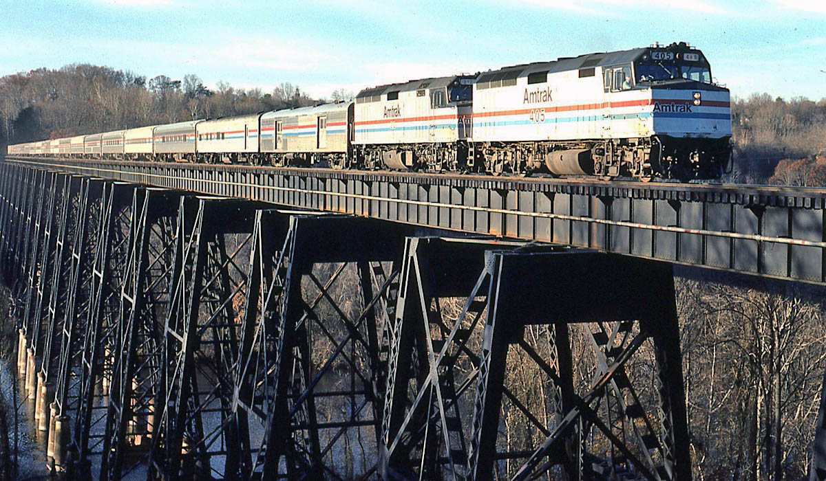
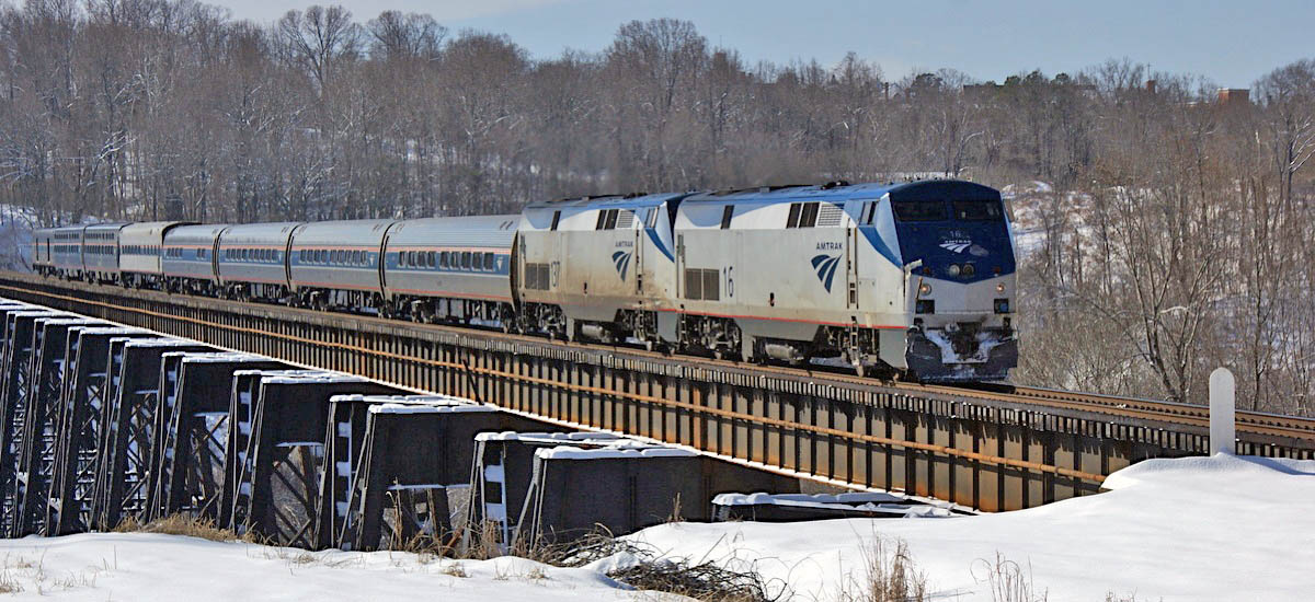
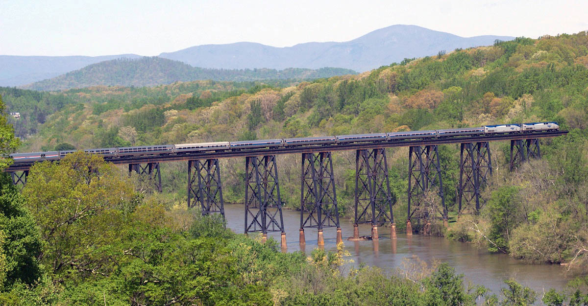
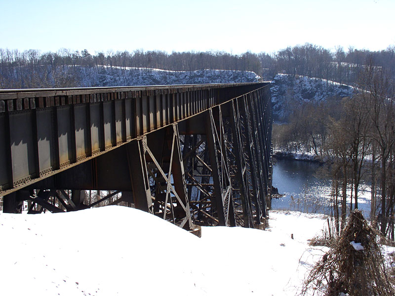 The daily Crescents cross the James River in Lynchburg, Virginia, across a tall deck plate girder bridge built in 1911. This span and three others were built in the early 1900's as part of the Southern Railway's (now Norfolk Southern) "Lynchburg cut-off" project, which bypassed the original line of the railroad through downtown Lynchburg, with its tight curves and steep grades. The line opened for freight traffic on March 1, 1911, and passenger traffic followed on April 16, 1911. The span was built with double-track. The Southern single-tracked the trestle about 1962. This span has been the sight of several pedestrian fatalities over the years, the most recent being November 17, 2011.
In addition to this massive, iconic structure, (1860 ft. long and 150 ft. high) the other three trestles on the seven-mile-long cut-off are Harris Creek trestle, to the north of the James, and Blackwater Creek and Fishing Creek trestles to the south.
The daily Crescents cross the James River in Lynchburg, Virginia, across a tall deck plate girder bridge built in 1911. This span and three others were built in the early 1900's as part of the Southern Railway's (now Norfolk Southern) "Lynchburg cut-off" project, which bypassed the original line of the railroad through downtown Lynchburg, with its tight curves and steep grades. The line opened for freight traffic on March 1, 1911, and passenger traffic followed on April 16, 1911. The span was built with double-track. The Southern single-tracked the trestle about 1962. This span has been the sight of several pedestrian fatalities over the years, the most recent being November 17, 2011.
In addition to this massive, iconic structure, (1860 ft. long and 150 ft. high) the other three trestles on the seven-mile-long cut-off are Harris Creek trestle, to the north of the James, and Blackwater Creek and Fishing Creek trestles to the south.
Garland Harper
Lynchburg, Va / Nov 1990 / Garland Harper
Lynchburg, Va / Feb 2015 / Garland Harper
Lynchburg, Va / Apr 2015 / Garland Harper
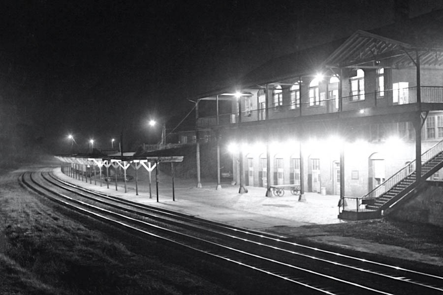
Kemper Street Station
Lynchburg, Va / May 1973 / Garland Harper
Lynchburg, Va / Jul 2001 / JCH
Lynchburg, Va / Jul 2001 / JCH
Lynchburg, Va / Jul 2001 / JCH
Lynchburg, Va / Jul 2001 / JCH
Lynchburg, Va / Jul 2001 / JCH
Click to see Amtrak's Lynchburg station plotted on a Google Maps page
from Southern Railways Depots - Volume 2
- Ralph Ward / collection
from Southern Railways Depots - Volume 2
- Ralph Ward / collection
from Southern Railways Depots - Volume 2
- Ralph Ward / collection
Lynchburg, Va / Sep 1984 / Garland Harper
Lynchburg, Va / Jun 1984 / Garland Harper
Lynchburg, Va / May 2000 / Garland Harper
Lynchburg, Va / Jan 2002 / Garland Harper
Lynchburg, Va / Aug 2001 / Garland Harper
Lynchburg, Va / Apr 2002 / Garland Harper
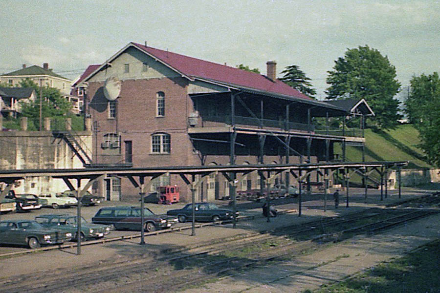
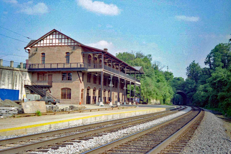
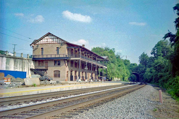
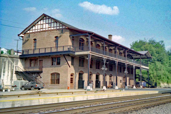
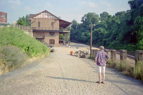
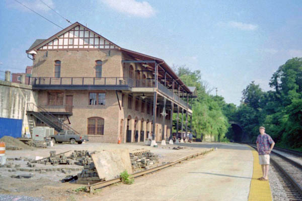
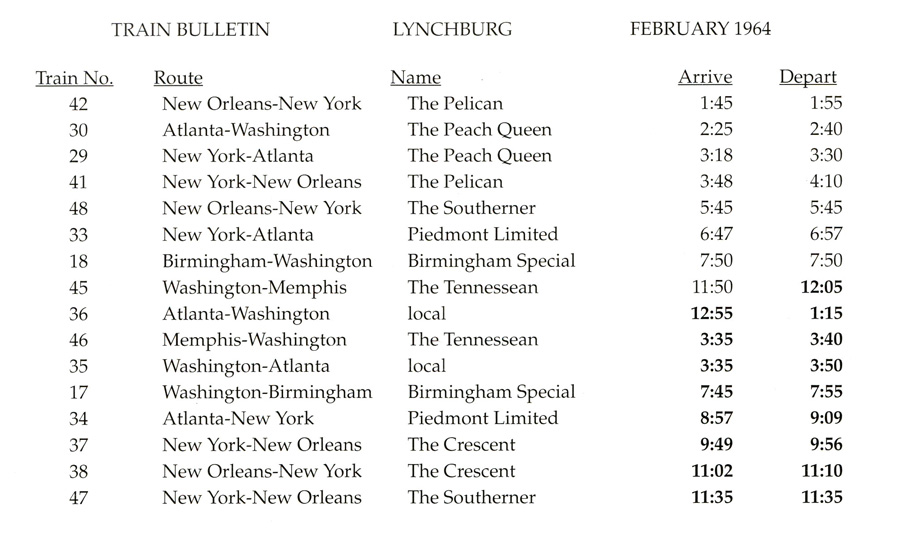
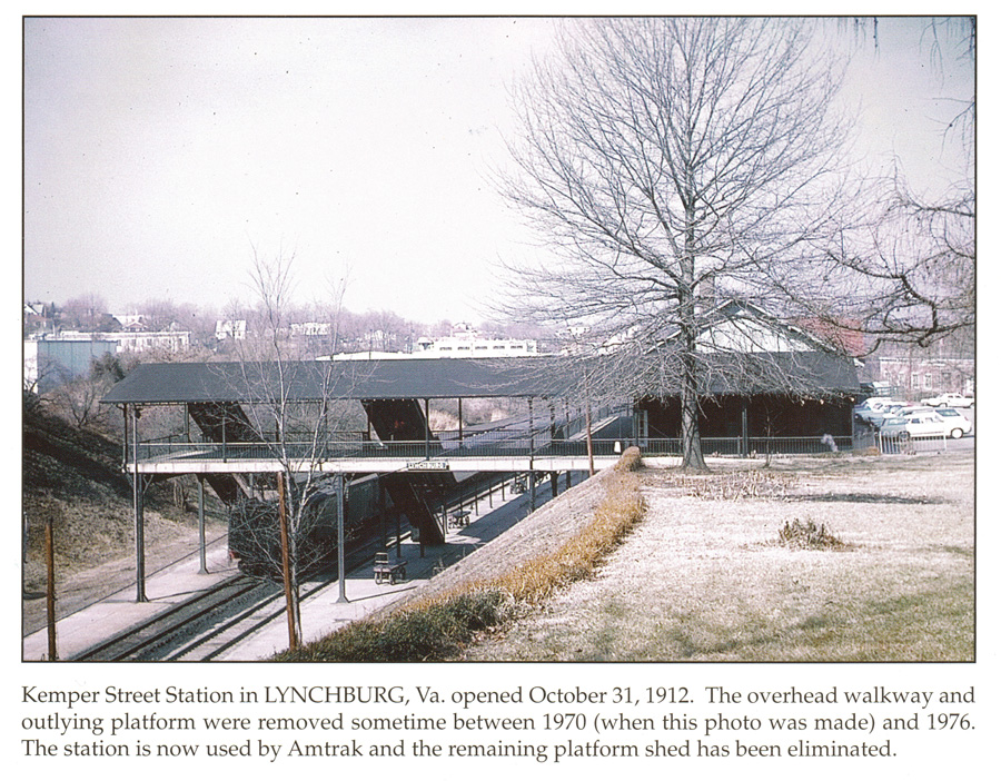
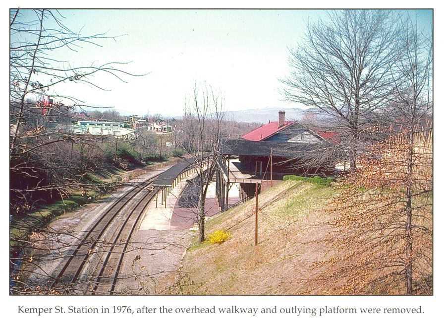
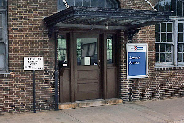
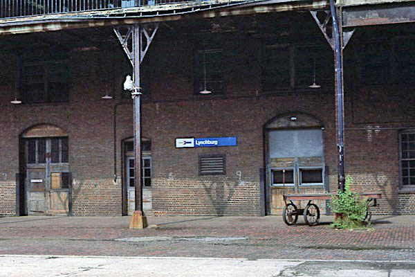
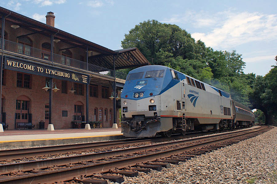
 The Kemper Street station, southwest of downtown, began serving passengers on the Southern Railway line when it opened in 1912. Originally, there was a walkway over the tracks to another platform, but it was later removed. Built into the side of a hill, the station can be entered from two levels. The top floor, which contains office space, fronts Kemper St. Rail customers access the Amtrak waiting room on the ground floor via a staircase on Kemper St., or by using a driveway on the north side of the station that leads to the lower level and platform.
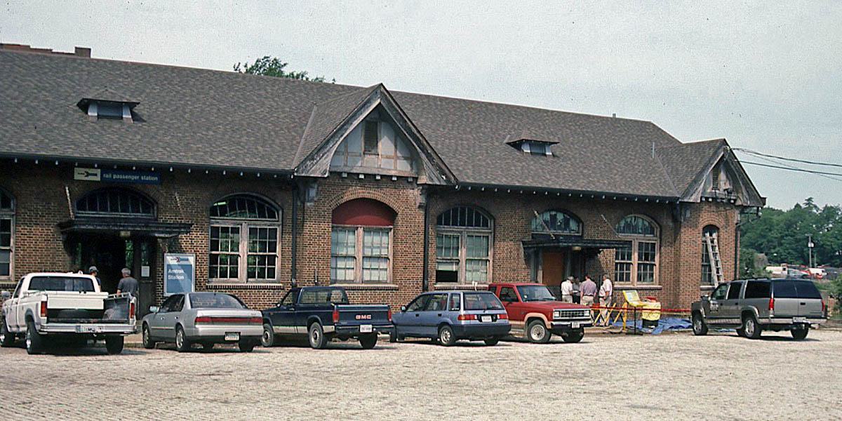
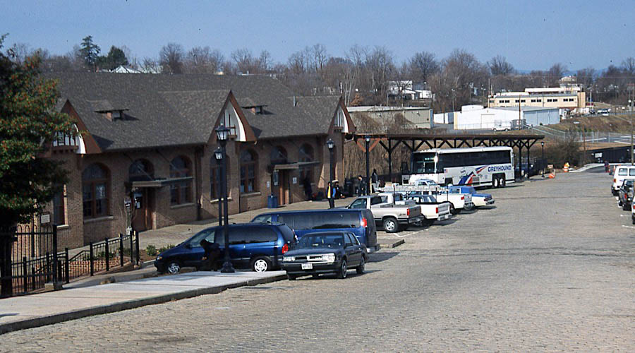
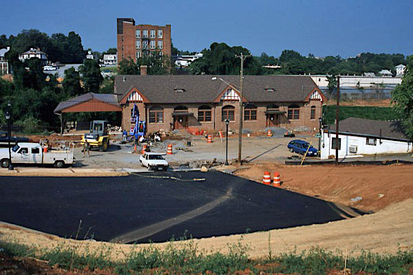
Over the years, Kemper Street station was neglected and fell into disrepair. The Lynchburg City Council’s determination to save the structure led to a redevelopment effort. In 2000, work began on an extensive restoration including the roof, utilities, boiler system, a historic museum display and new visitors’ center. Emphasis in design was on maintaining period lighting, finishes and the existing historic fabric of the train station. On April 26, 2002, the city of Lynchburg celebrated the restoration of the building, which in addition to transportation uses included space that could be rented for offices.
This city was named for its founder, John Lynch, who at the age of 17 started a ferry service across the James River in 1757. In 1786, the Virginia General Assembly granted a town charter to Lynch. Lynchburg was incorporated as a town in 1805 and as a city in 1852. The Society of Friends was the first religious group to settle here. Lynchburg today is often called the “City of Churches” for the large number and variety of religious buildings found in the city.
Tobacco, iron, and steel were the chief industries in early Lynchburg, making it one of the wealthiest cities per capita in the United States in the latter part of the 19th century. Transportation facilities included the James River Batteau, and later the James River and Kanawha Canal, then four railroads through the city, including the Virginia and Tennessee Railroad and the Norfolk and Petersburg Railroad.
Lynchburg served as a major storage depot during the Civil War, as well as a burial place for many of the war’s casualties. The breastworks for the defense of the city can still be seen at Fort Early. Lynchburg is also close to the Appomattox Court House, where the Civil War ended on April 9, 1865.
collection
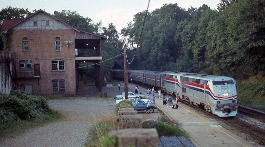
Lynchburg, Va / 1970s / collection
Lynchburg, Va / 1970s / collection
Lynchburg, Va / Oct 1979 / Garland Harper
Lynchburg, Va / Aug 1993 / Garland Harper
Lynchburg, Va / Apr 1995 / Garland Harper
Lynchburg, Va / May 1995 / Garland Harper
Lynchburg, Va / Jan 1996 / Garland Harper
Lynchburg, Va / Aug 2009 / Garland Harper
Lynchburg, Va / May 2012 / Garland Harper
Train #198 / Lynchburg, Va / Jun 2017 / Garland Harper
Lynchburg, Va / Garland Harper
See next our Crescent Central States scrapbook here in Mainlines